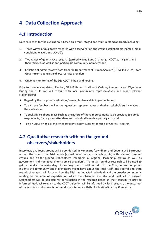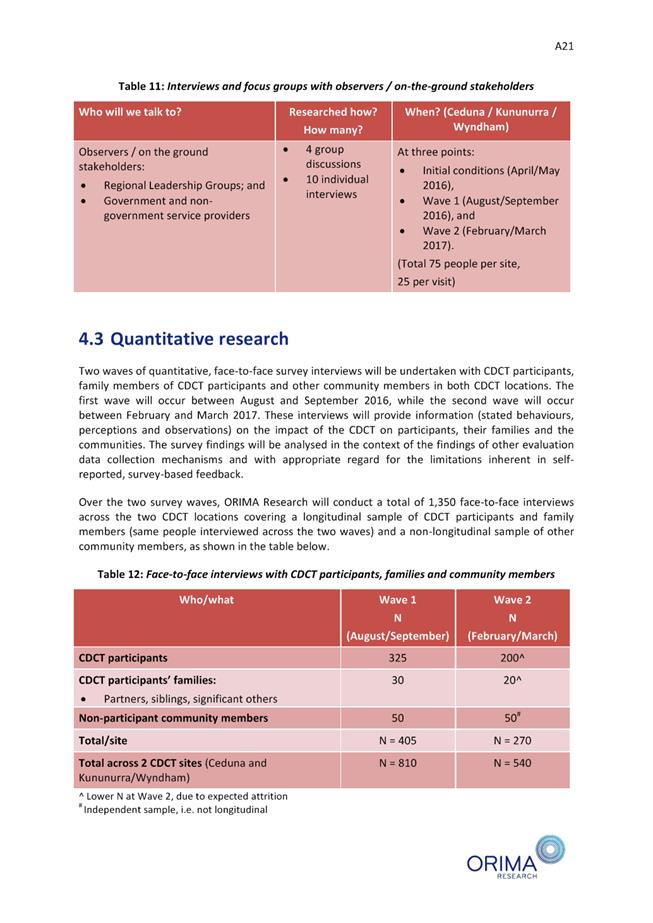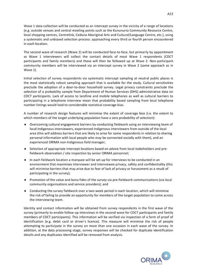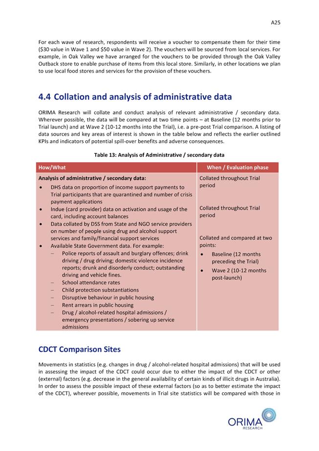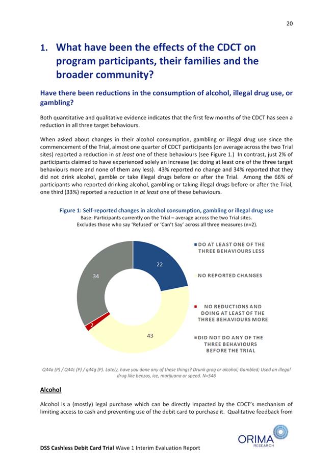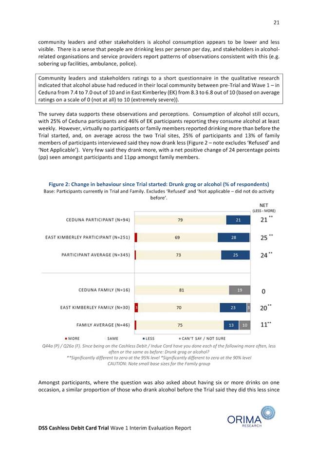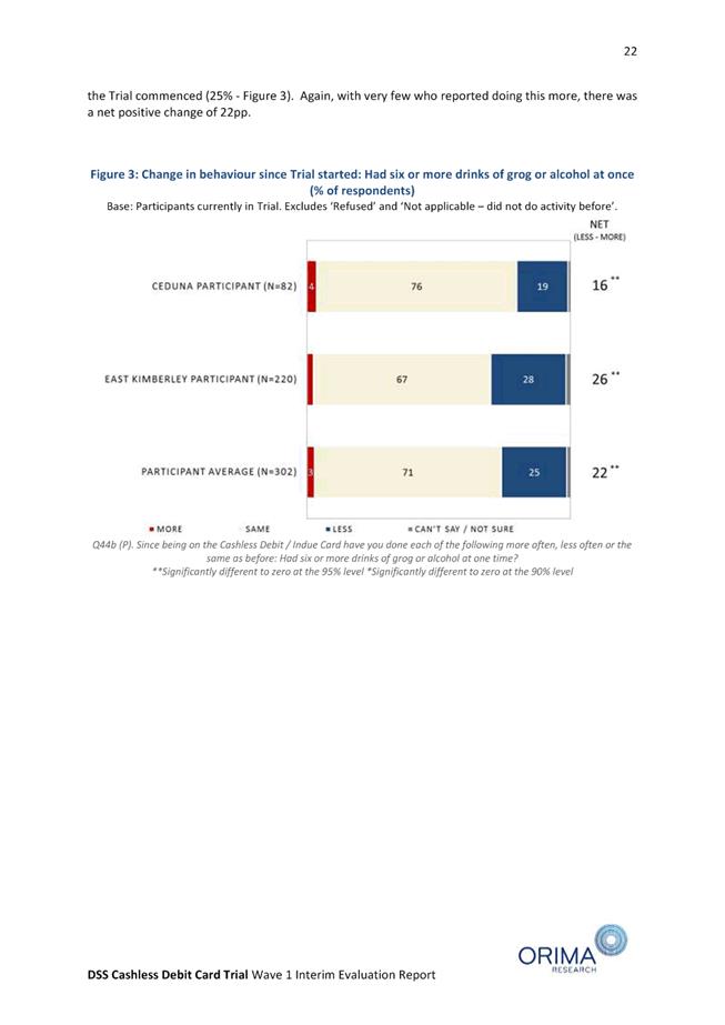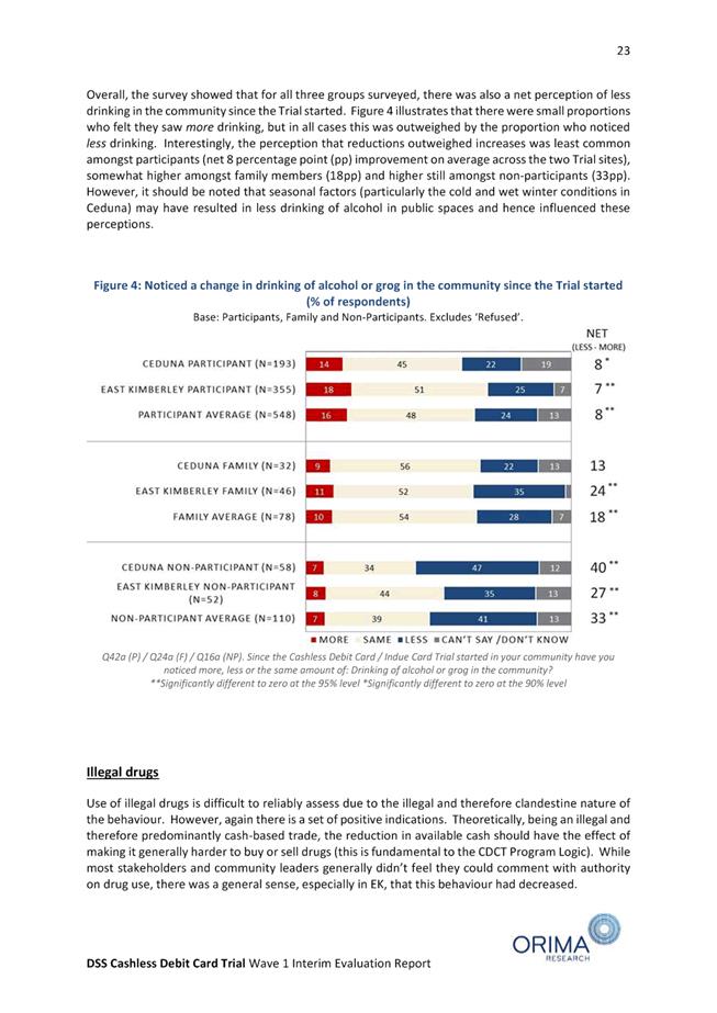
MISSION AND VALUES OF COUNCIL
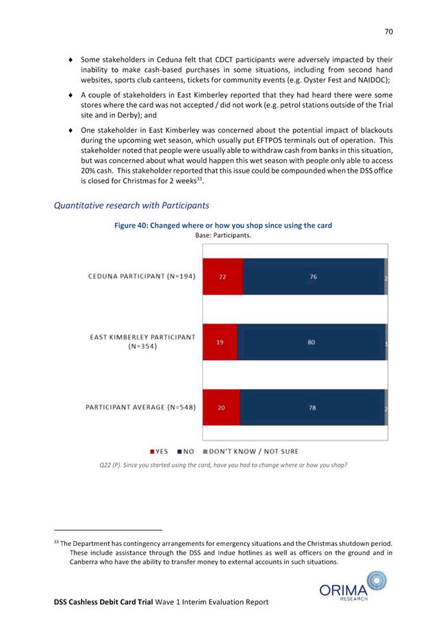
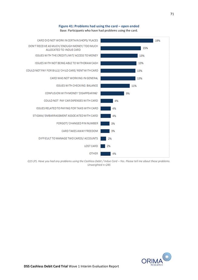
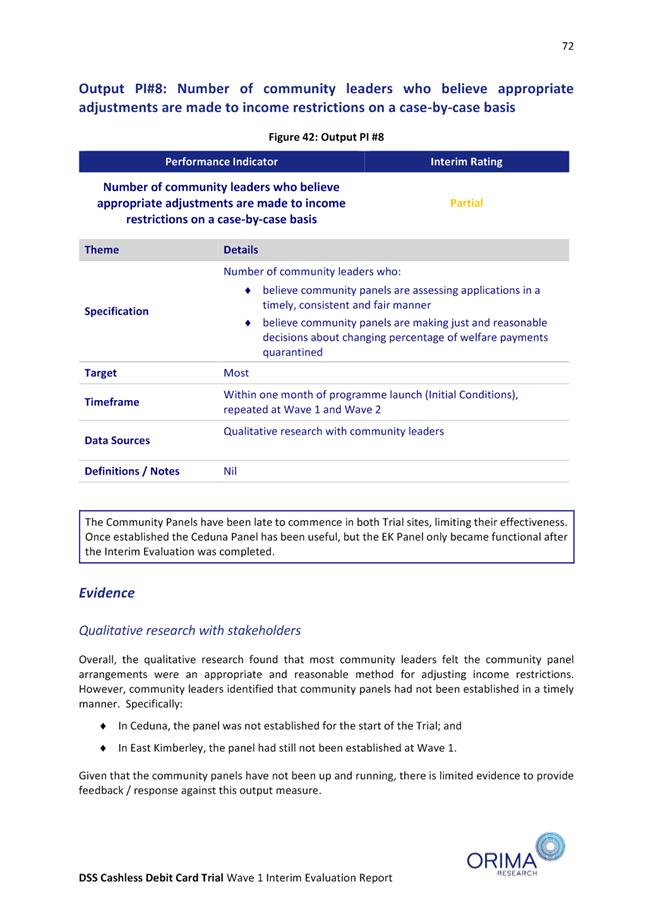
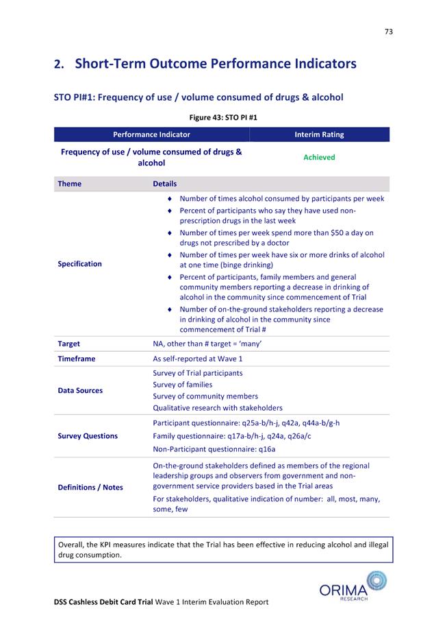
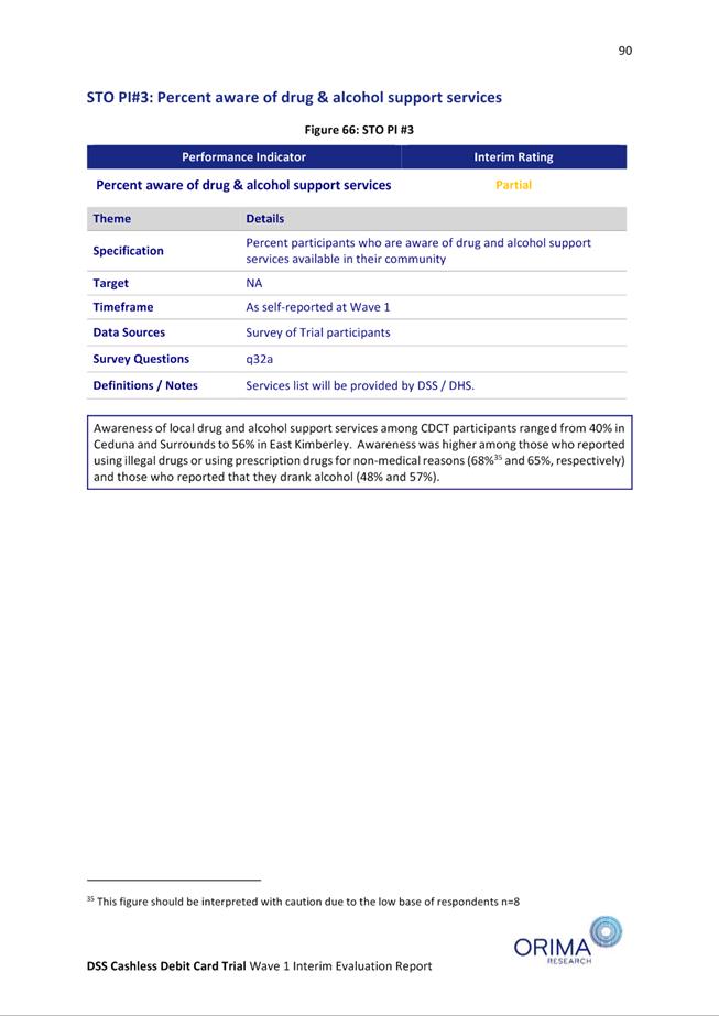
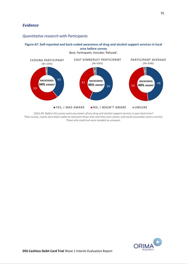
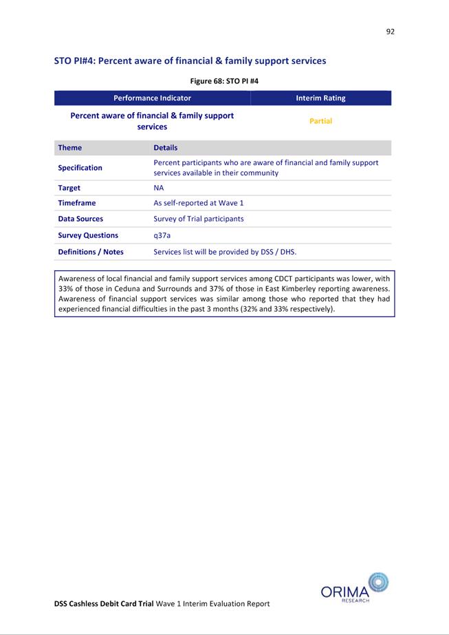
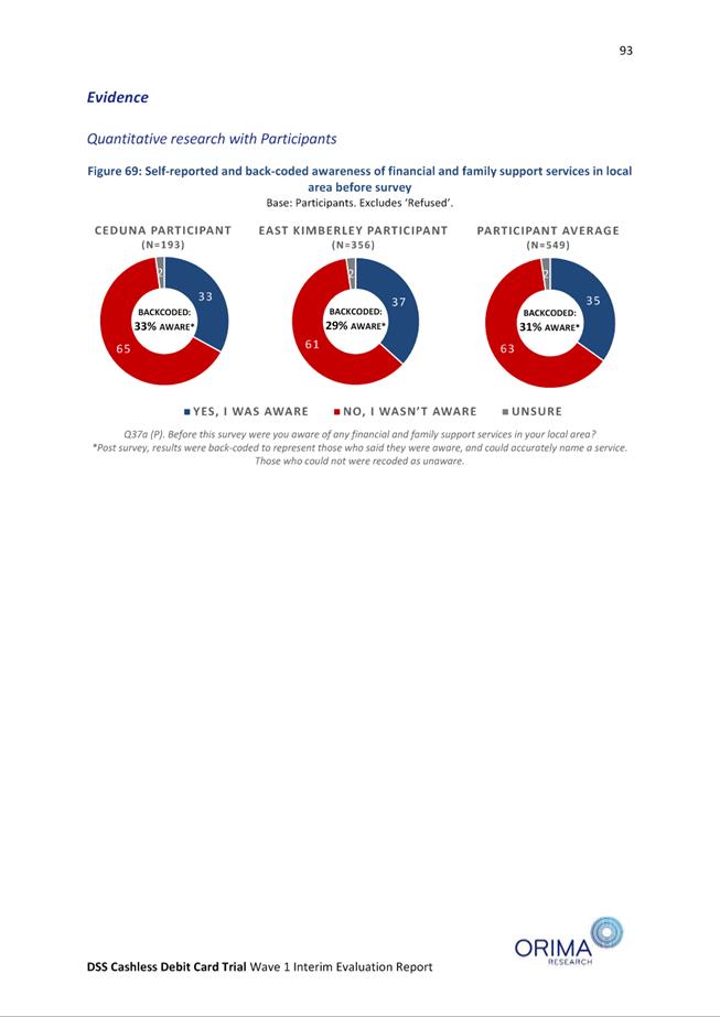
"A Sustainable Community that is
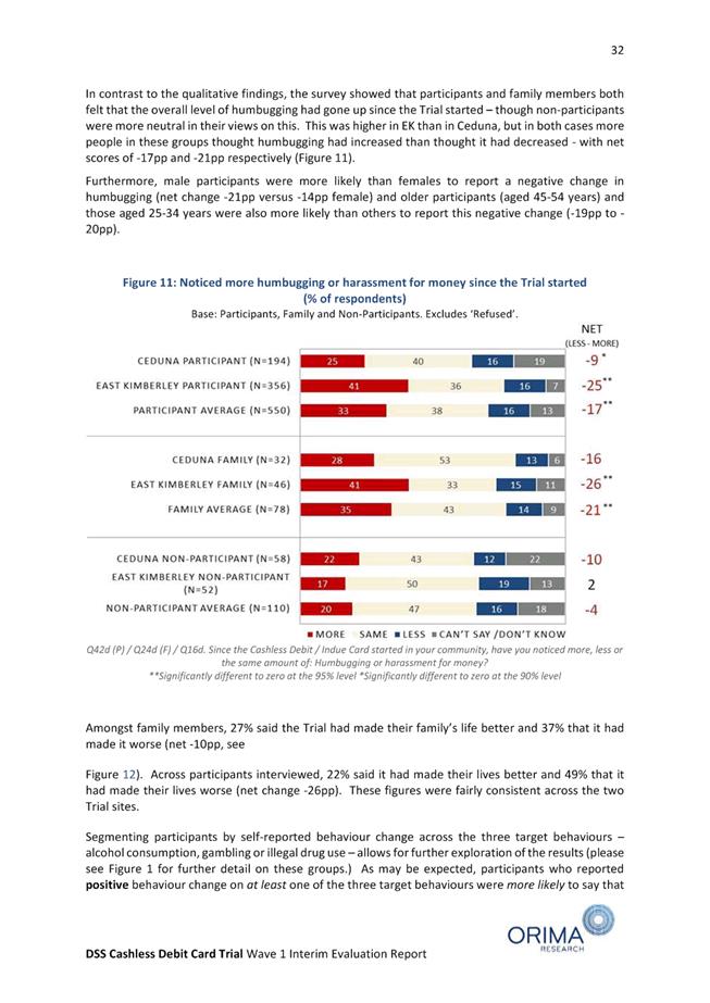
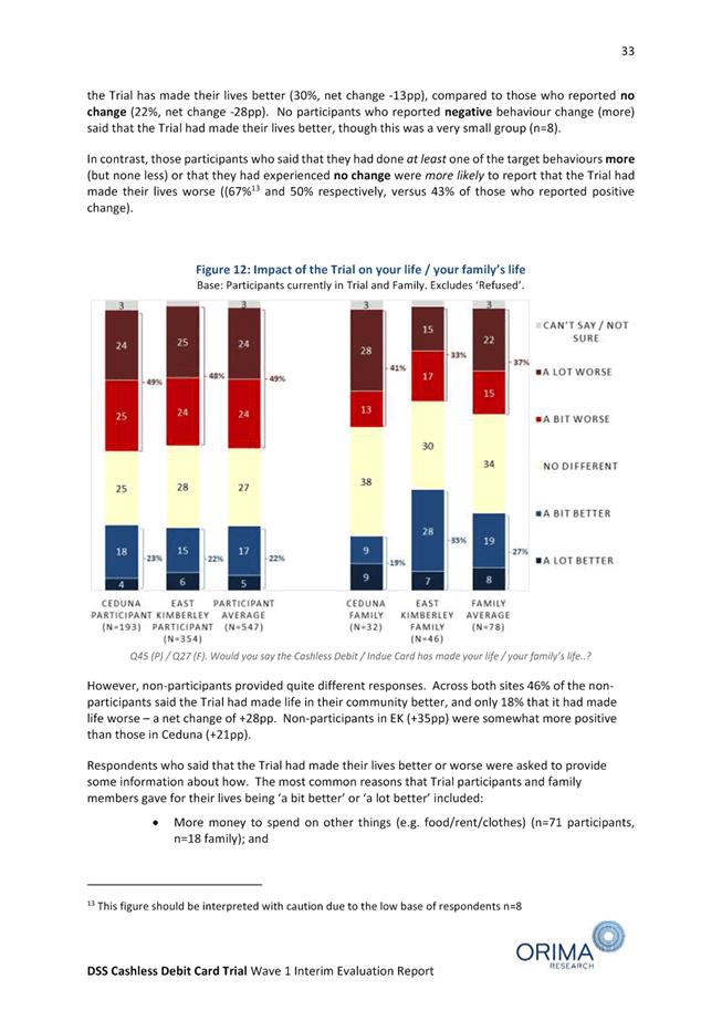
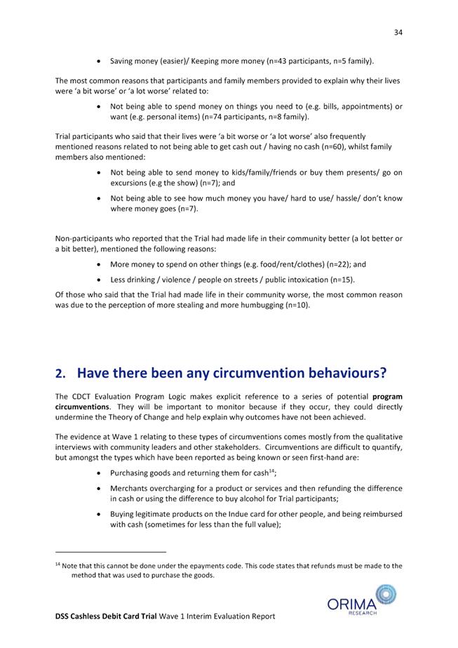
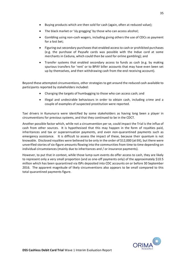
inclusive, attractive, healthy and pleasant to live in, that uses our land so
as to preserve our history and environment, respects the rights and equality of
our citizens and manages our future growth wisely."
CONFIRMED
MINUTES
OF THE
Ordinary Meeting of Council
7 September 2017
"A
thriving and friendly community that recognises our history and embraces
cultural diversity and economic opportunity, whilst nurturing our unique
natural and built environment."
OUR MISSION
“To
deliver affordable and quality Local Government services.”
CORE
VALUES OF THE SHIRE
The core
values that underpin the achievement of the
mission
will be based on a strong customer service
focus and a
positive attitude:
Communication
Integrity
Respect
Innovation
Transparency
Courtesy
DISCLAIMER
The purpose of Council Meetings is to discuss, and where possible,
make resolutions about items appearing on the agenda. Whilst Council has
the power to resolve such items and may in fact, appear to have done so at the
meeting, no person should rely on or act on the basis of such decision or on
any advice or information provided by a Member or Officer, or on the content of
any discussion occurring, during the course of the meeting.
Persons should be aware that the provisions of the Local
Government Act 1995 (Section 5.25 (e)) establish procedures for revocation or
rescission of a Council decision. No person should rely on the decisions
made by Council until formal advice of the Council decision is received by that
person. The Shire of Broome expressly disclaims liability for any loss or
damage suffered by any person as a result of relying on or acting on the basis
of any resolution of Council, or any advice or information provided by a Member
or Officer, or the content of any discussion occurring, during the course of
the Council meeting.
Minutes
– Ordinary Meeting of Council 7 September 2017 Page
4 of 1404
|
Councillor
|
Cr R Johnston
|
Cr H Tracey
|
Cr M Fairborn
|
Cr W Fryer
|
Cr E Foy
|
Cr D Male
|
Cr P Matsumoto
|
Cr C Mitchell
|
Cr B Rudeforth
|
|
2015
|
26 November
|
|
|
|
|
|
|
LOA
|
|
|
|
2015
|
17 December
|
|
|
|
|
|
|
|
|
|
|
2016
|
25 February
|
|
|
|
|
A
|
|
|
|
|
|
2016
|
31 March
|
|
|
|
|
LOA
|
|
|
|
|
|
2016
|
28 April
|
|
LOA
|
A
|
LOA
|
LOA
|
|
|
|
|
|
2016
|
26 May
|
|
|
A
|
|
|
|
LOA
|
|
|
|
2016
|
30 June
|
|
LOA
|
|
|
|
|
|
|
LOA
|
|
2016
|
28 July
|
|
|
|
|
|
|
|
|
|
|
2016
|
25 August
|
|
|
|
|
LOA
|
|
|
|
|
|
2016
|
29 September
|
|
A
|
|
|
|
LOA
|
|
|
|
|
2016
|
27 October
|
|
|
|
|
|
|
|
LOA
|
|
|
2016
|
24 November
|
|
|
LOA
|
|
|
A
|
|
|
|
|
2016
|
15 December
|
|
|
|
|
A
|
|
|
|
A
|
|
2017
|
23 February
|
|
|
|
|
|
|
|
|
A
|
|
2017
|
30 March
|
|
|
LOA
|
|
LOA
|
|
|
|
|
|
2017
|
27 April
|
|
A
|
LOA
|
A
|
|
|
|
|
|
|
2017
|
25 May
|
|
|
|
|
LOA
|
|
|
|
|
|
2017
|
29 June
|
|
|
|
A
|
LOA
|
|
|
|
|
|
2017
|
27 July
|
|
A
|
|
|
LOA
|
|
|
|
|
|
2017
|
7 September
|
A
|
|
|
|
LOA
|
|
|
LOA
|
|
|
·
LOA
(Leave of Absence)
|
·
NA
(Non Attendance)
|
|
·
A
(Apologies)
|
|
2.25. Disqualification
for failure to attend meetings
(1) A
council may, by resolution, grant leave of absence, to a member.
(2) Leave
is not to be granted to a member in respect of more than 6 consecutive ordinary
meetings of the council without the approval of the Minister, unless all
of the meetings are within a period of 3 months.
(3A) Leave
is not to be granted in respect of —
(a) a
meeting that has concluded; or
(b) the
part of a meeting before the granting of leave.
(3) The
granting of the leave, or refusal to grant the leave and reasons for
that refusal, is to be recorded in the
minutes of the meeting.
(4) A
member who is absent, without obtaining leave of the council, throughout 3
consecutive ordinary meetings of the council is disqualified from continuing
his or her membership of the council, unless all of the meetings are
within a 2 month period.
(5A) If
a council holds 3 or more ordinary meetings within a 2 month period, and a
member is absent without leave throughout each of those meetings, the member is
disqualified if he or she is absent without leave throughout the ordinary
meeting of the council immediately following the end of that period.
(5) The
non‑attendance of a member at the time and place appointed for an
ordinary meeting of the council does not constitute absence from an ordinary
meeting of the council —
(a) if
no meeting of the council at which a quorum is present is actually held on that
day; or
(b) if
the non‑attendance occurs —
(i) while
the member has ceased to act as a member after written notice has been given to
the member under section 2.27(3) and before written notice has been given to
the member under section 2.27(5); or
(ii) while
proceedings in connection with the disqualification of the member have been
commenced and are pending; or
(iiia) while
the member is suspended under section 5.117(1)(a)(iv); or
(iii) while
the election of the member is disputed and proceedings relating to the disputed
election have been commenced and are pending.
(6) A
member who before the commencement of the Local
Government Amendment Act 2009 section 5 1 was granted
leave during an ordinary meeting of the council from which the member was
absent is to be taken to have first obtained leave for the remainder of that
meeting.
[Section
2.25 amended by No. 49 of 2004 s. 19(1); No. 17 of 2009 s. 5.]
Minutes –
Ordinary Meeting of Council 7 September 2017 Page 8 of 1404
MINUTES
OF THE Ordinary Meeting of Council
OF THE SHIRE OF BROOME,
HELD
IN THE Council Chambers, Corner Weld and
Haas Streets, Broome, ON Thursday
7 September 2017, COMMENCING AT 5.00pm.
The Chairman welcomed Councillors,
Officers and members of the public and declared the meeting open at 5.00pm.
Attendance: Cr
H Tracey Deputy
Shire President
Cr
M Fairborn
Cr
W Fryer
Cr
D Male
Cr
P Matsumoto
Cr
B Rudeforth
Leave of Absence:
The Chairperson noted that a Leave of Absence was granted
to Cr D Male for the Ordinary Meeting of Council to be held 31 August 2017 however
was no longer required.
The Chairperson also noted that a
request for a Leave of Absence was received from Cr W Fryer for the Ordinary
Meeting of Council to be held 31 August 2017 however was no longer required.
A written request for a Leave of Absence from the Ordinary Meeting of Council to be held 7 September 2017
was received from Cr E Foy:
A written request for a Leave of Absence for all meetings of Council
and Committees held from 7 September to 12 October 2017 was received from Cr C
Mitchell:
Apologies: Cr
R Johnston Shire
President
Officers: Mr
S Mastrolembo Chief Executive Officer
Mr
J Watt Director
Corporate Services
Ms
A Nugent Director
Development and Community
Mr
S Harding Director
Infrastructure
Mr
D Forrest Manager
Governance
Mr
S Penn Media
and Promotions Officer
Ms
M Wevers Senior
Administration and Governance Officer
Public
Gallery: Katrina
Comito Pearl Sea
Laundry
Paul
Comito Pearl
Sea Laundry
Sally
Dobel
Ken
Paterson
Kim
Malone Broome
Bowling Club
Glenn
Cordingley Broome Advertiser
Matthew
Hill Notre
Dame
Joy
Hill St
Mary’s College
Ross
Lampard Broome
Bowling Club
Cecile
O’Connor ABC
Jakeb
Waddell Broome
Advertiser
Helen
Capsalis St
Mary’s
Kevin
May Broome
Bowling Club
Lesley
Morris
|
FINANCIAL
INTEREST
|
|
Councillor
|
Item
No
|
Item
|
Nature
of Interest
|
|
Cr D
Male
|
9.3.1
|
COLD
STORAGE LOGISTICS HUB FEASIBILITY STUDY
|
Financial
– client of my business.
|
|
IMPARTIALITY
|
|
Councillor
|
Item
No
|
Item
|
Nature
of Interest
|
|
Nil.
|
The following questions were
received from Lesley Morris prior to the meeting:
Question One:
Last week the Shire’s contractor was at 12-Mile
clearing the road verges and that is very much appreciated. What is not
appreciated is that, I believe under instruction from one of your Shire
Officers, the dirt, scrub and trees removed from the verges was being dumped
into what I believe is a compensating basin (storm water collection pit) at the
end of Kanagae Drive. We as a community continually have to deal with the
dumping of rubbish, debris etc in the bush. We have just been through a serious
tightening up and enforcement of firebreak rules this year so why is the Shire
dumping into what I believe is a storm water collection pit and potentially
adding flammable materials to our surrounding bush?
Response provided by Director
Infrastructure:
In your
question you make reference to a drainage compensation Basin, by way of clarity
the area that you refer is not a drainage compensation Basin but rather an old
borrow pit. The old borrow pit that has been used by the residents of 12
Mile and others for many years.
The lay
of the land indicates that overland flow is generally WNW which is away from
the properties. There is no reason why a compensating basin would be
constructed downstream of any drainage system they are generally located at the
upstream side to allow for the drainage system to cater of excessive
flows.
The
shire of Broome are carry out the works which involved removing vegetation from
the invert of the drains which includes some of the vegetation being
placed temporarily in a location at the end of Kanagae Road where it meets
Chi street. This is to be removed in the near future when all works are
completed.
It
should be noted that there are a number of piles of dirt general rubbish and
vegetation as well as some white goods that have been dumped at the location
which are certainly not related to Council activities.
Question Two:
Does the
Shire have a duty of care to:
(a) dispose of flammable materials so as not
to cause risk or in this case additional risk to others? And,
(b) if what I believe is a compensating basin
is being used to dump the dirt, scrub and trees and a person suffers damage to
their property due to that filling, whether it be a compensating basin or not,
could the Shire be liable to pay compensation for damages?
Response provided by Director
Infrastructure:
The
small volume of vegetation that you are referring to is minor in relation to
the other materials that have been dumped at the site and the nature of the
bushland surrounding the borrow pit area. The suggestion that Council has added
combustible material to the area is overstated given that all Councils stored
vegetation is to be removed at the end of the works in the area. In addition to
this it should be noted that Council maintains the roads and drains within the
12 mile area on an annual basis to minimise any impacts on local residents.
********
The following questions were
received from Katrina Comito prior to the meeting:
Question One:
My husband Paul and I have owned
Pearl Sea Laundry Services for the past 19 years. We recently purpose built a
commercial laundry in Blue Haze, a commercial zoned area, and we met the strict
Health and Planning regulations set out by the Shire of Broome. On 29th
June 2017 an advert was placed in the Broome Advertiser by the Shire of Broome
advertising for Public Comment for a proposed “Dry Cleaning
Premises” at Kimberley Sands Resort. When we were eventually able to view
the application, we found that it is not a Dry Cleaning Service that Kimberley
Sands Resort is proposing, it is in fact an expansion of an existing in-house
laundry to become a commercial laundry. The application lists 3 commercial
washing machines and 3 commercial dryers and NO Dry Cleaning equipment. The
application clearly states that Kimberley Sands wishes to provide laundry
services (washing sheets and towels) to another resort and “potentially
other properties”. It is not a guest laundry, it is not a laundromat and
it is not a dry cleaner. As they will be charging other properties a fee for
laundry services this would mean they will be operating a Commercial Laundry in
a Tourist Zone with no requirement to meet Health and Planning approvals as
Pearl Sea has had to in the Commercial Zone area of Blue Haze. In relation to
Item 9.2.5 of the Agenda for today’s Council Meeting why was the
application for “Dry Cleaning Premises” considered and the
recommendation made when it is an application for a Commercial Laundry which is
not a preferred land use as stated in the Cable Beach Development Strategy.
Response provided by Director
Development and Community:
As outlined in Agenda Item 9.2.5,
Local Planning Scheme No. 6 does not have a specific land use definition for a
laundry. However, it does have the defined land use ‘dry cleaning
premises’. When assessing an application and determining the land use
permissibility under the Local Planning Scheme, all defined land uses are
reviewed and if it can be determined that the activity falls within the type or
class of a defined land use then this is to be used.
It is noted that there is a
difference between dry cleaning, which typically uses chemicals to clean
materials, and a laundry, which uses water. However, as both activities
involve the cleaning of garments and fabrics, a laundry is deemed to be in the
same class or genus of activity as a ‘dry cleaning premises’ and
therefore is a discretionary land use in the Tourist Zone.
Dry cleaning is listed as a
preferred land use activity in the Cable Beach Development Strategy as the
Strategy reflects the defined land uses in the Local Planning Scheme.
What is proposed as part of this development application is a less intensive
land use than a dry cleaning premises and therefore while a laundry is not specifically
mentioned in the Strategy, given a dry cleaning premises is a preferred land
use, this application is consistent with the Strategy.
Question Two:
Will Councillors approve a
Commercial Laundry to operate in a Tourist Zone?
Response provided by Chairman:
Council will consider agenda item
9.2.5 at tonight’s meeting.
The Chairman sought
clarification from the Director Development and Community:
Within the Cable Beach Development
Strategy, is a commercial laundry an approved operation?
Response provided by Director
Development and Community:
Local Planning Scheme 6 does not
have a definition for laundry, only for dry cleaning. The commerciality aspect
is not a consideration. That particular land use is in the same class as a dry
cleaning premises whereby both involve cleaning of garments and fabric and is
therefore considered to fall within the definition of dry cleaning. The Cable
Beach Development Strategy was developed in accordance with Local Planning
Scheme 6 and will therefore use the same definitions. The land use definition
falls within the scope of a dry cleaning premises.
Further clarification was
sought from the Chairman:
Is there wording that says a commercial
laundry is not a preferred land use?
Response provided by Director
Development and Community:
No, that wording is not used in Local
Planning Scheme 6. The commercial aspect is relevant as to whether the site
needs to be registered as an offensive trade under the Health Local Law 2016.
The Chairman sought
clarification from Katrina Comito:
Have you read the wording on this
within the Strategy?
Response provided by Katrina
Comito:
Along the lines of laundromat with
no more than 10 machines. Kimberley Sands has 12, and another 7 in the in-house
laundry. If they operate an in-house laundry to provide services to other
resorts that would be our concern as they already have an onsite guest laundry.
The summary of their application is that it is going to be a guest laundry but
if they are charging a fee for the job that they are doing, we don’t
think it is fair that they don’t have to fit within the guidelines that
we’ve had to fit into.
6.1 The
Chairman referred to the presentation prior to the commencement of the meeting given
to Joel Hill of St Mary’s College who designed the winning Best Secondary
School Banners in the Terrace entry for the WALGA Local Government Convention
2017.
6.2 The
Chairman advised the State Government had today announced the State Budget
which included the following funding for Broome:
·
$9.7m
to upgrade boat facilities at Town Beach and Entrance Point
·
$1m
towards planning for a new Boat Harbour
Cr D Male presented a petition from
Kevin May, President of the Broome Bowling Club, requesting to ‘retain an
onsite caretaker in temporary accommodation prior to the completion of
permanent structure.”
Cr H Tracey presented a petition from
Nancy Kennedy requesting ‘the Shire of Broome introduce a ban against the
provision of soft plastic shopping bags from retail outlets in Broome and
settlements on the Dampier Peninsula”.
The petitions were accepted and items
would be presented to the next Ordinary Meeting of Council.
Under section 5.23 (2)(d) of the Local
Government Act 1995 Council may resolve to move the meeting behind closed
doors.
9.1

PRIORITY STATEMENT
Embracing our cultural diversity and the relationship
between our unique heritage and people, we aim to work in partnership with the
community to provide relevant, quality services and infrastructure that meet
the needs and aspirations of our community and those visiting and doing
business in our region.
Supporting and contributing to the well-being and safety
of our community is paramount, as is our focus on community engagement and
participation.
Council aims to build safe, strong and resilient
communities with access to services, infrastructure and opportunities that will
result in an increase in active civic participation, a reduction in anti-social
behaviour and improved social cohesion.
Minutes –
Ordinary Meeting of Council 7 September 2017 Page 25 of 1404
|
9.1.1 BRAC 1 YOUTH BIKE
PRECINCT MASTERPLAN
LOCATION/ADDRESS: Res
42502
APPLICANT: Nil
FILE: RCS24
AUTHOR: Club
Development Officer
CONTRIBUTOR/S: Manager
Sport & Recreation
RESPONSIBLE
OFFICER: Director
Development and Community
DISCLOSURE
OF INTEREST: Nil
DATE OF REPORT: 9
August 2017
|
|
SUMMARY: This
report presents the public feedback received on the draft BRAC 1 Youth Bike Precinct
Masterplan for Council’s consideration. The report recommends that
Council note the feedback, and endorse the Masterplan as an informing
document for the implementation of youth/recreation infrastructure at the
BRAC 1 Youth Bike Precinct.
|
BACKGROUND
Previous
Considerations
OMC July 2016 Item
9.2.5
OMC November 2016 Item
9.2.2
OMC June 2017 Item
9.1.3
At the November 2016 Ordinary Meeting
of Council, Council adopted the Broome Recreational Trails Masterplan and
Marketing Plan as informing strategies to the Shire’s Integrated Planning
and Reporting Framework. It also agreed to consider recommendations in the
Masterplan to inform future investment decisions. One of the
recommendations arising from the Recreational Trails Masterplan was the development
of a Youth Precinct at BRAC.
As a result, Council reallocated
$40,000 from the 2016/17 Annual Budget GL account – 113394 towards
developing a Masterplan for the BRAC 1 Youth Precinct.
Consultants were appointed in January
2017 with a focus on four key areas.
1. Consult
with the community around what is desired at the site with the focus on key
youth activities including running, cycling/bike groups and youth groups
including the Shire of Broome Youth Advisory Council.
2. Detailed
plans for the potential recreational facilities at the site with a focus on
youth related activities.
3. Site
assessment and recommendations into feasibility of permanent infrastructure on
the reserve.
4. A
long term maintenance/management plan.
At the June 2017 Ordinary Meeting of
Council, Council agreed to receive the draft BRAC 1 Youth Bike Precinct
Masterplan and requested that the Chief Executive Officer advertise the
document to seek community feedback for a period of four weeks, and present any
submissions to Council for future consideration.
The Masterplan includes a proposed
staging plan, costings, funding options and a maintenance and management plan,
and recommends priority projects for the BRAC 1 Youth Bike Precinct site.
It is widely acknowledged there is currently
no bike related facility for local youth in Broome, despite the activity being
one of the most popular. The Masterplan has been broken down into three stages
with a focus on activating the site as soon as possible to meet the growing
demand.
COMMENT
The draft
Masterplan was prepared by UDLA and informed by extensive community
engagement. The Masterplan proposes that the following items be included
in the BRAC 1 Youth Bike Precinct in stages:
· Mountain bike pump track – of asphalt construction and
on the higher ground in the site;
· Mountain bike trail – located on higher ground in the
site, approximately 1 km in length;
· Mountain bike skill component – variations to the
riding surface incorporated at different points of the bike trail;
· Walk path – to encircle the site near its boundary;
· Informal jump area – designated area for the creation
of a jumps course, to be created by the community;
· Youth Precinct car parking – formalised car park to
service the Youth Precinct, constructed as an extension to the existing BRAC
car park;
· Shade shelter – mountain bike trail head and pump
track facilities – combined facilities and rest area for cross country
trail and pump track;
· Shade shelter – BBQ and picnic area – provision
of general amenity such as shade, seating areas, BBQs and drink fountains,
centrally located to service users of various recreational elements;
· Open lawn for temporary events and recreation – open
lawn area for events, pop up traders, food vans, workshops, exercise groups,
casual kick about, etc;
· Stage and hardstand for event use – proposed stage
and linear hardstand area adjacent to lawn to accommodate temporary events such
as shows, pop up vans, etc;
· Street sports courts – can accommodate multiple
sports on the one court (eg. basketball ring and soccer goal) with one being a
caged court to contain balls within the space;
· Kids safety bike track and play elements – close to
lawn and site entrance, separated from access road, including play elements
such as logs, rocks, slides, etc;
· Art opportunity at high profile entrance points and near
rest areas – opportunity for inclusion of public art;
· Low key mountain bike loops through drainage area –
opportunity to extend the trail length by including low key loops through the
drainage areas;
· New dual use path along Frederick Street – inclusion
of footpath along the northern side of Frederick Street and along access road
to encourage walking and cycling to the site and between BRAC and The
Boulevard;
· Internal access roads – creation of an inviting, safe
access way connecting the site, BRAC and Frederick Street;
· BMX track and spectator facilitates – track of
asphalt and concrete construction large enough to host events and formalised 8
person races; and
· Gates for connection with the BRAC oval – addition of
a series of gates through the current garrison fence.
The draft Masterplan includes a detailed
implementation plan, which stages the implementation of the elements of the
precinct and includes probable costings. Information on the estimated costs of
implementing Stage 1 is included under the Financial Implications heading
below. It also includes a maintenance and management plan for the
precinct.
The Masterplan was released for
public comment from 7 July - 4 August 2017. A survey was developed to assist
with focussing feedback on key questions related to the site, and the draft
Masterplan was promoted through local media, Shire news and social media. Three
separate media interviews (ABC, Goolarri Media and Spirit FM) were undertaken
promoting the Masterplan, and the public feedback forms and information display
boards were placed in both the Shire Administration building and Broome
Recreation and Aquatic Centre. Emails were also sent to all people engaged in
the consultation process during the development of the Masterplan.
Following the feedback period, the
response was overwhelmingly positive. The feedback is summarised below and in Attachments
2 and 3 to this report. As a result, officers consider it necessary to make
only a minor amendment to the draft Masterplan, this being to include lighting
of the facility in Stage 1 of the Masterplan (rather than stage 2). This
change is recommended to ensure safety and security at the site and is in
response to feedback received regarding the importance of lighting being
provided in the early stages of the Precinct’s development.
Therefore, it is recommended that
Council endorse the Masterplan as shown in Attachment 1 as an informing
document for the implementation of youth/recreation infrastructure at the BRAC
1 Youth Bike Precinct.
CONSULTATION
There were 35 responses to the BRAC 1
Youth Bike Precinct Masterplan survey. The following responses were received.
|
Are you supportive of the BRAC 1
Youth Bike Precinct?
|
|
Yes: 34 respondents
|
No: 1 respondent
|
There was one comment provided for
this question:
- It
will create a hang out for the delinquents that are over running the town. It
won’t be safe to go there if they hang out in gangs. How long until they
destroy or burn everything. Don’t waste rate payers money.
|
Is there anything you would like to
change on the plan?
|
|
Yes: 12 respondents
|
No: 22 respondents.
|
There were 11 comments provided for
this question:
- It
would be a major shame to build this and not include a skate park, including a
ramp and bowl. As I used to own the skate shop at the Boulevard I can assure
you there is a huge interest not only from the local youth but the many young
tourists and the kids that come with their parents. There is not a huge amount
for kids to do whilst the parents are busy. Being able to bring their own
skateboard or scooter on holidays knowing that Broome has a quality park would
be a huge attraction.
- Proper
skate park.
- I
would like more grass for families to play on while bigger kids ride their
bikes. If #10 is for toddlers I think this needs to be bigger and possibly not
next to the car park.
- Don't
build it.
- Add
fitness equipment corresponding to walking track. Community garden to be
included. Water fountains along walk track and at each site. Native trees to
include bush food. Art opportunity to incorporate places for Shinju art for
after Shinju. Disability access to all areas to be considered.
- Adding
a skate track, or a path without edges so skating on blades or quads
is
smooth.
- Design
needs to be cross purpose ...great for the community ...and attraction for
visitors.
- LED
Lighting for security and evening use.
- Consideration
has not been given to the significant barrier that Frederick St and Cable Beach
Roads pose to people accessing the site on foot/bike. There is heavy traffic,
no islands on CB Rd, a small awkward island to the Boulevard and a larger safer
island opposite Jewell St, but too far away to be of use. There needs to be
islands opposite the skate park and Miller Park, and bring forward from stage 2
to stage 1 your footpath.
- Is
there a safe area for kids aged under 5 where they will be at less risk of the
bigger kids zooming past?
- More
shade.
|
What components listed below should
be constructed as a priority?
|
|
MTB Pump Track 25
|
33% or 11 respondents listed as no
1 priority.
|
|
2a MTB Trail 29
|
45% or 15 respondents listed as no
1 priority.
|
|
2b MTB Skill component 19
|
3% or 1 respondent listed as no 1
priority.
|
|
Walk/run path 13
|
6% or 2 respondents listed as no 1
priority.
|
|
Informal jump area 9
|
9% or 3 respondents listed as no 1
priority.
|
|
Youth Precinct Car parking. 5
|
6% or 2 respondents listed as no 1
priority.
|
|
Would you like to be involved in
the development or management of the site?
|
|
Yes: 12 respondents
|
No: 23 respondents
|
There were 14 other comments received
in the survey responses regarding the proposed plan.
- Would
be good to also use site for xtreme water park in the season, currently xtreme
water park operates in summer in Perth could relocate to Broome in winter.
- Place
lots of lights and security cameras or have it regularly patrolled.
- I
think the proposed upgrades to Town Beach, Cable Beach and adjacent the
Boulevard are Great Ideas. I also believe the Frederick St upgrade could
include an off-leash dog park. If done correctly it would encourage responsible
dog owners to interact together and socialise their pets in a friendly area
other than at the beach, therefore reducing some of the issues faced currently
at the beach. I would love to be involved in this as I have a great reputation
in Dog Management at an interstate Council and helped implement some successful
strategies.
- I
would like to see a new skate park added to the site as the current one is too
small, for the amount of people who use it. One like the skate park in the
Fremantle Youth precinct is ideal as caters for all ages and skill level. I am
also supportive of a Parkour area as a great gross motor and sensory activity
for older children who have grown out of the traditional playgrounds. Otherwise
it looks fantastic.
- Great
idea. Worked with group that was involved with the trails around Mundaring and
Kalamunda, WA, and it has done a lot to revitalise the area and feel it would
be really good for the local area, Will be attractive to people of all ages.
- I'm
not happy for my rates increasing & services cut from my home yet money is
available to waste on some place for kids to hang out together in gangs. I
wouldn't feel safe taking my children there. Have you factored in the cost of
replacing everything that gets burnt down? You are welcoming antisocial
behaviour and paying for it with rate payers money.
- Great
idea
- Possible
fencing along Boulevard and Park connection to only allow access at rear and
front of Boulevard as loading truck use that road often. Possible hazard with
kids using it as a short cut.
- Bike
Riders love Broome, Numbers are big and all age groups, do it soon ok.
- I
don't know if the shire is planning to add more skate facilities in its
upcoming developments, but it would be wonderful if more could be done in that
area, especially for the bigger kids and teenagers, within this area or at town
beach.
- Native
plants and shade trees, improve visual amenity and access along Frederick St in
first stage, consider dust management for areas waiting next stage development.
- There
appears to be a big focus on mountain biking which is great but possibly
represents the views of who was at the meetings. I believe that there needs to
be more thought given to the young, growing and facility poor Broome North
suburb as this will be an area that requires things for young people to do in
the future. It would be good to see a proper oval there for footy or cricket
with nets, and even a pavilion which could be a real community focal point in
this area. This is something that is missing there and it could be used in a
myriad of ways.
In addition, two emails were received
from the key stakeholders with the following feedback:
Krissie Dickman, LGSCI Regional
Manager
- The
project ranks as a high program priority as it is a new physical activity space
and I believe that the Shire of Broome would be able to demonstrate a strong need
with the appropriate supporting information in the grant application. The
funding strategy is technically eligible, but in a competitive process it may
come up against similar ranking project that have lessor risk for the State and
larger local buy in. To clarify that statement, the current strategy
presents a ratio 2:1 for funding with the State contribution to be 66% and the
Shire less than 33%. A ratio of 1:1 or 1:2 would present a stronger case
in a competitive round.
Vince McQuillen, PrimeWest (see
Attachments 4, 5 and 6)
- PrimeWest
as the owners of the Broome Boulevard Shopping Centre are pleased to provide
our support to the Council’s proposed Cycle Park initiative. We believe
this development will be of significant value to the local community and
provide excellent active recreational opportunities for young people in the
area. We commend the council on this proposed initiative and would be please to
offer our support in any way feasible to assist in the delivery of this vision.
Furthermore, to assist in
integrating the proposed cycle park with our existing centre we would be
pleased to construct, at our expense, an additional section of footpath with
associated at grade pedestrian crossings as shown on the attached concept plan.
We would also like to propose the construction of a new entry statement/shelter
at the boundary of the two properties to serve as a wayfinding aid and help to
strengthen safe pedestrian linkages between the new cycle park and our
centre. The proposed path (refer aerial photo) would also provide safe
passage behind the existing petrol station and provide ample protection to
pedestrian/cyclist from the heavy vehicle loading area of the centre.
In addition to the above we would
also like to propose a community design competition for a new public art
installation which would also serve as a bicycle rack facility at the entrance
to our centre (please refer attached example images) We believe this design
completion would provide an opportunity for positive youth engagement and help
to strengthen the local community’s connection with the new cycle
facilities.
STATUTORY ENVIRONMENT
Local Government Act 1995
Section 3.18 Performing
executive functions
(3) A
local government is to satisfy itself that services and facilities that it
provides –
(a) integrate
and coordinate, so far as practicable, with any provided by the Commonwealth,
the State or any public-body; and
(b) do
not duplicate, to an extent that the local government considers inappropriate,
services or facilities provided by the Commonwealth, the State or any other
body or person, whether public or private; and
(c) are
managed efficiently and effectively.
POLICY IMPLICATIONS
Policy 5.1.10 Community Engagement
FINANCIAL IMPLICATIONS
The consultants who prepared the
draft Masterplan have recommended a three stage implementation plan to develop
the site in its entirety. Should Council choose to endorse the Masterplan, the
costings identified in the Masterplan will need to be incorporated into the
Shire’s Long Term Financial Plan.
The balance of Stage 1 is proposed to
be funded through grant funding and in-kind support. The projects listed in
Stage 1 are as follows:
|
Description
|
Cost
|
|
Pump Track
|
$229,650
|
|
Bike trail including skill components
|
$90,250
|
|
Walking track/path
|
$48,500
|
|
Informal jump area
|
$2,000
|
|
Car parking
|
$92,000
|
|
Lighting
|
$50,000
|
|
Sub total
|
$512,400
|
|
Preliminaries (9%)
|
$46,116
|
|
Design (7%)
|
$35,868
|
|
Contingency (15%)
|
$76,860
|
|
Works total
|
$671,244
|
The main funding programs being
targeted for Stage 1 are the Department of Local Government, Sport and Cultural
Industries (DLGSCI) Community Sport & Recreation Facilities Fund (CSRFF)
and Lottery West’s Community Outdoor Spaces grants.
DLGSCI has indicated that they will
not fund the trails components of the project as it better aligns with Lottery
West’s funding streams, and this meaning that the CSRFF grant application
will focus solely on the pump track.
Lottery West has indicated the
project meets their key selection criteria, but has suggested there may be a
reluctance to fund another project in the Shire of Broome whilst other
significant funded projects are not complete. Therefore, a larger amount of
corporate in-kind contribution could be required to activate the site.
In order to activate the site and
maintain momentum following the consultation period and the development of the
Masterplan, it is intended that officers apply for funds from DLGSCI for the
pump track only through the CSRFF and attempt to source funds for the remaining
components of Stage 1 when other key Lottery West funded projects are further
progressed and therefore opportunities to apply to agencies such as Lottery
West become available.
With the lack of funds immediately
available and to avoid competing for funds with other key projects taking place
within the municipality, officers have requested a revised/scaled down version
of the proposed pump track to provide a more affordable option for Stage 1. The
estimate of quantities keeps the project at $200,000 for the pump track
component of the Masterplan (Attachment 7), requiring a $100,000 local
contribution to leverage funding from the CSRFF Small Grants Program.
The current 2017/18 budget has the
Youth Bike Precinct funding strategy as follows:
|
Project
|
Funds
|
|
Muni funds
|
$34,870
|
|
Department of Sport and Recreation
|
$45,000
|
|
Lottery West
|
$60,000
|
|
In kind
|
$20,000
|
|
BRAC 1 Youth Bike Precinct
|
$159,870
|
With the unlikelihood of Lottery West
funds becoming available until other funded projects in the region are further
progressed, and DLGSCI only funding the pump track; to proceed with
installation of the pump track component only the funding strategy is proposed
as follows:
|
Shire/Local contribution
|
$100,000
|
|
Dept Local Govt, Sport & Cultural Industries
|
$100,000
|
|
Total project cost
|
$200,000
|
The Shire/local contribution is now
proposed to consist of the amounts shown below:
|
Project
|
Funds
|
|
Muni funds
|
$85,000
|
|
In kind
|
$15,000
|
|
Total
|
$100,000
|
This strategy will require the
following FACR amendments at a quarterly 2017/18 budget review:
|
Account
|
Detail
|
Current budget
|
Proposed budget
|
|
1181420.34
|
Youth Bike Recreation Area
|
$159,870
|
$200,000
|
|
113403.10
|
Other Rec & Sport - Grants operating
|
$(3,605,000)
|
$(3,600,000)
|
|
113403.12
|
Other Rec & Sport – Dev contributions
|
$(20,000)
|
$(15,000)
|
There is also the potential for
officers to apply for additional funding options and increased in kind
contributions to reduce the financial cost to Council. This will be ongoing as
the project planning progresses.
An Expression of Interest has been
lodged with the Federal Government’s Stronger Communities Programme for
an infrastructure grant. Shire officers will look to apply for a maximum grant
of $20,000. Applications close on 28 September 2017 and projects need to be
completed by June 2018. This could assist in alleviating the need for
additional funds to be allocated from existing budgets.
In kind
There are a range of local businesses
and interest groups who could collaborate on different aspects of the project,
from track maintenance and construction to the beautification of the area
through native planting and local art. There is also the potential to encourage
businesses to sponsor the track, or sections of it.
PrimeWest has also informed the Shire
of Broome of its desire to fund a pedestrian access point linking the Broome
Boulevard Shopping Centre to the precinct, and to discuss further support (see
Attachments 4, 5 and 6).
There is currently $15,000 of in kind
support factored into the budget which relates to earthworks, landscaping and
planting to be undertaken by third parties.
RISK
|
Option
|
Description
|
Risk
|
Risk rating
|
|
1
|
Council endorse the draft BRAC 1
Youth Bike Precinct Masterplan
|
Community expectations will be that
there are sufficient funds available to implement the recommendations.
|
Low
|
|
2
|
Council does not endorse the draft
BRAC 1 Youth Bike Precinct Masterplan
|
Shire of Broome has no planning
toward developing a facility specifically designated for youth, general
members of the public or visitors to ride bikes.
|
High
|
|
Areas of town continue to be
vulnerable to anti-social behaviour from bored youth.
|
High
|
STRATEGIC
IMPLICATIONS
Our People
Goal – Foster a community environment that is accessible, affordable,
inclusive, healthy and safe:
Effective communication
Affordable services and initiatives
to satisfy community need
Accessible and safe community spaces
Participation in recreational and
leisure activity
A healthy and safe environment
Our Place
Goal – Help to protect the nature and built environment and cultural
heritage of Broome whilst recognising the unique sense of the place:
Realistic and sustainable land use
strategies for the Shire within state and national frameworks and in
consultation with the community
A unique natural environment for the
benefit and enjoyment of current and future generations
A preserved, unique and significant
historical and cultural heritage of Broome
Core asset management to optimise
Shire’s infrastructure whilst minimising life cycle costs.
Our
Prosperity Goal – Create the means to enable local jobs creation and
lifestyle affordability for the current and future population:
Affordable and equitable services and
infrastructure
Our
Organisation Goal – Continually enhance the Shire’s organisational
capacity to service the needs of a growing community:
Effective community engagement
VOTING REQUIREMENTS
Absolute Majority
|
Council Resolution:
(Report Recommendation)
Moved: Cr M Fairborn Seconded:
Cr W Fryer
That Council:
1. Notes the
feedback received from the public in relation to the BRAC 1 Youth Bike
Precinct Masterplan.
2. Endorses
the BRAC 1 Youth Bike Precinct Masterplan as an informing document under the
Shire’s Integrated Planning Framework and:
(a) Requests
that the Chief Executive Officer allocate up to $40,130 to GL account 1181420 at a quarterly Financial Costings
Review to implement the pump track component of the BRAC 1 Youth Precinct
Masterplan.
(b) Requests
that the Chief Executive Officer commence negotiations and approach local
businesses for in-kind support for the implementation of Stage 1 of the BRAC
1 Youth Bike Precinct.
(c) Supports
the Shire of Broome’s Community Sport & Recreation
Facilities Fund application to the Department of Local Government,
Sport and Cultural Industries for funds to implement the BRAC 1 Youth Bike
Precinct Masterplan, as well planned and needed by the Municipality.
CARRIED
UNANIMOUSLY BY ABSOLUTE MAJORITY 6/0
|
Attachments
|
1.
|
BRAC 1 Youth Bike
Precinct Masterplan - Final Draft
|
|
2.
|
Survey data
|
|
3.
|
Survey data - Extended
answers
|
|
4.
|
Primewest Email
|
|
5.
|
Primewest proposal
|
|
6.
|
Primewest aerial
|
|
Item 9.1.1 - BRAC 1 YOUTH BIKE PRECINCT MASTERPLAN
|


|
Item 9.1.1 - BRAC 1 YOUTH BIKE PRECINCT MASTERPLAN
|


|
Item 9.1.1 - BRAC 1 YOUTH BIKE PRECINCT MASTERPLAN
|

|
Item 9.1.1 - BRAC 1 YOUTH BIKE PRECINCT MASTERPLAN
|


|
Item 9.1.1 - BRAC 1 YOUTH BIKE PRECINCT MASTERPLAN
|

|
Item 9.1.1 - BRAC 1 YOUTH BIKE PRECINCT MASTERPLAN
|

Minutes –
Ordinary Meeting of Council 7 September 2017 Page 158 of 1404
|
9.1.2 DEPARTMENT OF LOCAL
GOVERNMENT, SPORT & CULTURAL INDUSTRIES - COMMUNITY SPORTING &
RECREATION FACILITIES FUND 2018 - 19
LOCATION/ADDRESS: Various
APPLICANT: Various
FILE: GPC08
AUTHOR: Manager
Sport & Recreation
CONTRIBUTOR/S: Club
Development Officer
RESPONSIBLE
OFFICER: Director
Development and Community
DISCLOSURE
OF INTEREST: Nil
DATE OF REPORT: 9
August 2017
|
|
SUMMARY: The
Western Australian Department of Local Government, Sport and Cultural
Industries (DLGSCI) Community Sporting and Recreational Facilities
Fund (CSRFF) 2018 - 2019 grant process seeks to have all applications
submitted for priority assessment and endorsement through the local
government authority in which the project is located. This report seeks
Council’s consideration and priority assessment of four applications
under two funding streams within the current funding round from within the
Shire of Broome prior to being submitted to DLGSCI.
|
BACKGROUND
Previous
Considerations
OMC 7 July 2011 Item
9.3.4
OMC 1 September 2011 Item
9.3.4
OMC 6 September 2012 Item
9.1.1
OMC 15 August 2013 Item
9.1.2
OMC 28 August 2014 Item
9.1.2
OMC 31 March 2016 Item
9.2.2
OMC 25 August 2016 Item
9.2.8
The WA Department of Local
Government, Sport and Cultural Industries (DLGSCI) (formally the
Department of Sport and Recreation) calls for applications for financial
assistance through the Community Sporting and Recreation Facilities Fund (CSRFF)
via three categories:
· Small Grants
· Annual Grants
· Forward Planning Grants
DLGSCI’s CSRFF grants program
provides financial assistance to community groups and local government
authorities to develop basic infrastructure and support planning studies for
sport and recreation. The program aims to increase participation in
sport and recreation with an emphasis on physical activity through rational
development of good quality, well-designed and well-utilised
facilities.
Grant applicants must be a local government authorities or a
not-for-profit sport, recreation or community organisations incorporated under
the Associations Incorporation Act 2015. The land on which a funded
facility is to be developed must be one of the following:
· Crown reserve;
· Land owned by a public authority;
· Municipal property; or
· Land held for public purposes by trustees under a valid
lease, title or trust deed that adequately protects the interests of the
public.
DLGSCI’s CSRFF grant process
seeks to have all applications submitted for endorsement through the local
government authority (LGA) in which the project is located.
DLGSCI CSRFF Project Assessment
Sheet for LGAs
The CSRFF Project
Assessment process requires the LGA to rank, in order of priority, all
applications received. All projects need to be considered in the context
of their local, regional and State sport and recreation facilities plans to
ensure the project meets the needs of the community.
In addition, the assessment process
requires LGAs to rate all applications received as either:
(a) Well planned and needed by
municipality;
(b) Well planned and needed by applicant;
(c) Needed by municipality, more planning
required;
(d) Needed by applicant, more planning
required;
(e) Idea has merit, more planning work
needed; and
(f) Not recommended.
This rating should reflect how
worthwhile the project is and indicate importance in relation to actual need
and benefit to the community.
DLGSCI seeks to have all LGA rankings
and ratings endorsed by Councils and a copy of Council Minutes confirming
financial contributions or intention to include in discussions in the
forthcoming budget processes (if applicable) to be included within the
application form.
COMMENT
The Shire of Broome has received four
applications from within the municipality that are required to be assessed and
prioritised by Council prior to being submitted to DLGSCI before 16th
September 2017. These applications were submitted under two different streams,
and are summarised as follows:
CSRFF Annual/Forward Planning
Grants
|
Applicant
|
Project
|
Grant request
|
Project cost
|
|
Broome Surf Life Saving Club
|
North West Training Facility
|
$750,000
|
$3,874,472
|
|
Broome Bowling Club
|
Synthetic green and lighting
replacement
|
$90,900
|
$272,790
|
CSRFF Small Grants
|
Applicant
|
Project
|
Grant request
|
Project cost
|
|
Broome Golf Club
|
Club room redevelopment Planning
Studies
|
$25,000
|
$140,971.60
|
|
Shire of Broome
|
BRAC 1 Youth Bike Precinct –
Pump track
|
$100,000
|
$200,000
|
Annual/Forward Planning Grants
Broome Surf Life Saving Club
The Broome Surf Life Saving Club (BSLSC)
has submitted an application for funding to deliver the construction of the
BSLSC North West Training Facility (see application in Attachment 1).
The facility is a replacement of most of the existing building, with all but
the existing storage area being dismantled and replaced with:
· Training
and equipment rooms
· Multifunctional
meeting/training/conference rooms
· Multi
club meeting/office space
· Radio
control tower that offers 180 degree surveillance of Cable Beach
· Commercial
kitchen
· Expanded
amenities
This application is the second time
that the Club has applied to the CSRFF, after being unsuccessful in the 2017/18
funding round. During the application process for the previous funding round
the Shire of Broome agreed to assist with a self supporting loan of up to
$500,000 through the West Australian Government Treasury Corporation if required.
The resolution from the 25 August 2016 Ordinary Meeting of Council (OMC)
is shown below.
|
COUNCIL RESOLUTION:
(REPORT RECOMMENTDATION)
Moved: Cr D Male Seconded:
Cr H Tracey
That Council:
1. Recommends
the following application to the Department of Sport and Recreation’s
Community Sporting and Recreation Facilities Fund Forward Planning 2016/2017
for funding and be prioritised as follows:
|
Applicant
|
Project Funding
|
Priority
|
|
Shire of Broome
|
A
(Well planned and needed by Municipality)
|
One
|
2. Requests
the Chief Executive Officer to inform the Department of Sport and Recreation
accordingly.
3. Requests
the Chief Executive Officer to assist in the negotiation of a self supporting
loan to a maximum of $500,000 for the Broome Surf Life Saving Club through
the West Australian Government Treasury Corporation if required.
4. Notes
that the final decision to enter into a self supporting loan with the Broome
Surf Life Saving Club will be brought to Council for consideration and
approval.
CARRIED
UNANIMOUSLY 8/0
|
Council also resolved to financially
support the project at the OMC on 15 December 2016, through the following
resolution:
|
Council
Resolution:
Moved: Cr D Male Seconded:
Cr C Mitchell
That Council:
1. Receives
the letter of request from the Broome Surf Life Saving Club and notes the
support currently provided by the Shire of Broome to the Broome Surf Life
Saving Club through the provision of a peppercorn lease and Parks and Gardens
maintenance of the immediate surrounds;
2. Notes
Council’s previous resolution of 25 August 2016:
(a)
To assist with the negotiation of a self supporting loan of up to $500,000
through the West Australian Government Treasury Corporation if required;
(b) That
the final decision to enter into a self supporting loan with the Broome Surf
Life Saving Club will be brought to Council for consideration and approval;
3. Approves
a contribution to the Broome Surf Life Saving Club North West Training
Facility to the value of $242,011 through the following:
(a) A
100% reduction in Planning Application Fees;
(b) A
100% reduction in Waste Management Fees associated with the development;
(c) A
100% reduction of Building Application Fees;
(d) Consider
the inclusion of the construction of a disability access ramp to the public
reserve fronting the Broome Surf Life Saving Club, and a pathway from the
vehicle access bridge to the top of the beach access stairs in the 2017/18
budget, following the submission of a project brief;
(e) Cash contribution of $76,116 to be funded from the Building
Reserve (Building Renewal Allocation), based on 50% Building Renewal
expenditure allocated towards the existing facility under the Shire’s
Building Asset Management Plan.
(f) Notes
the summary of Shire contribution below:
|
Item
|
Shire Contribution
|
|
Building approval
|
$5,333
|
|
Development Approval
|
$13,771
|
|
Estimated Waste Transfer
Facility fees (calculated at 80m3)
|
$4,240
|
|
Disability access ramp at
surf club
|
$70,000
|
|
Pathway - Access bridge to
shower/top of stairs
|
$20,000
|
|
Peppercorn lease (estimated)
|
$20,000
|
|
Parks and Gardens
maintenance of the immediate surrounding area (15% of precinct)
|
$32,551
|
|
Cash Contribution (based on
50% Building Renewal of existing building)
|
$76,116
|
|
Total
|
$242,011
|
4. Authorises
the Chief Executive Officer to execute any and all documentation associated
with the Broome Surf Life Saving Club’s application for development and
building approval on behalf of the Shire of Broome as the land owner of the
Cable Beach Foreshore Reserve;
5. Requests
the Chief Executive Officer to commence re-negotiation of the lease agreement
between the Broome Surf Life Saving Club and the Shire of Broome; and,
6. Requests
the Chief Executive Officer to advise the Broome Surf Life Saving Club
accordingly and seek to amend the Shire’s Annual Budget should this
project proceed.
CARRIED UNANIMOUSLY 7/0
|
Since the previous application, the
Club has been able to secure funding from several other sources in addition to
that of the Shire of Broome, although DLGSCI has advised that only certain
aspects of the Shire contribution would be considered a valid contribution to
the project. The additional funding is summarised below:
|
Funding source
|
Amount
|
|
Lottery West
|
$1,500,000
|
|
Community Chest funding (KDC)
|
$300,000
|
|
Shire of Broome (cash)
|
$76,116
|
|
Shire of Broome (other)
|
$93,344
|
The Club has also revised the scale
of their project to enable it to be constructed in a staged approach,
recognising the limited amount of funds that are currently available from
several sources. The revised plans have been priced at a total of $3,874,472.
The Club’s contribution of
$500,000 and the additional funding committed above, along with local business
support places the project in a much stronger financial position than at the
time of its previous application, with the Club’s funding strategy to be
as shown below:
|
Funding source
|
Amount
|
|
Lottery West
|
$1,500,000
|
|
Community Chest funding (KDC)
|
$300,000
|
|
Shire of Broome (cash)
|
$76,116
|
|
Shire of Broome (donated works)
|
$93,344
|
|
Shire of Broome (Project steering group)
|
$4,200
|
|
West Australian Treasury
Corporation (Self Supporting Loan)
|
$500,000
|
|
Broome Surf Life Saving Club
|
$500,000
|
|
Donated materials
|
$35,000
|
|
Donation of project management
|
50,000
|
|
Donation of design, plans and
drawings
|
$67,800
|
|
Requested from CSRFF
|
$748,012
|
|
Total
|
$3,874,472
|
Broome Bowling Club
The Broome Bowling Club has applied
to replace their synthetic green and associated lighting (see application in Attachment
2). The club installed their existing synthetic green in 2009. The product has
a life expectancy of approximately ten years, but over the last 12 months has
begun to show signs of accelerated deterioration. The surface is wearing in
patches and no longer playing/rolling true.
The lighting is in the vicinity of 20
years old and does not provide full or even light coverage. Some poles are
located to light the previously existing second turf green. The lights are
metal halide, and a change to LED technology and 240 watts along with more
appropriate positioning of light poles will allow for a more energy/cost
efficient lighting system and an even, well lit green.
The initial synthetic green was
installed by the Broome Bowling Club with the assistance of a self supporting
loan through the West Australian Government Treasury Corporation, negotiated by
the Shire of Broome. The loan was paid back in full prior to the agreed terms.
The Shire of Broome Framework for the development of Sport
and Recreation Facilities 2016 – 2025 (adopted by Council February 2014)
identifies that there are a number of clubs that operate under a licence or
lease agreement, including the Broome Bowling Club. It is noted that in the
case of development projects for these facilities that:
It is proposed that the
Shire’s responsibility in this regard is limited mostly to planning
assistance, offering support for funding applications and in some instances
where resources permit, a financial contribution to facility improvements
considered on a case by case basis. The facilities currently identified in this
category include Broome Bowling Club, Broome Surf Life Saving Club, Broome
Fishing Club, Broome Sailing Club, Broome Golf Club, Broome Horse Riders Club,
Broome Pistol Club, Broome Field and Game Club and Broome Speedway.
The Club has not requested financial
support from the Shire for this current application and is contributing
$150,700 of its own funds which have been obtained through the establishment of
a renewal fund specifically for the replacement of the synthetic green when
required. The Club holds a lease with the Shire of Broome for its existing
premises that expires in 2035. The Club is responsible for the repairs and
maintenance of the facilities under that agreement.
Small Grants
Broome Golf Club
The Broome Golf Club are applying for
funds to carry out planning studies for the redevelopment of the club house
(see application in Attachment 3). The existing club house was built in
the early 1970s and is showing signs of structural concerns. The need for the
redevelopment of the club house on the existing site is clear, and the planning
studies proposed to be undertaken with this funding will ensure that the
project is prepared for in a thorough and coordinated approach. The components
of the proposed planning will include:
· Finalisation of
concepts
· Business case
· Fire consultant
· Geotechnical study
- Structural and civil
· Quantity surveyor
cost estimate
· Building surveyor
– BCA compliance check
· Bushfire attack
assessment
· Electrical infrastructure/engineering
· Hydraulic
infrastructure/engineering
BRAC 1 – Youth Bike Precinct
At the June 2017 OMC, Council agreed
to receive the draft BRAC 1 Youth Bike Precinct Masterplan and requested that
the Chief Executive Officer advertise the document to seek community feedback
for a period of four weeks, and present any submissions to Council for future
consideration (below).
Council Resolution:
(Report Recommendation)
Moved: Cr H Tracey Seconded:
Cr M Fairborn
That Council receives
the Draft BRAC 1 Youth Bike Precinct Masterplan and requests the Chief
Executive Officer to advertise the document to seek community feedback for a
period of four weeks and present any submissions to Council for future
consideration.
CARRIED UNANIMOUSLY 7/0
The Masterplan includes a proposed
staging plan, costings, funding options and a maintenance and management plan,
and recommends priority projects for the BRAC 1 Youth Bike Precinct site. The
final Masterplan will be considered by Council at the August 2017 OMC, whereby
Council’s endorsement of the final Masterplan will be sought.
It is widely acknowledged that there
is currently no bike related facility for local youth in Broome, despite the
activity being one of the most popular. The Masterplan has been broken down
into three stages with a focus on activating the site as soon as possible to
meet the growing demand. A key part of the public survey was for respondents to
comment on what they saw as the priority parts of the Masterplan for
implementation/construction. The key components chosen by the public were the
Pump Track (33%) and the Mountain Bike Trail (45%).
Discussions with DLGSCI into
potential funding opportunities for this precinct resulted in advice that the
only component of Stage 1 of this precinct that aligns with the guidelines of
the CSRFF would be the pump track. The remainder of Stage 1, and a large
portion of the rest of the site would be more suited to funding by Lottery West
Community Outdoor Spaces grants. Due to the prescribed funding ratio for this
program, up to 50% of the project cost can be applied for if applicants are
considered eligible for the development bonus. Broome is classed as
geographically isolated and remote, and is therefore considered eligible for
the greater ratio of grant funding.
The pump track specified in the BRAC
1 Precinct Masterplan was approximately 650m2 and had an estimated
cost of $229,650. To ensure the project is affordable and at a minimum, the
site can be activated, a reduction of scale in the size of the pump track has
been costed. The revised costing means the project falls within the CSRFF Small
Grants category. This requires 50% local contribution which can be made up of
cash contribution and in-kind. The revised costing as provided by Common Ground
Trails Pty Ltd is detailed below, and provides the basis of the CSRFF small
grant application for the Shire of Broome (Attachment 4).
|
Item
|
Description
|
Cost
|
|
Design/engineering
|
Pump Track Concept Design, Detailed
Design, Stormwater Design, Engineers certification
|
$10,000
|
|
Preliminaries
|
Insurances, mobilisation, site
establishment, travel, site clean up and demobilisation
|
$17,000
|
|
Sub Surface Drainage
|
Supply and installation of
connected storm water system
|
$10,000
|
|
Base course materials
|
Supply of base course materials
(Road Base or equiv min spec)
|
$49,500
|
|
Asphalt
|
Supply and installation of asphalt
(45mm AC 10)
|
$52,500
|
|
Plant and equipment
|
Hire of plant and equipment
including tracked skid steer, excavator, trench compactor, compactors
|
$18,000
|
|
Labour
|
Labour for drainage, earthworks,
shaping, watering, compaction
|
$26,000
|
|
Project Management
|
Design and construction project
management / site management
|
$7,000
|
|
Contingency
|
|
$10,000
|
|
|
Total cost
|
$200,000
|
Summary
The CSRFF Project Assessment process
requires the LGA to rank, in order of priority, all applications received under
each funding stream. The four applications received from within the Shire of
Broome for this round of funding are all worthy projects that have an
identified need for them to proceed.
Annual/Forward Planning Grants
Overall, the Broome Surf Life Saving
Club is considered the priority project for the region due to the condition of
the existing building and the need for repair/works. The project has already
had funding committed from Lottery West, KDC and cash and in kind from the
Shire. Therefore, it is recommended that Council identify this as
the priority one project for the Shire for the Annual/Forward Planning
Grants.
The Broome Bowling Club is
recommended as the second priority as the project is needed to ensure the
continuity of the Club and the facility. The synthetic green is vital
infrastructure for the Club to continue and if it fails makes the Club unviable
and unable to operate.
Small Grants
The Broome Golf Club planning studies
are required to get the redevelopment of the clubhouse to a point at which
funding can be sourced and the project can commence. The existing club house is
in a very important location and is an important piece of infrastructure for
the town, and so it is recommended that it is ranked as the priority one for
the Small Grants.
The Shire of Broome’s BRAC 1
Youth Precinct is able to be staged. Also, due to the fact that
additional funding is unlikely to be available until a later date through other
agencies, it is recommended that this project is ranked in second place. While
the development of the Precinct is important, these works are not replacing
existing facilities that are showing signs of age and deterioration like the
other projects. Therefore, while this project is very important and
worthwhile, it is not recommended that it be ranked as highly as the other
Small Grant application submitted.
CONSULTATION
Broome Surf Life Saving Club
Extensive consultation has been
undertaken throughout the process of preparing the current and the previous
grant applications between the Club, the Shire and Council, DLGSCI and Lottery
West. The Club has received several of letters of support from community groups
for this project. These letters are contained within the grant application
shown in Attachment 1.
Broome Bowling Club
The Bowling Club has satisfied the
consultation requirements of the CSRFF having discussed their project with
DLGSCI, Shire of Broome and Bowls WA. While not affiliated with Bowls WA as
this organisation does not service remote areas, the Club has still ensured
that they are aware of their plans and the need for the project to proceed.
Broome Golf Club
Extensive community engagement was
undertaken in collaboration with the Shire of Broome through the form of a
stakeholder/member survey. The results indicated that there is significant
appetite for redevelopment of the clubhouse facilities. There has been
significant discussion and consultation regarding this project with high level
Shire of Broome staff and elected members, and State Government agencies.
BRAC 1 Youth Bike Precinct
During the development of the BRAC 1
Youth Precinct Masterplan, 12 workshops were held with key stakeholders
including Shire of Broome officers and representatives from the DLGSCI, Broome
Boulevard Shopping Centre and Broome International Airport.
There was a specific focus on youth
engagement, including consultation with:
· Shire of
Broome Youth Advisory Council.
· Broome Girls
Academy.
· Broome
Sports Association’s Talent Development Program.
· North West
Regional TAFE’s Sport and Recreation students.
· Two Broome
Senior High School outdoor recreation classes.
· Two St
Mary’s Secondary College outdoor recreation classes.
The above is in addition to the 21
attendees the Community Workshop in March 2017, and the 35 responses received
during the four week public comment period for the draft Masterplan.
STATUTORY ENVIRONMENT
Local Government Act 1995
POLICY IMPLICATIONS
Nil.
FINANCIAL IMPLICATIONS
Broome Surf Life Saving Club
The financial implications for the
Shire of Broome for this project are as per Council resolution 9.2.4 –
OMC 15 December 2016, and summarised as below:
|
Item
|
Shire Contribution
|
|
Building approval
|
$5,333
|
|
Development Approval
|
$13,771
|
|
Estimated Waste Transfer Facility
fees (calculated at 80m3)
|
$4,240
|
|
Disability access ramp at surf club
|
$70,000
|
|
Pathway - Access bridge to
shower/top of stairs
|
$20,000
|
|
Peppercorn lease (estimated)
|
$20,000
|
|
Parks and Gardens maintenance of
the immediate surrounding area (15% of precinct)
|
$32,551
|
|
Cash Contribution (based on 50%
Building Renewal of existing building)
|
$76,116
|
|
Total
|
$242,011
|
Broome Bowling Club
Nil financial implications for Shire
of Broome.
Broome Golf Club
The financial implications for the
Shire of Broome for this project is as per the Golf Club’s successful
funding applications to the Shire’s Community Sponsorship Program
(Council resolution 9.1.4 – OMC April 2017). The Club was successful in
receiving grants of $5,000 through the Community Sponsorship Program under both
the Annual Grants stream, and the Energy Development Limited (EDL) West
Kimberley Community Donations stream.
|
|
Sponsorship category
|
Allocation
|
GL account
|
|
1
|
Community Sponsorship Program
|
$5,000
|
22172
|
|
2
|
EDL West Kimberley Community
Donations
|
$5,000
|
22173
|
BRAC 1
Youth Bike Precinct
To leverage funds from the CSRFF, the
Shire needs to contribute at least 50% of the $200,000 project cost. There is
currently $159,870 allocated to the BRAC 1 Youth Precinct.
The intended funding strategy was
budgeted as follows:
|
Project
|
Funds
|
|
Muni funds
|
$34,870
|
|
Department of Sport and Recreation
|
$45,000
|
|
Lottery West
|
$60,000
|
|
In kind
|
$20,000
|
|
BRAC 1 Youth Bike Precinct
|
$159,870
|
With the unlikelihood of Lottery West
funds becoming available until other funded projects in the region are further
progressed, and DLGSCI not funding trails, to proceed with installation of the
pump track component only the funding strategy is proposed as follows:
|
Shire/Local contribution
|
$100,000
|
|
Dept Local Govt, Sport & Cultural Industries
|
$100,000
|
|
Total project cost
|
$200,000
|
The Shire/local contribution is now
proposed to consist of the amounts shown below:
|
Project
|
Funds
|
|
Muni funds
|
$85,000
|
|
In kind
|
$15,000
|
|
Total
|
$100,000
|
This strategy will require the
following FACR amendments to the 2017/18 budget:
|
Account
|
Detail
|
Current budget
|
Proposed budget
|
|
1181420.34
|
Youth Bike Recreation Area
|
$159,870
|
$200,000
|
|
113403.10
|
Other Rec & Sport - Grants operating
|
$(3,605,000)
|
$(3,600,000)
|
|
113403.12
|
Other Rec & Sport – Dev contributions
|
$(20,000)
|
$(15,000)
|
There is also the potential for
officers to apply for additional funding and seek increased in kind
contributions to reduce the financial cost to Council. This will be ongoing as
the project planning progresses.
RISK
|
Risk
|
Risk rating
|
Mitigation
|
|
Broome Surf Club is unsuccessful in
their application and jeopardises funding already received.
|
Medium
|
Rank as priority project for the
Shire of Broome and lobby for successful application.
|
|
Broome Bowling Club is unsuccessful
in their application and aging infrastructure unable to be replaced.
|
Medium
|
Rank highly as Shire of Broome
priority project, and if unsuccessful assist with resubmitted application in
2018.
|
|
BRAC 1 Youth Precinct application
is unsuccessful in receiving funding, postponing implementation of stage 1 of
masterplan resulting in community frustration at lack of progress.
|
Medium
|
Research and identify alternative
options for funding from other agencies to enable activation of the space.
|
STRATEGIC
IMPLICATIONS
Our People
Goal – Foster a community environment that is accessible, affordable,
inclusive, healthy and safe:
Affordable services and initiatives
to satisfy community need
Accessible and safe community spaces
A healthy and safe environment
Our Place
Goal – Help to protect the nature and built environment and cultural
heritage of Broome whilst recognising the unique sense of the place:
A built environment that reflects
arid tropical climate design principles and historical built form
A unique natural environment for the
benefit and enjoyment of current and future generations
Our
Prosperity Goal – Create the means to enable local jobs creation and
lifestyle affordability for the current and future population:
Affordable and equitable services and
infrastructure
Affordable land for residential,
industrial, commercial and community use
VOTING REQUIREMENTS
Simple Majority
|
Council Resolution:
(Report Recommendation)
Moved: Cr P Matsumoto Seconded:
Cr M Fairborn
That Council:
1. Recommends
the following applications to the Department of Local Government, Sport and
Cultural Industries Community Sporting and Recreation Facilities Fund 2018/19
for funding and be prioritised as follows:
Annual/Forward
Planning Grants
|
Applicant
|
Project
Funding
|
Priority
|
|
Broome Surf Life Saving Club
|
A
(Well planned and needed by Municipality)
|
One
|
|
Broome Bowling Club
|
A
(Well planned and needed by Municipality)
|
Two
|
Small
Grants
|
Applicant
|
Project
Funding
|
Priority
|
|
Broome Golf Club
|
A
(Well planned and needed by Municipality)
|
One
|
|
Shire of Broome
|
A
(Well planned and needed by Municipality)
|
Two
|
2. Requests
that the Chief Executive Officer inform the Department of Local Government,
Sport and Cultural Industries of Council’s decision in accordance with
point 1 above.
CARRIED
UNANIMOUSLY 6/0
|
Attachments
|
1.
|
Broome Surf Life Saving
Club - CSRFF Application (Confidential to Councillors and Directors Only)
This attachment is confidential in accordance with
Section 5.23(2) of the Local Government Act 1995 section 5.23(2)((e)(iii)) as
it contains “a matter that if disclosed, would reveal information
about the business, professional, commercial or financial affairs of a
person, where the information is held by, or is about, a person other than
the local government”.
|
|
2.
|
Broome Bowling Club -
CSRFF Application (Confidential to Councillors and Directors Only)
This attachment is confidential in accordance with
Section 5.23(2) of the Local Government Act 1995 section 5.23(2)((e)(iii)) as
it contains “a matter that if disclosed, would reveal information
about the business, professional, commercial or financial affairs of a
person, where the information is held by, or is about, a person other than
the local government”.
|
|
3.
|
Broome Golf Club -
CSRFF Application (Confidential to Councillors and Directors Only)
This attachment is confidential in accordance with
Section 5.23(2) of the Local Government Act 1995 section 5.23(2)((e)(iii)) as
it contains “a matter that if disclosed, would reveal information
about the business, professional, commercial or financial affairs of a
person, where the information is held by, or is about, a person other than
the local government”.
|
|
4.
|
Shire of Broome, BRAC 1
Precinct - CSRFF Application
|
|
Item 9.1.2 - DEPARTMENT OF LOCAL GOVERNMENT, SPORT &
CULTURAL INDUSTRIES - COMMUNITY SPORTING & RECREATION FACILITIES FUND
2018 - 19
|


9.2
Our Place

PRIORITY STATEMENT
The Shire of Broome has an abundance of unique natural
features, coastal attractions, significant streetscapes, historic precincts and
a mix of old and new urban developments.
Our aim is for all communities and settled areas,
including the Broome Township, to be a place where the natural environment, on
which life depends, is maintained, whilst at the same time the built
environment contributes to the economy and a quality lifestyle for all.
Preserving the Shire’s natural environment is a
critical community outcome. Council will put into place strategies that nurture
and improve the Shire’s unique environment and biodiversity.
The Shire will work in partnership with the community
and other agencies to ensure responsible and accountable management of both the
natural and build environments is achieved in the short term and for future
generations.
Minutes –
Ordinary Meeting of Council 7 September 2017 Page 211 of 1404
|
9.2.1 CHANGE TO INTERTIDAL
BOUNDARIES FOR TOWN BEACH REVETMENT WALL AND FISHING PLATFORM AT TOWN BEACH
LOCATION/ADDRESS: Nil
APPLICANT: Nil
FILE: RES
31340
AUTHOR: Director
Infrastructure
CONTRIBUTOR/S: Land
Tenure Officer
RESPONSIBLE
OFFICER: Director
Infrastructure
DISCLOSURE
OF INTEREST: Nil
DATE OF REPORT: 14
August 2017
|
|
SUMMARY: The
purpose of this report is to have endorsement of Council to request Kimberley
Ports Authority to amend the Port Waters boundary to reflect the new land
alignment of the revetment wall at Town Beach and in addition the land which
forms the footprint of the proposed fishing platform at Town Beach.
In order to facilitate the proposed construction of the
revetment wall and fishing platform it is recommended that the boundary of
the Port Waters be amended to excise that portion of intertidal zone as shown
hatched on Attachment 1 and amalgamate that portion into Reserve 31340
(Town Beach).
|
BACKGROUND
Previous
Considerations
Nil
COMMENT
Council has identified the
construction of the revetment wall at Town Beach in the Corporate Business
Plan. The need for the revetment wall is due to the erosion of the pindan cliff
adjacent to the Town Beach park area which includes the Pioneer Cemetery. Detailed
designs of the revetment wall have been completed. These designs include the
rock wall itself, drainage, three stairways spread along the entire wall
length, lighting that can be switched off during Staircase to the Moon events
and an amphitheatre located at the top of the rock wall. There has been
provision made in the adopted budget 2017/18 for the design of a fishing
platform at Town Beach. The location of the fishing platform ties in with
the revetment wall as part of the overall Town Beach Masterplan.
The construction of both the
revetment wall and the fishing platform encroaches on the intertidal zone
located within Lot 600 of Deposited Plan 410010 which is subject to Port Waters
and under control of the Kimberley Ports Authority.
In order to facilitate the proposed
construction of the revetment wall and fishing platform it is recommended that
the boundary of the Port Waters be amended to excise that portion of intertidal
zone as shown hatched on Attachment 1 and amalgamate that portion into
Reserve 31340 (Town Beach). The additional area proposed to be requested
equates to 1.4537ha.
The extent of the boundary adjustment
sought makes allowances for the protection of the toe (base) of the revetment
wall, the protection of the link from the main wall to the proposed Jetty and
the working distance and width of the entire fishing platform length and width.
There have been discussions with the
Kimberley Ports Authority in which it has been indicated that they had no
concerns with a proposal to have the Port Waters boundaries adjusted to reflect
the revetment level and fishing platform alignment varied. The request for the
boundary adjustment if endorsed by Council will need to be considered and
endorsed by the Kimberley Ports Authority. It is envisaged that if approved at
the 31 August 2017 Council meeting that the Kimberley Ports Authority will
consider the matter at their September 2017 board meeting.
It is therefore recommended that
Council supports the proposed amendment to the Port Waters boundary to excise
that portion of the intertidal zone as indicated on Attachment 1 and
have that portion amalgamated into Reserve 31340.
CONSULTATION
Kimberley Ports Authority
STATUTORY ENVIRONMENT
Port Authority Act 1999
Local Government Act
Land Administration Act
POLICY IMPLICATIONS
Nil
FINANCIAL IMPLICATIONS
There are no anticipated additional
financial implications over and above the allowances made in the adopted budget
2017/18. There are no expected ongoing costs as a result of this request for
the boundary adjustment.
RISK
The risk of not having the boundary
corrected is that the capital works will be constructed in the intertidal zone
which will not be managed by Council therefore any construction or maintenance
works needed would require prior approval of the Kimberley Ports Authority.
This risk can be removed if Council endorse the proposed boundary adjustment
and the Kimberley Ports Authority accept the boundary adjustment.
STRATEGIC
IMPLICATIONS
Our People
Goal – Foster a community environment that is accessible, affordable,
inclusive, healthy and safe:
Affordable services and initiatives
to satisfy community need
Accessible and safe community spaces
Participation in recreational and
leisure activity
VOTING REQUIREMENTS
Simple Majority
|
Council Resolution:
(Report Recommendation)
Moved: Cr D Male Seconded:
Cr B Rudeforth
That Council supports the adjustment of the
Port Boundary in line with Attachment 1 and requests the Chief Executive
Officer to:
1. Progress
the matter with the Kimberley Ports Authority;
2. Approach
the Department of Planning, Lands and Heritage to amalgamate the excised
portion of Port Waters, as shown in Attachment 1, into Reserve 31340; and
3. Apply
for any licences or approvals and sign all relevant documents.
CARRIED UNANIMOUSLY 6/0
|
Attachments
|
1.
|
Proposed Boundary
Adjustment
|
|
Item 9.2.1 - CHANGE TO INTERTIDAL BOUNDARIES FOR TOWN
BEACH REVETMENT WALL AND FISHING PLATFORM AT TOWN BEACH
|

Minutes –
Ordinary Meeting of Council 7 September 2017 Page 217 of 1404
|
9.2.2 LOCAL GOVERNMENT PARKING
AND PARKING FACILITIES LOCAL LAW AMENDMENT LOCAL LAW (2) 2017
LOCATION/ADDRESS: Nil
APPLICANT: Nil
FILE: BYL11
AUTHOR: Manager
Emergency, Health and Ranger Services
CONTRIBUTOR/S: Nil
RESPONSIBLE
OFFICER: Director
Development and Community
DISCLOSURE
OF INTEREST: Nil
DATE OF REPORT: 4
August 2017
|
|
SUMMARY: At
the Ordinary Meeting of Council on 27 April 2017, Council resolved to make
the Shire of Broome Parking and Parking Facilities Amendment Local Law (2)
2017. The proposed local law was advertised for public comment and
submissions from interested parties invited in accordance with the Local
Government Act 1995.
The purpose of this report is for Council to consider the
submissions made during the submission period and, in accordance with the
provisions of Section 3.12(4) of the Local Government Act 1995, make
the Shire of Broome Parking and Parking Facilities Amendment Local Law (2)
2017.
|
BACKGROUND
Previous
Considerations
OMC 27 April 2017 Item
9.2.2
At the 30 March 2017 Ordinary Meeting
of Council, Councillor W Fryer presented a petition from Mr Cameron Howlett of
Broome. The petition requested amendments to the Shire of Broome Parking and
Parking Facilities Local Law 2012 (current Local Law). Specifically,
the request was to amend the Local Law to allow the parking of vehicles on
verges in Broome’s industrial estate. As a result, at the OMC on 27 April
2017, Council proposed to make the Parking and Parking Facilities Amendment
Local Law (2) 2017 (Amendment Local Law (2)) to remove the restriction
on motorists parking vehicles on verges in areas zoned ‘industry’
and ‘light and service industry’. The current Local Law currently
only allows parking on verges in front of properties zoned
‘residential’.
It should be noted that this is the
second amendment to the current Local Law that is being progressed. At the OMC
held on 30 March 2017, Council resolved to amend the Parking and Parking
Facilities Local Law 2012 to create the first Amendment Local Law (Amendment
Local Law (1)). The amendments proposed as part of the Amendment Local Law
(1) did not include altering or removing the restrictions relating to verge
parking and proposes a number of other wording changes to the current Local Law
arising from the Development Services Local Law and Policy Review. Amendment
Local Law (1) was progressed as a separate amendment and at the OMC on 27 July
2017, Council resolved to make and gazette Amendment Local Law (1). This
Council resolution is in the process of being implemented, however Amendment
Local Law (1) has not yet come into force.
With regard to Amendment Local Law
(2) the proposed changes were presented to Council at the 27 April OMC, where
Council resolved the following:
Council Resolution:
Moved: Cr R
Johnston
Seconded: Cr B Rudeforth
That Council:
1.
Notes the petition received from Mr Cameron Howlett as contained
in Attachment 1;
2.
Notes that officers have undertaken significant work in relation
to the verge parking enforcement initiative and the appropriateness of allowing
parking in the road carriageway in Broome’s industrial estates since a
halt was put on enforcement in February 2017;
3.
Proposes to make the Shire of Broome Parking and Parking
Facilities Amendment Local Law (2) 2017 as shown in Attachment 2 of this
report;
4.
Advertises in accordance with section 3.12(3)(a) of the Local
Government Act 1995 the proposed Shire of Broome Parking and Parking Facilities
Amendment Local Law (2) 2017 for a period of not less than six weeks; and
5.
In accordance with section 3.12(3)(b) of the Local Government Act
1995 forwards a copy of the advertisement and proposed Shire of Broome Parking
and Parking Facilities Amendment Local Law (2) 2017 to the Minister for Local
Government.
CARRIED
UNANIMOUSLY 6/0
Amendment Local Law (2) was
advertised for public comment for a period of six weeks and no submissions were
received.
Attachment 1 to this report
contains the proposed Amendment Local Law (2), and is unchanged from the
version of Amendment Local Law (2) presented to Council at the April OMC. Attachment
2 shows the current Local Law, including the amendments to be made by
Amendment Local Law (2) shown as tracked changes. Attachment 3 shows the
current Local Law, including the amendments to be made by Amendment Local Law
(2) without tracked changes.
COMMENT
No submissions were received during
the public submission period, nor did the Department of Local Government, Sport
and Cultural Industries (DLGSCI) provide comment. The lack of response
is likely due to the limited nature of the amendments proposed in Amendment
Local Law (2) and its progression almost parallel to Amendment Local Law
(1). It should be noted that no public submissions were received for
Amendment Local Law (1).
As no submissions were received
during the public comment period, it is recommended that Council resolve to
make Amendment Local Law (2) and undertake the necessary steps for the
amendments to take effect.
CONSULTATION
The proposed Local Law was advertised
for public comment for a period of 42 days in accordance with the requirements
of the Local Government Act 1995. No public submissions were received.
STATUTORY ENVIRONMENT
The Local
Government Act 1995 provides the head of power for local governments to
make local laws.
The process for the making of
local laws is prescribed in section 3.12 of the Local Government Act 1995.
This section states:
3.12. Procedure
for making local laws
(1) In making a local law a local government is to
follow the procedure described in this section, in the sequence in which it is
described.
(2) At a council meeting the person presiding is to
give notice to the meeting of the purpose and effect of the proposed local law
in the prescribed manner.
(3) The local government is to —
(a) give Statewide public notice stating
that —
(i) the local government proposes to make
a local law the purpose and effect of which is summarized in the notice; and
(ii) a copy of the proposed local law may be
inspected or obtained at any place specified in the notice; and
(iii) submissions about the proposed local law may be
made to the local government before a day to be specified in the notice, being
a day that is not less than 6 weeks after the notice is given;
and
(b) as soon as the notice is given, give a copy of the
proposed local law and a copy of the notice to the Minister and, if another
Minister administers the Act under which the local law is proposed to be made,
to that other Minister; and
(c) provide a copy of the proposed local law, in accordance
with the notice, to any person requesting it.
(3a) A notice under subsection (3) is also
to be published and exhibited as if it were a local public notice.
(4) After the last day for submissions, the local
government is to consider any submissions made and may make the local law* as
proposed or make a local law* that is not significantly different from what was
proposed.
* Absolute majority required.
(5) After making the local law, the local government is to
publish it in the Gazette and give a copy of it to the Minister and, if another
Minister administers the Act under which the local law is proposed to be made,
to that other Minister.
(6) After the local law has been published in the Gazette
the local government is to give local public notice —
(a) stating the title
of the local law; and
(b) summarizing the
purpose and effect of the local law (specifying the day on which it comes into
operation); and
(c) advising that
copies of the local law may be inspected or obtained from the local
government’s office.
(7) The Minister may give directions to local governments
requiring them to provide to the Parliament copies of local laws they have made
and any explanatory or other material relating to them.
(8) In this section —
making in
relation to a local law, includes making a local law to amend the text of, or
repeal, a local law.
After the last day for
submissions, the local government is to consider any submissions made, and may
make the local law as proposed or make a local law that is not significantly
different from what was proposed.
The local law is then published in
the Government Gazette and a copy sent to the relevant Minister and the State
Parliament Joint Standing Committee on Delegated Legislation.
The local law comes into effect 14
days after publication in the Government Gazette.
POLICY IMPLICATIONS
Nil
FINANCIAL IMPLICATIONS
In accordance with section 3.12 (6)
of the Local Government Act 1995, if Council resolves to make the
proposed Local Law, it will be necessary to advertise in a newspaper
circulating throughout the district and publish the text in the Government
Gazette. The current charge is $101.45 per page. The draft amended local law is
1 page long. This equates to a gazettal fee of approximately $101.45.
Advertising in newspapers is at a
cost of approximately $300. Three advertisements are required at a cost of
$900. This combined cost of advertising and gazetting is $1001.45 however this
may vary slightly due to changes in charges and fees beyond the Shires
control.
RISK
Should the current Local Law not be
amended the Shire will be open to criticism from local community members. This
criticism will be due to the enforcement of the current parking restrictions in
areas that are not engineered to cope with street parking.
There is a risk that the proposed
Local Law will not be valid if it is not properly drafted. The risk of
this occurring is considered Moderate. The risk of the incorrect drafting
of this Local Law is mitigated through submission of the approved draft to the DLGSCI
and subsequent review of the Joint Standing Committee on Delegated Legislation.
STRATEGIC
IMPLICATIONS
Our People
Goal – Foster a community environment that is accessible, affordable,
inclusive, healthy and safe:
Effective communication
Our
Organisation Goal – Continually enhance the Shire’s organisational
capacity to service the needs of a growing community:
An organisational culture that
strives for service excellence
Effective community engagement
Improved systems, processes and compliance
VOTING REQUIREMENTS
Absolute Majority
|
Council Resolution:
(Report Recommendation)
Moved: Cr D Male Seconded:
Cr M Fairborn
That Council:
1. Under
the provisions of section 3.12 of the Local Government Act 1995:
(a) Makes
the Shire of Broome Parking and Parking Facilities Amendment Local Law (2)
2017; and
(b) Publishes
the Shire of Broome Parking and Parking Facilities Amendment Local Law (2)
2017 in the Government Gazette and provides local public notice of the new
Local Law.
2. Forwards
a copy of the gazetted Shire of Broome Parking and Parking Facilities
Amendment Local Law (2) 2017 to the Minister for Local Government, and
provides documentation supporting the new local law to the Joint Standing
Committee on Delegated Legislation.
CARRIED UNANIMOUSLY
BY ABSOLUTE MAJORITY 6/0
|
Attachments
|
1.
|
Proposed Parking and
Parking Facilities Amendment Local Law (2) 2017
|
|
2.
|
Parking and Parking
Facilities Local Law 2012 Tracked
|
|
3.
|
Parking and Parking
Facilities Local Law 2012 Final
|
|
Item 9.2.2 - LOCAL GOVERNMENT PARKING AND PARKING
FACILITIES LOCAL LAW AMENDMENT LOCAL LAW (2) 2017
|
LOCAL GOVERNMENT ACT 1995
Shire
of Broome
PARKING AND PARKING
FACILITIES AMENDMENT LOCAL LAW (2) 2017
Under the powers
conferred by the Local Government Act 1995, and under all other powers
enabling it, the Council of the Shire of Broome resolved on 31 August 2017
to make the following local law.
1. Citation
This local law is the Shire
of Broome Parking and Parking Facilities Amendment Local Law (2) 2017.
2. Commencement
This local law comes
into operation 14 days after the date of its publication in the Government
Gazette.
3. Principal
local law amended
The Shire of Broome
Parking and Parking Facilities Local Law 2012 as published in the Government
Gazette on 31 July 2012 is referred to as the principal local law. The
principal local law is amended.
4
Clause 3.5 amended
Delete
clause 3.5(8) and insert “Subclause (7) does not apply to a verge
adjacent to premises zoned ‘industry’, ‘light and service
industry’ or ‘residential’ under the Local Planning Scheme if
the person is the owner or occupier of the premises adjacent to that portion of
the verge, or is a person authorized by the occupier to park on that portion of
the verge”.
The Common Seal of the )
Shire of Broome )
was affixed under the authority )
of a resolution of Council
in the )
presence of: )
_____________________________ _____________________________
R J JOHNSTON S
MASTROLEMBO
Shire
President
Chief Executive Officer
|
Item 9.2.2 - LOCAL GOVERNMENT PARKING AND PARKING FACILITIES LOCAL LAW
AMENDMENT LOCAL LAW (2) 2017
|


|
Item 9.2.2 - LOCAL GOVERNMENT PARKING AND PARKING FACILITIES LOCAL LAW
AMENDMENT LOCAL LAW (2) 2017
|
LOCAL GOVERNMENT ACT 1995
SHIRE OF BROOME
PARKING AND PARKING FACILITIES LOCAL LAW 2012
(This copy of the
Shire of Broome Parking and
Parking Facilities Local Law 2012
is as published
in the
Government Gazette on 31 July
2012)
LOCAL GOVERNMENT ACT 1995 SHIRE
OF BROOME
PARKING
AND PARKING FACILITIES LOCAL LAW
2012 2017ARRANGEMENT
Part 1 – Definitions
and Operations
1.1 Title
1.2 Commencement
1.3 Definitions
1.4 Repeal
1.5 Application of particular definitions
1.6 Application
1.7 Pre-existing signs
1.8 Classes of vehicles
1.9 Part of thoroughfare to which sign applies
1.10 Powers of the local
government
Part 2 – Parking
Stalls and Parking facilities
2.1 Determination of parking
stalls and parking
facilities
2.2 Vehicles to be within
parking stall on thoroughfare
2.3 Payment of fee to park in parking
facility
2.4 Suspension of parking facility restrictions
2.5 Vehicle
not to be removed
until fee paid
2.6 Entitlement to receipt
2.7 Parking ticket to be clearly
visible
2.8 Parking prohibitions and restrictions
Part 3 – Parking
Generally
3.1 Restrictions on parking in particular areas
3.2 Parking
vehicle on a carriageway
3.3 When
parallel and right-angled parking
apply
3.4 When angle parking applies
3.5 General prohibitions on parking
3.6 Authorised person
may order vehicle
on thoroughfare to be moved
3.7 Authorised person may mark tyres
3.8 No movement of vehicles
to avoid time limitation
3.9 No parking of vehicles
exposed for sale and in other circumstances
3.10 Parking on private land
3.11 Parking on local government property
3.12 Suspension of parking limitations for urgent, essential or official duties
Part 4 – Parking
and Stopping Generally
4.1 No stopping and no parking signs,
and yellow edge lines
Part 5 – Stopping
in Zones
for Particular Vehicles
5.1 Stopping in a loading
zone
5.2 Stopping in a taxi zone or a bus zone
5.3 Stopping in a mail zone
5.4 Other
limitations in zones
Part 6 – Other Places
Where Stopping is Restricted
6.1 Stopping in a shared zone
6.2 Double parking
6.3 Stopping near an obstruction
6.4 Stopping on a bridge or in a tunnel,
etc
6.5 Stopping on crests, curves,
etc
6.6 Stopping near a fire hydrant, etc
6.7 Stopping at or near a bus stop
6.8 Stopping on a path, median strip,
or traffic island
6.9 Stopping on verge
6.10 Obstructing access to and from a path, driveway,
etc
6.11 Stopping near a letter box
6.12 Stopping on a carriageway – heavy and long vehicles
6.13 Stopping on a carriageway with a bicycle
parking sign
6.14 Stopping on a carriageway with motor cycle parking sign
Part 7 – Miscellaneous
7.1 Removal of notices on vehicle
7.2 Unauthorised signs and defacing
of signs
7.3 Signs must be complied
with
7.4 General provisions about signs
7.5 Special purpose and emergency vehicles
7.6 Vehicles not to obstruct
a public place
Part 8 – Penalties
8.1 Offences and penalties
8.2 Form of notices
Schedule 1 - Parking
Region Schedule 2 - Prescribed Offences
LOCAL GOVERNMENT ACT 1995 SHIRE
OF BROOME
PARKING AND
PARKING FACILITIES LOCAL LAW 2012
Under
the powers conferred by the Local Government
Act 1995 and under all other powers
enabling it, the Council of
the Shire of Broome resolved
on 14 June 2012 to make the
following local law.
Part 1 – Definitions
and Operation
1.1 Title
This
local law may be cited
as the
Shire of Broome Parking and
Parking Facilities Local Law
2012.
1.2 Commencement
This local
law comes into operation 14 days after the
date of its publication in the Government
Gazette.
1.3 Definitions
In this
local law unless the
context otherwise requires
–
Act means
the Local Government Act 1995;
authorised person means
a person appointed by the local
government under section 9.10 of the Act,
to perform any of the functions
of an
authorised person under this local law;
authorised
vehicle means a vehicle authorised
by the
local government, CEO, authorised
person or by any written
law to park on a thoroughfare or parking facility;
bicycle means a vehicle with
2 or more wheels that is
built to be propelled by human power
through a belt, chain or gears
(whether or not it has
an auxiliary
motor) —
(a) including a pedicab, penny-farthing
and tricycle; but
(b) not including a wheelchair, wheeled recreational device, wheeled toy,
scooter or a power-assisted pedal cycle (if the
motor is operating);
bicycle path has the meaning
given to it by the
Code;
built-up area
has the
meaning given to it by the
Code;
bus means a motor vehicle,
built mainly to carry
people, that seats over 12
adults (including the driver);
bus embayment means an embayment
at the
side of a carriageway, designed so
that a public bus can
be driven
into it, for the purpose
of allowing
passengers to alight or enter, without
impeding the flow of traffic on
that carriageway, but does not
include a bus lane;
bus stop means a
length of carriageway commencing 20 metres
on the
approach side of, and
ending 10 metres on the
departure side of, a post indicating
that public buses stop at that point;
bus zone has
the meaning given to it
by the
Code;
caravan has the same
meaning given to it by
the Caravan Parks and
Camping Grounds Act 1995;
carriageway means –
(a) a portion
of thoroughfare
that is improved, designed or ordinarily used
for vehicular traffic and includes
the shoulders and areas, including embayments, at the
side or centre of the carriageway, used for
the stopping or parking of
vehicles; and
(b) where a thoroughfare has two or more
portions divided by a median strip, the
expression means each portion,
separately;
centre in relation to
a carriageway, means a line
or a series of lines,
marks or other indications
–
(a) for a two-way carriageway
– placed so as
to delineate vehicular traffic travelling in
different directions; or
(b) in the absence
of any
such lines, marks or other
indications – the middle
of the main,
travelled portion of the carriageway;
children’s crossing has
the meaning given to it
by the
Code; CEO means the
Chief Executive Officer of the local
government; Code means
the Road Traffic Code 2000;
commercial
vehicle means a motor vehicle
constructed for the conveyance of goods or merchandise,
or for
the conveyance of materials
used in any trade, business,
industry or work whatsoever, other than a motor vehicle
for the conveyance of passengers, and includes any motor
vehicle that is designed primarily for the carriage of persons
but which has been fitted
or adapted for the conveyance of the goods, merchandise or materials referred to,
and is in fact used for
that purpose;
Council means the Council
of the
Shire of Broome;
district means
the district of the local
government;
driver means
any person driving or in control
of a vehicle;
edge line for a carriageway means a line marked along
the carriageway at or near
the
far left or the far right of the
carriageway;
emergency vehicle has the meaning
given to it by the
Code;
footpath means
an area
that is open to the
public that is designated
for, or has as one of
its main uses, use by
pedestrians;
GVM (which
stands for “gross vehicle mass”) has the meaning given to it by the
Code; loading zone means a parking stall
which is set aside
for use by commercial vehicles if there
is a sign referable to that
stall marked “Loading
Zone”;
local government means
the Shire of Broome;
local
government property means anything —
(a) which
belongs to, is owned by or is under the care, control and management of the
local government;
(b) which is an
“otherwise unvested facility within section 3.53 of the Act; or
(c) of which the
local government is a management body under the Land Administration Act
1997;
mail zone has the meaning
given to it by the
Code;
median strip means
any physical provision, other than
lines, dividing a road to separate vehicular
traffic proceeding in opposing directions
or to
separate 2 one-way carriageways
for vehicular traffic proceeding in opposing directions;
motorcycle means a motor vehicle that has 2 wheels
and includes —
(a) a 2-wheeled motor vehicle with a sidecar
attached to it that is
supported by a third wheel; and
(b) a motor vehicle
with 3 wheels that is ridden in
the same way as a motor vehicle
with 2 wheels,
but
does not include any trailer;
motor vehicle means a self-propelled vehicle that is
not operated on rails; and the expression
includes a trailer, semi-trailer
or
caravan while attached
to a motor vehicle, but does
not include a power assisted pedal
cycle or motorised scooter;
motorised scooter has the meaning
given to it by the
Code;
no parking area means —
(a) a portion of
carriageway to which a no parking
sign applies; or
(b) an area to
which a no parking sign applies;
no parking sign means a sign with
the words “no parking” in red letters on
a white background, or the letter “P”
within a red annulus and a red
diagonal line across it on
a white
background;
no stopping area means —
(a) a portion of
carriageway to which a no stopping
sign applies; or
(b) an
area to which a no
stopping sign applies;
no stopping sign means a sign with
the words “no stopping” or “no standing” in red letters on
a white background or the letter “S”
within a red annulus and
a red diagonal line across
it on
a white background;
occupier has the meaning
given to it by the
Act;
owner –
(a) where used in
relation to a vehicle licensed under
the Road Traffic Act, means the
person in whose name the
vehicle has been registered under the Road Traffic
Act;
(b) where used in
relation to any other vehicle, means
the person who owns, or
is
entitled to possession
of that
vehicle; and
(c) where used in
relation to land, has the meaning
given to it by the
Act;
park means to permit
a vehicle, whether attended or not
by any
person, to remain stationary except for the purpose of –
(a) avoiding conflict with
other traffic;
(b) complying with the
provisions of any law; or
(c) taking
up or
setting down persons or
goods (for a maximum of 2 minutes);
parking area
means
—
(a) a portion of
carriageway to which a permissive
parking sign applies; or
(b) an area to
which a permissive parking sign applies;
parking facilities includes land, buildings,
shelters, metered zones, metered
spaces, parking stalls and
other facilities open to the
public generally for the parking
of vehicles with
or without
charge and signs, notices and
facilities used in connection with the parking
of vehicles;
parking meter includes the stand
on which
the meter is erected and
a ticket issuing machine;
parking region
means the
area described in Schedule 1;
parking
stall means a section
or part
of
a thoroughfare or of
a parking facility which is marked or
defined by painted lines, metallic
studs, coloured bricks or pavers or similar devices for
the purpose of indicating where a vehicle may be
parked, but does not include a metered space;
pedestrian crossing
has the
meaning given to it by
the Code;
public place means any thoroughfare
or local government property;
Road Traffic
Act means the Road
Traffic Act 1974; Schedule
means a Schedule to
this local law; scooter
has the meaning given to
it by
the Code;
shared zone means
the network of roads in
an area
with —
(a) a “shared zone” sign on each
road into the area, indicating
the same number; and
(b) an “end shared zone” sign on each
road out of the area;
sign includes a traffic sign, inscription, road marking,
mark, structure or device approved by
the local government on which
may be shown words, numbers, expressions
or symbols,
and which is placed on
or near
a thoroughfare or within
a parking
facility or local government property
for the purpose of prohibiting, regulating, guiding, directing or restricting the parking
of vehicles;
special purpose
vehicle has the meaning
given to it by the
Code;
stop in relation to
a vehicle means to stop a vehicle
and permit it to remain
stationary, except for the purposes of avoiding conflict with
other traffic or of complying
with the provisions of any law;
symbol includes any symbol
specified by Australian Standard 1742.11-1999
and any symbol specified
from time to time by Standards
Australia for use in the
regulation of parking and
any reference to the wording
of any sign in this local
law shall be also deemed to
include a reference to the corresponding
symbol;
taxi means
a taxi within the meaning of
the Taxi Act 1994
or a taxi-car in
section 47Z of the
Transport Co-ordination Act 1966;
taxi zone has the meaning
given to it by the
Code;
thoroughfare means a road or
other thoroughfare including parking areas, structures or other things appurtenant to the thoroughfare that are within its
limits, and nothing is
prevented from being a thoroughfare
only because it is not
open at each end;
ticket issuing
machine means a parking meter
which issues, as a result of
money being inserted in
the machine or such other
form of payment as may
be permitted
to be made,
a ticket showing the period during
which it is lawful to
remain parked in a metered
space to which the machine
is referable;
traffic island
means
any physical provision, other than lines,
marks or other indications on a carriageway, made at or near
an intersection,
to guide
vehicular traffic;
trailer means any vehicle
without motive power of its own,
designed for attachment to a motor vehicle
for the purpose of being
towed, but does not include
the rear portion of an articulated
vehicle or a side car;
vehicle includes –
(a) every conveyance, not being a train, vessel or aircraft, and every
object capable of being
propelled or drawn, on wheels
or tracks by any means; and
(b) where the context
permits, an animal being driven
or ridden;
verge means the portion
of a thoroughfare which lies between
the boundary of a carriageway
and the adjacent property line
but does not include a footpath; wheeled recreational
device has the meaning given
to it
by the
Code; and wheeled toy has the meaning
given to it by the
Code.
1.4 Repeal
The
Shire of Broome Local Laws Relating
to Parking
and Use of Vehicles 2003
as published in the
Government Gazette on
5 March 2004 and as amended
and published in the
Government Gazette on 8 June 2007 is
repealed.
1.5 Application of particular definitions
(1) For the purposes of
the application of the
definitions no parking area
and parking area, an
arrow inscribed on a traffic sign
erected at an angle
to the
boundary of the carriageway is deemed to
be pointing
in the
direction in which it
would point, if the signs
were turned at an
angle of less than
90 degrees
until parallel with the
boundary.
(2) Unless the
context otherwise requires, where a term
is used,
but not defined, in this local
law, and that term is
defined in the Road Traffic
Act or in the Code,
then the term has
the meaning given to it
in that
Act or the Code.
1.6 Application
(1) Subject to subclause
(2), this local law applies
to the
parking region.
(2) This local law
does not apply to
a parking facility that is
not occupied by the local government,
unless the local government and the owner or
occupier of that facility have agreed in
writing that this local law
will apply to that
facility.
(3) The agreement referred to in subclause
(2) may be made on
such terms and conditions
as the
parties may agree.
(4) The provisions of Parts 2, 3,
and 4 do not apply to a bicycle
parked at a bicycle rail or bicycle
rack.
1.7 Pre-existing signs
(1) A sign that
–
(a) was erected by
the local government or the
Commissioner of Main Roads prior to the
coming into operation of this
local law; and
(b) relates to the
parking of vehicles within the parking region, is deemed for the purposes
of this
local law to have been
erected by the local government under
the authority of this local law.
(2) An inscription
or symbol
on a sign referred to in subclause
(1) operates and has effect according
to its
tenor, and where the inscription
or symbol
relates to the stopping of vehicles,
it is
deemed for the purposes
of this local law to operate and have effect as
if it
related to the parking of
vehicles.
1.8 Classes of
vehicles
For the
purpose of this local law,
vehicles are divided into classes
as follows
–
(a) buses;
(b) commercial vehicles;
(c) motorcycles and bicycles;
(d) taxis;
and
(e) all other vehicles.
1.9 Part of
thoroughfare to which sign applies
Where
under this local law the
parking of vehicles in a thoroughfare
is controlled
by a sign, the sign
must be read as applying
to that part of the thoroughfare which –
(a) lies beyond
the sign;
(b) lies between the
sign and the next sign
beyond that sign; and
(c) is on that
side of the thoroughfare nearest to
the sign.
1.10 Powers of
the local government
The
Council may, by resolution, prohibit or regulate by signs
or otherwise,
the stopping or parking
of any
vehicle or any class of
vehicles in any part
of the
parking region but must do so
consistently with the provisions of this local law.
Part 2 – Parking
Stalls and Parking Facilities
2.1 Determination
of parking stalls and parking facilities
(1) The Council may
by resolution
constitute, determine and vary –
(a) parking stalls;
(b) parking facilities;
(c) permitted time and
conditions of parking in parking stalls
and parking facilities which
may vary with the locality;
(d) permitted classes of
vehicles which may park in
parking stalls and parking
facilities;
(e) permitted classes of
persons who may park in
specified parking stalls or parking facilities;
and
(f) the manner of
parking in parking stalls and
parking facilities.
(2) Where the Council
makes a resolution under subclause (1) it will erect
signs to give effect
to the
determination.
2.2 Vehicles to
be within
parking stall on a
thoroughfare
(1) Subject
to subclauses (2), (3) and (4), a person must
not park a vehicle in a parking stall
in a thoroughfare otherwise
than –
(a) parallel to and
as close
to the
kerb as is practicable;
(b) wholly
within the stall; and
(c) headed in
the direction of the movement
of traffic on the
side of the thoroughfare
in which
the stall is situated.
(2) Subject to
subclause (3), where a parking stall
in a thoroughfare is set out
otherwise than parallel to
the kerb, then a person must
park a vehicle in that stall
wholly within it.
(3) If a vehicle
is too
long or too wide to
fit completely within a single
parking stall then the person parking
the vehicle must do so
within the minimum number of
parking stalls needed to
park that vehicle.
(4) A
person must not park a vehicle
partly within and partly outside
a parking area.
2.3 Payment
of fee to park in a parking facility
A person must
not park a vehicle or permit
a vehicle to remain
parked in any parking
facility during any
period for which a fee is
payable unless –
(a) in the case
of a parking facility having an
authorised person on duty, the appropriate
fee is paid when demanded;
or
(b) in the case
of a parking facility equipped
with parking meters, the
appropriate fee is inserted
in the
meter or the required payment is
made in such other form as may be permitted.
2.4 Suspension of parking facility restrictions
The
Council may by resolution declare that the provisions
of clause
3.3 do not apply during periods
on particular
days in relation to particular parking facilities as specified
in
such resolution.
2.5 Vehicle not
to be
removed until fee paid
A person must
not remove a vehicle which has been parked
in a parking facility until
the appropriate fee has been
paid for the period
for which the vehicle has
been parked.
2.6 Entitlement to receipt
A person paying
a fee at a parking facility is
entitled to receive a receipt on demand showing the
period of parking covered by
such payment.
2.7 Parking
ticket to be clearly visible
A driver of
a vehicle in a parking facility which
is equipped
with a ticket issuing machine
must on purchasing a ticket from
the machine for a period of
parking, place the ticket inside the
vehicle in such a position that
the ticket is clearly visible
to and
the expiry time or
time for which the ticket
remains valid is able to
be read
by an
authorised person examining the ticket from outside
the vehicle.
2.8 Parking prohibitions
and restrictions
(1) A person must
not –
(a) park a vehicle so
as to
obstruct an entrance to,
or an
exit from a parking facility,
or an
access way within a parking facility;
(b) except with the
permission of the local government
or an
authorised person, park a vehicle
on any
part of a parking facility contrary
to a sign referable to that
part;
(c) permit a vehicle to
park on any part of
a parking facility, if an authorised person directs the
driver of such vehicle to
move the vehicle; or
(d) park or attempt
to park
a vehicle in a parking stall
in which
another vehicle is parked,
but this paragraph does not
prevent the parking of a motorcycle
and a bicycle together in
a stall marked “M/C”, if
the bicycle is parked
in accordance with
subclause (2).
(2) A
person must not park any bicycle
–
(a) in a parking stall
other than in a stall marked
“M/C”; and
(b) in such stall,
other than against the kerb.
Part 3 – Parking
Generally
3.1 Restrictions on parking
in particular
areas
(1) A person
must not park a vehicle in
a thoroughfare or part
of a thoroughfare, or part of a parking
facility –
(a) if
by a sign it is set apart for the parking
of vehicles
of a different class;
(b) if
by a sign it is set apart for the parking
of vehicles
by persons
of a different class; or
(c) during any
period when the parking of vehicles
is prohibited
by a sign.
(2) A person
must not park a vehicle
–
(a) in a no
parking area;
(b) in
a parking area, except in accordance
with both the signs associated
with the parking area
and with this local law;
(c) in a stall
marked “M/C” unless it
is a motorcycle without a sidecar or
a trailer, or it is
a bicycle.
(3) A person must not park a motorcycle without a
sidecar or a trailer, or a bicycle in a parking stall not marked
“M/C”, except where there are no stalls marked “M/C”
within 500 metres of the parking stall.(4) A person must not, without
the prior permission of the
local government, the CEO, or an
authorised person, park a vehicle in
an area
designated by a sign stating “Authorised Vehicles
Only”.
3.2 Parking vehicle on a carriageway
(1) A person parking
a vehicle on a carriageway other than
in a parking stall must park
it –
(a) in
the case of a two-way carriageway, so that it
is as
near as practicable to, and parallel
with, the left boundary of
the carriageway and headed in
the direction of the
movement of traffic on the
side of the thoroughfare
on which
the vehicle is parked;
(b) in the
case of a one-way carriageway, so that it is as near
as practicable to and
parallel with either boundary of
the carriageway and headed in
the
direction of the
movement of traffic on
the side of the
thoroughfare on which the
vehicle is parked;
(c) so
that at least 3 metres of the width of
the carriageway lies between
the
vehicle and the
farther boundary of the carriageway,
or any
continuous line or median
strip, or between the vehicle
and a vehicle parked on the
farther side of the
carriageway;
(d) so
that the front and the rear of
the vehicle respectively is not
less than 1 meter from any other vehicle, except a motorcycle
without a trailer or a bicycle
parked in accordance
with this local law; and
(e) so
that it does not obstruct any vehicle
on the
carriageway,
unless otherwise
indicated on a parking regulation
sign or markings on the
carriageway.
(2) In this clause
continuous dividing line means –
(a) a
single continuous dividing line only;
(b) a
single continuous dividing line to the
left or right of a broken
dividing line; or
(c) 2
parallel continuous dividing lines.
3.3 When parallel and
right-angled parking apply
Where
a traffic sign associated with a parking area
is not
inscribed with the words “angle parking”,
or with
an equivalent
symbol depicting this purpose, then
unless a sign associated with the parking area or
marks on the carriageway indicate that vehicles have to park in a different position, then –
(a) where
the parking area is adjacent to the boundary
of a carriageway, a person parking
a vehicle in the parking
area must park it
as near
as
practicable to and
parallel with that boundary;
and
(b) where the
parking area is at or near the centre of
the carriageway, a person
parking a vehicle in that parking area
must park it at
approximately right angles to the
centre of the carriageway.
3.4 When angle parking
applies
(1) This clause does
not apply to –
(a) a passenger vehicle or a commercial vehicle with a mass, including any load, of over
3 tonnes; or
(b) a person
parking either a motor cycle without a trailer or a bicycle.
(2) Where a sign associated with
a parking area is inscribed with the words “angle parking”
or with
an equivalent
symbol depicting this purpose, a person parking a vehicle in the
area must park the vehicle
at an
angle of approximately 45 degrees to the
centre of the carriageway unless otherwise
indicated by the inscription on the parking sign
or by marks
on the
carriageway.
3.5 General prohibitions on parking
(1) This clause does
not apply to a vehicle parked
in a parking stall or to
a bicycle in a bicycle rack.
(2) Subclauses (3)(c), (e) and (g) do not apply to
a vehicle which parks in a bus embayment.
(3) Subject to any law relating to
intersections with traffic control signals, a person must not park a vehicle
so that
any portion of the vehicle
is –
(a) between any other
stationary vehicles and the
centre of the carriageway;
(b) on or
adjacent to a median strip;
(c) obstructing
a right of way, private driveway or carriageway or
so close
as to
deny a vehicle reasonable access to or egress
from the right of way, private
driveway or carriageway;
(d) alongside or opposite
any excavation, works, hoarding, scaffolding or obstruction
on the
carriageway, if the vehicle would
obstruct traffic;
(e) on or within
10 metres of any portion of a carriageway
bounded by a traffic island;
(f) on any footpath
or pedestrian
crossing;
(g) between the boundaries
of a carriageway and any double
longitudinal line consisting
of 2 continuous lines or between
a double longitudinal line consisting of a continuous line and a broken or dotted
line and the boundary
of a carriageway nearer to
the continuous line, unless
there is a distance of at
least 3 metres clear
between the vehicle and the
double longitudinal line;
Example
Parallel parking – minimum distance from other vehicles and
dividing strip

In the example, the vehicles marked with an “X’ are parked
in contravention of clause 3.5(3).
(h) on an
intersection, except adjacent to a carriageway boundary that is not broken
by an
intersecting carriageway;
(i) within 1 metre of
a fire hydrant or fire plug,
or of
any sign or mark indicating the existence of a fire hydrant
or fire
plug;
(j) within 3 metres of
a public letter pillar box located
on a thoroughfare, unless the vehicle is
being used for the purposes
of collecting
postal articles from the pillar box;
or
(k) within 10 metres
of the
nearer property line of any thoroughfare
intersecting the thoroughfare on the side on
which the vehicle is parked,
unless a sign or markings on the carriageway indicate otherwise.
Example
Measurement of distance – T-intersection without traffic lights

(4) A person
must not park a vehicle so
that any portion of the
vehicle is within 10 metres of
the departure side of –
(a) a sign inscribed
with the words “Bus Stop” or “Hail Bus
Here”, or with equivalent
symbols depicting these purposes, unless the vehicle is
a bus stopped to take
up or
set down passengers; or
(b) a children’s crossing or pedestrian
crossing.
(5) A person
must not park a vehicle so
that any portion of the
vehicle is within 20 metres of
the approach side of –
(a) a sign inscribed
with the words “Bus Stop” or “Hail Bus Here”, or with equivalent symbols depicting these purposes,
unless the vehicle is a bus stopped
to take
up or
set down passengers; or
(b) a children’s crossing or pedestrian
crossing.
Example 1
Measurement of distance – children’s crossing

Example 2
Measurement of distance – pedestrian crossing

(6) A
person must not park a vehicle
so that
any portion of the vehicle
is within 20 metres of either
the approach side or
the departure side of the
nearest rail of a railway level crossing
Example
Measurement of distance
– level crossing

(7) A person
shall not park on a verge
unless that portion of the
verge has been approved
in writing by the local government
as a parking area.
Subclause (7) does not
apply to a verge adjacent to
a premises zoned industry, light and service industry or residential under the local
planning scheme if the
person is the owner or
occupier of the premises adjacent
to that
portion of the verge, or
is
a person authorised by the occupier to
park on that portion
of the
verge.
3.6 Authorised person may order
vehicle on thoroughfare to be
moved
The
driver of a vehicle must not
park that vehicle on any
part of a thoroughfare in contravention of this local law
after an authorised person has
directed the driver to move it.
3.7 Authorised
person may mark the tyres of a
vehicle
(1) An authorised
person may mark the tyres of
a vehicle parked in a parking stall
or
parking facility with
chalk or any other non-indelible
substance for a purpose connected
with or arising out of
his or her duties or powers.
(2) A person
must not remove a mark made
by an authorised person so that
the purpose of the
affixing of such a mark is
defeated or likely to be
defeated.
3.8 No movement of
vehicles to avoid time limitation
(1) Where the parking
of vehicles
in a parking facility is permitted
for a limited time, a person
must not move a vehicle within
the parking facility so that
the total time of parking exceeds
the maximum time allowed for parking in the parking
facility.
(2) Where the parking
of vehicles
in a thoroughfare is permitted for a limited time, a
person must not
move a vehicle along that thoroughfare
so that the total time of
parking exceeds the maximum
time permitted, unless the
vehicle has first been removed
from the thoroughfare for at least 2 hours.
3.9 No parking of
vehicles exposed for sale and in
other circumstances
A
person must not park a vehicle
on any
portion of a thoroughfare
–
(a) for the
purpose of exposing it for sale;
(b) if that
vehicle is not licensed under
the Road Traffic Act;
(c) if that vehicle
is a trailer or a caravan unattached
to a motor vehicle; or
(d) for the
purpose of effecting repairs to
it, other than the minimum
repairs necessary to enable
the vehicle to be moved to
a place other than a thoroughfare.
3.10 Parking on private
land
(1) In this clause
a reference to “land”
does not include land –
(a) which
is
local government property;
(b) which is the
subject of an agreement referred to in subclause 1.6(2);
or
(c) which
is identified in a Schedule.
(2) A person
must not park a vehicle on
land without the consent of the
owner or occupier of
the land on which the
vehicle is parked.
(3) Where the owner
or occupier
of the
land, by a sign referable to that land or
otherwise, consents to the
parking of vehicles of a specified
class or classes on the
land for a limited period,
a person must not park a vehicle
on the
land otherwise than in
accordance with the consent.
3.11 Parking on local
government property
No
person other than an employee
of the
local government in the course
of his
or her duties
or a person authorised by the
local government shall drive or park
a vehicle upon or over
any portion of a local government property other than
upon an area specifically set
aside for that purpose.
3.12 Suspension of parking
limitations for urgent, essential
or official
duties
(1) Where, by a sign,
the parking of vehicles is
permitted for a limited time
on a portion of a thoroughfare
or parking
facility, the local government,
the CEO or an authorised
person may permit a person
to park
a vehicle in that portion of the
thoroughfare or parking facility
for longer than the permitted
time in order that
the person may carry out
urgent, essential or official
duties.
(2) Where permission is granted under subclause
(1), the local government, the CEO or an authorised
person may prohibit the use
by any
other vehicle of that portion
of the thoroughfare
or parking
facility to which the permission relates, for the duration of that permission.
Part 4 – Parking
and Stopping Generally
4.1 No stopping and
no parking
signs, and yellow edge
lines
(1) A driver
shall not stop on a length
of carriageway,
or in
an area,
to which
a no stopping sign applies.
(2) A driver
must not stop on a length
of carriageway
or in
an area
to which
a no parking sign applies,
unless the driver –
(a) is
dropping off, or picking up, passengers
or goods;
(b) does not
leave the vehicle unattended; and
(c) completes the dropping off, or
picking up, of the passengers
or goods
within 2 minutes of stopping
and drives on.
(3) A driver must
not stop at the side
of a carriageway marked with a continuous
yellow edge line.
(4) In this
clause a driver leaves the vehicle unattended
if the
driver leaves the vehicle so the driver is
over 3 metres from the
closest point of the vehicle.
Part 5 – Stopping
in Zones
for Particular Vehicles
5.1 Stopping in
a loading zone
A
person must not stop a vehicle
in
a loading zone unless
it is
–
(a) a
motor vehicle used for commercial or trade purposes
engaged in the
picking up or setting
down of goods; or
(b) a
motor vehicle taking up or
setting down passengers,
but, in any
event, must not remain in that
loading zone –
(c) for longer
than a time indicated on the
sign designating the loading zone;
or
(d) longer
than 30 minutes if no time is indicated
on the
sign.
5.2 Stopping in a taxi
zone or a bus zone
(1) A driver must
not stop in a taxi zone,
unless the driver is driving
a taxi.
(2) A driver
must not stop in a bus
zone, unless the driver
is driving
a public bus, or a bus of a type that is permitted to stop at
the bus zone by information
on or
with the “bus zone” sign applying to
the bus zone.
5.3 Stopping in a mail
zone
A
person must not stop a vehicle
in a mail zone.
5.4 Other limitations in zones
A person must
not stop a vehicle in a zone
to which
a traffic sign applies if stopping
the
vehicle would be
contrary to any limitation in respect
to classes
of persons
or vehicles,
or
specific activities allowed, as indicated by additional words on a traffic sign
that applies to the
zone.
Part 6 – Other
Places Where Stopping is Restricted
6.1 Stopping in
a shared zone
A
driver must not stop in
a shared zone unless –
(a) the
driver stops at a place on a length
of carriageway,
or in
an area,
to which
a parking
control sign applies and the
driver is permitted to stop at that
place under this local
law;
(b) the driver
stops in a parking stall and
the driver is permitted to stop in the parking
stall under this local law;
(c) the
driver is dropping off, or picking up,
passengers or goods; or
(d) the driver
is engaged
in door-to-door
delivery or collection of goods,
or in
the
collection of waste
or garbage.
6.2 Double parking
(1) A driver
must not stop a vehicle so
that any portion of the vehicle
is between
any other stopped vehicle
and the centre of the
carriageway.
(2) This clause does
not apply to –
(a) a
driver stopped in traffic; or
(b) a
driver angle parking on the
side of the carriageway
or in
a median strip parking area,
in accordance
with this local law.
Examples
Example 1

In example
1, the vehicle “B” is stopped in contravention of clause 6.2(1).
Example 2

In example
2, the angle parked vehicles are not stopped in contravention of this clause.
6.3 Stopping near an
obstruction
A driver must
not stop on a carriageway near an obstruction on the carriageway in a position that
further obstructs traffic on
the carriageway.
6.4 Stopping on
a bridge or in a tunnel, etc.
(1) A driver
must not stop a vehicle on
a bridge, causeway, ramp or similar
structure unless –
(a) the carriageway is at least as
wide on the structure
as it
is on
each of the approaches
and a traffic sign does not
prohibit stopping or parking; or
(b) the driver
stops at a place on a length
of carriageway, or
in an
area, to which a parking
control sign applies and the
driver is permitted to stop at that
place under this local
law.
Example
Stopping on
a bridge where the carriageway on the bridge is narrower than on an approach

In the example the vehicle is stopped in contravention of clause
6.4(1).
(2) A driver
must not stop a vehicle in
a tunnel or underpass unless –
(a) the carriageway is at least as
wide in the tunnel
or underpass
as it
is on
each of the approaches
and a traffic sign does not prohibit stopping or parking; or
(b) the driver of
a motor vehicle stops at a bus
stop, or in a bus zone
or parking area
marked on the carriageway, for the purpose of
setting down or taking
up
passengers.
6.5 Stopping on crests,
curves, etc.
(1) Subject to subclause
(2), a driver must not stop
a vehicle on, or partly on,
a carriageway
in any
position where it is not
visible to the driver of
an overtaking
vehicle from a distance of
50 metres
within a built-up area and from
a distance of 150 metres outside a built-up area.
(2) A driver
may stop on a crest or
curve on a carriageway that is
not in a built-up area if the driver
stops at a place on the
carriageway, or in an area, to which a parking
control sign applies and
the driver is permitted to stop at that
place under this local law.
6.6 Stopping
near a fire hydrant etc.
(1) A driver must
not stop a vehicle so that
any portion of the vehicle
is within
1 metre of a fire hydrant
or fire
plug, or of any
sign or mark indicating the existence of a fire hydrant
or
fire plug, unless –
(a) the driver is
driving a public bus, and the
driver stops in a bus zone
or at
a bus stop and does
not leave the bus unattended; or
(b) the driver is
driving a taxi, and the driver
stops in a taxi zone and
does not leave the
taxi unattended.
Examples
Fire hydrant indicators

Fire plug indicator

(2) In this
clause a driver leaves the vehicle unattended
if the
driver leaves the vehicle so the driver is
over 3 metres from the
closest point of the vehicle.
6.7 Stopping at or
near a bus stop
(1) A driver
must not stop a vehicle so
that any portion of the
vehicle is within 20 metres
of
the approach side of a bus
stop, or within 10 metres of
the departure side of a bus stop, unless
–
(a) the vehicle is
a public bus stopped to take up or set down passengers; or
(b) the driver
stops at a place on a length
of carriageway or
in an
area to which a parking
control sign applies and the
driver is permitted to stop at that
place under this local
law.
(2) In this
clause –
(a) distances are measured
in the
direction in which the driver
is driving;
and
(b) a trailer attached
to a public bus is deemed to
be a part of the public
bus.
6.8 Stopping on a
path, median strip, or traffic island
The
driver of a vehicle (other than
a bicycle or an animal) must
not stop so that any portion of the
vehicle is on a footpath, traffic
island or median strip, unless
the driver stops in an
area to which a parking
control sign applies and the
driver is permitted to stop at that
place under this local
law.
6.9 Stopping on verge
(1) A person must
not –
(a) stop a vehicle other
than a bicycle;
(b) stop a
commercial vehicle or bus, or a trailer or
caravan unattached to a motor vehicle;
or
(c) stop a vehicle during
any period when the stopping
of vehicles
on that
verge is prohibited by a sign adjacent and
referable to that verge,
so
that any portion of it is
on a verge.
(2) Subclause (1)(a) does
not apply to the person
if he or she is the
owner or occupier of the
premises adjacent to that verge, or is
a person authorised by the occupier
of those premises
to stop
the vehicle so that any
portion of it is on
the verge.
(3) Subclause (1)(b) does
not apply to a commercial vehicle when it is
being loaded or unloaded
with reasonable expedition
with goods, merchandise or materials
collected from or delivered to
the premises adjacent to the portion of
the verge on which the commercial vehicle
is parked,
provided no obstruction is caused
to the passage
of any
vehicle or person using
a carriageway or a footpath.
6.10 Obstructing access to
and from a footpath, driveway, etc.
(1) A driver
must not stop a vehicle so
that any portion of the vehicle
is in
front of a footpath or in a
position that obstructs access by
vehicles or pedestrians to or from
that footpath, unless –
(a) the
driver is dropping off, or picking
up, passengers; or
(b) the driver
stops in a parking stall and the driver is permitted
to stop
in the parking
stall under this local law.
(2) A driver
must not stop a vehicle on
or across
a driveway or other way of
access for vehicles travelling
to or
from adjacent land, unless –
(a) the
driver is dropping off, or picking
up, passengers; or
(b) the driver
stops in a parking stall and
the driver is permitted to stop in the parking
stall under this local law.
Example
Blocking a
driveway

In the
example, the vehicle marked with an ‘X’ is stopped in contravention
of clause 6.10(2).
6.11 Stopping near a letter
box
A driver must
not stop a vehicle so that any
portion of the vehicle
is within
3 metres of a public letter
pillar box, unless the driver
–
(a) is
dropping off, or picking up, passengers
or mail;
or
(b) stops
at a place on a length of carriageway
or in
an area
to which
a parking control sign applies
and the driver is permitted
to stop
at that
place under this local
law.
6.12 Stopping on a carriageway – heavy and
long vehicles
(1) A person
must not park a vehicle or
any combination of vehicles that, together with any
projection on, or load carried
by, the vehicle or combination of vehicles, is 7.5
metres or more in
length or exceeds a GVM of
4.5 tonnes –
(a) on a carriageway in a built-up area for
any period exceeding 1 hour, unless engaged
in the
picking up or setting down
of goods;
or
(b) on a carriageway outside a built-up area, except
on the
shoulder of the carriageway or in a truck bay or other area set
aside for the parking of
goods vehicles.
Nothing in
this clause affects or overrides
the limitations or conditions imposed by any other clause
in this local law, or by any
other local law or traffic sign
relating to the parking or
stopping of vehicles.
6.13 Stopping on a carriageway with a bicycle
parking sign
The
driver of a vehicle, other than
a bicycle, must not stop on
a length of carriageway to which a “bicycle
parking” sign applies,
unless the driver is dropping
off or picking up passengers.
6.14 Stopping on a carriageway with motor
cycle parking sign
The
driver of a vehicle must not
stop on a length of
carriageway or in an area
to which
a “motor
cycle parking” sign applies, or an
area marked “M/C”
unless –
(a) the
vehicle is a motor cycle; or
(b) the driver
is dropping
off, or picking up, passengers.
Part 7 – Miscellaneous
7.1 Removal of notices on
vehicle
A person,
other than the driver of the vehicle or a person
acting under the direction of the driver
of the
vehicle, must not remove from the
vehicle any notice put on
the vehicle by an authorised person.
7.2 Unauthorised signs and defacing of signs
A
person must not, without the
authority of the local government –
(a) mark,
set up or exhibit a sign purporting
to be
or resembling
a sign marked, set up
or exhibited
by the
local government under this local
law;
(b) remove, deface
or misuse
a sign or property, set up
or exhibited
by the
local government under this
local law, or attempt to do
any such act; or
(c) affix a board,
sign, placard, notice or other
thing to or paint or write
upon any part of
a sign set up or exhibited
by the
local government under this local
law.
7.3 Signs must be
complied with
An
inscription or symbol on a sign
operates and has effect according to its tenor and
a person
contravening the direction on a sign
commits an offence under this
local law.
7.4 General provisions about signs
(1) A sign
marked, erected, set up, established
or displayed
on or near
a thoroughfare is, in
the absence of evidence to
the contrary, presumed to
be a sign marked, erected, set up, established
or displayed under the authority of this local law.
(2) The first 3 letters
of any
day of the week when used
on a sign indicate that day
of the week.
7.5 Special purpose and
emergency vehicles
Notwithstanding anything
to the
contrary in this local law, the driver of –
(a) a
special purpose vehicle may, only
in the
course of his or her
duties and when it is expedient and safe to do so, stop or park
the vehicle in any place,
at any time; and
(b) an emergency
vehicle may, in the course
of his
or her
duties and when it is expedient and safe to do so or where he
or she
honestly and reasonably
believes that it is expedient and safe to do so,
stop or park the vehicle
at any place, at any time.
7.6 Vehicles not to
obstruct a public place
(1) A person
must not leave a vehicle, or
any part of a vehicle, in a public place so that
it
obstructs the use
of any
part of that public
place without the permission of the local government or unless authorised under any written law.
(2) A person
will not contravene subclause (1) where the
vehicle is left for
a period not exceeding 24 hours.
Part 8 - Penalties
8.1 Offences and
penalties
(1) Any person who
fails to do anything required
or directed
to be
done under this local law, or
who does anything which under
this local law that person
is prohibited
from doing, commits an
offence.
(2) An offence
against any provision of this local
law is a prescribed offence for
the
purposes of section 9.16(1) of the Act.
(3) Any person
who commits an offence under
this local law will be
liable, upon conviction, to a penalty not exceeding
$1,000, and if the offence is
of a continuing nature, to
an additional
penalty not exceeding $100 for
each day or part of
a day during which the offence
has continued.
(4) The amount appearing
in the
final column of Schedule 2 directly opposite
a clause specified in that
Schedule is the modified penalty for an offence against
that clause.
8.2 Form of notices
For the
purposes of this local law
–
(a) the
form of the notice referred
to in
section 9.13 of the
Act is Form 1 in Schedule
1 of the Local Government (Functions and General) Regulations 1996;
(b) the form of the infringement notice
referred to in section 9.17 of the Act is Form 2 in
Schedule 1 of the Local
Government (Functions and General) Regulations 1996;
and
(c) the
form of the infringement withdrawal notice referred to
in section 9.20
of the Act
is Form
3 in Schedule 1 of the Local
Government (Functions and General)
Regulations 1996.

Schedule 1 – Parking Region
[cl 1.6(1)]
The parking region
is the
whole of the district, but excludes the following
portions of the district –
(1) the approach and
departure prohibition areas of all
existing and future traffic
control signal installations as determined
by the Commissioner of Main Roads;
(2) prohibition areas applicable
to all
existing and future bridges and
subways as determined by the Commissioner of Main Roads; and
(3) any road which
comes under the control of
the Commissioner of Main Roads, unless
the control of parking and
parking facilities on that road
is carried
out subject to the
control and direction of the Commissioner
of Main
Roads, or has been delegated by the Commissioner to the local government.
Schedule 2 – Prescribed Offences
[cl 8.1(4)]
OFFENCES AND
MODIFIED PENALTIES
|
ITEM NO.
|
CLAUSE NO.
|
NATURE OF OFFENCE
|
MODIFIED PENALTY
$
|
|
1
|
2.2(1)
|
Failure to park
wholly within parking stall
|
60
|
|
2
|
2.2(4)
|
Failure to park
wholly within parking area
|
60
|
|
3
|
2.8(1)(a)
|
Causing obstruction in a parking facility
|
50
|
|
4
|
2.8(1)(b)
|
Parking contrary to sign
in a parking facility
|
50
|
|
5
|
2.8(1)(c)
|
Parking contrary to directions
of authorised person
|
60
|
|
6
|
2.8(1)(d)
|
Parking or attempting
to park a vehicle in a parking stall
occupied by another vehicle
|
40
|
|
7
|
3.1(1)(a)
|
Parking wrong class
of vehicle
|
40
|
|
8
|
3.1(1)(b)
|
Parking by persons
of a different class
|
45
|
|
9
|
3.1(1)(c)
|
Parking during prohibited
period
|
45
|
|
10
|
3.1(2)(a)
|
Parking
in no parking area
|
60
|
|
11
|
3.1(2)(b)
|
Parking contrary to
signs or limitations
|
60
|
|
12
|
3.1(2)(c)
|
Parking vehicle in motor cycle only
area
|
60
|
|
13
|
3.1(3)
|
Parking motor cycle
in stall not marked “M/C”
|
60
|
|
14
|
3.1(4)
|
Parking without permission in an area
designated with a sign “Authorised
Vehicles Only”
|
60
|
|
15
|
3.2(1)(a)
|
Failure to park
on the left of two-way
carriageway
|
60
|
|
16
|
3.2(1)(a)
|
Parking against the flow of traffic
|
60
|
|
17
|
3.2(1)(b)
|
Failure to park
on boundary of one-way carriageway
|
60
|
|
18
|
3.2(1)(c)
|
Parking when
distance from farther boundary less than 3 metres
|
45
|
|
19
|
3.2(1)(d)
|
Parking closer than 1
metre from another vehicle
|
40
|
|
20
|
3.2(1)(e)
|
Causing obstruction
|
60
|
|
21
|
3.3(b)
|
Failure to park
at approximate right angle
|
60
|
|
22
|
3.4(2)
|
Failure to park
at an appropriate angle
|
60
|
|
23
|
3.5(3)(a)
and
6.2
|
Double parking
|
60
|
|
24
|
3.5(3)(b)
|
Parking on or
adjacent to a median strip
|
60
|
|
25
|
3.5(3)(c)
|
Denying access to
private drive or right of
way
|
60
|
|
26
|
3.5(3)(d)
|
Parking beside
excavation or obstruction so as
to obstruct traffic
|
60
|
|
27
|
3.5(3)(e)
|
Parking within 10
metres of traffic island
|
60
|
|
28
|
3.5(3)(f)
|
Parking on footpath/pedestrian crossing
|
60
|
|
29
|
3.5(3)(g)
|
Parking contrary to
continuous line markings
|
60
|
|
30
|
3.5(3)(h)
|
Parking on intersection
|
60
|
|
31
|
3.5(3)(i)
|
Parking within 1 metre of fire
hydrant or fire plug
|
60
|
|
32
|
3.5(3)(j)
|
Parking within 3 metres of public letter
box
|
60
|
|
33
|
3.5(3)(k)
|
Parking within 10
metres of intersection
|
60
|
|
34
|
3.5(4)
|
Parking vehicle within 10 metres
of departure side of bus stop,
children's crossing or pedestrian crossing
|
60
|
|
35
|
3.5(5)
|
Parking vehicle
within 20 metres of
approach side of bus
stop, children's crossing
or pedestrian crossing
|
60
|
|
36
|
3.5(6)
|
Parking vehicle
within 20 metres of
approach side or departure
side of railway level crossing
|
60
|
|
37
|
3.5(7)
|
Parking on a verge
that is not an approved
parking area
|
60
|
|
38
|
3.6
|
Parking contrary to direction of authorised
person
|
60
|
|
39
|
3.7(2)
|
Removing mark of
authorised person
|
60
|
|
40
|
3.8
|
Moving vehicle to avoid time limitation
|
60
|
|
41
|
3.9(a)
|
Parking in thoroughfare
for purpose of sale
|
60
|
|
42
|
3.9(b)
|
Parking unlicensed vehicle in thoroughfare
|
60
|
|
43
|
3.9(c)
|
Parking a trailer/caravan on a thoroughfare
|
60
|
|
44
|
3.9(d)
|
Parking in thoroughfare
for purpose of repairs
|
60
|
|
45
|
3.10(2)
|
Parking on land
that is not a parking facility without consent
|
60
|
|
46
|
3.10(3)
|
Parking on land
not in accordance with consent
|
60
|
|
47
|
3.11
|
Driving or parking
on local government property
|
60
|
|
48
|
4.1(1)
|
Stopping contrary to a no stopping sign
|
60
|
|
49
|
4.1(2)
|
Parking contrary to a no parking sign
|
60
|
|
50
|
4.1(3)
|
Stopping within continuous
yellow lines
|
60
|
|
51
|
5.1
|
Stopping unlawfully in a loading zone
|
60
|
|
52
|
5.2
|
Stopping unlawfully in a taxi zone or
bus zone
|
60
|
|
53
|
5.3
|
Stopping unlawfully in a mail zone
|
60
|
|
54
|
5.4
|
Stopping in a zone
contrary to a sign
|
60
|
|
55
|
6.1
|
Stopping in a shared
zone
|
60
|
|
56
|
6.3
|
Stopping near an
obstruction
|
60
|
|
57
|
6.4
|
Stopping on a bridge
or tunnel
|
60
|
|
58
|
6.5
|
Stopping on crests/curves
etc
|
60
|
|
59
|
6.6
|
Stopping near fire
hydrant
|
60
|
|
60
|
6.7
|
Stopping near bus
stop
|
60
|

|
61
|
6.8
|
Stopping on path,
median strip or traffic island
|
60
|
|
62
|
6.9
|
Stopping on verge
|
60
|
|
63
|
6.10
|
Obstructing path, a driveway etc
|
60
|
|
64
|
6.11
|
Stopping near letter
box
|
60
|
|
65
|
6.12
|
Stopping heavy or
long vehicles on carriageway
|
60
|
|
66
|
6.13
|
Stopping in bicycle
parking area
|
60
|
|
67
|
6.14
|
Stopping in motorcycle
parking area
|
60
|
|
68
|
7.6
|
Leaving vehicle so as to obstruct
a public place
|
60
|

Dated 15 June
2012
The Common Seal of the )
Shire of Broome ) was affixed under the authority ) of a resolution of Council in the ) presence of: )


G T CAMPBELL K R DONOHOE
Shire President Chief Executive Officer

Minutes –
Ordinary Meeting of Council 7 September 2017 Page 291 of 1404
|
9.2.3 ADOPTION OF THE BROOME
TOWNSITE COASTAL HAZARD RISK MANAGEMENT AND ADAPTATION PLAN
LOCATION/ADDRESS: Broome
Townsite
APPLICANT: Nil
FILE: PLA95.1;
LPS6/5
AUTHOR: Strategic
Planning Coordinator
CONTRIBUTOR/S: Nil
RESPONSIBLE
OFFICER: Director
Development and Community
DISCLOSURE
OF INTEREST: Nil
DATE OF REPORT: 19
June 2017
|
|
SUMMARY: In
March 2017 Council resolved to advertise the draft Coastal Hazard Risk
Management and Adaptation Plan for the Broome townsite (CHRMAP). The
purpose of the CHRMAP is to systematically identify coastal inundation and
erosion hazards across the Broome townsite, and put in place controls to
manage and mitigate the risk in association with the community and
stakeholders.
The draft CHRMAP was advertised for 46 days from 27 April
2017 to 12 June 2017. The Shire received a total of three submissions, none
of which raised any objections.
This report recommends that Council adopt the Broome
townsite CHRMAP.
|
BACKGROUND
Previous
Considerations
OMC 30 June 2016 Item
9.2.2
OMC 25 August 2016 Item
9.2.2
OMC 30 March 2017 Item
9.2.1
OMC 30 March 2017 Item
9.2.2
Coastal
Vulnerability Study
In 2013 the Shire
commissioned consultants to undertake a Coastal Vulnerability Study (CVS)
to investigate the combined potential impacts of storm surge, coastal
inundation, tidal movement, shoreline stability, stormwater drainage and
the interactions of surface and groundwater on the Broome townsite, including
consideration of sea level rise. The CVS was comprised of 4 technical reports
including:
· a
storm tide and coastal inundation assessment;
· a
hydraulic assessment which considered flooding from stormwater runoff;
· a
hydro-geological assessment which considered the interaction between surface
and groundwater; and
· a
shoreline stability assessment, which considered coastal processes including
sediment transport and produced hazard lines to measure shoreline changes over
a 100 year planning timeframe.
The CVS also
included inundation maps and coastal processes maps which visually depict the
outcomes of the technical studies. This work provides the foundation for the
Broome townsite Coastal Hazard Risk Management and Adaptation Plan (CHRMAP),
however some refinements to the way the data is presented have been undertaken,
as discussed in subsequent sections of this report. The CVS was formally
received by Council in June 2016.
Amendment
No. 5 to Local Planning Scheme No. 6 – Creation of a ‘Coastal
Hazard Risk Area’ Special Control Area
‘Coastal
Hazards’ generally include inundation from seawater (usually associated
with storm surge) and coastal erosion. The extent which such hazards are likely
to impact on land in Broome was considered in the CVS through the storm tide
and coastal inundation assessment and the shoreline stability assessment.
In accordance
with State Planning Policy 2.6 – State Coastal Planning Policy (SPP
2.6), land is considered to be ‘at risk of coastal
hazards’ if in a 100 year timeframe (i.e. by 2110) it is subject to:
· The
maximum extent of storm inundation, defined as the peak steady water level plus
wave run-up, with the storm event based on ocean forces and coastal processes
that have a 0.2 percent or one-in-five hundred year probability of being
equalled or exceeded in any given year (1 in 500 year ARI);
and/or
· Erosion
based on:
o ‘S1’
– ocean forces and coastal processes from a tropical cyclone storm event
which have a one percent or one-in-one hundred probability of being equalled or
exceeded in any given year (1 in 100 year ARI);
o ‘S2’
– allowance for historic shoreline movement trends calculated by
examining historical aerial photography;
o ‘S3’
– allowance for sea level rise, set as a default distance of 90m of
shoreline recession based on a vertical sea level rise of 0.9m to 2110; and
o an uncertainty
allowance, set at 0.2m a year.
It is noted that
the formula for erosion set out above is based upon the coast in question being
sandy, which was an assumption made in the CVS in determining the hazard lines,
and may be conservative for coasts that are predominantly rocky or contain
extensive mangrove cover.
In March 2017
Council resolved to support Scheme Amendment No. 5 (Amendment No. 5) to
Local Planning Scheme No. 6 (LPS6) which would see all land that
is considered to be at risk of coastal hazards included in a ‘Coastal
Hazard Risk Area’ Special Control Area (SCA). The SCA is intended
to provide clarity to officers, landowners, and the general public about where
the requirements of SPP 2.6 apply. Whilst the extent of the proposed SCA are
generally based on the findings of the CVS, a few refinements were made as
follows:
· The
coastal processes (erosion) line in the CVS only extends as far north as Gray
Street. The Shire’s appointed consultants for the CHRMAP used the data
obtained through the CVS to further extend this line around Dampier Creek to
cover the entire study area.
· The
coastal processes (inundation) maps in the CVS depict the combined level of
inundation that is predicted from a 1 in 500 year ARI coastal inundation event
and a 1 in 100 year ARI catchment flooding event (essentially, stormwater
runoff as a result of a 1 in 100 year ARI rainfall event). This does not
strictly meet the SPP 2.6 criteria as it includes areas that will only be
impacted by overland flooding from stormwater runoff, rather than by coastal
processes.
To separate the
coastal and stormwater inundation extents, the Shire’s appointed
consultants compared the outputs of the CVS modelling to the outputs of the
District Stormwater Management Strategy, which considered overland flooding
only. The difference between the two data sets was used to generate the extents
of the SCA, as the area that would be affected by a 1 in 500 year ARI storm
event. This approach was supported by staff from the Department of Planning
(now Department Planning, Lands and Heritage (DPLH)) and Department of
Transport.
The extent of the
SCA is shown in Attachment 1. Amendment No. 5 will require Coastal
Hazard Risk Management and Adaptation Planning (Adaptation Planning) to
be undertaken in accordance with the methodology set out in SPP2.6 for all new
non-exempt development in the SCA. The CHRMAP will provide direction for each
coastal compartment in terms of Adaptation Planning and in many instances
should be sufficient to fulfil this requirement. However it is envisaged that a
further Local Planning Policy based on the CHRMAP will be developed to provide
additional clarity for development assessment.
It is noted that
the proposed SCA provisions allow for individual landowners to request
variations to the CHRMAP on a case by case basis, should they demonstrate
through an Adaptation Planning process an alternative solution that can
satisfactorily manage the hazard risk. Council will have the right to refuse
any such solution if it considers the adaptation strategies proposed will lead
to adverse impacts on the occupiers or users of the development, the
inhabitants of the locality, the functionality of any reserve in the locality
or the likely future development of the locality.
Amendment No. 5
was supported by Council on 30 March 2017 and is currently under consideration
from the Western Australian Planning Commission (WAPC).
COMMENT
The Broome townsite CHRMAP has been
undertaken in accordance with the 2014 Coastal Hazard Risk Management and
Adaptation Guidelines (CHRMAP Guidelines), SPP 2.6 and associated
SPP 2.6 Guidelines.
Content of the CHRMAP
Clause 5.5 of SPP 2.6 states, with respect to Adaptation Planning:
(i)
Adequate coastal hazard risk management and adaptation
planning should be undertaken by the responsible management authority and/or
proponent where existing or proposed development or landholders are in an area
at risk of being affected by coastal hazards over the planning timeframe.
Coastal hazard risk management and adaptation planning should include as a
minimum, a process that establishes the context, vulnerability assessment, risk
identification, analysis, evaluation, adaptation, funding arrangements,
maintenance, monitoring and review, and communicate and consult.
The WAPC has provided detailed
guidance into best practice Adaptation Planning through the CHRMAP Guidelines.
The Broome townsite CHRMAP has been prepared in accordance with the CHRMAP
Guidelines.
The following stages of Adaptation
Planning are described in the CHRMAP Guidelines:
· Establish
the Context – Outlines the framework for
identifying and analysing the coastal hazard risks being considered.
· Identify
the Risks – Provides an understanding of historical and
potential impacts of erosion and storm surge inundation on the assets and their
values, including impacts from climate change and associated sea level rise.
· Analyse
the Risks – Considers the likelihood and consequence of
the risks identified.
· Evaluate
the Risks – Establishes a risk priority scale taking into account
existing controls.
· Risk
Management and Adaptation – Presents options for managing and/or
adapting to risks and assesses these options.
· Monitor
and Review – Sets out how the CHRMAP will remain current through
regular monitoring and review.
· Communicate
and Consult – Describes how the results of the CHRMAP will be
distributed or publicised.
Each of the elements of the final
draft Broome townsite CHRMAP is described in greater detail below. The draft
Broome townsite CHRMAP is provided as Attachment 2 to this report.
Establish the Context
This section briefly describes the
scope of the CHRMAP and study area, provides background about the community and
stakeholder engagement process that has been undertaken and considers the
existing corporate and land use planning frameworks. The CHRMAP separates the
townsite into nine coastal compartments with similar geomorphological
characteristics. Figure 1 below shows the various coastal compartments.

Figure 1 – Coastal Compartments
Identify the Risks
This section summarises the outcomes
of the CVS with the refinements described in reference to Amendment No. 5
above. A series of maps are provided for each coastal compartment with hazard
lines indicating the coastal processes allowance for erosion at a series of
timescales – current risk, 2040, 2070 and 2110. For those
compartments that will be impacted by coastal inundation (compartments 7-9
only), the maps also depict the extent and depth of a 1 in 500 year ARI storm
surge event. The hazard maps further identify key assets located within each
compartment and the report text summarises the timeframe in which these assets
will be impacted by coastal hazards.
Analyse and Evaluate the Risks
This section discusses the likelihood
that each coastal compartment will experience erosion and/or inundation over
each planning period. It further provides a consequence scale, which
categorises risks from ‘catastrophic’ to
‘insignificant.’ The consequence scale is depicted in Figure 2
below.

Figure 2 – Consequence Scale
The CHRMAP then provides an
evaluation of risks for key assets in each compartment based on likelihood and
consequence for the 2040, 2070 and 2110 timescales. The risk analysis for the
CHRMAP concentrates on the most immediate planning period 2040, with consideration
of the outcomes as far as the 2070 planning period. Through this approach the
CHRMAP seeks to define what is critical for the Shire to consider currently and
into the immediate future (approximately the next 25 years). The projected
erosion and inundation for scenarios out to the 2110 planning period are
recognised in Adaptation Planning recommendations for development controls and
infrastructure over the longer term (2110) and are captured in the likelihood
scales developed to assess the risk. The consequence of each risk has been
informed by the community engagement undertaken in July – August 2106 as
well as advice from Shire staff and the project Steering Committee.
Risk Management and Adaptation
This section sets out a preferred
risk management and adaptation pathway for each coastal compartment using the
hierarchy of ‘Avoid’, ‘Planned/Managed Retreat’,
‘Accommodate’ and ‘Protect’ set out in SPP 2.6 and
visually depicted in Figure 3 below. The stages of the hierarchy are described
in SPP 2.6 in the following way:
· Avoid
the presence of new development within an area identified to be affected by
coastal hazards;
· Planned
or Managed Retreat or the relocation or removal of assets within an area
identified as likely to be subject to intolerable risk of damage from coastal
hazards over the planning time frame;
· If
sufficient justification can be provided for not avoiding development of land
that is at risk from coastal hazards then Accommodation adaptation
measures should be provided that suitably address the identified risks. Such
measures would involve design and/or management strategies that render the
risks from the identified coastal hazards acceptable; and
· Where
sufficient justification can be provided for not avoiding the use or
development of land that is at risk from coastal hazards and accommodation
measures alone cannot adequately address the risks from coastal hazards, then
coastal Protection works may be proposed for areas where there is a need
to preserve the foreshore reserve, public access and public safety, property
and infrastructure that is not expendable.

Figure 3 – Adaptation Hierarchy, WAPC
Some coastal compartments have been
broken down into sections with different pathways, and different pathways have
been proposed for erosion and inundation in compartments affected by both
hazard types. The proposed adaptation pathway(s) for each compartment is set
out below.
|
Coastal
Compartment
|
Adaptation
Strategy Recommendations
|
|
Cable Beach
|
For areas north and south of
central tourist area
Planning Approach
· Avoid.
Any future planning approaches will need to be sited landward of the
identified 2110 planning period coastal erosion hazard.
For central section (Surf Club,
Zanders café, Amphitheatre etc)
Recommendations
· Further
studies on a coastal protection option for up to 500m of the main foreshore
area is recommended and supported through the CHRMAP with a view to adopting
a Protect strategy for this section of coast. Will require a detailed
erodibility study to determine the underlying geotechnical properties of the
foreshore beneath the dune. Following the erodibility assessment, requirement
for concept engineering, consultation with community/stakeholders and further
economic analysis of option/s.
Planning Approach (general)
· Avoid
further development of vacant land within the identified coastal erosion
hazard area for areas north and south of the central tourist hub;
· Planned
/ Managed Retreat for existing assets located on land prone to coastal
erosion within the 2110 planning timeframe for land not proposed to be
protected by a seawall; and
· Accommodate
land uses exempted by Part 7 of SPP 2.6 Schedule 1 eg. Community use of
foreshore.
Planning Approach for areas
behind a coastal protection structure (type of coastal protection, alignment
and timing to be confirmed in future studies)
· Protect
existing assets through a coastal protection structure.
Shire Structures
· Managed
Retreat for current structures and properties within the erosion hazard
area.
|
|
Gantheaume Cliffs
|
Planning Approach
· Avoid
further development within the identified 2110 coastal erosion hazard on
vacant land; and
· Accommodate,
Managed Retreat for existing assets located on land prone to coastal
erosion within the 2110 planning timeframe (eg Broome Turf Club).
Shire Structures in foreshore areas
· Managed
Retreat for coastal structures and roads.
|
|
Reddell Beach
|
Planning Approach
· Avoid
further development within the identified 2110 coastal erosion hazard on
vacant land; and
· Accommodate,
Managed Retreat for existing assets located on land prone to coastal
erosion within the 2110 planning timeframe.
Shire Structures in foreshore areas
· Managed
Retreat for coastal structures and roads.
|
|
Entrance Point
|
Recommendations
· Recommended
the Kimberley Port Authority undertake a detailed erodibility study to
determine the underlying geotechnical properties of the foreshore area.
Planning Approach
· Avoid
further development within the identified 2110 coastal erosion hazard on
vacant land; and
· Accommodate,
Managed Retreat for existing assets located on land prone to coastal
erosion within the 2110 planning timeframe.
Shire Structures in foreshore areas
· Managed
Retreat for coastal structures and roads.
|
|
Simpsons Beach
|
Planning Approach
· Avoid
further development within the identified 2110 coastal erosion hazard on
vacant land; and
· Accommodate,
Managed Retreat for existing assets located on land prone to coastal
erosion within the 2110 planning timeframe.
Shire Structures in foreshore areas
· Managed
Retreat for coastal structures.
|
|
Town Beach
|
Recommendations
· Further
studies on construction of the Town Beach revetment (engineering,
environmental and local stakeholder issues);
· Develop an
appropriate Emergency Response Plan for the Roebuck Bay caravan park;
· Undertake
a foreshore management plan; and
· Investigate
remediation of the dune in front of the properties in Demco Drive.
Planning Approach
· Accommodate
developable land located on land prone to coastal erosion within the 2110
planning timeframe;
· Accommodate
Land uses exempted by Part 7 of SPP 2.6 Schedule 1 eg. Community use of
foreshore; and
· Protect
existing assets through a coastal protection structure for areas landward of
the planned revetment / seawall north of old jetty area.
Shire Structures in foreshore areas
· Managed
Retreat for minor structures within the erosion hazard area;
· Accommodate
for minor structures in the defined storm surge inundation area; and
· Protect
Shire assets covered by the revetment / seawall at the eroding Pindan
Cliff north of Old Jetty Groyne (Pioneer Cemetery, foreshore area in Town
Beach Reserve).
|
|
Broome Central
|
Recommendations
· A coastal
protection structure to Protect Chinatown peninsula providing storm
surge immunity and coastal erosion protection is supported through CHRMAP.
Further studies required to determine type, alignment and timing. At latest
the structure is assumed to be constructed for the 2070 planning period.
Planning Approach
· Accommodate
developable land located on land prone to coastal erosion within the 2110
planning timeframe;
· Accommodate
land prone to storm surge flooding through Special Control Area and
specific requirements for planning approval of properties within the defined
storm surge inundation area; and
· Accommodate
Land uses exempted by Part 7 of SPP 2.6 Schedule 1 eg Community use of
foreshore.
For areas within the Chinatown
peninsula
· Protect
Existing assets.
Shire Structures in foreshore areas
· Managed
Retreat for minor structures within the erosion hazard area; and
· Accommodate
for minor structures in the defined storm surge inundation area.
|
|
Dampier Creek Inner
|
Planning Approach
· Avoid further
development within the identified 2110 coastal erosion hazard on vacant land;
and
· Accommodate
land prone to storm surge flooding, through Special Control Area and specific
requirements for planning approval of properties within.
Shire Structures in foreshore areas
· Managed
Retreat for minor structures and properties within the erosion hazard
area; and
· Accommodate
for minor structures in the defined storm surge inundation area.
|
|
Dampier Creek East
|
Planning Approach
· Avoid further
development within the identified 2110 coastal erosion hazard on vacant land;
and
· Avoid land
prone to storm surge flooding.
Shire Structures in foreshore areas
· Managed
Retreat for minor structures and properties within the erosion hazard
area; and
· Accommodate
for minor structures in the defined storm surge inundation area.
|
For compartments or portions of
compartments where ‘Accommodate’ is the preferred adaptation
pathway, the CHRMAP recommends a series of development control measures to be
further refined through a Local Planning Policy.
Potential development control
measures for coastal inundation
The planning response for properties
identified at risk of coastal inundation are as follows:
· Raising
finished floor levels for all habitable rooms (dwellings) or net lettable area
(commercial / retail / community buildings) to 500mm above the identified storm
surge level. This can be done by:
o filling of the land, with up
to 0.5m of fill permitted ‘as of right’ and fill between 0.5m and
1m considered on a case by case basis if there are no adverse amenity impacts
on adjoining properties; or
o structural / building design
responses (such as elevated ‘Queenslander’ style housing); or
o a combination of the
two.
· Building
design specifications including:
o designated construction
materials;
o a requirement for the building
design at ground level to be permeable to allow storm surge to flow through;
o non-habitable ground floors;
and/or
o specifications relating to the
siting and design of major services and fittings, such as electrical wiring.
· Requirements
to prepare and implement site-specific emergency management plans.
· Requirements
to place a Section 70A notification on titles to advise potential future
purchasers of the presence of coastal hazards.
Potential development control
measures for coastal erosion
In approving development on land
identified as prone to coastal processes within the planning timeframe, the
Shire may be inclined to impose conditions on the planning approval seeking the
applicant indemnify the Shire against future actions, claims, demands or costs.
For accommodation of erosion, Section 70A notifications are recommended to be
placed on the titles of all lots at risk of coastal processes as a condition of
planning approval, and this is an accepted practice recognised within SPP 2.6.
As part of adaptation approaches, it
is recommended that the Shire develop a Local Planning Policy to outline how
future development within the coastal hazard area will be assessed.
Monitoring and review
This section proposes a structured
monitoring program to build on the data developed in the CVS and regularly
assess the changes to the dunes, mangrove and pindan shorelines to track the
rate of future erosion. It will identify the adaptive capacity of these systems
through increasing the understanding of their response to future coastal
pressures including climate change and sea level rise. Proposed monitoring
actions include:
· Photo
monitoring of the shoreline (which can be done in conjunction with community
groups);
· A
geotechnical assessment of Town Beach in the vicinity of the Roebuck Bay
caravan park and Cable Beach dunes in the vicinity of the Surf Club, Zanders
cafe, Amphitheatre;
· Assessment
of the shoreline after large cyclones to note any significant changes and
subsequent recovery. This can also include an assessment of if and how the
mangrove system worked to attenuate waves and water levels; and
· Beach
Transect survey at specific locations, to be undertaken by a surveyor and tied
into local datum.
Indicative costs associated with
these monitoring actions are outlined in the ‘Financial
Implications’ section of this report. It is recommended that the
CHRMAP be reviewed every five years to consider its effectiveness and
applicability in response to changes that may occur in local understanding of
the coast as well as policy changes which may occur at a State level with
regard to coastal risk management.
Communication and consultation
A Community and Stakeholder
Engagement Strategy (CSE Strategy) was prepared in the early stages of
the project, endorsed by the Steering Committee and formally received by
Council in June 2016. The CSE Strategy contained a number of actions that would
engage the community in the preparation of the draft CHRMAP, which were
completed and are summarised in the Outcomes Report which forms part of Attachment
2, as well as in the ‘Consultation’ section of this
report.
The CSE Strategy also considered the
level of communication and consultation that would be appropriate during public
advertising and once the CHRMAP has been adopted. This is also detailed
in the ‘Consultation’ section of this report. The CSE Strategy is
included as Attachment 3.
Summary
Overall, the CHRMAP is considered to
set out a clear pathway for adapting to coastal hazards in Broome over the next
5 to 10 years. The actions and adaptation options outlined are realistic
and achievable, and establish a pathway for implementation to inform Council
decision making into the future. Following the public comment period and
review of the submissions some minor editorial adjustments have been made and
in response to a submission, reference a landmark (Town Beach Jetty) has been
updated. Therefore, it is recommended that Council adopt the Broome
Townsite CHRMAP as contained in Attachment 2.
CONSULTATION
The CSE Strategy provided an
engagement program to ensure the community has the opportunity to participate
in the development of the draft CHRMAP. This included:
· Two
Information Forums held in July 2016, which provided an overview of coastal
planning policies in WA, the Broome Townsite CVS and the process for the Broome
Townsite CHRMAP. The level of engagement for the Information Forums was
set at ‘Inform’.
· Two
Workshops held in August 2016, in which participants identified key coastal
infrastructure and assets that hold economic, social and environmental value,
discussed consequence scales for the identified coastal hazards, defined risk
tolerances to the identified hazards and discussed adaptation options that
could address the risks. The level of engagement for the Information Forums was
set at ‘Involve’.
· Interested
parties who could not attend the Information Forums and/or Workshops were
encouraged to make contact with Shire officers to seek information and share
their thoughts.
To publicise the Information Forums
and Workshops, the Shire employed the following methods:
· Establishment
of a dedicated CHRMAP webpage on the Shire’s website and CHRMAP email for
project enquiries;
· Additional
promotion though the ‘Latest News’ and ‘Have My Say’
sections of the website;
· Posts on the
Shire’s Facebook page;
· Media
Release and promotion in the ‘Shire News’ column (newspaper and
email distribution);
· Interview
with the Shire’s Director Development Services on ABC Radio;
· A poster
displayed in the Shire Administration Office and Broome Public Library; and
· Letters of
invitation including a FAQ Sheet sent to all landowners with property that will
be affected by the CHRMAP and key stakeholder organisations.
Advertising of the Draft CHRMAP
The draft CHRMAP was adopted for the
purposes of advertising on 30 March 2017. The extent of advertising included:
· Letters sent
to affected landowners and key stakeholder organisations;
· Updating the
CHRMAP webpage with a summary of the process so far, a link to the draft
CHRMAP, submission form, and links to an online feedback form.
· Display of
the draft CHRMAP at Shire Administration Office with submission and feedback
forms.
· Advert in
the local paper.
· Media
release.
· Social media
posts via the Shire’s Facebook Page.
A total of
three submissions were received. Submitters included Department of
Education, Roebuck Bay Caravan Park and member of the public. Minor editorial
suggestions were identified but no objections were received. A Schedule of
Submissions is provided in Attachment 4.
STATUTORY ENVIRONMENT
Planning and Development (Local
Planning Schemes) Regulations 2015
Schedule 2 – Deemed
Provisions
67. Matters to
be considered by local government
In considering an application for
development approval the local government is to have due regard to the
following matters to the extent that, in the opinion of the local government,
those matters are relevant to the development the subject of the application
—
(c) any
approved State planning policy;
(q) the
suitability of the land for the development taking into account the possible
risk of flooding, tidal inundation, subsidence, landslip, bush fire, soil
erosion, land degradation or any other risk;
(r) the
suitability of the land for the development taking into account the possible
risk to human health or safety
POLICY IMPLICATIONS
State Planning Policy 2.6
5.5 Coastal
Hazard Risk Management and Adaptation Planning
(i) Adequate coastal hazard risk management
and adaptation planning should be undertaken by the responsible management
authority and/or proponent where existing or proposed development or
landholders are in an area at risk of being affected by coastal hazards over
the planning timeframe. Coastal hazard risk management and adaptation planning
should include as a minimum, a process that establishes the context,
vulnerability assessment, risk identification, analysis, evaluation,
adaptation, funding arrangements, maintenance, monitoring and review, and
communicate and consult.
(ii) Where a coastal hazard risk is
identified it should be disclosed to those likely to be affected. On
consideration of approval for subdivision and/or development current and/or
future lot owners should be made aware of the coastal hazard risk by providing
the following notification on the certificate of title: VULNERABLE COASTAL
AREA – This lot is located in an area likely to be subject to coastal
erosion and/or inundation over the next 100 years.
(iii) Where risk assessments identify a level of
risk that is unacceptable to the affected community or proposed development,
adaptation measures need to be prepared to reduce those risks down to
acceptable or tolerable levels. Adaptation measures should be sought from the
following coastal hazard risk management and adaptation planning hierarchy on a
sequential and preferential basis:
(1) Avoid the presence of new development within an area
identified to be affected by coastal hazards. Determination of the likely
consequences of coastal hazards should be done in consideration of local
conditions and in accordance with the guidelines provided in Schedule One.
(2) Planned or Managed Retreat or the relocation
or removal of assets within an
area
identified as likely to be subject to intolerable risk of damage from coastal
hazards over the planning time frame.
(3) If sufficient justification can be provided for not avoiding
development of land that is at risk from coastal hazards then Accommodation
adaptation measures should be provided that suitably address the identified
risks. Such measures would involve design and/or management strategies that render
the risks from the identified coastal hazards acceptable.
(4) Where sufficient justification can be provided for not
avoiding the use or development of land that is at risk from coastal hazards
and accommodation measures alone cannot adequately address the risks from
coastal hazards, then coastal Protection works may be proposed for areas
where there is a need to preserve the foreshore reserve, public access and
public safety, property and infrastructure that is not expendable.
(iv) Where new information or methods become available
that significantly modify the understanding of the coastal hazards then all
areas within the newly defined risk areas should be reviewed again through the
coastal hazard risk management and adaptation planning hierarchy above, as part
of the ongoing monitoring and review process.
5.6 Infill
Development
(i)
New development should be located on the least
vulnerable portion of the development site.
(ii)
Where development is likely to be subject to coastal hazards
over the planning timeframe, coastal hazard risk management and adaptation
planning measures (Section 5.5) should be implemented to reduce the risk from
coastal hazards over the full planning time frame to an acceptable level.
5.7 Coastal
Protection Works
(i)
New coastal protection works are not permitted, except
where such works are considered only after all other options for avoiding and
adapting to coastal hazards have been fully explored, as part of a
comprehensive coastal hazard risk management process.
(ii)
Existing coastal protection works that require significant
upgrade or maintenance over the planning timeframe should be considered as new
coastal protection works, including consideration of the most appropriate form.
iii)
Coastal protection works should only be supported:
(a)
where it is demonstrated there are no significant negative impacts
on the adjacent environment within the sediment cell; and
(b)
in conjunction with appropriate funding arrangements for the
construction and ongoing care, control and maintenance being put in place.
(iv)
Coastal protection works, where necessary and justified should be:
(a) adequately
considered and planned as part of making decisions about land use, subdivision
and development within the coastal zone;
(b) primarily
proposed in the public interest to ensure they maintain a coastal
foreshore
reserve, public access, public amenity and public safety as well as to protect
high value property and infrastructure that is not expendable; and
(v) evaluated
at a sediment cell level and take into consideration the future protection
requirements of adjoining development.
FINANCIAL IMPLICATIONS
The monitoring program set out in the
CHRMAP is anticipated to have annual costs as set out below, leading to a total
cost of $50,000 over 5 years:
|
CHRMAP Monitoring
|
Lifecycle Cost (Annual)
|
Remarks
|
|
Year
1
|
$12,000
|
Annual
Monitoring programme to include:
· Photo
monitoring program – Coastal Compartments 1 to 6
· Shoreline
Transect Survey
· Site
specific investigations at critical risk locations
· Shoreline
movement assessment from aerial photogrammetry
· Mangrove
Coverage Assessment from Aerials Compartments 6 to 9
· Report
of findings.
|
|
Year
2
|
$8,000
|
Same as
Year 1 without mangrove coverage assessment and Shoreline movement assessment
from aerial photogrammetry
|
|
Year
3
|
$10,000
|
Same as
Year 1 without mangrove coverage assessment
|
|
Year
4
|
$8,000
|
Same as
Year 2
|
|
Year
5
|
$12,000
|
Same as
Year 1
|
|
TOTAL
|
$50,000
|
|
In addition, the CHRMAP recommends
that additional technical studies are undertaken to guide the design of
‘Protection’ options. Estimated costs associated with these
investigations are set out in the table below:
|
Further studies to support Protection options
|
Capital or Start Up Expense
|
Remarks
|
|
Year
2
|
$80,000
|
Geotechnical
Assessment and Erodibility Study, Cable Beach Dune
|
|
Year
3
|
$60,000
|
Geotechnical
Assessment and Erodibility Study, Town Beach (in front of Roebuck Bay Caravan
Park)
|
|
Year
4
|
$25,000
|
Feasibility
assessment of sand nourishment for Demco Drive Dune
|
|
Year
5
|
Nil
|
Nil
|
|
TOTAL
|
$165,000
|
|
|
Post Cyclone inspection (as
required) Cost Estimate $5000
|
There is currently no money earmarked
in the Shire’s Corporate Business Plan 2017-2021 (CBP) for ongoing
monitoring or additional studies associated with the CHRMAP. However, the CBP
recognises the importance of implementing and reviewing the CHRMAP as required,
and includes this as an ongoing action over the life of the plan. It is
anticipated that the ongoing monitoring costs and preparation of technical
studies will be met primarily through grant funding. However, as many grants
require a co-contribution from the local government, there are likely to be
some financial implications on the annual operating budget, which will be
considered by Council on a yearly basis.
The CHRMAP has not endeavoured to
provide detailed costings for the ‘Protection’ pathways recommended
as no technical assessments or detailed designs have been completed for these
concepts, with the exception of the Town Beach Revetment which is discussed
below. However, it is considered that a buried seawall at Cable Beach could
have an indicative cost of $6 million with annual maintenance costs up to
$100,000, ‘Option 1’ in Chinatown could have an indicative cost of
$4 million and ‘Option 2’ in Chinatown could have an indicative
cost of $16 million. The Town Beach Revetment works which are supported in the
CHRMAP were designed and costed in 2012 and are included in the CBP in the
capital program for 2017-18 at a cost of $4,182,506.
The CHRMAP did not undertake a
detailed Cost Benefit Analysis for Cable Beach, however it noted that the value
of Shire assets at risk was approximately $4.5 million in 2015 and $5.9 million
in 2040. At Town Beach the CHRMAP identifies that the value of Shire Assets at
risk was approximately $1.3 million in 2015 and $3.1 million in 2040. Both
these locations are considered important tourism locations, as well as a
well-used and loved community spaces, and the social and economic impact of
losing these areas would be great.
RISK
The CHRMAP provide the Shire of
Broome with an appropriate risk assessment and management planning framework
for incorporating coastal hazard considerations into decision-making processes.
The establishment of the SCA will clearly identify land that is predicted to be
affected by coastal hazards until 2110, while the CHRMAP will provide guidance
on the decision making process involving land that is at risk from coastal
erosion and inundation. Through risk identification, analysis and evaluation
the Shire will be better placed to address coastal hazard risk.
In terms of consequence, the risk of
not taking action is considered Extreme in terms of potential impact on health,
Shire finances, property and reputation. There may also be adverse
environmental impacts, however, without undertaking a full environmental
assessment, it is difficult to understand the true impact.
There could also be a liability risk
if the Shire fails to take into account the outcomes of the CHRMAP in the
decision making process. It is considered that the Shire has a duty of care to
prevent the loss or injury to people or property, especially in instances where
there risks have been made clear, and risk management and adaptation options
are available.
By undertaking a systematic approach
to coastal hazards through the CHRMAP, and putting in place controls to manage
coastal hazard risk in association with the affected community and stakeholders,
the Shire is able to reduce the risk to property and life, whilst also
respecting the natural processes that create coastal erosion and inundation.
Therefore by undertaking the CHRMAP, the Shire will reduce its risk from
Extreme to Moderate.
STRATEGIC
IMPLICATIONS
Our People
Goal – Foster a community environment that is accessible, affordable,
inclusive, healthy and safe:
Accessible and safe community spaces
A healthy and safe environment
Our Place
Goal – Help to protect the nature and built environment and cultural
heritage of Broome whilst recognising the unique sense of the place:
Realistic and sustainable land use
strategies for the Shire within state and national frameworks and in
consultation with the community
A built environment that reflects
arid tropical climate design principles and historical built form
A preserved, unique and significant
historical and cultural heritage of Broome
Retention and expansion of
Broome’s iconic tourism assets and reputation
Our
Prosperity Goal – Create the means to enable local jobs creation and
lifestyle affordability for the current and future population:
Affordable land for residential,
industrial, commercial and community use
Key economic development strategies
for the Shire which are aligned to regional outcomes working through recognised
planning and development groups/committees
Our
Organisation Goal – Continually enhance the Shire’s organisational
capacity to service the needs of a growing community:
Sustainable and integrated strategic
and operational plans
Effective community engagement
VOTING REQUIREMENTS
Simple Majority
Attachments
|
1.
|
Extent of the Proposed
'Coastal Hazard Risk Area' Special Control Area
|
|
2.
|
Final Draft CHRMAP
|
|
3.
|
Community and
Stakeholder Engagement Strategy
|
|
4.
|
Schedule of Submissions
|
|
Item 9.2.3 - ADOPTION OF THE BROOME TOWNSITE COASTAL
HAZARD RISK MANAGEMENT AND ADAPTATION PLAN
|


|
Item 9.2.3 - ADOPTION OF THE BROOME TOWNSITE COASTAL HAZARD RISK MANAGEMENT AND
ADAPTATION PLAN
|


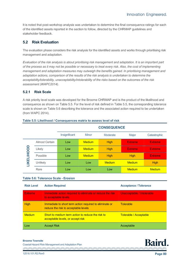

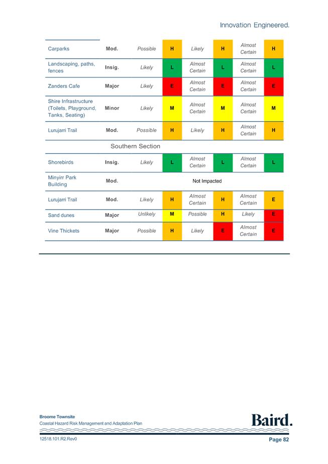


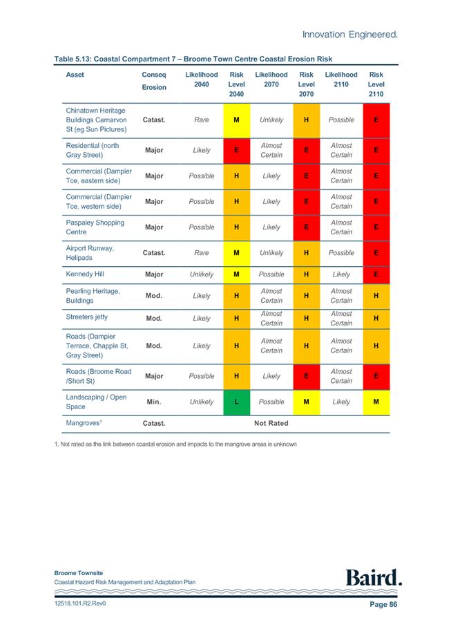
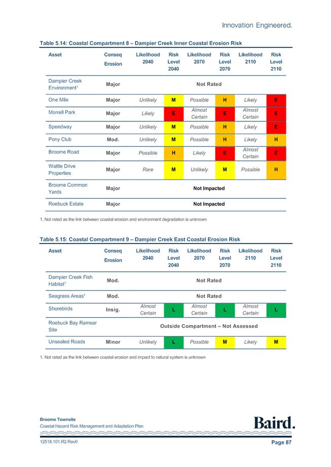
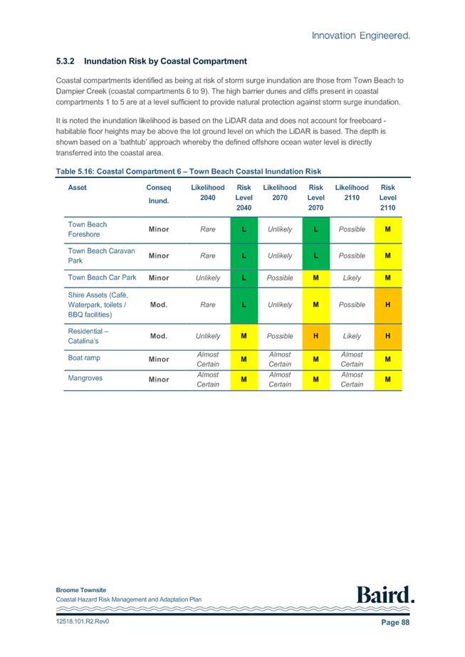
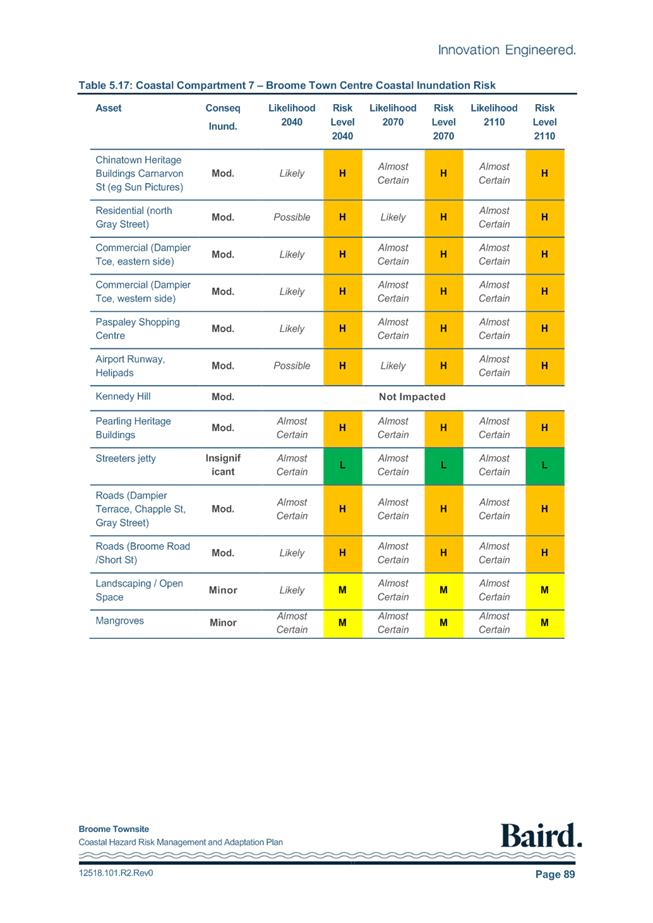
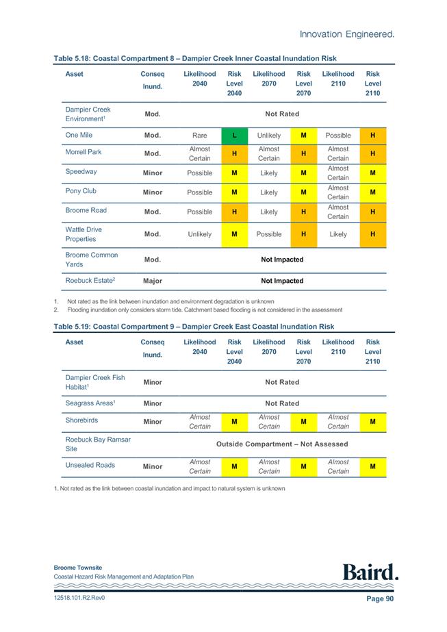


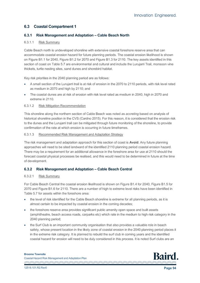

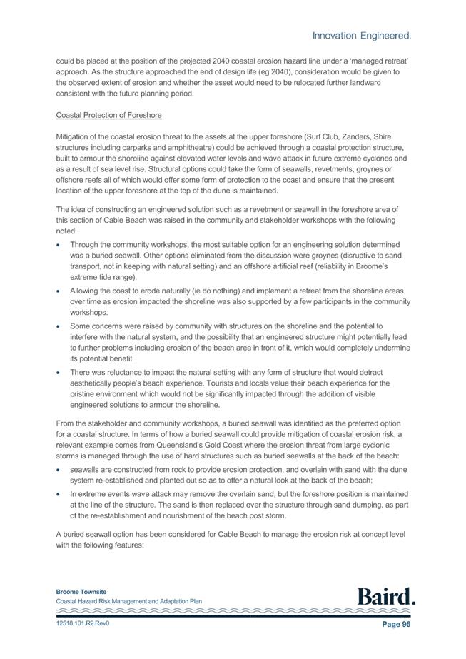


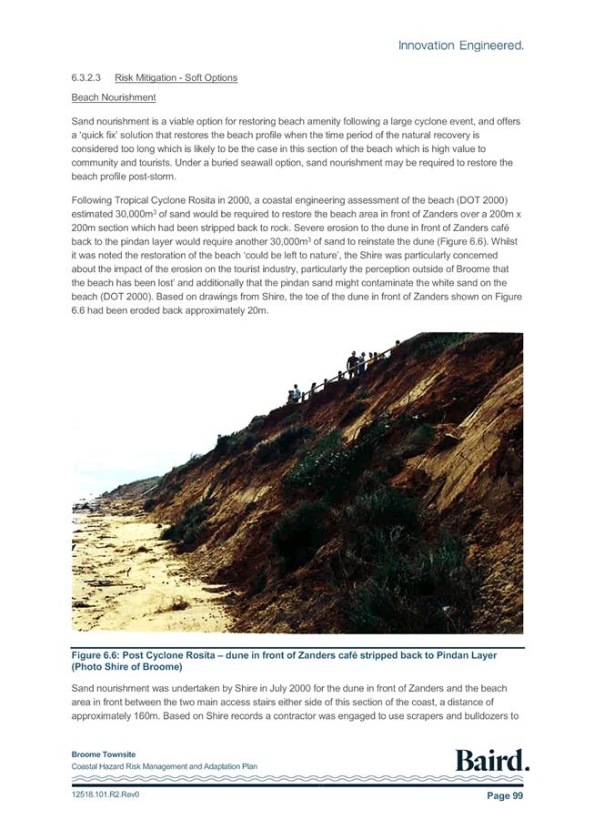
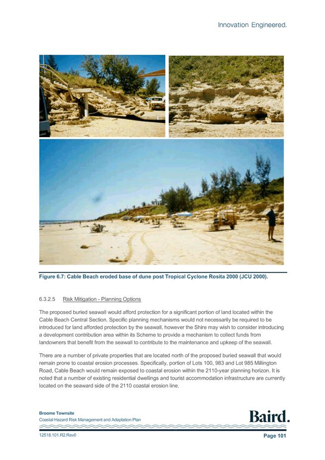
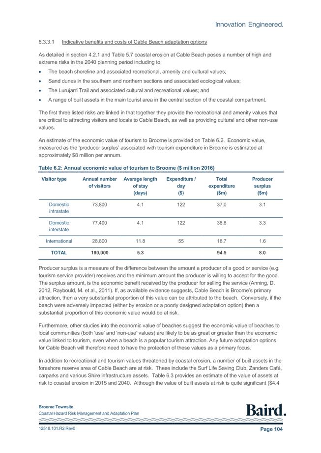
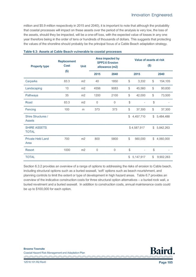
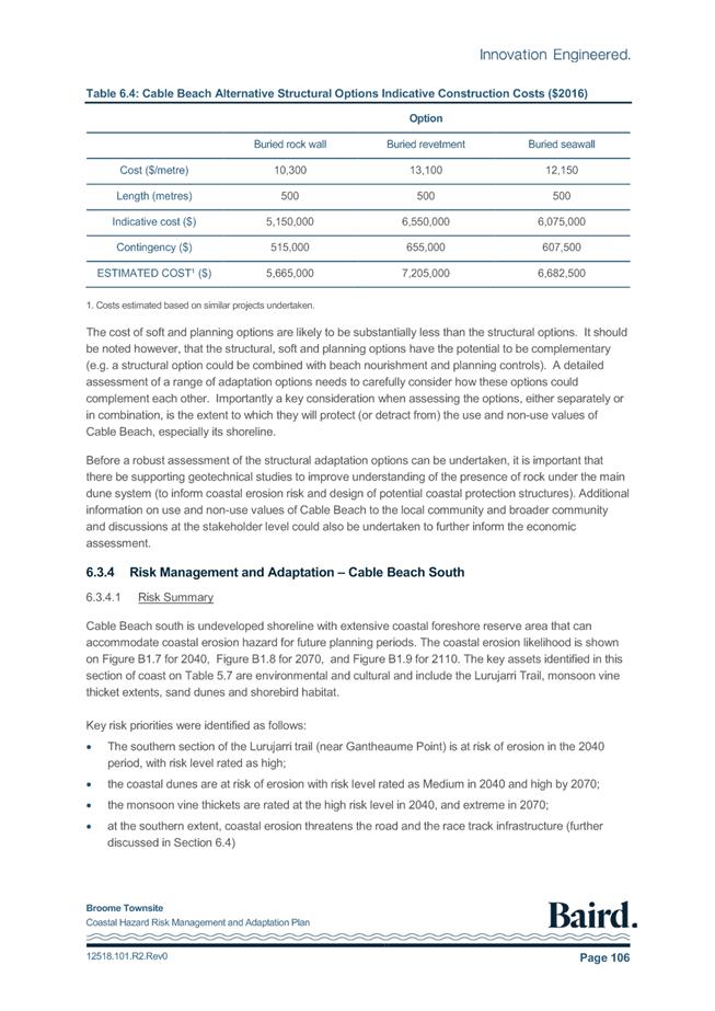
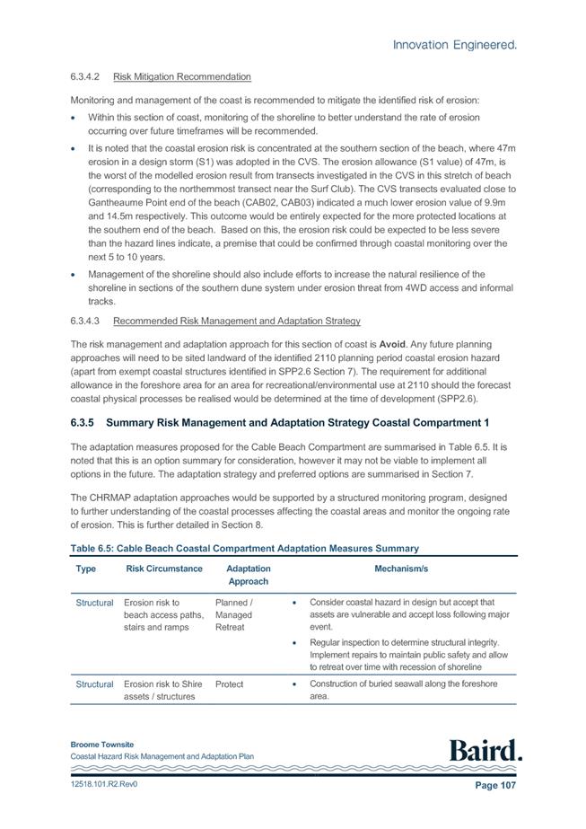
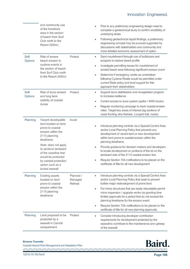
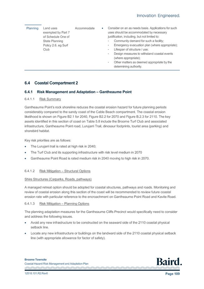
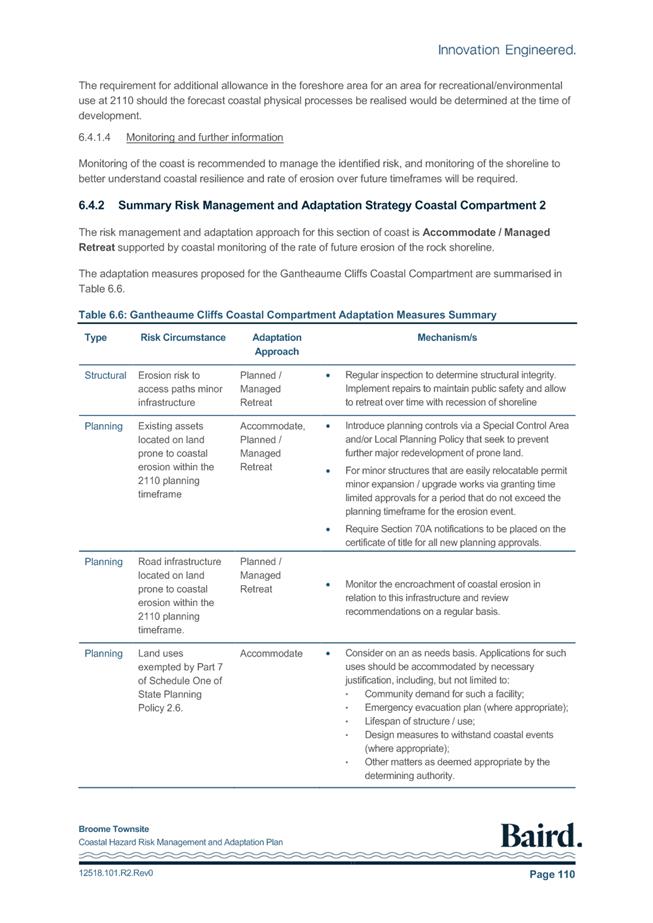
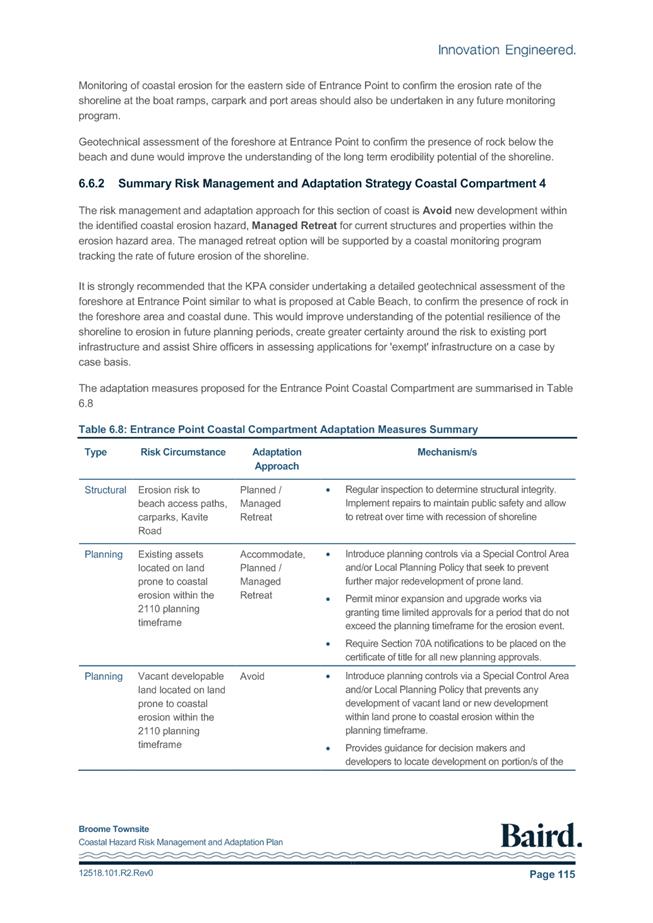
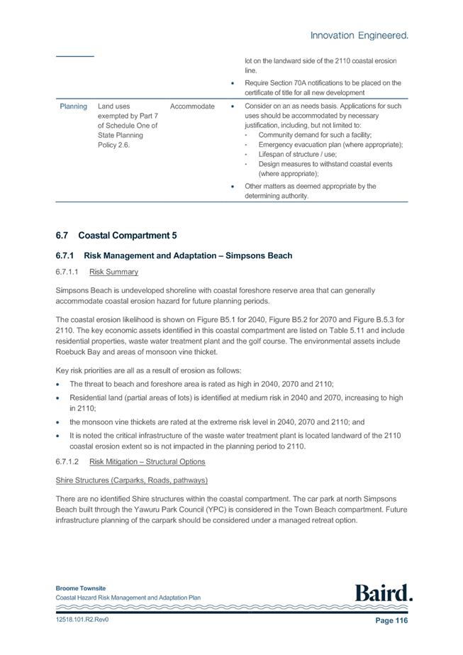
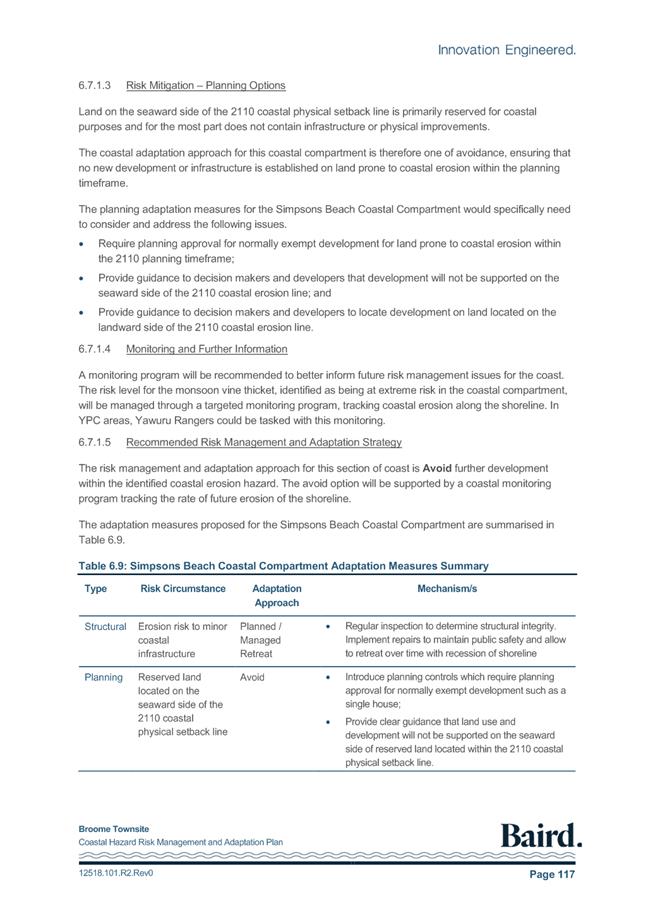
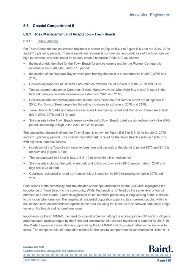
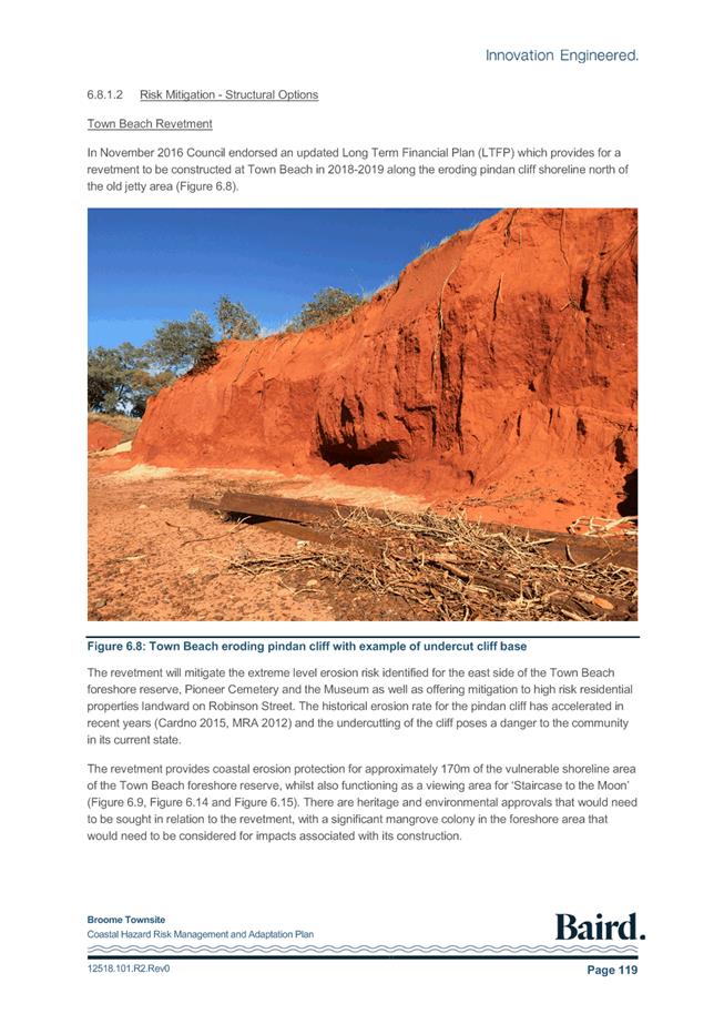
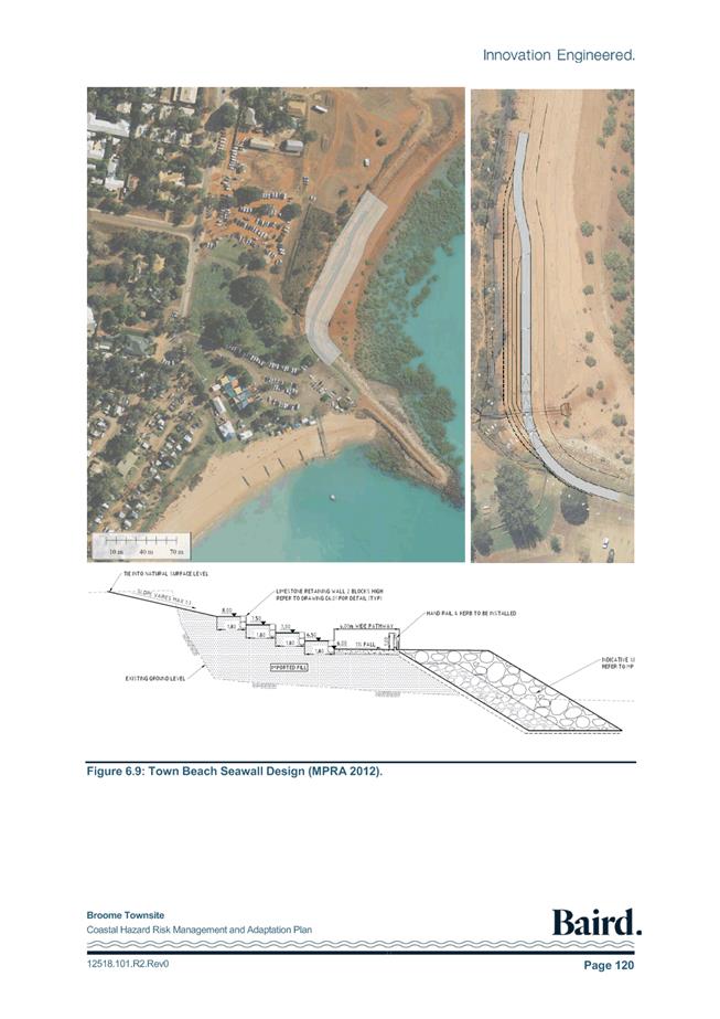
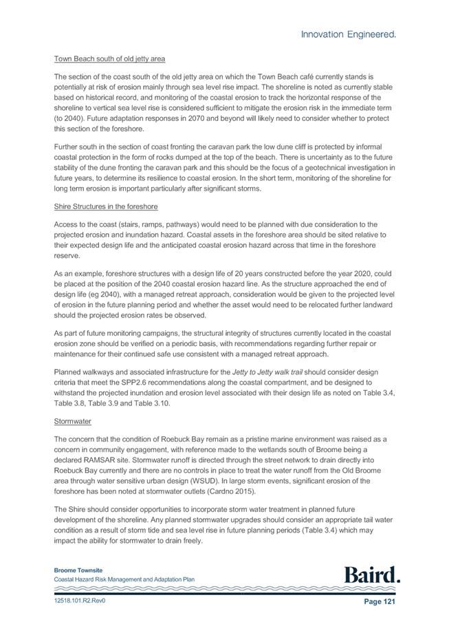
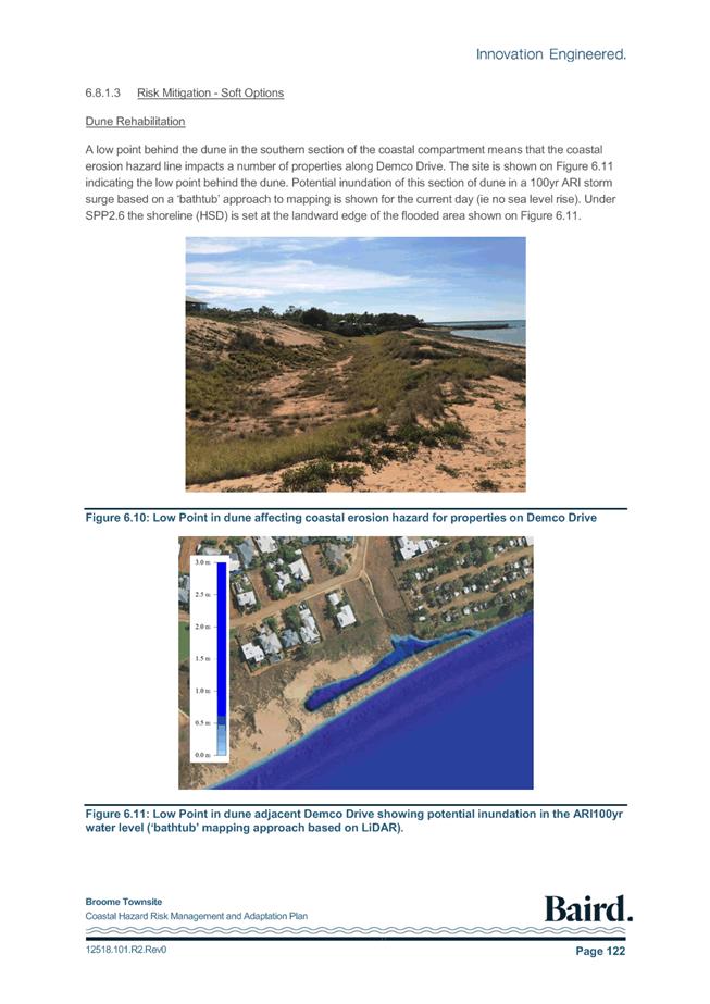
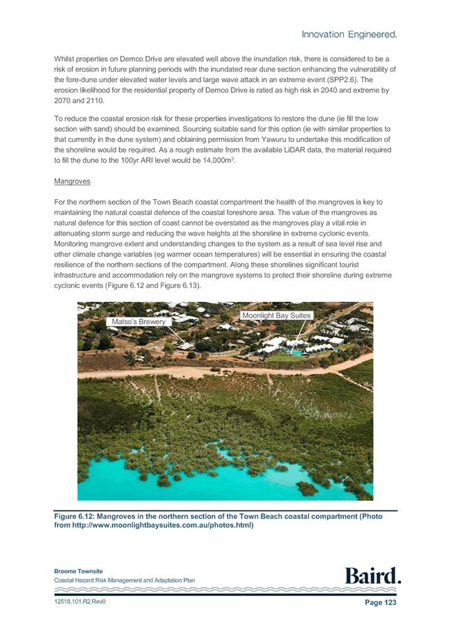
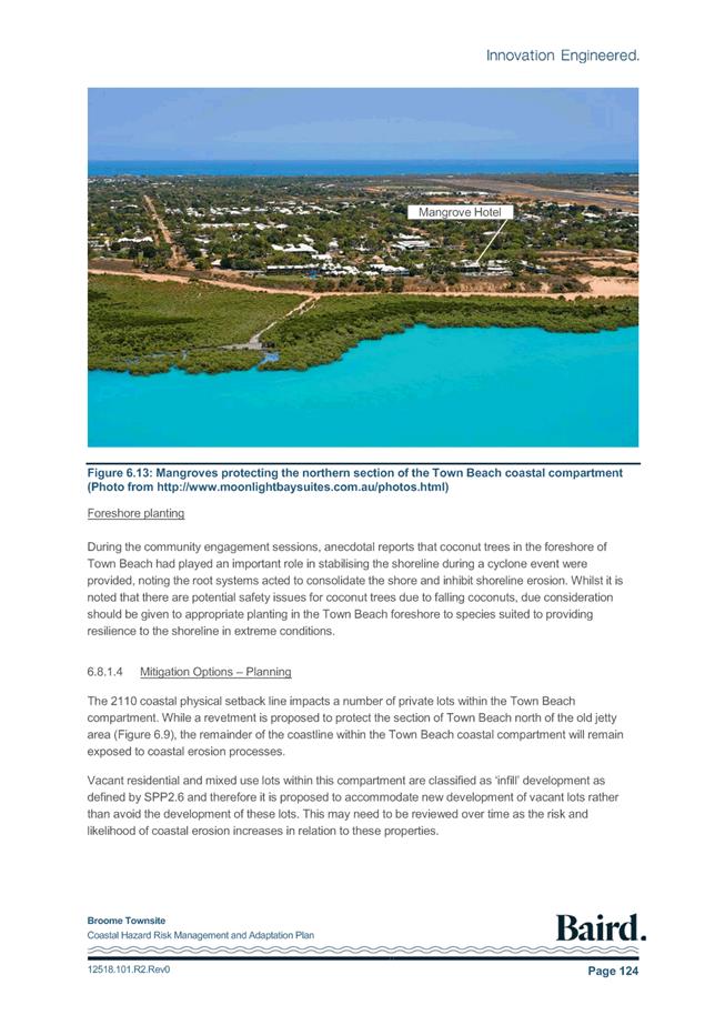
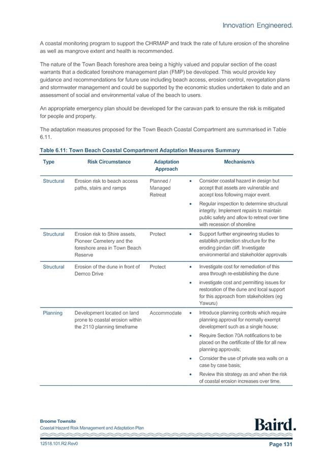
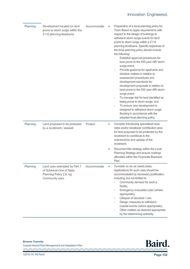
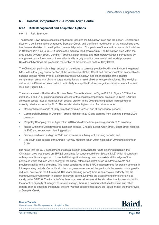
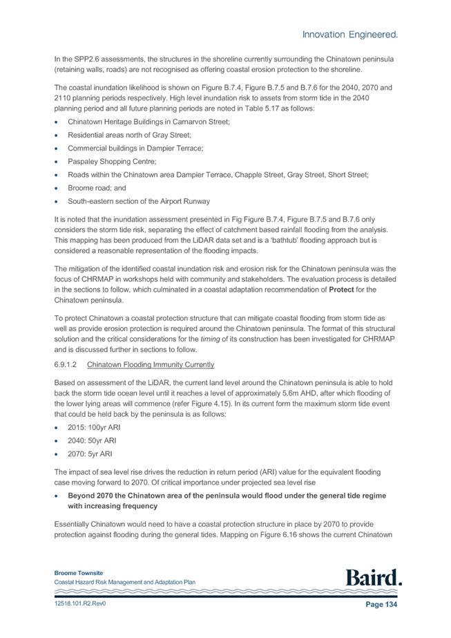
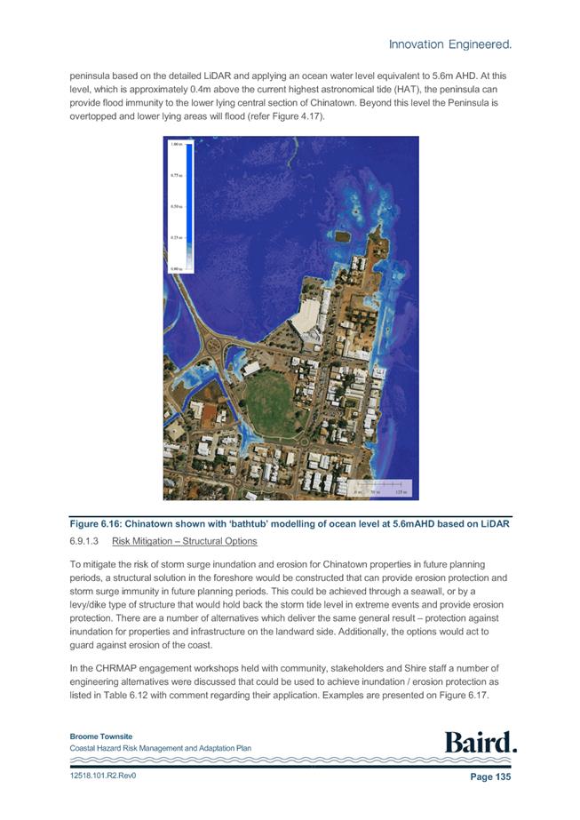
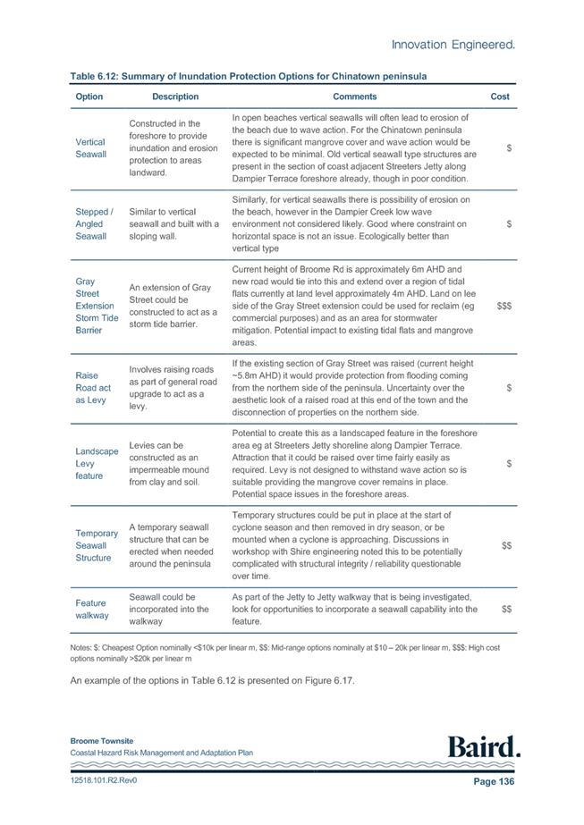
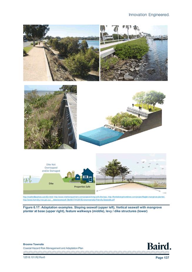
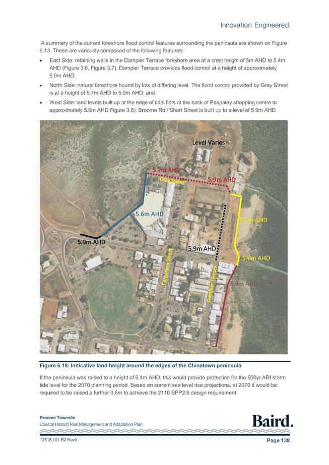
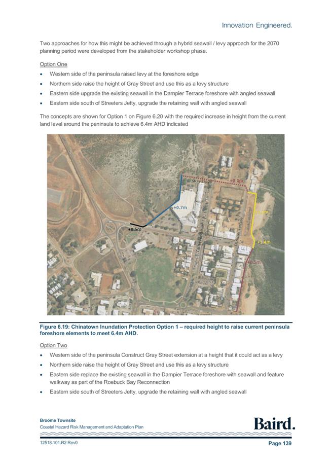
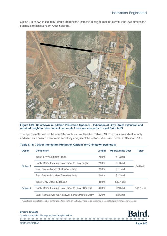
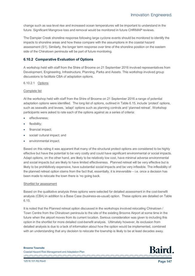
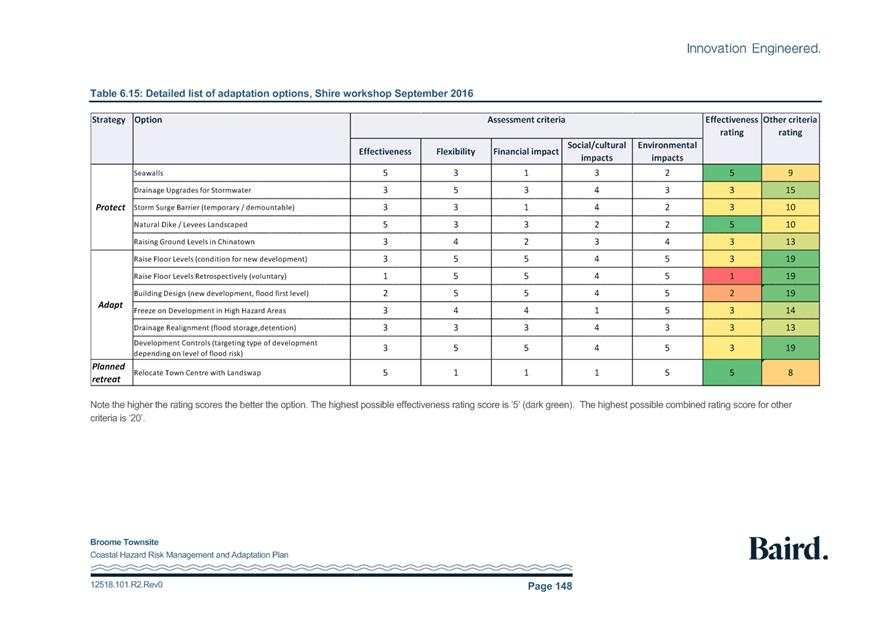
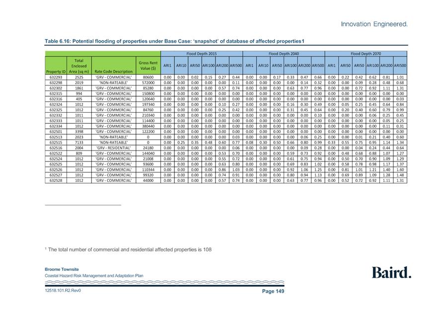
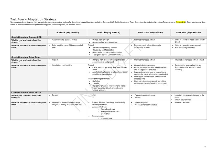
|
Item 9.2.3 - ADOPTION OF THE BROOME TOWNSITE COASTAL
HAZARD RISK MANAGEMENT AND ADAPTATION PLAN
|


|
Document ID: PG 2016/716-383 Broome, Coastal Hazard Risk Plan,
Baird-Tender/7 Final Documents/1 Lodged/Stakeholder Engagement/FINAL Community
Engagement Strategy 07.06.16.docx
|
|
Issue
|
Date
|
Status
|
Prepared by
|
Approved by
|
|
Name
|
Initials
|
Name
|
Initials
|
|
1
|
27.04.16
|
Draft
|
Jessica Black
|
|
Cath Blake-Powell
|
|
|
2
|
10.05.16
|
Draft
|
Jessica Black
|
|
Cath Blake-Powell
|
|
|
3
|
03.06.16
|
Final Draft
|
Jessica Black
|
|
Cath Blake-Powell
|
|
|
4
|
07.06.16
|
Final
|
Jessica Black
|
|
Cath Blake-Powell
|
|
|
This report has been prepared for the exclusive use of
the Client, in accordance with the agreement between the Client and TPG
(‘Agreement’).
TPG accepts no liability or responsibility whatsoever in
respect of any use of or reliance upon this report by any person who is not a
party to the Agreement or an intended recipient.
In particular, it should be noted that this report is a
qualitative assessment only, based on the scope and timing of services
defined by the Client and is based on information supplied by the Client and
its agents.
TPG cannot be held accountable for information supplied
by others and relied upon by TPG.
Copyright and any other Intellectual Property arising
from the report and the provision of the services in accordance with the
Agreement belongs exclusively to TPG unless otherwise agreed and may not be
reproduced or disclosed to any person other than the Client without the
express written authority of TPG.
|
Contents
1. Introduction 1
2. Project
Background and Scope 2
3. Purpose
and Objectives 3
4. Stakeholder
Identification and Analysis 4
4.1. Identification 4
4.2. Analysis 4
4.3. Stakeholder Analysis 5
5. Overview
Approach to Communications & Engagement 6
5.1. Key Project Messages – Communications 7
6. Project
Communications 8
6.1. Project Teams 8
6.2. Consultant Project Team 8
6.3. Shire Project Team 8
6.4. Project Steering Committee 8
6.5. Project Team Communications 8
6.6. External Communications 8
6.7. Regular Communications 9
7. Communications
and Engagement Actions 10
8. Feedback Mechanisms 13
9. Conflict Resolution 14
1. Introduction
The Project Consultant Team (Baird Australia, TPG Town Planning,
Urban Design and Heritage (TPG) and Marsden Jacob Associates) has been
appointed by the Shire of Broome (‘The Shire’) to undertake a
Coastal Hazard Risk Management and Adaptation Plan (CHRMAP) for the Broome
townsite area.
This Community and Stakeholder Engagement Plan (CSEP) seeks to
ensure that the community and stakeholders are informed and are actively and
effectively engaged throughout the CHRMAP process.
The purpose of this CSEP is to:
· Provide an understanding
of the purpose and intent of the CHRMAP;
· Define the project
structure, key roles and responsibilities of the Consultant Team and the Shire
along with communication protocols;
· Establish guiding
communication and engagement objectives;
· Identify key project
stakeholders;
· Establish an appropriate
community engagement approach, tools and techniques;
· Outline the engagement
and communications schedule;
· Acknowledge political
sensitivities and provide an approach to dealing with user group conflict; and
· Establish a feedback
mechanism.
The CSEP has been presented to the Project Steering Committee
for consideration prior to commencing the community engagement process.
2. Project Background and
Scope
The Shire of Broome has recently completed a Coastal
Vulnerability Study (CVS) for the townsite of Broome, which identified that
portions of the townsite are at risk from coastal hazards, namely inundation
and erosion, over a 100 year planning timeframe. In accordance with State
Planning Policy 2.6 – State Coastal Planning Policy (SPP2.6), areas at
risk of being affected by coastal hazards require a Coastal Hazard Risk
Management and Adaptation Plan (CHRMAP).
The CHRMAP will utilise the outcomes of the CVS to:
1. Inform
key stakeholders and the Broome community about the coastal hazard risks
identified in the CVS;
2. Undertake
a widespread stakeholder and community engagement program that will identify
the values of various coastal assets, inform the tolerance of the identified
coastal hazard risks, identify potential adaptation options to address the
risks and indicate the level of support for these options; and
3. Produce
a Broome Townsite CHRMAP in accordance with the Western Australian Planning
Commission's (WAPC's) CHRMAP Guidelines, to be adopted by Council.
The extremes of Broome’s tides continue to shape the town
and the lives of its residents. From daily fishing times, to the historic
and recurrent flooding of the Sun Pictures - residents have a connection and respect
for the water and the changes in tide levels. Therefore, the
community’s involvement in this project is crucial to its success - not
only because the outcomes of the CHRMAP are likely to be of significant
interest to stakeholders, but also because of this community’s strong
connection to the coast.
The CHRMAP will inform the community about potential risks;
identify community and cultural values and the social value of environmental
assets as well as key coastal infrastructure and assets; and provide a clear
pathway for the Shire of Broome and partners to address coastal hazard risks
over time. Ultimately, the CHRMAP will guide investment decisions by the
Shire in terms of the location and maintenance of coastal infrastructure, and
provide guidance for the development of statutory planning controls
3. Purpose
and Objectives
Community and
stakeholder engagement has a number of identifiable benefits that can be
realised during the course of this project. In summary, community and
stakeholder engagement:
· Encourages local
communities and stakeholders to express their views;
· Fosters a sense of
community cohesion;
· Enables the acquisition
of local knowledge;
· Creates a mutual sense
of ownership and shared responsibility for the process and the outcomes
achieved;
· Has the ability to
achieve outcomes that are reflective of the aspirations of the community and
stakeholders;
· Can assist in producing
quality outcomes that are practical, relevant and can be effectively
implemented; and
· Has the ability to help
manage expectations and allay fears of the unknown and possible change in
circumstances.
The following objectives will
guide the ongoing consultation and engagement elements of this project:
· Encourage the
participation of everyone affected by or interested in the CHRMAP;
· Create an encouraging
and supportive engagement environment;
· Ensure information
regarding the CHRMAP process is easily accessible and understood;
· Foster an appreciation
and understanding of varying views and needs with respect to the CHRMAP;
· Facilitate the building
of social capital and functional relationships between different stakeholders;
· Ensure an open,
transparent and accountable community and stakeholder engagement process is
undertaken;
· Allow sufficient time to
participate and engage in the CHRMAP process;
· Provide a consistent
approach to community and stakeholder engagement;
· Ensure the communication
and engagement expectations of the community and stakeholders are managed and
guided in accordance with the CSEP; and
· Provide the community
with feedback, whilst respecting the privacy and confidentially of those
engaged.
These objectives form the framework around which the detailed
engagement methodology, as reflected within the Communications and Engagement
Actions schedule, is developed.
4. Stakeholder
Identification and Analysis
4.1. Identification
Understanding who the project stakeholders are is a critical
element of any project or programme. By understanding who these individuals and
groups are it is possible to understand what degree of influence and thus
involvement they will and should have as part of the project.
Stakeholders have been identified and broadly grouped as follows:
· Shire of Broome Council
and Staff;
· Project Steering
Committee;
· Government departments
and service authorities;
· Affected landowners and
lessees;
· Yawuru Prescribed Body
Corporate (PBC) and other Aboriginal organisations;
· Community interest
groups; and
· Local residents and the
broader community.
4.2. Analysis
Analysing
the stakeholders is an essential part of developing an engagement plan. The
following Stakeholder Matrix provides an assessment of the level of influence
each group has, their recommended level of engagement and the most appropriate
method to engage them with.
Stakeholder Matrix Diagram
|
High Influence
|
B
Manage Closely
|
A
Keep Satisfied
|
|
Low Influence
|
D
Monitor
(Minimum
effort)
|
C
Keep Informed
|
|
|
Low Interest
|
High Interest
|
|
A
|
High influence, highly
interested people: these are the people you must fully engage and make the
greatest efforts to satisfy.
|
|
B
|
High influence, less interested
people: work in with these people to keep them informed and satisfied, but
not so much that they become bored with your message.
|
|
C
|
Low influence, interested
people: keep these people adequately informed and talk to them to ensure that
no major issues are arising. These people can often be very helpful with the
detail of your project.
|
|
D
|
Low influence, less interested
people: again, monitor these people, but do not bore them with excessive
communication.
|
1.1.
4.3. Stakeholder
Analysis
A detailed stakeholder analysis table has been
provided to the Shire. A brief summary of this analysis includes:
|
Stakeholder Group
|
Level of Influence/
Interest
|
|
Councillors
|
A
|
|
Shire Staff
|
A - C
|
|
Shire Committees
|
C - D
|
|
Stakeholders (Authorities & Organisations)
|
A - C
|
|
Landowners - Coastal Inundation
|
C
|
|
Landowners - Coastal Process Setback
|
C
|
|
Affected Lessees - Coastal Inundation/Coastal Process Setback
|
C
|
|
Broome's Transient Population
|
D
|
|
Other Local Broome Residents
|
C - D
|
5. Overview
Approach to Communications & Engagement
The community engagement will be delivered in collaboration with
the Shire of Broome and in consultation with the Steering Committee. The
objective of the community engagement will be to inform the CHRMAP development
through a program that engages the key stakeholders and community and which
will:
1. identify the values of the coastal assets;
2. inform the tolerance of the identified coastal
hazard risks;
3. identify potential adaption options to address
the risks; and
4. indicate the level of support for these options.
The intention of this component of work is to ensure that
community concern is addressed, and that the CHRMAP process is explained so
that community expectations are managed. The project team will inform the
community of the outcomes of the CVS and the predicted impact on the Broome
town and community, and ensure that there is the opportunity for the
participants to ask questions on the coastal hazard risk identified in the CVS
and understand how their participation will be captured in the CHRMAP process.
The Community engagement would adhere to the International
Association for Public Participation (IAP2) platform and the Shire’s
Community Engagement Framework, which established five levels of engagement,
including:
· Inform – to provide the public with balanced and objective
information to assist them in understanding the problem, alternatives,
opportunities and/or solutions.
· Consult – to obtain public feedback on analysis,
alternatives and/or decisions.
· Involve – to work directly with the public throughout the
process to ensure that public concerns and aspirations are consistently
understood and considered.
· Collaborate – to partner with the public in each aspect of
the decision including the development of alternatives and the identification
of the preferred solution.
· Empower – to place final decision making in the hands of
the public.
A variety of communication and engagement activities will be
undertaken as part of the CHRMAP engagement process - please refer to Section 7
of this document for an indication of when these processes will be used (and in
what order they’ll be employed). These activities include:
· Briefing notes &
Council briefings:
Communication materials will be prepared and provided to Council and the
Shire’s staff in different forms. Dissemination of this information will
be at key milestones in the project based on the relevance of the
information;
· Government department
and servicing authorities communication: Written and/or verbal
communications will be initiated by the Shire during the preliminary stages of
the project to ensure government departments and servicing authorities are made
aware of the project and its scope. Feedback on relevant opportunities and
constraints will also be sought;
· Stakeholder/Community
Information Forums: x2
open Community Information Forums will provide information packs to all
attendees, which will allow participants to be more informed (of the project
and the outcomes of the CVS) prior to any workshops taking place. The
information session will also outline the project’s approach, and outline
ways that the community can be involved in the process. The facilitation of an
open briefing session is an important step in managing community concern. There
are two information sessions proposed (to both be held on the same day) to
allow as many people to attend as possible (and to cater for Broome’s
diverse population). A range of tools and techniques will be employed to
raise awareness of these workshops including invitations, flyers and posters,
newspaper and radio advertisements, and online information;
· Stakeholder/Community
Workshops: These
workshops will take participants through a logical process of understanding the
issues, the context and the technical components of the Coastal Hazard Risk
Management and Adaptation Plan and encourage community and stakeholders to
articulate risk tolerances and community values of coastal assets.
Additionally, it will allow stakeholders to provide opportunities to contribute
to the proposed management and adaptation, as well as ask questions of the
assessment. A range of tools and techniques will be employed to raise
awareness of these workshops including invitations, flyers and posters,
newspaper and radio advertisements, and online information;
· Feedback Forms/Surveys: As part of the public
advertising period, feedback on the CHRMAP will be sought via an online/hard
copy feedback forms/surveys. The above-mentioned tools and techniques
associated with raising awareness of the workshops will also be employed to
raise awareness of the feedback form process.
5.1. Key Project Messages – Communications
Communication will form an integral component of this project. The
use of readily accessible wording and material preparation for all
communication mediums will aim to maximise access and understanding of the
project as a whole, key issues and recommendations.
The following outline the key project messages that will need to
be re-enforced throughout the project when preparing any communication
materials:
1. The
Shire recently completed a Coastal Vulnerability Study (CVS) for the townsite
of Broome, which identified portions of the townsite that are at risk from
coastal hazards (including inundation and erosion) over the next 100 years.
2. The
Shire is now preparing a Coastal Hazard Risk Management Adaptation Plan
(CHRMAP), which will translate
scientific coastal modelling (and local community input) into a document that
will provide guidance for the development of statutory planning
controls and guide investment decisions into the future.
3. There will be a number of
opportunities for the community and stakeholders to have their say throughout
the CHRMAP process. Community and stakeholder involvement will be sought
to:
· identify key
coastal infrastructure/assets that hold community, cultural, and
environmental value;
· describe
tolerances to the identified coastal hazard risks; and
· provide
feedback to (and identifying additional) proposed
adaptation options to address the risks.
4. Adaptation
actions to be considered in the CHRMAP will include an assessment of all the
options set out the coastal hazard risk and adaptation planning hierarchy in
State Planning Policy 2.6, including:
· ‘Avoidance’ - Avoid the presence of new development
within an area identified to be affected by coastal hazards.
· ‘Planned
or Managed Retreat’ - the relocation or removal of assets within an area
identified as likely to be subject to intolerable risk of damage from coastal
hazards over the planning time frame.
· ‘Accommodation’
– design and/or management strategies that render the risks from the
identified coastal hazards acceptable.
· ‘Protection’
- areas where there is a need to preserve the foreshore reserve, public access
and public safety, property and infrastructure that is not expendable.
6. Project
Communications
6.1. Project
Teams
The following is a list of persons that comprise the core
project team, being the key members of the Shire’s Staff and the Project
Consultant Team:
6.2. Consultant
Project Team
· Jim
Churchill (Baird Australia) – Project Manager and Lead Coastal Hazard and
Risk
· Jessica
Black (TPG) – Lead Community and Stakeholder Engagement Consultant
· Mike
Davis (TPG) – Lead Strategic and Statutory Planner
· Cath
Blake-Powell (TPG) – Stakeholder Engagement Director
· Dr
Peter Kinrade (Marsden Jacob Associates) – Identification and analysis of
adaptation options, CBA
· Nadja
Arnold (Marsden Jacob Associates) – CBA Analysis and Modelling
6.3. Shire
Project Team
· Monica Sullivan –
Strategic Planning Coordinator
· Aletta
Nugent – Director Development Services
6.4. Project
Steering Committee
· Shire
of Broome representatives (as above)
· Hilary
Wilkins – LandCorp
· Cate
Gustavvson – Department of Planning
· Deborah
Millener – Department of Planning
· Tim
Bray – Kimberley Development Commission
6.5. Project Team Communications
Day-to-day contact regarding the community engagement approach
shall be between the Principal Points of Contact:
· Shire of Broome: Monica
Sullivan – Strategic Planning Coordinator
· TPG Conversations:
Jessica Black –
Lead Community and Stakeholder Engagement Consultant
Jim Churchill (Baird Australia) – Project Manager shall be
kept informed throughout the project.
Communications between and requests of the Shire and Project
Consultant Team are to be acknowledged and responded to in a timely manner to
ensure project timeframes are met.
6.6. External
Communications
External project communications are to be controlled through the
Shire and all information produced by the Project Consultant Team shall be
distributed by such person, unless otherwise required/agreed.
It is anticipated that the project team will work with the
Shire’s Team to prepare the material; TPG shall provide a graphic
template for communications (and advice regarding the content) and the Shire
Team shall be responsible for the compilation of this material. The Shire
will be responsible for circulation, via the Shire’s website, mobile
application and/ or hard copy distribution.
The following “Communications and Engagement
Actions” table also identifies how often general communications and
engagement will occur (refer to section 7).
6.7. Regular
Communications
Regular communications will need to occur to ensure Council,
staff, the community and key stakeholders are kept informed and up to date on
project activities.
7. Communications and Engagement Actions
|
Key Tasks
|
Detailed Description
|
Completion Date
|
Responsibility
|
Target Audience
|
|
Stage 1 – Project
Inception & Stakeholder Engagement Strategy
|
|
1.1
|
Project
Inception
|
Meet
with the Shire’s Project Team to discuss and clarify project scope of
works, including scope of community engagement.
Determine
and request relevant information and data (base mapping, population and
demographic data, background reports and studies, key stakeholders and Shire
staff members).
|
30th
March 2016
|
|
Project
Team
|
|
1.2
|
Stakeholder
Identification
|
Prepare
a detailed stakeholder list in conjunction with the Shire.
|
31st
March 2016
|
The Shire – to supply
draft list
TPG – to review
& work with The Shire to determine levels of anticipated involvement in
project.
|
NA
|
|
1.3
|
Finalise
Community Engagement Plan
|
Following
the identification of all relevant stakeholders, prepare a community
engagement plan.
|
2nd
May 2016
|
TPG (in consultation with
The Shire)
|
NA
|
|
Stage
2 – Literature Review and Preparation of Issues Paper
|
|
2.1
|
Coastal
Literature Review
|
|
2.2
|
Issues
Paper -
|
Summarise
the coastal issues from the CVS and planning issues from a review of the
planning documents that will need to be addressed in the CHRMAP and community
engagement process.
|
27th
May 2016
|
Baird
|
|
|
2.3
|
Planning
Documents & Strategic Documents Preview
|
|
Stage 3 –
Preparation of Draft CHRMAP (dates may change as the project progresses)
|
|
3.1
|
Council
Briefing
|
Baird to provide a briefing
to Council, informing of the CVS Outcomes and CHRMAP process
|
14th
June 2016
|
Baird
|
|
|
3.2
|
Communications
& Advertising
|
TPG to liaise with Council
Officer’s on the preparation of CHRMAP communications and
advertising. Tasks include:
· 8/6/16
- 17/6/16
Prepare
Communications & Advertising material including:
o Prepare
“Issues Summary” for public information, which shall address:
- What is the
Shire of Broome Coastal Hazard Risk Management Adaptation Plan (CHRMAP)?
- Why is the
CHRMAP being undertaken?
- What is a
Coastal Hazard Risk?
- When is the plan being prepared?
- Who will be involved?
- What is a
CVS & what does the CVS mean?
- Where can you get information on
the project?
- Frequently Asked Questions,
including:
- How will
this affect my insurance?
- How will my
property be affected?
1.
(TPG/Baird/The Shire to organise);
o Prepare letter of invitation
for the Information Forums and Workshops to key community
members/stakeholders identified in Stakeholder Analysis. Provide key
(summarised) information from “Issues Summary” (The Shire to
organise & print/distribute, TPG to advise on wording & provide
graphics template);
o Prepare advertisements for the Information Forums and Workshops
within local newspapers and local radio stations, which shall include key
event information, links to the The Shire webpage, and requests for event
RSVP (The Shire to organise & print/distribute, TPG to advise on wording
& provide graphics template);
o Prepare of information flyers/posters (The Shire to organise &
print/distribute, TPG to advise on wording & provide graphics template).
o Set up a
Shire contact email address (and phone number/contact name) for individuals
to ask questions and register interest for the Information Forums and
Workshops (The Shire to organise);
o Prepare
RSVP form - ask for information including: key demographic information,
whether the individual is part of any community groups, whether they have an
affected property (and where that property is located), why they wish to
attend the event/s, which forum/workshop they wish to attend, and whether they would like a copy of the
“Issues Summary” sent out to them prior to the Information Forum (The Shire to organise & print/distribute, TPG to
advise on wording & provide graphics template).
· 20/6/16
Launch
Communications & Advertising material including:
o Distribution of letters (The
Shire);
o Advertisements within local newspapers and radio
stations (The Shire);
o Information
flyers/posters made available at key locations such as the Shire’s
Administration Building and within public gathering places (The Shire);
o Launch information on The Shire webpage, which
shall include: the “Issues Summary”, details regarding the
forums/workshops, and a link to the RSVP form for forum/workshop attendance,
and an email address to lodge questions (The Shire);
o Advertisements on Facebook Page,. (The Shire
to organise – TPG to advise on wording);
o Mail out
“Issues Summary” upon request.
· 6/7/16
- RSVP closing date for the Information Forums and Workshops.
· 13/7/16
– mail out “Issues Summary” as requested.
|
8th
June – 15th July 2016
|
TPG – engagement
materials & event advertising/ communications advice.
The Shire – Event advertising
and communications (including receiving registrations & confirming
attendees).
Baird – engagement
materials (technical information).
|
NA
|
|
3.3
|
Preparation
for Information Forum
|
TPG to liaise with Council
Officer’s on the preparation of the Information Forums. Tasks
include:
· 14/6/16
Book
venue/s and organise catering (The Shire)
Venues
that are chosen should be easily accessible by foot and car, and are spaces
that will feel welcoming to all cultural groups.
· 8/6/16
– 19/7/16
Event
logistics & engagement materials coordinated. Determine MC for event.
(The Shire & TPG)
|
13th
June – 19th July 2016
|
TPG – engagement
materials (including PowerPoint presentation).
The Shire – Venue hire and
catering, provision of Audio Visual equipment, & the Shire Section of the
PowerPoint.
Baird –
engagement materials (including PowerPoint presentation).
|
NA
|
|
3.4
|
Information
Forums
Level of
Engagement: Inform
|
Facilitate Information Forums, x1 2hr Forum during the
day and x1 2hr Forum in the evening (after work). These sessions shall
include the following process:
· Introductions and welcome: outline the project,
objectives, process, timeframes and opportunities for the community to engage
in the process.
· Presentation on CVS – explain technical
information with clear graphics and simple language;
· Presentation on implications of CVS – explain
technical information with clear graphics and simple language;
· Reiterate the project’s next steps (workshop
details etc);
· Open up for questions from the participants;
· Close.
* Provide printouts of the
“Issues Summary”
|
Wednesday 20th
July 2016
|
TPG – workshop facilitation, event
advertising advice, workshop setup & pack down.
The Shire – catering, assist
with forum, forum setup & pack down.
Baird –
presentation & forum facilitation, forum setup & pack down.
|
Community
& Stakeholders
|
|
3.5
|
Communications
& Advertising
|
TPG to liaise with Council
Officer’s on the preparation of CHRMAP communications and
advertising. Tasks include:
· 25/7/16
- 29/7/16
Prep
Communications & Advertising material including:
o Preparation
of advertisements for Workshops within local newspapers and local radio
stations;
· Preparation of information flyers/posters (The Shire to organise & print/distribute, TPG to
advise on wording & provide graphics template).
· 29/7/16
Launch
Communications & Advertising material including:
o Advertisements within local newspapers and radio
stations (The Shire);
o Information
flyers/posters made available at key locations such as the Shire’s
Administration Building and within public gathering places; (The Shire to organise & print/distribute, TPG to
advise on wording & provide graphics template)
o Advertisements
on Facebook Page. (The Shire to
organise & print/distribute, TPG to advise on wording & provide
graphics template)
· 10/8/16
- RSVP closing date for Workshops.
· 11/8/16
– Send “Information Packs” as requested (mail or email)
(The Shire)
|
21st
July – 15th August 2016
|
TPG – engagement
materials & event advertising/ communications advice.
The Shire – Event advertising
and communications (including receiving registrations & confirming
attendees).
Baird – engagement
materials (technical information).
|
NA
|
|
3.6
|
Preparation
for Workshops
|
TPG to liaise with Council
Officer’s on the preparation of the Information Forums. Tasks
include:
· 22/7/16
Book
venue/s and organise catering (The Shire)
Venues
that are chosen should be easily accessible by foot and car, and are spaces
that will feel welcoming to all cultural groups.
· 22/7/16
– 15/8/16
Event
logistics & engagement materials coordinated. (The Shire & TPG)
|
22nd
July – 15th August 2016
|
TPG – engagement
materials (including PowerPoint presentation).
The Shire – Venue hire and
catering, engagement materials (including PowerPoint presentation).
Baird –
engagement materials (including PowerPoint presentation).
|
NA
|
|
3.7
|
Workshops
Level of
Engagement: Involve
|
Facilitate Workshops, x1 3-4hr daytime workshop and x1
3-4hr evening workshop. The proposed workshop process is as follows:
|
16th
August 2016
|
TPG – workshop facilitation, event
advertising advice, workshop setup & pack down.
The Shire – catering, assist
with workshop, workshop setup & pack down, & compile engagement
outputs.
Baird – presentation
& workshop facilitation, workshop setup & pack down.
|
Community
& Stakeholders
|
|
· Introductions and welcome: outline the project,
objectives, process, timeframes and opportunities for the community to engage
in the process.
· Brief Presentation on CVS and its implications –
explain technical information with clear graphics and simple language;
· Exercise 1
– COASTAL ASSETS
Table exercises in small
groups: using a large aerial photograph,
participants are asked to identify their valuable coastal assets using sticky
dots: green stickers to identify environmental assets, red stickers to identify
social assets, & blue stickers to identify economic assets.
· Re-group and present back to the workshop participants
and the findings will be documented.
|
· Exercise 1/A – ADAPTATION OPTIONS
Table exercises in small
groups: overlay CVS findings onto coastal assets
drawing.
· Baird to present preliminary Adaption Options to
Workshop
· Exercise 1/B – ADAPTATION OPTIONS
Table exercises in small
groups: participants are asked to rate the
preliminary adaptation options and discuss alternative options within groups
· Re-group and present back to the workshop participants
and the findings will be documented.
· Entire workshop asked to identify and prioritise (with
sticky dots) preferred adaptation options.
· Open up for questions from the participants.
· Close.
|
|
*
Provide printouts of the “Issues Summary”
* Depending on who attends, tables may be grouped
according to affected areas (this can be confirmed once RSVPs have been
received).
|
|
3.8
|
Community
and Stakeholder Engagement Summary
|
Following
the above, we will briefly analyse the information gathered and summarise the
key “learnings”, which will be used by the project team to inform
the CHRMAP.
|
31st
August 2016
|
The Shire – collate and
summarise outputs from workshops
TPG – analyse results
|
Shire
& Project Team
|
|
3.9
|
Feedback
to Stakeholders and Community Members
|
Share
the outcomes of the engagement process with key stakeholders and the broader
community in a timely manner. Utilise the Shire’s website and other
online and print media opportunities to ensure the feedback loop is
maintained. This feedback will be provided via the The Shire webpage,
Facebook account, and/or emails.
|
31st
August 2016
|
The
Shire
|
Community
& Stakeholders
|
|
3.10
|
Draft
CHRMAP
|
Deliver
Community Engagement Strategy, Complete Stage all tasks for development of
CHRMAP
|
1st
November 2016
|
Baird
|
Shire
|
|
Stage 4 –
Preparation of Final CHRMAP (dates may change as the project progresses)
|
|
4.1
|
Peer
Review
|
Steering
Committee and Shire to review Draft CHRMAP
|
15th
November 2016
|
Baird
|
Shire
|
|
4.2
|
Final
Draft CHRMAP Adopted by Council for Advertising
|
Peer
Review Comments incorporated into final draft of CHRMAP
|
1st
December 2016
|
Baird
|
Shire
|
|
4.3
|
Public
Advertising Preparation
Level of
Engagement: Consult
|
Shire Officers to prepare
public advertising including:
· Project update & invitations to comment on proposed CHRMAP via
Facebook, Twitter, local newspaper and radio advertisements, &
posters/flyers at key community locations; (The Shire)
· Written invitations to comment on proposed CHRMAP to be mailed to key
stakeholders; (The Shire)
· Webpage outlining key information, including: summary of process so
far, outcomes thus far and rationales for proposed CHRMAP, CHRMAP document
(published only after Council consent), links to online survey to provide
feedback; (The Shire)
· Draft CHRMAP document to be printed and displayed at Council building
(and local Library), alongside printed feedback forms (with same questions as
online survey) to enable people to provide had written feedback; (The Shire)
|
1
February 2017 – 15 March 2017
|
The Shire – to carry out all
tasks
TPG – to provide advice
on logistics of process and summarise feedback
|
Community
& Stakeholders
|
|
4.4
|
Final
Adoption of CHRMAP
|
Following
on from the above, we will briefly analyse the information gathered during the Workshop #2
and the Public Advertising feedback. The output will be a summary of key
“learnings” and will be used by the project team to inform the
concept designs and importantly, to share with key stakeholders and the
broader community.
|
May 2017
|
The Shire – collate and
summarise public advertising/community engagement responses & outputs
from the workshop.
TPG – analyse results
|
Shire
& Project Team
|
|
4.5
|
Feedback
to Stakeholders and Community Members
|
Share
the outcomes of the CHRMAP with key stakeholders and the broader community in
a timely manner. Utilise the Shire’s website and other online and print
media opportunities to ensure the feedback loop is maintained. This
feedback will be provided via the The Shire webpage, Facebook account, and/or
emails.
|
May
2017
|
The
Shire
|
Community
& Stakeholders
|
|
|
|
|
|
|
|
8. Feedback Mechanisms
Providing post-engagement feedback reassures the community that
the views and concerns of participants were acknowledged and considered. It
enables a greater degree of trust and cooperation to be established between the
community and decision-makers. It is also important that accurate feedback be
given in a timely manner and that throughout the engagement activities the
community is informed of the feedback methodology.
Feedback is to be expressed clearly and logically in ways the
community can easily comprehend and should include an analysis of the
information and data obtained and an evaluation of the process
administered. It shall be administered as and when appropriate and will
be guided by Section 7 – Communication and Engagement Actions.
9. Conflict
Resolution
In the event there is a conflict resolution
requirement within the project the following would apply:
· as soon
as identified by an individual on the project team, they shall notify the rest
of the project team;
· the
project team will work together to understand the origins of the conflict,
identify the stakeholders involved and develop an engagement approach to
minimise its effects.
|
Item 9.2.3 - ADOPTION OF THE BROOME TOWNSITE COASTAL HAZARD RISK MANAGEMENT AND
ADAPTATION PLAN
|
SCHEDULE OF SUBMISSIONS
For Broome Townsite Coastal Hazard
Risk Management Adaptation Plan
|
Number
|
Name/ Address
|
Affected Property
|
Summary of Submissions
|
Officer Comment and Recommendation
|
|
1
|
Department of Education
151 Royal Street, East Perth WA 6004
|
N/A
|
No objection.
|
Noted.
Recommendation: No further action required.
|
|
2
|
Roebuck Bay Caravan Park, 91 Walcott
Street, Broome 6725
|
Roebuck Bay Caravan Park, 91 Walcott
Street, Broome 6725
|
A minor comment is that the text
refers to the" old wharf area", probably should be more accurately
described as being "the old
jetty area"
In that same para there is
rightfully a comment about the pindan cliff erosion north of that area.
There is also about 40 metres of
pindan cliff south of the described area that is subject to erosion although
this has been somewhat controlled by the Park Operators by selective fill and
planting of vegetation. There is however a long term risk of significant
erosion.
There is comment about the caravan
park in the Town Beach sector of the report. Erosion has largely been
controlled, apart from the pindan cliffs mentioned that are in the park, by
the
operators of the park over the past
27 years by again using selective fill and vegetation and in fact in front of
town beach significant stabilisation and protection has been achieved.
The risk of inundation by sea
surging is not as high in the section known as section four as the banks are
some 4 metres high and covered with some vegetation. In the section known as
section three the around height is probably around 1 .5 metres above high
tide level.
For future mitigation of risk it is
suggested that the building of chalets or similar not be allowed in Section
three.
There is also a comment about an
emergency evacuation plan being developed for the park. Current practices
that are in place virtually cover the risk as most of the park would be at
least 4/5 metres above sea level and section three does not have permanents
placed there and all vans etc are fully moveable in the case of need. This is
the reason for suggesting that no permanent structures be allowed to be
constructed in section three.
|
Old Jetty Area Wording
Comments are noted. The
wording in the CHRMAP has been amended from the ‘Old Wharf Area’
to the ‘Old Jetty Area’.
Level of Coastal Erosion
The CHRMAP has been developed using
data from the Coastal Vulnerability Study (CVS) which provides a detailed
assessment of the potential impacts to the Broome townsite as a result of
coastal erosion (immediate storm impact, long term recession/ accretion and
sea level rise) and inundation as a result of catchment flooding and storm
surge (including assessment of nearshore processes such as wave setup and
wave run-up).
The CVS was comprised of a number of
specialist studies as follows:
•
Storm tide and coastal inundation assessment;
• Hydraulic Assessment;
•
Hydro-geological assessment (not used in preparation of the CHRMAP); and
• Shoreline Stability
assessment
The CVS takes into account longer
term trends (sea level rise and cyclone events) that may not be noticeable on
a day to day basis, but are quantifiable based on climatic science.
Therefore, the CVS is considered to be the best available information
for the Shire to be using to undertaking coastal adaptation planning.
Existing Coastal Protection
The protection structures in the
section of coast fronting the caravan park have not been considered in the
coastal processes assessment under SPP 2.6. The rationale being that that
whilst erosion may have been controlled over the last 27 years, there is no
guarantee that such protection will be in place in the future.
The importance of the structures for
managing coastal hazard risk in this section of coast is evident, however the
commitment to ensure they remain in place throughout the future 100 years
planning period (2110) and the responsibility of ongoing maintenance and any
future rebuilding of the structures at the end of their design life will
require further definition as part of the CHRMAP process.
The CHRMAP identifies that the dune
fronting the caravan park should be the focus of a geotechnical investigation
to determine its resilience to coastal erosion. In the short term, monitoring
of the shoreline for long term erosion is important particularly after
significant storms.
Any future redevelopment of the
caravan park would be required to consider the risk of coastal hazards and
plan appropriately. A caravan park emergency plan would ensure that risk is
mitigated for people and property.
Officer Recommendation: The wording of the ‘Old Wharf
Area’ has been changed as recommended in the submission.
|
|
3
|
Peter White
historicalsocietyue@gmail.com
|
N/A
|
Early last year I submitted to the
Threaten Species Scientific Committee TSSC of the Federal Dept for the
Environment a "Threatening Process" application (26 pages) see
attached. The application was rejected on a technicality that tracks
(dinosaur) are not "real" fossils but traces of life fossils termed
ichnofossils and therefore the proposed Kimberley coast dinosaur tracks are
not covered by current categories in the extinct EPBC Act 1999 legislation.
However Director Jason Ferris reply
1st Sept 2016 indicated there were no problems - "provides thorough
details" of the discussion presented. He indicated it will be published
on their web site as an application not to proceed with at this time. However
this local initiative may move things along as predicted sea level rises will
see most tracks permanently submerged and no one will get to see them.
I submit it for the Broome Council's
information and review as one of the current Aust Heritage Council's Themes
is "Geoheritage"
|
Noted.
Officer Recommendation: No further action required.
|
Minutes –
Ordinary Meeting of Council 7 September 2017 Page 650 of 1404
|
9.2.4 ADOPTION OF PROPOSED
SCHEME AMENDMENT NO.7 TO LOCAL PLANNING SCHEME NO.6 - OMNIBUS AMENDMENT
LOCATION/ADDRESS: Nil
APPLICANT: Nil
FILE: LPS6/7
AUTHOR: Strategic
Planning Coordinator
CONTRIBUTOR/S: Nil
RESPONSIBLE
OFFICER: Director
Development and Community
DISCLOSURE
OF INTEREST: Nil
DATE OF REPORT: 19
June 2017
|
|
SUMMARY: At
the Ordinary Meeting of Council held on 30 March 2017, Council resolved to
advertise Scheme Amendment No. 7. The amendment is referred to as an
‘omnibus amendment’ as it progresses a group of mostly unrelated
amendments so they can be put in place in the most efficient manner. Omnibus
amendments generally deal with minor modifications on the basis that more
substantial proposals require a greater level of scrutiny and assessment, and
are more appropriately progressed as separate amendments.
This amendment proposes a number of changes to the Scheme
Text and Scheme Maps, aiming in all cases to correct anomalies and ensure
that the Scheme Text and Scheme Maps are appropriately updated to align both
with LPS6, the adopted strategic planning framework and the Planning and
Development (Local Planning Schemes) Regulations 2015.
The amendment was advertised for 43 days from 18 May 2017
to 30 June 2017, thus satisfying the required 42 days advertising period
pursuant to regulation 47(4) of the Planning and Development (Local
Planning Schemes) Regulations 2015. A total of five submissions were
received.
The submissions from private land owners related to the
proposed car parking provisions for ‘Medical Centre’ and the
implications of rezoning Frangipani Drive from ‘Tourist’ to
‘Residential’. There was also a request from the Water
Corporation to modify the amendment to rezone Lot 241 & Reserve 39111 on
Robinson Street from ‘Parks Recreation and Drainage’ to
‘Public Purposes’ reserve with the notation ‘S’ for
Sewerage.
It is recommended that Council consider the submissions
received and support the proposed amendment with
modifications.
|
BACKGROUND
Previous
Considerations
OMC 25 February 2016 Item
9.2.3
OMC 30 March 2017 Item
9.2.6
Background
On 30 January 2015 the Shire of
Broome Local Planning Scheme No. 6 (LPS6) was published in the
Government Gazette and came into operation. LPS6, which incorporates the Scheme
text and Scheme maps, controls and guides development and growth within the
Shire of Broome.
It is common practice to undertake a
periodic, relatively minor review of local planning schemes. These reviews are
usually undertaken as an ‘omnibus amendment’ to the scheme.
Council
resolved to advertise Scheme Amendment No 7, the ‘omnibus
amendment’ at the Ordinary Meeting of Council held on the 30 March 2017.
The amendment was advertised between May and June 2017 and in total five
submissions were received.
COMMENT
The omnibus amendment proposes a
number of changes to LPS6 which are intended to ensure the efficient and
effective administration of the scheme, reflect the Shire’s identified
strategic direction and provide rational guidance for land use and development within
the Shire generally. The majority of the changes proposed in the Scheme
Amendment have been workshopped with Council over time.
The intent and scope of the changes
proposed in the amendment can be broadly grouped into the following categories:
· Correction
of minor text errors and omissions that were not identified when LPS6 was first
gazetted;
· Updating the
zoning table to include additional land uses defined in Schedule 1 and review
of the permissibility of certain land uses;
· Updating
provisions to reflect outcomes of the Chinatown Development Strategy, the Old
Broome Development Strategy and the Cable Beach Development Strategy;
· Updating
standards for the assessment of outbuildings in the ‘Rural
Residential’ zone;
· Changes to
Schedule 8 – Development Standards;
· Changes to
Schedule 9 – Car, Motorcycle and Bicycle Ratios; and
· Address a
number of mapping corrections that have been identified through the process of
adopting LPS6 and other minor modifications to the Scheme maps.
The Amendment Report in Attachment
1 provides a detailed explanation of each of the proposed amendments and
their justification. All the mapping changes are shown in Attachment 2.
A summary of the key changes are outlined below.
Alignment with strategic framework
The Shire’s Local Planning
Strategy (LPS) was endorsed by the Western Australian Planning
Commission (WAPC) in August 2014. The LPS sets out the medium to long
term planning direction for the Shire over the next 10-15 years and provides
the rationale for the zones and other provisions of LPS6. The majority of the
changes proposed through the Scheme Amendment are minor in nature and do not
impact any of the strategic recommendations in the LPS.
The LPS separates the Broome townsite
into a number of precincts and anticipates that ‘Development
Strategies’ may be prepared for each precinct. Section 3.3 of the LPS
states that the Development Strategies will ‘guide development in the
Precincts and will assist Council in making recommendations to the WAPC on
subdivisions.’
To date, three Development Strategies
have been prepared and adopted by Council:
• Chinatown
Development Strategy (Precinct 1), adopted February 2013;
• Old
Broome Development Strategy (Precinct 2), adopted November 2014; and
• Cable
Beach Development Strategy (Precinct 11), adopted July 2016.
These strategies provide the most
up-to-date strategic framework in terms of desired built form and land use
provisions in and around the Broome townsite. The Scheme Amendment will ensure
that LPS6 is aligned with the outcomes of the adopted strategic documents,
providing greater clarity to applicants in terms of land use permissibility and
facilitating a more transparent decision making process.
Parking requirements
The Shire’s Local Planning
Policies in relation to parking were reviewed and compiled into one Local
Planning Policy 8.9 – Parking. This updated Policy was considered by
Council at the September and December 2016 Ordinary Meetings of Council. When
the parking policies were first workshopped with Council, concerns were also
raised with regard to the amount of car parking bays developers are required to
provide (parking ratios) and the width of the car parking bays.
As both parking ratios and the width
of the car parking bays are contained in Schedule 9 of LPS6, it was
foreshadowed that changes in relation to these elements would be delivered
through the omnibus amendment.
With regards to the parking ratios, a
detailed benchmarking exercise was undertaken, whereby the Shire compared its
parking standards to other local governments. As a result of this review, the
required number of parking bays for some land uses are proposed to be amended.
The amendments proposed to the parking ratios are all detailed under section
4.5 of Attachment 1 and in summary include:
· Some
land uses require that parking bays are provided based on the ‘gross
floor area’ or ‘building area’ of the development. It is
proposed to amend this to ‘net lettable area’ to ensure that
parking calculations better reflect the usable areas of businesses. This is
consistent with the majority of the other local governments that were reviewed
and will prevent bays being provided for portions of buildings which are not
capable of being occupied by customers/employees.
· Including
land uses into the Schedule that were previously undefined (including
exhibition centre, family day care, fast food outlet-drive through, holiday
home and so on). This provides greater certainty to people seeking to undertake
these land uses.
· Decrease
the number of bays required to be provided for restaurant, shop, tourist
development and consulting room/medical centre land uses. These changes have
been proposed based on the benchmarking exercise undertaken and also following
reviews of previous decisions of Council.
· Amending
the parking ratio for Childcare Centre from ‘a minimum of 5 bays for the
picking up and dropping off of children plus 1 bay per employee’ to
‘1 bay for every 10 children the centre is approved to accommodate, plus
1 bay per employee with a minimum of 5 bays required’. This change is
proposed in the event a larger centre was proposed, so that adequate parking
bays are provided.
The car parking bay widths are
contained in Table 3 in Schedule 9 of LPS6. The Scheme currently requires all
public car parking bays to be 2.7m in width. It is proposed to incorporate
three different classifications of car parking types (short term, long term and
bays within the Shire’s Road Reserves) and establish widths based on the use
of the bays. This is aligned with the Australian Standards which define the
parking bay width based on the ‘user class’ of the vehicle. In
essence, the proposed amendments would result in the bay width decreasing by
0.1m for short term parking (which would include shopping centres and parking
bays in the Town Centre, hospitals and medical centres and so on) and 0.2m for
longer term parking (which would include office developments, industrial land
uses and so on). Parking bays developed in the road reserve are proposed to
remain at 2.7m.
It is considered that the proposed
changes are more responsive to the needs of car park users than the existing
provisions, whilst also providing more flexibility to developers in terms of
design.
Land use – permissibility
A number of amendments are proposed
to the zoning table, as described in section 4.2 of Attachment 1. In
summary, the changes to the zoning table are as follows:
· Change
‘Agriculture-Intensive’ from an ‘A’ to a
‘P’ in the General Agriculture zone, thereby making this land use
exempt from the need to obtain development approval.
· Include land
uses that are defined under LPS6, however are not incorporated into the zoning
table. This will provide greater certainty and direction on where such land
uses can be developed.
· Change the
land use permissibility for ‘club premises’, ‘educational
establishment’ and ‘plant nursery’ from a ‘D’ to
an ‘A’ in the Residential and Rural Residential zones. The effect
of this change will be if an application for these types of land uses are
submitted, it would need to undergo public consultation prior to be determined.
This is proposed in that these land uses could potentially impact the adjoining
landowner and therefore should require consultation.
· Change
‘Industry-General’ from a ‘P’ to a ‘D’ in
the Light and Service Industry zone, to give discretion to the Shire to
consider the merits of such uses, particularly given the proximity of some
Light and Service Industry properties to Residential areas.
Development standards
Schedule 8 of LPS6 incorporates
development standards for various zones and includes matters such as setbacks,
site coverage, plot ratio and so on. In some cases, the Scheme Text specifies
that some zones are to be developed equivalent to an R40 standard, yet the
standards in the Schedule do not align with the R40 development standards. It
is proposed that these inconsistencies in the Scheme are removed.
Conclusion
In summary, the proposed omnibus
amendment is necessary to make administrative and drafting modifications, as
well as allow greater flexibility and clarity to the permissibility of land
uses to ensure the intent of the Scheme can be clearly interpreted and
implemented.
A review of the submissions received
during the advertising period is provided under the ‘Consultation’
heading below. In summary, it is not proposed to modify the amendment except to
address the Water Corporations submission, whereby it is sought that Local
Scheme Reservation for Lot 241 and Reserve 39111 (shown in Attachment 3)
be changed from ‘Parks Recreation and Drainage’ to ‘Public
Purposes’.
CONSULTATION
The amendment was advertised for 43
days from 18 May 2017 to 30 June 2017, thus satisfying the required 42 days
advertising period pursuant to regulation 47(4) of the Planning and
Development (Local Planning Schemes) Regulations 2015.
Advertising consisted of:
· publication
of a public notice in a locally circulating newspaper (Broome Advertiser);
· display of a
copy of the notice in the Shire administration office and on the Shire website;
· display of a
copy of the scheme amendment documentation for public inspection, including
notification to any Public Authority the Shire considers will be affected by
the amendment; and
· providing
the notice to any landowners whose property is considered to be directly
affected by the amendment.
The Shire received a total of five
submissions. These related to the proposed car parking provisions for
‘Medical Centre’ and the impact of rezoning Frangipani Drive from
‘Tourist’ to ‘Residential’. There was also a request
from the Water Corporation to rezone a lot from ‘Parks Recreation and
Drainage’ to ‘Public Purposes’ reserve with the notation
‘S’ for Sewerage. A copy of the Schedule of Submissions can be
found in Attachment 4. The key points are summarised below:
Medical Centre Car Parking
Provisions
One submission identified the need
for the proposed ‘Medical Centre’ parking provisions to better
reflect the infrequent use of consulting rooms in Broome, noting that they
often have visiting consultants who are only resident for one in every five
weeks. In response, it is acknowledged that there may be instances where health
professionals are based in Broome on an infrequent basis, however, it would be
incorrect to assume that this applies to all consulting rooms.
The proposed car parking provisions
will ensure that there is sufficient car parking when consulting rooms are
occupied. It is also worth noting that the revised standards are consistent
with other regional centres, such as Port Hedland.
Rezoning of Frangipani Drive
One submission questioned whether the
rezoning of Frangipani Drive from ‘Tourist’ to
‘Residential’ would impact upon the rateability of the properties,
and queried what implications the rezoning would have on the Strata Company and
easements within the subject properties.
In response, it is important to note
that zoning of land is a tenure blind process, which is used to control both
the use of land and form of development. The purpose of zoning is to group
together similar uses and to manage potential land use conflicts. The proposed
rezoning is reflective of the current land uses on the subject lots and is
consistent with the Cable Beach Development Strategy and Local Planning
Strategy.
The rezoning will not impact the
rateability of residential properties that are proposed to be rezoned nor will
it impact upon the existing strata arrangements.
Water Corporation Modification
Request
During the consultation period, Water
Corporation requested that their properties located on Lot 241 and Reserve
39111 be rezoned from ‘Parks Recreation and Drainage’ to
‘Public Purposes’ reserve with the notation ‘S’ for
Sewerage. The proposed modification is supported at an officer level as the
land is currently used as a wastewater pumping station therefore the change of
reserve purpose would better reflect the existing land use. The lot was
previously zoned ‘Public Purpose- Sewerage’ under Town Planning
Scheme No. 4.
STATUTORY ENVIRONMENT
Planning and Development Act
2005
75. Amending
scheme
A local government may amend a
local planning scheme with reference to any land within its district, or with
reference to land within its district and other land within any adjacent
district, by an amendment —
(a) prepared
by the local government, approved by the Minister and published in the Gazette;
or
(b) proposed
by all or any of the owners of any land in the scheme area, adopted, with or
without modifications, by the local government, approved by the Minister and
published in the Gazette.
81. Proposed
scheme or amendment to be referred to EPA
When a local government resolves
to prepare or adopt a local planning scheme, or an amendment to a local
planning scheme, the local government is to forthwith refer the proposed local
planning scheme or amendment to the EPA by giving to the EPA —
(a) written
notice of that resolution; and
(b) such
written information about the local planning scheme or amendment as is
sufficient to enable the EPA to comply with section 48A of the EP Act in
relation to the local planning scheme or amendment.
Planning and Development
Regulations 2015
34. Terms used
standard amendment
means any of the following amendments to a local planning
scheme —
(a) an
amendment relating to a zone or reserve that is consistent with the
objectives identified in the scheme for that zone or reserve;
(b) an
amendment that is consistent with a local planning strategy for the scheme
that has been endorsed by the
Commission;
(c) an
amendment to the scheme so that it is consistent with a region planning scheme
that applies to the scheme area, other than an amendment that is a
basic amendment;
(d) an
amendment to the scheme map that is consistent with a structure plan, activity
centre plan or local development plan that has been approved under the scheme
for the land to which the amendment relates if the scheme does not currently
include zones of all the types that are outlined in the plan;
(e) an
amendment that would have minimal impact on land in the scheme area that is not
the subject of the amendment;
(f) an
amendment that does not result in any significant environmental, social,
economic or governance impacts on land in the scheme area;
(g) any
other amendment that is not a complex or basic amendment.
35. Resolution
to prepare or adopt amendment to local planning scheme
(1) A
resolution of a local government to prepare or adopt an amendment to a local
planning scheme must be in a form
approved by the Commission.
Note: Section 75 of the Act
provides for a local government to amend a local planning scheme or adopt an
amendment to a local planning scheme proposed by
all or any of
the owners of land in the scheme area.
(2) A
resolution must —
(a) specify
whether, in the opinion of the local government, the amendment is a complex
amendment, a standard amendment or a basic amendment; and
(b) include
an explanation of the reason for the local government forming that opinion.
(3) An
amendment to a local planning scheme must be accompanied by all documents
necessary to convey the intent and reasons for the amendment.
47. Advertisement
of standard amendment
(1) Subject
to sections 81 and 82 of the Act, if a local government resolves under
regulation 35(1) to prepare a standard amendment to a local planning scheme or
to adopt a standard amendment to a local planning scheme proposed by the owner
of land in the scheme area, the local government must, as soon as is reasonably
practicable, prepare a notice in a form approved by the Commission giving
details of –
(a) the
purpose of the amendment; and
(b) where
the amendment may be inspected; and
(c) to
whom and during what period submissions in respect of the amendment
may be made.
(2) On
completion of the preparation of the notice, the local government must
advertise the standard amendment to a local planning scheme as follows —
(a) publish
the notice in a newspaper circulating in the scheme area;
(b) display
a copy of the notice in the offices of the local government for the
period for making submissions set out in the notice;
(c) give
a copy of the notice to each public authority that the local government
considers is likely to be affected by the amendment;
(d) publish
a copy of the notice and the amendment on the website of the local government;
(e) advertise
the scheme as directed by the Commission and in any other way the
local government considers
appropriate.
(3) The
local government must ensure that the standard amendment to the local planning
scheme is made available for inspection by the public during office hours at
the office of the local government.
(4) The
period for submissions set out in a notice must be not less than a period of 42
days commencing on the day on which the notice is published in a newspaper
circulating in the scheme area.
50. Consideration
of submissions on standard amendments
(1) In
this regulation — consideration period, in relation to a standard
amendment to a local planning scheme, means the period ending on the latest of
the following days —
(a) the
day that is 60 days after the end of the submission period for the
(b) the
day that is 21 days after the receipt of a statement in respect of the
amendment delivered under section 48F(2)(a) of the EP Act;
(c) the
day that is 21 days after the receipt of a statement in respect of the
amendment delivered under section 48G(3) of the EP Act if that statement is in
response to a request by the local government made under section 48G(1) of the
EP Act before the later of the days set out in paragraphs (a) and (b);
(d) a
day approved by the Commission; submission period, in relation to a standard
amendment to a local planning scheme, means the period for making submissions
specified in the notice in respect of the amendment referred to in regulation
47(1).
(2) The
local government —
(a) must
consider all submissions in relation to a standard amendment to a local
planning scheme lodged with the local government within the submission period;
and
(b) may,
at the discretion of the local government, consider submissions in relation to
the amendment lodged after the end of the submission period but before the end
of the consideration period.
(3) Before
the end of the consideration period for a standard amendment to a local
planning scheme, or a later date approved by the Commission, the local
government must pass a resolution —
(a) to
support the amendment without modification; or
(b) to
support the amendment with proposed modifications to address issues raised in
the submissions; or
(c) not
to support the amendment.
(4) If
no submissions have been received within the submission period, the resolution
referred to in subregulation (3) must be passed as soon as is reasonably
practicable after the end of the submission period.
POLICY IMPLICATIONS
Nil
FINANCIAL IMPLICATIONS
As the Shire is preparing the scheme amendment,
there will be minor costs associated with undertaking public advertising. It is
estimated these costs will not exceed $800 and will be accommodated within the
existing operational budget.
RISK
The proposed amendment corrects
anomalies and addresses minor issues in the existing LPS6. The risk of adverse
outcomes in relation to development in the Shire if these anomalies and issues
are not corrected is considered Moderate.
By implementing the proposed changes
through the omnibus scheme amendment, this risk will reduce to Low.
STRATEGIC
IMPLICATIONS
Our People
Goal – Foster a community environment that is accessible, affordable,
inclusive, healthy and safe:
Effective communication
Affordable services and initiatives
to satisfy community need
A healthy and safe environment
Our Place
Goal – Help to protect the nature and built environment and cultural
heritage of Broome whilst recognising the unique sense of the place:
Realistic and sustainable land use
strategies for the Shire within state and national frameworks and in
consultation with the community
A built environment that reflects
arid tropical climate design principles and historical built form
A unique natural environment for the
benefit and enjoyment of current and future generations
Retention and expansion of
Broome’s iconic tourism assets and reputation
Our
Prosperity Goal – Create the means to enable local jobs creation and
lifestyle affordability for the current and future population:
Affordable and equitable services and
infrastructure
Our
Organisation Goal – Continually enhance the Shire’s organisational
capacity to service the needs of a growing community:
An organisational culture that
strives for service excellence
Improved systems, processes and
compliance
VOTING REQUIREMENTS
Simple Majority
|
Council Resolution:
(Report Recommendation)
Moved: Cr M Fairborn Seconded:
Cr W Fryer
That Council:
1. Considers
all the submissions received through the public advertising submission period
of proposed Amendment No. 7 to the Shire’s Local Planning Scheme No.6
in accordance with regulation 50 (2) of the Planning and Development (Local
Planning Schemes) Regulations 2015.
2. Supports
Amendment No. 7 to Local Planning Scheme No.6 with modification to rezone Lot
241 & Reserve 39111 on Robinson Street from ‘Parks Recreation and
Drainage’ to ‘Public Purposes’ reserve with the notation
‘S’ for Sewerage in accordance with regulation 50 (3) of the
Planning and Development (Local Planning Schemes) Regulations 2015.
3. In
accordance with regulation 53 (1) of the Planning and Development (Local
Planning Schemes) Regulations 2015, provides the Western Australian Planning
Commission with a copy of:
(a) the
advertised amendment together with modifications;
(b) a
schedule of submissions;
(c) the
response of the local government in respect of each submission;
(d) a
copy of the Council resolution; and
(e) a
copy of the proposed mapping changes.
4. Forwards
the amendment documentation to the Western Australian Planning Commission and
the Minister for Planning in accordance with regulation 53 (1) of the
Planning and Development (Local Planning Schemes) Regulations 2015.
5. Acknowledges
in writing the receipt of each submission received in accordance with
regulation 49 (2) of the Planning and Development (Local Planning Schemes)
Regulations 2015.
CARRIED
UNANIMOUSLY 6/0
|
Attachments
|
1.
|
Amendment Report
|
|
2.
|
Proposed Mapping
Changes
|
|
3.
|
Water Corporation Site
- Location Plan
|
|
4.
|
Schedule of Submissions
|
|
Item 9.2.4 - ADOPTION OF PROPOSED SCHEME AMENDMENT NO.7
TO LOCAL PLANNING SCHEME NO.6 - OMNIBUS AMENDMENT
|


PLANNING
AND DEVELOPMENT ACT 2005
RESOLUTION
DECIDING TO AMEND A LOCAL PLANNING SCHEME
SHIRE
OF BROOME
LOCAL
PLANNING SCHEME NO. 6
AMENDMENT
NO. 7
RESOLVED
that the local government, pursuant to Section 75 of the Planning and
Development Act 2005, amend the Shire of Broome Local Planning Scheme No 6
by:
1. Correction
of Minor Text Errors and Omissions
1.1 Replace
‘expect’ in Clause 5.2.7.2 (a) with ‘except’
1.2 Replace
‘Commercial Arbitration Act 1985’ in Clause 5.3.8.7 (f) with
‘Commercial Arbitration Act 2012’
1.3 Replace
‘Commercial Arbitration Act 1985’ in Clause 5.3.16 with ‘Commercial
Arbitration Act 2012’
1.4 Replace
‘Health Act of Western Australia 1990’ in the definition of
‘lodging house’ in Schedule 1 with ‘Health Act
1911’.
1.5 Remove
the definition of ‘fast food outlet’ in Schedule 1.
1.6 Insert
the definition of ‘lunch bar’ in Schedule 1, as ‘means
premises or part of premises used for the sale of takeaway food (in a form
ready to be consumed without further preparation) within industrial or
commercial areas.’
2. Zoning
Table
Amend
Clause 3.17 – Zoning Table to:
2.1 Change
‘Industry-General’ from a ‘P’ to a ‘D’ in
the ‘Light and Service Industry’ zone
2.2 Change
‘Staff Accommodation’ from a ‘D’ to an ‘X’
in the ‘Rural Residential’ zone
2.3 Include
the land use of ‘Tavern’ as a ‘P’ in the ‘Town
Centre’ zone, a ‘D’ in the ‘Tourist’ and
‘Low Impact Tourist Development’ zones, an ‘A’ in the
‘Mixed Use’ and ‘Local Centre’ zones, and an
‘X’ in the ‘Residential,’ ‘Rural
Residential,’ ‘Service Commercial’, ‘Industry’,
‘Light and Service Industry’, ‘General Agriculture’,
‘Culture and Natural Resource Use’ and ‘Rural
Smallholdings’ zones.
2.4 Include
the land use of ‘lunch bar’ as ‘P’ in the ‘Town
Centre’, ‘Local Centre,’ ‘Tourist’ and ‘Low
Impact Tourist Development’ zones, ‘D’ in the ‘Mixed
Use’ and ‘Industry’ zones and ‘X’ in the
‘Residential,’ ‘Rural Residential,’ ‘Service
Commercial’ and ‘Light and Service Industry’ zones.
2.5 Change
‘Club Premises’ from a ‘D’ to an ‘A’ in the
‘Residential’ zone
2.6 Change
‘Educational Establishment’ from a ‘D’ to an
‘A’ in the ‘Residential’ and ‘Rural
Residential’ zones
2.7 Change
‘Plant Nursery’ from a ‘D’ to an ‘A’ in the
‘Rural Residential’ zone
2.8 Change
‘Agriculture Intensive’ from an ‘A’ to a
‘P’ in the ‘General Agriculture’ zone and from an
‘A’ to a ‘D’ in the ‘Culture and Natural Resource
Use’ zone.
3. Alignment
with Strategic Framework
Cable
Beach Development Strategy
3.1 In
Schedule 2, delete ‘A7’.
3.2 Rezone
Lots 4-23 and 57-70 Frangipani Drive from ‘Tourist’ to
‘Residential’ zone with a density of R10
3.3 Include
a new subclause under Clause 4.3 – Special Application of Residential
Design Codes to state: ‘4.3.8 The setbacks for Lots 4-23 and 57-70
Frangipani Drive under clause 5.1.2 and 5.1.3 of the Residential Design Codes
are to be calculated at the R40 standards.’
Old Broome Development Strategy
3.4 Amend
Clause 3.17 – Zoning Table within the ‘Mixed Use’ zone to:
a) Change ‘Bed and
Breakfast Accommodation’ from ‘P’ to ‘D’
b) Change ‘Car
Park’ from ‘P’ to ‘D’
c) Change
‘Cinema/Theatre from ‘P’ to ‘D’
d) Change ‘Civic
Use’ from ‘P’ to ‘D’
e) Change ‘Club
Premises’ from ‘P’ to ‘D’
f) Change
‘Community Purposes’ from ‘P’ to ‘D’
g) Change ‘Dry
Cleaning Premises’ from ‘D’ to ‘X’
h) Change ‘Funeral
Parlour’ from ‘D’ to ‘X’
i) Change
‘Health Club’ from ‘P’ to ‘D’
j) Change
‘Hotel’ from ‘P’ to ‘D’
k) Change ‘Industry
Cottage’ from ‘D’ to ‘P’
l) Change
‘Liquor Store from ‘A’ to ‘X’
m) Change ‘Motel’ from
‘P’ to ‘D’
n) Change
‘Museum’ from ‘P’ to ‘D’
o) Change
‘Office’ from ‘P’ to ‘D’
p) Change ‘Place of
Assembly and Worship’ from ‘P’ to ‘A’
q) Change ‘Plant
Nursery’ from ‘D’ to ‘X’
r) Change
‘Recreation – Indoor’ from ‘P’ to ‘D’
s) Change
‘Restaurant’ from ‘P’ to ‘D’
t) Change
‘Tourist Development’ from ‘P’ to ‘D’
u) Change ‘Vehicle
Hire’ from ‘D’ to ‘X’
Chinatown Development Strategy
3.5 Amend
Clause 3.17 – Zoning Table within the ‘Town Centre’ zone to:
a) Change ‘Art and Craft
Centre’ from ‘P’ to ‘D’
b) Change ‘Nightclub’
from ‘P’ to ‘D’
c) Change ‘Recreation
– Indoor’ from ‘P’ to ‘D’
d) Change Recreation –
Private’ from ‘P’ to ‘D’
e) Change ‘Tourist
Development’ from ‘P’ to ‘D’
4. Standards
for Outbuildings in the Rural Residential Zone
4.1 Replace
all reference to ‘shed’ or ‘sheds’ with
‘outbuilding’ or ‘outbuildings.’
4.2 Replace
Clause 3.31(c) with:
‘The
maximum aggregate floor area of outbuilding(s) on a lot should not exceed 200m2
and an outbuilding shall not exceed a wall height of 4.5 metres and a
ridge height of 6 metres.’
4.3 Replace
‘An increase in the floor area of the shed and the number of sheds per
lot’ within 3.31.1(d) with ‘An increase in the floor area or wall
height and ridge height…’
5. Schedule
8 – Development Standards
Amend
Schedule 8 – Development Standards to:
5.1 Replace
‘Clause 4.1’ at the top of the table with ‘Clause 3.29’
5.2 Insert
‘(metres)’ in the table headings after ‘Front,’
‘Secondary Street,’ ‘Rear’ and ‘Side’
setbacks
5.3 For
the ‘Rural Residential’ zone, replace ‘*’ in the
columns for rear and side setbacks with ‘10’.
5.4 For
the ‘Mixed Use’ zone, replace ‘50%’ in the column for
Site Coverage with ‘55%’
5.5 For
the ‘Mixed Use’ zone, replace ‘0.5’ in the column for
Plot Ratio with ‘0.6’
5.6 Insert
a new Special Condition/Comment for the ‘Mixed Use’ zone to state
‘For all development on properties identified with a density coding of
R10 on the Scheme maps, site coverage and setbacks are to be as per the
provisions of the Residential Design Codes that apply to a density of
R10’
5.7 Insert
a new Special Condition/Comment for the ‘Mixed Use’ zone to state
‘Landscaping for all development shall be provided and maintained
abutting the boundary of all street frontages to a minimum depth of 3 metres
from the boundary. Where a nil setback is proposed landscaping is to be
provided in the adjacent road reserve.’
5.8 For
the ‘Service Commercial’ zone, replace ‘0.5’ in the
column for Plot Ratio with ‘0.75’
5.9 For
the ‘Service Commercial’ zone, replace ‘*’ in the
column for rear setback with ‘nil’.
5.10 For the
‘Local Centre’ zone, replace ‘0.5’ in the column for
Plot Ratio with ‘1’
5.11 For the
‘Industry’ and ‘Light and Service Industry’ zones,
replace ‘0.5’ in the column for Plot Ratio with ‘0.75’
5.12 For the
‘Tourist’ zone, replace ‘50%’ in the column for Site
Coverage with ‘55%’
5.13 For the
‘Tourist’ zone, replace ‘0.5’ in the column for Plot
Ratio with ‘0.6’
5.14 For the
‘Tourist’ zone, replace the information in the columns for Setback
with ‘as per the provisions of the Residential Design Codes that apply to
a density of R40.’
5.15 Insert a
new Special Condition/Comment for the ‘Tourist’ zone to state
‘Nil front setbacks may be provided where indicated supported in an
endorsed development strategy.’
6. Schedule
9 – Car, Motorcycle and Bicycle Ratios
Amend
Table 1 in Schedule 9 – Car, Motorcycle and Bicycle Ratios to:
6.1 Replace
‘Town Centre – Chinatown’ zone with ‘Town Centre’
zone – (Chinatown)
6.2 Amend
the ‘minimum number of parking bays’ for ‘Residential (all
types) to add after ‘below’, ‘with the exception of
residential development which can be considered under the provisions of the
Residential Design Codes’.
6.3 Replace
all instances of ‘gross floor area’ or ‘building area‘
with ‘net lettable area.’
6.4 Include
the following zones in the list of zones: ‘Town Centre’ (excluding
Chinatown); ‘Low Impact Tourist,’ ‘Service Commercial’
and ‘Culture and Natural Resource Use’
6.5 Replace
‘General Rural’ in the list of zones with ‘General
Agriculture,’ ‘Rural Agriculture’ with ‘Rural
Smallholdings’ and ‘Rural Living’ with ‘Rural
Residential’
6.6 Delete
‘Port’ and ‘Waterbank Conservation’ from the list of
zones.
6.7 Delete
the row for the use class ‘Art Gallery’
6.8 Amend
the use class ‘Camping and Caravan Parks’ to ‘Caravan
Park’
6.9 Replace
the requirements for ‘Child Care Centre’ with ‘1 bay for
every 10 children the centre is approved to accommodate, plus 1 bay per
employee with a minimum of 5 bays required.’
6.10 Amend the
use class ‘Community Purposes/Clubs’ to ‘Community
Purposes/Club Premises’
6.11 Amend the
use class ‘Consulting Room’ to ‘Consulting Room/Medical
Centre’ with the requirements ‘4 bays for each health consultant
room.’
6.12 Amend the
use class ‘Education Centre’ to ‘Education
Establishment.’
6.13 Include new
row for the use class ‘Exhibition Centre’ with the requirements
‘1 bay per 40m2 of net lettable area.’
6.14 Include new
row for the use class ‘Family Day Care’ with the requirements
‘2 bays for the dwelling, plus 2 drop off/pick up bays’
6.15 Include new
row for the use class ‘Fast Food Outlet – Drive Through’ with
the requirements ‘2 bays per 2m2 of counter area, plus 1 bay
per employee. Where a drive through facility is provided, 4 stacking bays plus
1 waiting bay.’
6.16 Include new
row for the use class ‘Holiday Home – standard’ with the
requirements ‘To be in accordance with the provisions of the Residential
Design Codes’
6.17 Include new
row for the use class ‘Holiday Home – large’ with the
requirements ‘To be in accordance with the provisions of the Residential
Design Codes, plus 1 bay.’
6.18 Replace the
requirements for ‘Home Business’ with ‘To be in accordance
with the provisions of the Residential Design Codes, plus 1 bay, plus 1 bay for
each employee not resident in the dwelling’
6.19 Replace the
requirements for ‘Home Occupation’ with ‘To be in accordance
with the provisions of the Residential Design Codes.
6.20 Delete the
row for the use class ‘Library (use not listed)’
6.21 Include new
row for the use class ‘Lunch Bar’ with the requirements ‘2
bays per 2m2 of counter area, plus 1 bay per employee.’
6.22 Delete the
row for the use class ‘Motor Vehicle Hire’
6.23 Amend the
use class ‘Motor Vehicle Repairs and Wrecking’ to ‘Motor
Vehicle and/or Marine Wrecking’ and replace the requirements with
‘1 bay per 50m2 of storage area used for vehicle
wrecking.’
6.24 Include new
row for the use class ‘Motor Vehicle Repairs’ with the requirements
‘1 bay per 30m2 of sales/customer service area and office
space, plus 2 bays per service bay’
6.25 Amend the
use class ‘Motor Vehicle Sales’ to ‘Motor Vehicle, Boat or
Caravan Sales’ and replace the requirements with ‘1 bay per 150m2
of site area allocated to vehicle display, 1 bay per 30m2 of
sales/customer service area and office space, plus 2 bays per service bay, plus
an additional 4 drop off bays if vehicle hire is provided.’
6.26 Delete the
row for the use class ‘Museum’
6.27 Replace
‘for each two beds the building is designed to accommodate’ with
‘per bedroom’ in the requirements for ‘Residential
Building’
6.28 Replace the
requirements for ‘Residential Development…’ with ‘To be
in accordance with Clause 4.3.3 of LPS6 with the exception of grouped and
multiple dwellings in Chinatown which is to be in accordance with the
Residential Design Codes.’
6.29 Replace
‘4m2’ with ‘6m2’ in
the requirements for ‘Restaurant (including Alfresco dining areas)’
and delete ‘1 bay for each 6m2 of drinking or assembly area,
where provided. ’
6.30 Delete the
row for the use class ‘Retail Premises-
Hire/Shop’
6.31 Replace the
requirements for ‘Service Station’ with ‘2 vehicle standing
points per fuel pump, 2 bays for every service bay and 1 bay for every
employee, plus 1 bay per 20m2 net lettable area of retail
space’
6.32 Include new
row for the use class ‘Shop’ with the requirements ‘1 bay per
20m2 net lettable area.’
6.33 Delete the
row for the use class ‘Take Away/Fast Food Outlets (Use not
Listed)’
6.34 Delete
‘(Use not listed)‘ from the use class ‘Tavern’
6.35 For the use
class ‘Tourist Development’:
a. Replace the requirements
for ‘Long stay Units’ with ‘To be in accordance with Clause
4.3.3 of LPS6.’
b. Replace ‘6m2’
with ‘12m2’ in the requirements for ‘Restaurants,
cafes and bars’
c. Delete ‘1
boat/trailer bay for every 10 units except where tandem parking is provided or
a management statement indicates how the parking of boats are going to be
accommodated in an alternative way.’
6.36 Replace
‘professional person’ with ‘treatment/consulting room’
in the requirements for ‘Veterinary Centre.’
6.37 Delete
the row for the use class ‘Other uses not listed’
Amend
Table 2 in Schedule 9 – Car, Motorcycle and Bicycle Ratios to:
6.38 Replace
‘Bicycle Racks’ in the heading for ‘Table 2’ with
‘Bicycle Parking’
6.39 Replace
‘Bicycle racks’ with ‘Bicycle Parking’
6.40 Replace
the requirements for ‘Bicycle parking’ with ‘To be provided
in accordance with categories of land use with all land uses not listed at the
discretion of the local government:
|
Type of Land Use
|
Visitor Parking Spaces (Net Lettable
Area)
|
Employee Parking Spaces (Nett Lettable
Area)
|
|
Shop
|
2 per 500m2
|
If over 500m2, 2 spaces and end of trip
facilities for employee use.
|
|
Showroom
|
2 per 1,000m2
|
If over 1,000m2, 2 spaces and end of trip
facilities for employee use.
|
|
Fast Food
Outlet – Drive Through, Lunch Bar
|
2 per 50m2
|
If over 150m2, 2 spaces and end of trip
facilities for employee use.
|
|
Restaurant,
Tavern
|
2 per 100m2 public area
|
If over 150m2, 2 spaces and end of trip
facilities for employee use.
|
|
Office
|
2 per 750m2
|
If over 750m2 2 spaces and end of trip
facilities for employee use.
|
|
Medical Centre
|
2 per 4 practitioners
|
If more than 8 practitioners 2 spaces and end of trip
facilities for employee use.
|
|
Child Care
Centre
|
2 per 8 employees
|
If more than 8 employees 2 spaces and end of trip
facilities for employee use.
|
|
Tourist
Development
|
2 per 8 accommodation units
|
N/A
|
|
Exhibition
Centre, Recreation (Indoor), Health Club, Club Premises, Place of Assembly or
Worship
|
2 per 200m2
|
N/A
|
Amend
Table 3 (Dimensions of Parking Bays) in Schedule 9 – Car, Motorcycle and
Bicycle Ratios to:
6.41 Delete
table heading ‘Table 3 – Dimensions of ACROD, Motorcycle Bays and
Bicycle Racks’ and replace with ‘ ‘Table 3 – Car,
Motorcycle and Bicycle Parking Dimensions’
6.42 Replace
‘ACROD Parking Bays’ with ‘ACROD Car Parking Bays’
6.43 Replace
the requirements for ‘ACROD Parking Bays’ with ‘As per
Australian Standard AS2890.6 2009’
6.44 Delete
the row for ‘Car Parking – Accessible’
6.45 Delete
the row for ‘Car parking – Public Car Parks’
6.46 Insert
‘Car Parking – not short term parking*’, ‘*refer to
user class 1 and 1A in AS 2890’ and include the following minimum
dimensions:
Width
– 2.5metres, can be reduced to 2.4 metres if parallel parking proposed
Length
– parallel parking – 6 metres
Length
– angle parking -5.5 metres
Aisle
width/reversing space – minimum 6m.
6.47 Include
new row for ‘Car Parking – Public Car Park for short term parking,
including parking in the Town Centre zone or parking bays in association with a
hospital, consulting rooms/medical centre, shop and service stations land
use’ and include the following minimum dimensions:
Width
– 2.6 metres, can be reduced to 2.4 metres if parallel parking proposed
Length
– parallel parking – 6 metres
Length
angle parking – 5.5 metres
Aisle
width/reversing space – minimum 6 metres
6.48 Include
new row for ‘Car Parking – Public Car Park within road
reserves’ and include the following minimum dimensions:
Width
2.7 metres, can be reduced to 2.4 metres if parallel parking proposed.
Length
– parallel parking – 6 metres
Length
– angle parking – 6 metres
Aisle
width – minimum 6m
7. Other Matters
7.1 In
Clause 3.34.2(a), insert ‘unless otherwise indicated on the Scheme
Maps’ after ‘R40 Residential Design Code.’
7.2 In
Schedule 4, amend the Conditions associated with Special Use ‘PF’
(Pearl Farm) for Lot 154 Willie Creek Road to state:
1. Uses may include:
a. Pearl Farm and ancillary
uses
b. Tourist Display
c. Office
d. Shop
e. Caretaker’s
accommodation
2. Site and development
requirements – as determined by local government
7.3 Delete
existing Clause 3.41.2 – Subdivision requirements in the ‘Low
Impact Tourism’ zone’ and replace with ‘The local government
will not support subdivision and strata titling of land within the Low Impact
Tourist zone unless it is consistent with any relevant local development plan
or any other relevant plan or strategy endorsed by the local government and,
where necessary, the Commission.’
8. Correction
of Minor Mapping Errors and Omissions
Amending the Scheme Maps as follows:
|
|
Address
|
Proposed
Modification
|
|
8.1
|
Entire
Scheme Area
|
Amend
all maps to reflect the updated colours for all zones and reserves, where
applicable, as set out in Schedule 3 of the Planning and Development
(Local Planning Schemes) Regulations 2015
|
|
8.2
|
Lot
240 (No. 71) Robinson Street, Broome (Map 32)
|
Amend
from ‘Parks Recreation and Drainage’ reserve to ‘Public
Purposes’ reserve with the notation ‘M’ (Museum’)
|
|
8.3
|
Lot
3066 (No. 75) Reid Road, Cable Beach (Map 30)
|
Amend
from ‘Parks Recreation and Drainage’ reserve to ‘Public
Purposes’ reserve with the notation ‘T’ (Telecom’)
|
|
8.4
|
Portions
of Shelduck Way and Dunnart Crescent, Djugun (Maps 27 and 30)
|
Rezone
from ‘Residential’ zone to ‘Local Roads’ reserve
|
|
8.5
|
Lot
728 (No. 2) Blick Drive, Broome (Map 32)
|
Insert
R-Coding ‘R30’
|
|
8.6
|
Lot
45 (No. 14) and Lot 46 (No. 12) Mostyn Place, Broome (Map 32)
|
Include
entirety of lots within R-Coding ‘R12.5’
|
|
8.7
|
Lot
616 (No. 1) Larja Link, Cable Beach (Map 32)
|
Amend
R-Coding from ‘R17.5’ to ‘R30’
|
|
8.8
|
Lot
629 (No. 39) Woods Drive, Cable Beach (Map 32)
|
Amend
R-Coding from ‘R40’ to ‘R30’
|
|
8.9
|
Lot
605 Clementson Street, Minyirr (Map 32)
|
Amend
from ‘Local Road’ to ‘Parks Recreation and Drainage’
reserve
|
|
8.10
|
Lots
501 and 502 Frangipani Drive, Cable Beach (Map 27)
|
Amend
from ‘Tourist’ zone to ‘Parks Recreation and
Drainage’ reserve
|
|
8.10
|
Lots
4-23 and 57-70 Frangipani Drive (Map 27)
|
Rezone
Lots 4-23 and 57-70 Frangipani Drive from ‘Tourist’ to
‘Residential’ zone with a density of R10
|
|
8.11
|
Lot
366 Gwendoline Crossing, Bilingurr (Map 27)
|
Amend
from ‘Local Road’ to ‘Parks Recreation and Drainage’
reserve
|
|
8.12
|
Lots
360, 352, 2605, 2606 Fairway Drive, Pt. Lot 9007 Magabala Road and Lots 1024,
1776 and 1224 Locke Street (Maps 23, 24, and 27)
|
Amend
from ‘No Zone’ to ‘Development’ zone
|
|
8.13
|
Pt
Lot 555 Old Broome Road, Djugun (Map 27)
|
Rezone
from ‘Development’ zone to ‘Local Road’ reserve
|
|
8.14
|
Pt
Lot 2242 (No .147) Old Broome Road, Djugun (Map 27)
|
Amend
from ‘Local Road’ reserve to ‘Development’ zone
|
|
8.15
|
Pt.
Lot 730 on Plan 71878 (Map 3)
|
Amend
location of the ‘Low Impact Tourism’ zone to the location of the
Barn Hill Caravan Park.
|
|
8.16
|
Pt.
Lot 591 Broome Road, Waterbank (Maps 10 and 16)
|
Amend
notation of ‘Public Purpose’ Reserve from ‘WS’ (Water
Supply) to ‘MS’ (Motorsport)
|
|
8.17
|
Lot
3127 Coucal Street, Cable Beach (Map 27)
|
Amend
from ‘Parks, Recreation and Drainage’ reserve to ‘Local
Road’ reserve.
|
|
8.18
|
Map
Legend
|
Delete
the following ‘Special Use’ notations:
· F
Fisheries
· H Hotel
· M Motel
· O Office
· R
Residential
· O/R Office/Residential
· H/M Hotel/Motel
· F/R Fisheries/Residential
|
|
8.19
|
Lot
6 (No. 5) Sanctuary Road, Cable Beach (Map 27)
|
Remove
the additional use designation for ‘Service Station’.
|
|
8.20
|
Lot
241 (No. 73) and Reserve 39111 Robinson St, Broome
|
Rezone
from ‘Parks Recreation and Drainage’ to ‘Public
Purposes’ reserve with the notation ‘S’ for Sewerage.
|
This
Amendment is a standard amendment under the provisions of the Planning and
Development (Local Planning Schemes) Regulations 2015 for the following
reasons:
a) It
is consistent with the Shire’s Local Planning Strategy
b) It
will have minimal impacts on land in the scheme area that is not subject to the
amendment; and
c) It will not result in any significant
environmental, social, economic or governance impacts on land in the scheme
area.
Dated
this
__________ day of ___________________ 2017
_________________________
CHIEF EXECUTIVE OFFICER
FILE
NO. LPS6/7
PROPOSAL
TO AMEND A LOCAL PLANNING SCHEME
|
1) LOCAL
AUTHORITY
|
SHIRE OF BROOME
|
|
2) DESCRIPTION
OF TOWN PLANNING SCHEME
|
LOCAL PLANNING SCHEME NO.6
|
|
3)
TYPE OF SCHEME
|
LOCAL PLANNING SCHEME
|
|
4)
SERIAL NUMBER OF AMENDMENT
|
AMENDMENT NO. 7
|
|
5) PURPOSE
|
OMNIBUS AMENDMENT
|
AMENDMENT REPORT
1.0 Purpose
On
30 January 2015 the Shire of Broome Local Planning Scheme No. 6 (LPS6) was
published in the Government Gazette and came into operation. LPS6, which
incorporates the Scheme text and Scheme maps, controls and guides development
and growth within the Shire of Broome.
It
is common practice to undertake a periodic, relatively minor review of local
planning schemes. These reviews are usually undertaken as an ‘omnibus
amendment’ to the scheme and in response to a number of matters which,
amongst other things, include changes brought about by ongoing strategy and
policy formulation, and/or to effect general improvements for administration
purposes.
It
is noted that the Shire has already undertaken a basic amendment to LPS6 to
incorporate the Deemed Provisions of the Planning and Development (Local
Planning Schemes) Regulations 2015. This was known as Amendment No. 4 to
LPS6 and was published in the Government Gazette on 5 August
2016.
2.0 Background
This
Amendment proposes a number of changes to the LPS6. The Shire is of the view
that the various changes proposed are necessary for the more efficient and
effective administration of the scheme, will reflect the Shire’s
identified strategic direction, and will provide rational guidance for land use
and development within the Shire generally.
The
intent and scope of the changes proposed in the amendment can be broadly
grouped into the following categories:
· Correction of minor text errors and
omissions that were not identified when LPS6 was first gazetted;
· Updating the zoning table to include
additional land uses defined in Schedule 1 and review the permissibility of
certain land uses;
· Updating provisions to reflect outcomes
of the Chinatown Development Strategy, the Old Broome Development Strategy and
the Cable Beach Development Strategy;
· Updating standards for the assessment of
outbuildings in the ‘Rural Residential’ zone;
· Changes to Schedule 8 –
Development Standards;
· Changes to Schedule 9 – Car,
Motorcycle and Bicycle Ratios; and
· Address a number of mapping corrections
that have been identified through the process of adopting LPS6 and other minor
modifications to the Scheme maps.
This
report has been structures to reflect the categories above and provides the
rationale for each amendment.
3.0
Planning Considerations
3.1 Shire
of Broome Local Planning Strategy
The
Shire’s Local Planning Strategy (LPS) was endorsed by the Western
Australian Planning Commission (WAPC) in August 2014. The Local Planning
Strategy sets out medium to long term planning directions for the Shire over
the next 10-15 years and provides the rationale for the zones and other
provisions of LPS6. The majority of the changes proposed through this Amendment
are minor in nature and do not impact any of the strategic recommendations in
the LPS.
The
LPS separates the Broome townsite into a number of precincts and anticipates
that ‘Development Strategies’ may be prepared for each precinct.
Section 3.3 of the LPS states that the Development Strategies will ‘guide
development in the Precincts and will assist Council in making recommendations
to the WAPC on subdivisions.’
To
date, three Development Strategies have been prepared and adopted by Council:
· Chinatown Development Strategy (Precinct
1), adopted February 2013;
· Old Broome Development Strategy
(Precinct 2), adopted November 2014; and
· Cable Beach Development Strategy
(Precinct 11), adopted July 2016.
Each
Development Strategy contains recommendations for modifications to LPS6, which
have been incorporated into this Amendment and are further discussed in Section
4.0 of this report.
Given
the above, the Amendment is considered to be consistent with the Shire’s
strategic planning framework.
4.0 Planning
Rationale for Proposed Scheme Amendment Changes
The
changes proposed in this Amendment fall into main categories as follows:
· Correction of minor text errors and
omissions that were not identified when LPS6 was first gazetted;
· Update the zoning table to include
additional land uses defined in Schedule 1 and review the permissibility of
certain land uses;
· Update provisions of LPS6 to align with
the strategic planning framework, including the Chinatown Development Strategy,
the Old Broome Development Strategy and the Cable Beach Development Strategy;
· Update standards for the assessment of
outbuildings in the ‘Rural Residential’ zone;
· Changes to Schedule 8 –
Development Standards;
· Changes to Schedule 9 – Car,
Motorcycle and Bicycle Ratios; and
· Addressing a number of mapping
corrections that have been identified through the process of adopting LPS6 and
other minor modifications to the Scheme maps.
The
report has been structured to reflect each of these categories and the
rationale for each amendment is provided under the headings below.
4.1 Correction of Minor
Text Errors and Omissions
The
majority of these changes are either grammatical or updating the names of
legislation. The table provided below sets out the proposed amendment and the
rational for the change proposed.
|
Proposed Amendment
|
Rationale
|
|
Replace ‘expect’ in Clause
5.2.7.2 (a) with ‘except’
|
Administrative correction
|
|
Replace ‘Commercial Arbitration
Act 1985’ in Clause 5.3.8.7 (f) with ‘Commercial Arbitration Act
2012’
|
Updated Legislation
|
|
Replace ‘Commercial Arbitration
Act 1985’ in Clause 5.3.16 with ‘Commercial Arbitration Act
2012’
|
Updated Legislation
|
|
Replace ‘Health Act of Western
Australia 1990’ in the definition of ‘lodging house’ in
Schedule 1’ with ‘Health Act 1911’.
|
Administrative correction
|
|
Remove the definition of ‘Fast
Food Outlet’ in Schedule 1.
|
The use class ‘Fast Food
Outlet’ is defined in Schedule 1 but is not included within the LPS6
zoning table. The proposed scheme amendment recommends deleting fast food
outlet and replacing it with a new land use ‘lunch bar’.
|
|
Insert the definition of ‘Lunch
Bar’ in Schedule 1, as ‘means premises or part of premises used
for the sale of takeaway food (in a form ready to be consumed without further
preparation) within industrial or commercial areas.’
|
‘Lunch Bar’ is considered
preferable to ‘Fast Food Outlet’ as it includes small,
independently run take away outlets, whilst ‘fast food’ implies a
particular group of chain restaurants, which usually take the form of a
‘fast food outlet – drive through.’ The proposed definition
of ‘lunch bar’ is further aligned with the amendments currently
proposed by the Department of Planning to Schedule 1 – Model Provisions
for Local Planning Schemes
|
4.2 Zoning Table
The table below sets out the proposed
amendment and the rational for the change proposed.
|
Proposed Amendment
|
Rationale
|
|
Change ‘Industry-General’
from a ‘P’ to a ‘D’ in the ‘Light and Service
Industry’ zone
|
The ‘Industry-General’
land use differs from ‘Industry-Light’ in that it includes
operations which cause injury and affect the amenity of a locality and
includes heavy industry activities. Given that the purpose of the Light and
Service Industry zone is to ‘provide for industries and associated uses
which are compatible with residential uses’,
‘Industry-General’ land use should be a discretionary use rather
than permitted by the Scheme. This will prevent potential conflict that could
arise if heavy industry land uses was being proposed too close to a residential
areas.
|
|
Change ‘Staff
Accommodation’ from a ‘D’ to an ‘X’ in the
‘Rural Residential’ zone
|
Staff Accommodation allows for the
accommodation of persons directly employed in an approved activity carried
out on the lot. Given the size of the Rural Residential lots in the Shire of
Broome and the type of land use activities that can be undertake in this
zone, the need to accommodate employee’s onsite in these zones is
unlikely to arise. Note that Ancillary Dwelling (a granny flat) can still be
approved in these zones and are not limited to be occupied by persons
employed in an approved land use on the property.
|
|
Include the land use of
‘Tavern’ as a ‘P’ in the ‘Town Centre’
zone, a ‘D’ in the ‘Tourist’ and ‘Low Impact
Tourist Development’ zones, an ‘A’ in the ‘Mixed
Use’ and ‘Local Centre’ zones, and an ‘X’ in
the ‘Residential,’ ‘Rural Residential,’
‘Service Commercial’, ‘Industry’, ‘Light and
Service Industry’, ‘General Agriculture’, ‘Culture
and Natural Resource Use’ and ‘Rural Smallholdings’ zones.
|
Tavern is currently a defined land use
however is not incorporated into the zoning table.
This amendment seeks to incorporate
Tavern into the land use table and allocate land use permissibility’s.
|
|
Include the land use of ‘Lunch
Bar’ as ‘P’ in the ‘Town Centre’, ‘Local
Centre,’ ‘Tourist’ and ‘Low Impact Tourist
Development’ zones, ‘D’ in the ‘Mixed Use’ and
‘Industry’ zones and ‘X’ in the
‘Residential,’ ‘Rural Residential,’ ‘Service
Commercial’ and ‘Light and Service Industry’ zones.
|
As set out above, it is proposed to
include a land use definition of ‘Lunch Bar’ in line with changes
suggested by the Department of Planning to the Model Provisions.
It is proposed to allocate land use
permissibility through incorporating the land use into the zoning table
|
|
Change ‘Club Premises’
from a ‘D’ to an ‘A’ in the ‘Residential’
zone
|
A Club Premises is where a premises
can be used for the operations of a club or association or body of persons
with common interests (examples could include CWA, Lions Club, a bikers club
and so on). Such land uses can have the ability to impact upon the
residential amenity (the hours the operation, additional car parking and
vehicles attending the premises and so on). Given this, it is considered more
appropriate that adjoining landowners are afforded the opportunity to provide
comment on an application prior to a determination being made.
|
|
Change ‘Educational
Establishment’ from a ‘D’ to an ‘A’ in the
‘Residential’ and ‘Rural Residential’ zones
|
As per the comment above, considering
that this type of land use activity has the ability to impact upon the
residential amenity of an area, it is considered more appropriate that
comment is sought from adjoining landowner prior to an application being
determined.
|
|
Change ‘Plant Nursery’
from a ‘D’ to an ‘A’ in the ‘Rural
Residential’ zone
|
As per the comment above, considering
that this type of land use activity has the ability to impact upon the
residential amenity of an area, it is considered more appropriate that
comment is sought from adjoining landowner prior to an application being
determined
|
|
Change ‘Agriculture
Intensive’ from an ‘A’ to a ‘P’ in the
‘General Agriculture’ zone and from an ‘A’ to a
‘D’ in the ‘Culture and Natural Resource Use’ zones.
|
Agriculture Intensive is where land is
used for the production of vegetables, flowers, plants or fruits and nuts,
operation of plant or fruit nurseries or the development of land for
irrigated fodder production or irrigated pasture development (including turf
farms).
While in some local government areas,
Agriculture Intensive land use activities do have the potential to create
land use conflict and therefore are discretionary uses under zoning tables,
Broome is different.
Firstly, the land that is zoned
General Agriculture in the Shire is either a pastoral lease or Unallocated
Crown Land. Therefore applicants seeking to undertake these types of land use
activities must first obtain a diversification permit or other form of
approval from the Department of Lands. As a part of the DoL assessment process
consideration must be given to the whether the land can adequately
accommodate the proposed activity.
Further, given the Shire of Broome
falls within a proclaimed groundwater area under the Rights and Water Act
1914 applicants must obtain a permit from the Department of Water for the
abstraction of water. DoW in considering such proposals assess whether the
abstraction of water is sustainable. Furthermore, an applicant must also
obtain a clearing permit from the Department of Environment and Regulation
(DER) where the environmental impact of a proposal is addressed.
The only element that is not
reasonable assessed by other government authorities through the above process
that would be picked up through the planning assessment is suitable road
access and separation of incompatible land uses.
Given the following:
• that
all but one of the existing pastoral leases gain access off Main Roads, as
opposed to Local Roads; and
• The
size of pastoral stations means that such developments are well separated
from adjacent potential incompatible land uses
the development approval/assessment
process does not add value to the assessments undertaken by the other
government departments. As such, it is recommended that the land use is
permitted which will mean that an applicant will not need to seek approval
from the Shire to use land for Agriculture Intensive land use on land zoned
General Agriculture.
Given that the Culture and Natural
Resource Use zone has different tenure to that of the General Agriculture
zone (land is either UCL or Reserve vested with the ALT), there is potential
considerations that may arise with conflicting land uses (such as outstation
development) and tourist development and road access is more problematic, it
is proposed that this is a ‘D’ land use.
|
4.3 Alignment with
Strategic Framework
Cable Beach Development Strategy (2010)
Cable Beach Development Strategy was
adopted by Council on 28 July 2016. The Strategy provides guidance for future
development and land use in the Cable Beach, and identifies a number of actions
for the Shire and relevant partners to progress. In relation to this amendment,
the Cable Beach Development Strategy states the following:
· 5. Amend LPS6 to remove
the additional use designation for ‘Service Station’ from Lot 6
Sanctuary Road.
· 6. Amend LPS6 to rezone
properties along Frangipani Drive to ‘Residential’ as per Figure 3.
|
Proposed Amendment
|
Rationale
|
|
In Schedule 2, delete
‘A7’.
|
The proposed amendment incorporates
the actions set out in the adopted Cable Beach Development Strategy into
LPS6. The amendment ensures that LPS6 reflects the updated planning
framework.
The Strategy identifies that the
Broome North Local Centre (as identified in the 2010 Broome North Development
Plan) will be able to adequately cater for the day-to-day convenience needs
of residents and visitors in the Cable Beach tourist precinct, without the
need for another Local Centre within the Precinct.
The risk of two Local Centres with
similar functions in proximity to each other is that they will compete with
each other to the extent that one or both become unviable. This is a concern
particularly in light of the oversupply of retail floor space in Broome at
present.
|
|
Rezone Lots 4-23 and 57-70 Frangipani
Drive from ‘Tourist’ to ‘Residential’ zone with
a density of R10
|
The proposed residential zoning is
consistent with the adopted Cable Beach Development Strategy. The proposed
density (R-Code) is consistent with the lot sizes and is in accordance with
the approved subdivision.
|
|
Include a new subclause under Clause
4.3 – Special Application of Residential Design Codes to state:
4.3.8 The setbacks for Lots 4-23 and
57-70 Frangipani Drive under clause 5.1.2 and 5.1.3 of the Residential Design
Codes are to be calculated at the R40 standards.
|
The Overall Development Plan (ODP)
that guided this estate was adopted by Council at the Ordinary Meeting on the
29 May 2002. The ODP allocates a R10 density to the permanent/residential
lots within the estate, yet allows for setbacks to be at the R40 Codes.
Given it is now proposed to rezone
these lots to Residential R10, the carry through the setback allowed under
the ODP, it is proposed to include this additional text provision within the
Scheme.
|
Old Broome Development Strategy (2014)
The Old Broome Development Strategy
(OBDS) was adopted by Council on 27 November 2014. This sets out medium –
long term planning directions for Old Broome, including eight land use
precincts and their associated land use permissibility. The Strategy was
designed to build upon the recommendations of the Shire’s Local Planning
Strategy (LPS), which identifies the entirety of Old Broome as ‘Mixed
Use’.
The strategy notes that the underlying
zones in LPS6 do not reflect the ultimate intention for Old Broome as described
in the Local Planning Strategy. The LPS6 has a lifespan of 5 years as outlined
in the Planning and Development Act 2005. This timeframe is considerably
shorter than the Local Planning Strategy which has a 10-15 year lifespan.
It is intended that the majority of Old
Broome will eventually be zoned Mixed Use; however in the short term, it is not
appropriate to apply a blanket ‘mixed use’ zoning across the whole
area as there is not sufficient demand for such land. There is also the risk
that ad-hoc development driven by individual land owners' aspirations would not
be consistent with the principles of orderly and proper planning. Instead,
rezoning will take place over time in an orderly and spatially contiguous
manner, not excessively in advance of demand.
The proposed omnibus will amend the
zoning table to ensure that it reflects the desired land uses identified within
the OBDS the short – medium term. This will ensure reduce the
restrictions for preferred uses, whilst also providing the Shire greater
control over those uses that could aversely impact the amenity.
|
Proposed Amendment
|
Rationale
|
|
Amend Clause 3.17 – Zoning Table
within the ‘Mixed Use’ zone to :
a) Change
‘Bed and Breakfast Accommodation’ from ‘P’ to
‘D’
|
The amendment will ensure that a
merit- based assessment can be undertaken to determine whether the site is
suitable for the proposed land use.
|
|
b) Change
‘Car Park’ from ‘P’ to ‘D’
|
The amendment will ensure that a
merit- based assessment can be undertaken to determine whether the site is
suitable for the proposed land use.
|
|
c) Change
‘Cinema/Theatre from ‘P’ to ‘D’
|
The amendment will ensure that a
merit- based assessment can be undertaken to determine whether the site is
suitable for the proposed land use.
|
|
d) Change
‘Civic Use’ from ‘P’ to ‘D’
|
The amendment will ensure that a
merit- based assessment can be undertaken to determine whether the site is
suitable for the proposed land use.
|
|
e) Change
‘Club Premises’ from ‘P’ to ‘D’
|
The amendment will ensure that a
merit- based assessment can be undertaken to determine whether the site is
suitable for the proposed land use.
|
|
f) Change
‘Community Purposes’ from ‘P’ to ‘D’
|
The amendment will ensure that a
merit- based assessment can be undertaken to determine whether the site is
suitable for the proposed land use.
|
|
g) Change
‘Dry Cleaning Premises’ from ‘D’ to ‘X’
|
The use class is identified as inappropriate
in the Strategy and has therefore been changed to an ‘X’ use.
|
|
h) Change
‘Funeral Parlour’ from ‘D’ to ‘X’
|
The use class is identified as
inappropriate in the Strategy and has therefore been changed to an
‘X’ use.
|
|
i) Change
‘Health Club’ from ‘P’ to ‘D’
|
The amendment will ensure that a
merit- based assessment can be undertaken to determine whether the site is
suitable for the proposed land use.
|
|
j) Change
‘Hotel’ from ‘P’ to ‘D’
|
The amendment will ensure that a
merit- based assessment can be undertaken to determine whether the site is
suitable for the proposed land use.
|
|
k) Change
‘Industry Cottage’ from ‘D’ to ‘P’
|
The use class is identified as a
preferred use class in the Strategy has therefore been amended to a permitted
use
|
|
l) Change
‘Liquor Store’ from ‘A’ to ‘X’
|
The use class is identified as
inappropriate in the Strategy and has therefore been changed to an
‘X’ use
|
|
m) Change
‘Motel’ from ‘P’ to ‘D’
|
The amendment will ensure that a
merit- based assessment can be undertaken to determine whether the site is
suitable for the proposed land use.
|
|
n) Change
‘Museum’ from ‘P’ to ‘D’
|
The amendment will ensure that a
merit- based assessment can be undertaken to determine whether the site is
suitable for the proposed land use.
|
|
o) Change ‘Office’
from ‘P’ to ‘D’
|
The amendment will ensure that a
merit- based assessment can be undertaken to determine whether the site is
suitable for the proposed land use.
|
|
p) Change
‘Place of Assembly and Worship’ from ‘P’ to
‘A’
|
The amendment will ensure that a
merit- based assessment can be undertaken to determine whether the site is
suitable for the proposed land use.
|
|
q) Change
‘Plant Nursery’ from ‘D’ to ‘X’
|
The use class is identified as
inappropriate in the Strategy and has therefore been changed to an
‘X’ use
|
|
r) Change
‘Recreation – Indoor’ from ‘P’ to
‘D’
|
The amendment will ensure that a
merit- based assessment can be undertaken to determine whether the site is
suitable for the proposed land use.
|
|
s) Change
‘Restaurant’ from ‘P’ to ‘D’
|
The amendment will ensure that a
merit- based assessment can be undertaken to determine whether the site is
suitable for the proposed land use.
|
|
t) Change
‘Tourist Development’ from ‘P’ to ‘D’
|
The amendment will ensure that a
merit- based assessment can be undertaken to determine whether the site is
suitable for the proposed land use.
|
|
u) Change
‘Vehicle Hire’ from ‘D’ to ‘X’
|
The Old Broome Development Strategy
identifies ‘Vehicle Hire’ as an inappropriate land use within
strategy area that would be inconsistent with the desired vision. It has
therefore been changed to an ‘X’ use
|
Chinatown Development Strategy (2013)
The Chinatown Development Strategy was
adopted by Council on 21 February 2013. This document is referenced under
clause 4.32.1 of the Scheme, which identifies:
· All land use and
development shall be consistent with the Chinatown Development Strategy and
relevant design guidelines.
The proposed amendment will ensure that
the land use changes that are set out in the adopted Chinatown Development
Strategy are consistent with the LPS6 zoning table.
|
Proposed Amendment
|
Rationale
|
|
Amend Clause 3.17 – Zoning Table
within the ‘Town Centre’ zone to :
a) Change
‘Art and Craft Centre’ from ‘P’ to ‘D’
|
It is considered that a shop-front
type use with no potential negative impacts on amenity (noise, fumes,
vibration, etc) would be acceptable in Chinatown but arts and crafts could
also have a semi-industrial nature, which would may be appropriate in the Town
Centre. The change in land use permissibility will enable the Shire to
undertake a merits-based assessment to ensure there are no adverse impacts on
the streetscape.
|
|
b) Change
‘Nightclub’ from ‘P’ to ‘D’
|
The proposed amendment will provide
the Shire the discretion to determine whether a nightclub would adversely
impact the amenity of surrounding land uses.
|
|
c) Change
‘Recreation – Indoor’ from ‘P’ to
‘D’
|
Depending on its nature,
‘Recreation- Indoor’ may be acceptable in a Town Centre, or not.
The proposed amendment will provide the Shire discretion to differentiate
between different types of recreation use.
|
|
d) Change
Recreation – Private’ from ‘P’ to ‘D’
|
Depending on its nature,
‘Recreation-Private’ may be acceptable in a Town Centre, or not.
The proposed amendment will provide the Shire discretion to differentiate
between different types of recreation use.
|
|
e) Change
‘Tourist Development’ from ‘P’ to ‘D’
|
Tourist development could take any
number of forms, some of which could be appropriate in the Town Centre and
others not. The discretion to differentiate should be available.
|
4.4 Standards
for Outbuildings in the Rural Residential zone
|
Proposed Amendment
|
Rationale
|
|
Replace all reference to
‘shed’ or ‘sheds’ with ‘outbuilding’ or
‘outbuildings.’
|
The amendment will ensure consistency
of terminology between LPS6, Residential Design Codes and Schedule 2 (Deemed
Provisions for Local Planning Schemes) of the Planning and Development
(Local Planning Schemes) Regulations 2015.
|
|
Replace Clause 3.31.1(c) with:
‘The maximum aggregate floor
area of outbuilding(s) on a lot should not exceed 200m2 and an
outbuilding shall not exceed a wall height of 4.5 metres and a ridge height
of 6 metres.’
|
The introduction of
‘aggregate’ floor area is considered to have limited impact on
visual amenity as the combined floor area of multiple outbuildings would
still be restricted to that of a single large outbuilding.
The proposed increase in permissible
floor area from ‘100m2’ to ‘200m2’
is more in keeping with the storage requirements for rural residential lots
and is consistent with the approach of other local governments.
Existing building setbacks and the
introduction of maximum wall/ ridge heights will ensure that the visual
impact of outbuildings is mitigated.
The amendment will also facilitate a
more streamlined development process for applicants.
|
|
Replace ‘An increase in the
floor area of the shed and the number of sheds per lot’ with in
3.31.1(d) with ‘An increase in the floor area or wall height and ridge
height…’
|
This is an administrative correction
to reflect the proposed wall height and ridge height requirements to be
inserted under clause 3.31.1(d).
|
4.5 Schedule 8
– Development Standards
|
Proposed Amendment
|
Rationale
|
|
Replace ‘Clause 4.1’ at
the top of the table with ‘Clause 3.29’
|
Administrative correction
|
|
Insert ‘(metres)’ in the
table headings after ‘Front,’ ‘Secondary Street,’
‘Rear’ and ‘Side’ setbacks
|
Administrative correction to provide
clarity to applicants and provide for a more transparent decision making
process.
|
|
For the ‘Rural
Residential’ zone, replace ‘*’ in the columns for rear and
side setbacks with ‘10’.
|
The proposed amendment is considered
to provide clarity to applicants and is consistent with the R2 R-Code
setbacks requirements for lots greater than 5000m2.
|
|
For the ‘Mixed Use’ zone,
replace ‘50%’ in the column for Site Coverage with
‘55%’
|
This ensures consistency with the R40
requirements set out in Table 1 of the R-Codes and provides greater certainty
to applicants.
|
|
For the ‘Mixed Use’ zone,
replace ‘0.5’ in the column for Plot Ratio with ‘0.6’
|
This ensures consistency with the R40
requirements set out in Table 4 of the R-Codes
|
|
Insert a new Special Condition/Comment
for the ‘Mixed Use’ zone to state ‘For all development on properties
identified with a density coding of R10 on the Scheme maps, site coverage and
setbacks are to be as per the provisions of the Residential Design Codes that
apply to a density of R10’
|
The proposed amendment reflects the
intent of the Old Broome Development Strategy and the Local Housing Strategy.
The amendment will ensure consistency in design and improve the amenity of
the streetscape.
|
|
Insert a new Special Condition/Comment
for the ‘Mixed Use’ zone to state ‘Landscaping for all
development shall be provided and maintained abutting the boundary of all
street frontages to a minimum depth of 3 metres from the boundary. Where a
nil setback is proposed landscaping is to be provided in the adjacent road
reserve.’
|
The proposed amendment will ensure
that developments provide and maintain sufficient landscaping.
|
|
For the ‘Service
Commercial’ zone, replace ‘0.5’ in the column for Plot
Ratio with ‘0.75’
|
The proposed amendment will address
the current anomaly between site coverage and plot ratio, and provide more
flexibility to applicants in terms of design.
|
|
For the ‘Service
Commercial’ zone, replace ‘*’ in the column for rear
setback with ‘nil’.
|
Administrative correction to provide
clarity to applicants and provide for a more transparent decision making process.
It will also ensure that design is in keeping with the desired built form as
set out in Detailed Area Plan No.8.
|
|
For the ‘Local Centre’
zone, replace ‘0.5’ in the column for Plot Ratio with
‘1’
|
The proposed amendment will ensure
higher density in development is permitted within areas within key service
nodes.
|
|
For the ‘Industry’ and
‘Light and Service Industry’ zones, replace ‘0.5’ in
the column for Plot Ratio with ‘0.75’
|
The proposed amendment will address
the current anomaly between site coverage and plot ratio, and provide more
flexibility to applicants in terms of design.
|
|
For the ‘Tourist’ zone,
replace ‘50%’ in the column for Site Coverage with
‘55%’
|
The proposed amendment ensures
consistency between the development standards set out in Schedule 8 of LPS6
and the R40 requirements set out in clause 3.42.1 (e)
|
|
For the ‘Tourist’ zone,
replace ‘0.5’ in the column for Plot Ratio with ‘0.6’
|
The proposed amendment ensures
consistency between the development standards set out in Schedule 8 of LPS6
and the R40 requirements set out in clause 3.42.1 (e)
|
|
For the ‘Tourist’ zone,
replace the information in the columns for Setback with ‘as per the
provisions of the Residential Design Codes that apply to a density of
R40.’
|
The proposed amendment ensures
consistency between the development standards set out in Schedule 8 of LPS6
and the R40 requirements set out in clause 3.42.1 (e)
|
|
Insert a new Special Condition/Comment
for the ‘Tourist’ zone to state ‘Nil front setbacks may be
provided where indicated supported in an endorsed development
strategy.’
|
The proposed amendment ensures
consistency between the provisions of LPS6 and the setbacks identified in
endorsed development strategies.
|
4.5 Schedule 9
– Car, Motorcycle and Bicycle Ratios
Amend Table 1 in Schedule 9 – Car,
Motorcycle and Bicycle Ratios to:
|
Proposed Amendment
|
Rationale
|
|
Replace ‘Town Centre –
Chinatown’ zone with ‘Town Centre’ – (Chinatown)
|
Administrative correction to ensure
consistency with the zones identified in LPS6. The ‘Town Centre –
Chinatown’ zone formed part of LPS 4 but is now referred to as
‘Town Centre’.
|
|
Amend the ‘minimum number of
parking bays’ for ‘Residential (all types) to add after
‘below’, ‘with the exception of residential development
which can be considered under the provisions of the Residential Design
Codes’.
|
The proposed amendment will ensure
consistency with State Planning Policy 3.1 and will incentivise investment in
the Town Centre. It is also considered that the Town Centre is a service hub
therefore residents are less dependent on cars than in suburban areas.
|
|
Replace all instances of ‘gross
floor area’ or ‘building area‘ with ‘net lettable
area.’
|
The proposed amendment will ensure
that parking calculations better reflect the usable area of a business. This
approach consistent with other local governments.
|
|
Include the following zones in the
list of zones: ‘Town Centre’ (excluding Chinatown); ‘Low
Impact Tourist,’ ‘Service Commercial’ and ‘Culture
and Natural Resource Use’
|
There are currently inconsistencies
between the zones identified in Schedule 9 and Part 3 of LPS6. The amendment
will ensure that Schedule 9 is updated to reflect correct zoning.
|
|
Replace ‘General Rural’ in
the list of zones with ‘General Agriculture,’ ‘Rural
Agriculture’ with ‘Rural Smallholdings’ and ‘Rural
Living’ with ‘Rural Residential’
|
There are currently inconsistencies
between the zones identified in Schedule 9 and Part 3 of LPS6. The amendment
will ensure that Schedule 9 is updated to reflect correct zoning.
|
|
Delete ‘Port’ and
‘Waterbank Conservation’ from the list of zones.
|
‘Port’ and
‘Waterbank’ are not zones defined in the LPS6 zoning table and
are therefore to be removed.
|
|
Delete the row for the use class
‘Art Gallery’
|
‘Art Gallery’ is not a
defined use class in the zoning table and is therefore to be removed.
|
|
Amend the use class ‘Camping and
Caravan Parks’ to ‘Caravan Park’
|
‘Camping and Caravan
Parks’ is not a defined use in Schedule 1 of LPS6. The proposed
amendment will ensure consistent terminology between the Zoning Table,
Schedule 1 and Schedule 9.
|
|
Replace the requirements for
‘Child Care Centre’ with ‘1 bay for every 10 children the
centre is approved to accommodate, plus 1 bay per employee with a minimum of
5 bays required.’
|
The current parking requirements for
‘Child Care Centre’ would not be appropriate for a larger centre
and have therefore been amended provide a more accurate representation of
parking demand. The proposed requirements are consistent with the approaches
of other local governments.
|
|
Amend the use class ‘Community
Purposes/Clubs’ to ‘Community Purposes/Club Premises’
|
‘Clubs’ is not a defined
use in Schedule 1 of LPS6. The proposed amendment will ensure consistent
terminology between the Zoning Table, Schedule 1 and Schedule 9.
|
|
Amend the use class ‘Consulting
Room’ to ‘Consulting Room/Medical Centre’ with the
requirements ‘4 bays for each health consultant room’.
|
Consulting rooms is currently listed
in Schedule 9, however Medical Centre is not. As the uses classes are similar
it is proposed that ‘Medical Centre’ is incorporated into
Schedule 9 with ‘Consulting Room’ land use.
It is also proposed to amend the ratio
of parking bays required to support such land uses. Currently the Scheme
requires ‘four bays for each professional person plus on bay for each
other employee’. Defining the number of bays based on each
‘professional person’ is not clear and it is proposed that this
is replaced with ‘each health consultant room’. It is also
proposed that the need to provide further bays for each employee is removed
from the calculation as four bays for each room is deemed adequate to cater
for the parking likely to be required by such land uses and is also
consistent with other local government areas,
|
|
Amend the use class ‘Education
Centre’ to ‘Education Establishment.’
|
‘Education Centre’ is not
a defined use in Schedule 1 of LPS6. The proposed amendment will ensure
consistent terminology between the Zoning Table, Schedule 1 and Schedule 9.
|
|
Include new row for the use class
‘Exhibition Centre’ with the requirements ‘1 bay per 40m2
of net lettable area.’
|
There are currently no specific car
parking standards for ‘Exhibition Centre’ other than the general
provisions of ‘other uses not listed’. The proposed parking
requirements are consistent with similar uses, and will provide greater
certainty to applicants.
|
|
Include new row for the use class
‘Family Day Care’ with the requirements ‘2 bays for the
dwelling, plus 2 drop off/pick up bays’
|
There are currently no specific car
parking standards for ‘Family Day Care’ other than the general
provisions of ‘other uses not listed’. The proposed amendment is
considered to provide an accurate representation of parking demand, and is
consistent with other local government requirements.
|
|
Include new row for the use class
‘Fast Food Outlet – Drive Through’ with the requirements
‘2 bays per 2m2 of counter area, plus 1 bay per employee. Where a drive
through facility is provided, 4 stacking bays plus 1 waiting
bay.’
|
There are currently no specific car
parking standards for ‘Fast Food Outlet (Drive-through)’ other
than the general provisions of ‘other uses not listed’. The
proposed amendment is considered to provide a more accurate representation of
parking demand, and is consistent with other local government requirements.
It will provide greater certainty to applicants and ensure a more transparent
decision making process.
|
|
Include new row for the use class
‘Holiday Home – standard’ with the requirements ‘To
be in accordance with the provisions of the Residential Design Codes’
|
The amendment will ensure consistency
with State Planning Policy 3.1, providing greater certainty to applicants,
and ensure a more transparent decision making process.
|
|
Include new row for the use class
‘Holiday Home – large’ with the requirements ‘To be
in accordance with the provisions of the Residential Design Codes, plus 1
bay.’
|
There are currently no prescribed parking
standards for ‘Holiday Home (Large)’ in Schedule 9 other than the
general provisions of ‘other uses not listed’. The proposed
amendment is considered to provide an accurate representation of potential
parking demand, and ensure greater certainty for applicants.
|
|
Replace the requirements for
‘Home Business’ with ‘To be in accordance with the
provisions of the Residential Design Codes, plus 1 bay, plus 1 bay for each
employee not resident in the dwelling’
|
The proposed amendment is considered
to provide an accurate representation of potential parking demand, and ensure
greater certainty for applicants. It is also consistent with other local
governments across the state.
|
|
Replace the requirements for
‘Home Occupation’ with ‘To be in accordance with the
provisions of the Residential Design Codes.
|
A ‘Home Occupation’ does
not involve any additional staff beyond the subject household, or require a
car parking capacity beyond what would normally be expected in that zone. The
car parking requirements are therefore considered to be consistent with the
Residential Design Codes.
|
|
Delete the row for the use class
‘Library (use not listed)’
|
Library is not a defined use class in
the zoning table and has therefore been removed from Schedule 9.
|
|
Include new row for the use class
‘Lunch Bar’ with the requirements ‘2 bays per 2m2 of
counter area, plus 1 bay per employee.’
|
There are currently no prescribed
parking standards for ‘Lunch Bar’ in Schedule 9 other than the
general provisions of ‘other uses not listed’. The proposed
amendment is considered to provide an accurate representation of potential
parking demand, and ensure greater certainty for applicants.
|
|
Delete the row for the use class
‘Motor Vehicle Hire’
|
‘Motor Vehicle Hire’ is
not a defined use class in the zoning table and has therefore been deleted
from Schedule 9.
|
|
Amend the use class ‘Motor
Vehicle Repairs and Wrecking’ to ‘Motor Vehicle and/or Marine
Wrecking’ and replace the requirements with ‘1 bay per 50m2 of
storage area used for vehicle wrecking.’
|
The amendment ensures the land use is
consistent with the zoning table. It is also considered to provide an
accurate representation of potential parking demand, and ensure greater
certainty for applicants.
|
|
Include new row for the use class
‘Motor Vehicle Repairs’ with the requirements ‘1 bay per
30m2 of sales/customer service area and office space, plus 2 bays
per service bay’
|
The amendment ensures the land use is
consistent with the zoning table. It is also considered to provide an
accurate representation of potential parking demand, and ensure greater
certainty for applicants.
|
|
Amend the use class ‘Motor
Vehicle Sales’ to ‘Motor Vehicle, Boat or Caravan Sales’
and replace the requirements with ‘1 bay per 150m2 of site area
allocated to vehicle display, 1 bay per 30m2 of sales/customer service area
and office space, plus 2 bays per service bay, plus an additional 4 drop off
bays if vehicle hire is provided.’
|
The amendment ensures the land use is
consistent with the definitions in the zoning table. It is also considered to
provide a more accurate representation of potential parking demand, and
ensure greater certainty for applicants.
|
|
Delete the row for the use class
‘Museum’
|
The car parking requirements for an
‘Exhibition Centre’ are to be applied to a ‘Museum’
as they are both cross referenced in their respective land use definitions,
and are likely to generate the similar parking demand.
|
|
Replace ‘for each two beds the
building is designed to accommodate’ with ‘per bedroom’ in
the requirements for ‘Residential Building’
|
The proposed amendment is considered
to provide a more accurate representation of potential parking demand. It
will also and ensure greater certainty for applicants and is consistent with
the adopted Local Planning Policy 8.24 – Forms of Residential
Accommodation other than a Single House
|
|
Replace the requirements for
‘Residential Development…’ with ‘To be in accordance
with Clause 4.3.3 of LPS6 with the exception of grouped and multiple
dwellings in Chinatown which is to be in accordance with the Residential
Design Codes.’
|
The proposed amendment will provide an
incentive for developers of grouped and multiple dwellings in Chinatown. It
will also help achieve the desired residential density within the locality
and help sustain the local centre economy.
|
|
Replace ‘4m2’
with ‘6m2’ in the requirements for ‘Restaurant
(including Alfresco dining areas)’ and delete ‘1 bay for each 6m2
of drinking or assembly area, where provided.’
|
The amendment is considered to provide
a more accurate representation of potential parking demand. It is also
consistent with the parking requirements for restaurants in ‘Tourist
Development’ and other local governments.
|
|
Delete the row for the use class
‘Retail Premises- Hire/Shop’
|
‘Retail Premises- Hire/Shop’
is not a defined use class in the zoning table and has therefore been
removed.
|
|
Replace the requirements for
‘Service Station’ with ‘2 vehicle standing points per fuel
pump, 2 bays for every service bay and 1 bay for every employee, plus 1 bay
per 20m2 net lettable area of retail space’
|
The amendment seeks to address the
growing presence of convenience retail floor space within service stations.
The proposed parking requirements are considered to provide a more accurate
representation of potential parking demand and are consistent with other
local governments.
|
|
Include new row for the use class
‘Shop’ with the requirements ‘1 bay per 20m2 net
lettable area.’
|
The amendment is considered to provide
a more accurate representation of potential parking demand, and is consistent
with other local government requirements.
|
|
Delete the row for the use class
‘Take Away/Fast Food Outlets (Use not Listed)’
|
‘Take Away/Fast Food Outlets
(Use not Listed)’ is not a defined use class in the zoning table and
has therefore been removed.
|
|
Delete ‘(Use not listed)‘
from the use class ‘Tavern’
|
The proposed amendment will ensure
consistency with the proposed use class of ‘Tavern’.
|
|
For the use class ‘Tourist
Development’:
a. Replace
the requirements for ‘Long stay Units’ with ‘To be in
accordance with Clause 4.3.3 of LPS6.’
b. Replace
‘6m2’ with ‘12m2’ in the
requirements for ‘Restaurants, cafes and bars’
c. Delete
‘1 boat/trailer bay for every 10 units except where tandem parking is
provided or a management statement indicates how the parking of boats are
going to be accommodated in an alternative way.’
|
The amendment is considered to provide
a more accurate representation of potential parking demand.
Over time most tourist development
have been approved by Council varying the parking calculated for the
‘restaurant, cafes and bars’ land use component from one bay per
6m2 to one bay per 12m2. In recognition that patrons
attending the restaurants/cafes/bars will also come from the on-site
accommodation and as this provision is often varied, it is recommended that
the Scheme is updated to lessen the amount of bays required to be provided.
With regard to boat parking, the need
to allocate additional area on site to park boats is considered onerous given
that the majority of the patrons likely to attend such development would not
bring boats. People travelling with boats are likely to make arrangements for
parking prior to travelling to Broome or would stay in other forms of
accommodation if parking was not available for boats.
|
|
Replace ‘professional
person’ with ‘treatment/consulting room’ in the
requirements for ‘Veterinary Centre.’
|
The amendment is considered to provide
a more accurate representation of potential parking demand. It also provides
clarity in regards to the terminology as there were previously concerns
regarding the definition of a ‘professional person’.
|
|
Delete the row for the use class
‘Other uses not listed’
|
Clause 3.18 of LPS6 already identifies
assessment requirements for uses that are not specifically identified in the
zoning table
|
Amend Table 2 in Schedule 9 – Car,
Motorcycle and Bicycle Ratios to:
|
Proposed Amendment
|
Rationale
|
|
Replace ‘Bicycle Racks’ in
the heading for ‘Table 2’ with ‘Bicycle Parking’
|
The proposed amendment will provide
the applicant with more flexibility when proposing bicycle parking
|
|
Replace ‘Bicycle racks’
with ‘Bicycle Parking’
|
The proposed amendment will provide
the applicant with more flexibility when proposing bicycle parking
|
Replace the requirements for
‘Bicycle parking’ with ‘To be provided in accordance with
categories of land use with all land uses not listed at the discretion of the
local government:
|
Type of Land Use
|
Visitor Parking Spaces (Net Lettable
Area)
|
Employee Parking Spaces (Nett Lettable
Area)
|
|
Shop
|
2 per 500m2
|
If over 500m2, 2 spaces and end of trip
facilities for employee use.
|
|
Showroom
|
2 per 1,000m2
|
If over 1,000m2, 2 spaces and end of trip
facilities for employee use.
|
|
Fast Food
Outlet – Drive Through, Lunch Bar
|
2 per 50m2
|
If over 150m2, 2 spaces and end of trip
facilities for employee use.
|
|
Restaurant,
Tavern
|
2 per 100m2 public area
|
If over 150m2, 2 spaces and end of trip
facilities for employee use.
|
|
Office
|
2 per 750m2
|
If over 750m2 2 spaces and end of trip
facilities for employee use.
|
|
Medical Centre
|
2 per 4 practitioners
|
If more than 8 practitioners 2 spaces and end of trip
facilities for employee use.
|
|
Child Care
Centre
|
2 per 8 employees
|
If more than 8 employees 2 spaces and end of trip
facilities for employee use.
|
|
Tourist
Development
|
2 per 8 accommodation units
|
N/A
|
|
Exhibition
Centre, Recreation (Indoor), Health Club, Club Premises, Place of Assembly or
Worship
|
3 per 200m2
|
N/A
|
Amend Table 3 (Dimensions of Parking
Bays) in Schedule 9 – Car, Motorcycle and Bicycle Ratios to:
|
Proposed Amendment
|
Rationale
|
|
Delete table heading ‘Table 3
– Dimensions of ACROD, Motorcycle Bays and Bicycle Racks’ and
replace with ‘ ‘Table 3 – Car, Motorcycle and Bicycle
Parking Dimensions’
|
Administrative correction to better
reflect role of the Table (currently does not state ‘car
parking’)
|
|
Replace ‘ACROD Parking
Bays’ with ‘ACROD Car Parking Bays’
|
Administrative correction to provide
greater clarity.
|
|
Replace the requirements for
‘ACROD Parking Bays’ with ‘As per Australian Standard
AS2890.6 2009’
|
Administrative correction
|
|
Delete the row for ‘Car
Parking – Accessible’
|
The Scheme already defines ACROD
parking standard. This is a repetition and is therefore proposed to be
deleted.
|
|
Delete the row for ‘Car parking
– Public Car Parks’
|
This is to be amended to reflect the
different types of public car parks.
|
|
Insert ‘Car Parking – not
short term parking*’, ‘*refer to user class 1 and 1A in AS
2890’ and include the following minimum dimensions:
· Width – 2.5metres, can be
reduced to 2.4 metres if parallel parking proposed
· Length – parallel parking
– 6 metres
· Length – angle parking -5.5
metres
· Aisle width/reversing space –
minimum 6m.
|
Currently the Scheme requires that all
public parking bays are 2.7m in width regardless of the land use which they
service. The Australian Standard designate parking bays widths based on user
classes, with parking areas that have a higher frequency of vehicle movements
requiring larger bays widths, which acknowledges that greater risk of
conflict between vehicle movements.
This amendment seeks to change the
parking bay widths and clarify the required aisle/reversing space, which is
based on the user classes under the Australian Standard.
This category will apply to land uses
such as offices and industrial development, where vehicle movements are less
frequent and will result in a reduction of 0.2m to the bay width. This will
allow for land to be used for other purposes whilst still maintaining the
functionality of the parking areas.
|
|
Include new row for ‘Car Parking
– Public Car Park for short term parking including parking in the
Town Centre zone or parking bays in association with a hospital, consulting
rooms/medical centre, shop and service stations land use’ and include
the following minimum dimensions:
· Width – 2.6 metres, can be
reduced to 2.4 metres if parallel parking proposed
· Length – parallel parking
– 6 metres
· Length angle parking – 5.5
metres
· Aisle width/reversing space –
minimum 6 metres
|
As above, this amendment seeks to
amend the parking bay width for short term parking areas from 2.7m to 2.6m.
The amendment proposed are consistent with the Australian Standards. vehicles
to undertake multiple manoeuvres within the parking aisles.
|
|
Include new row for ‘Car Parking
– Public Car Park within road reserves’ and include the following
minimum dimensions:
· Width 2.7 metres, can be reduced to
2.4 metres if parallel parking proposed.
· Length – parallel parking
– 6 metres
· Length – angle parking – 6
metres
· Aisle width – minimum 6m
|
This parking standard will apply to an
applicant who is seeking to construct parking bays within the adjacent road
reserve. A greater dimension is proposed to accommodate for the predominance
of 4WD ownership in Broome and to avoid the need to vehicles to undertake
multiple manoeuvres within the parking aisles or prior to entering the road
carriageway.
|
4.6 Other Matters
|
Proposed Amendment
|
Rationale
|
|
In Clause 3.34.2(a), insert
‘unless otherwise indicated on the Scheme Maps’ after ‘R40
Residential Design Code.’
|
As some areas zoned Mixed Use have an
R10 density allocated, to ensure that this is reflected correctly in the
Scheme Text, this amendment is proposed to be included.
|
|
In Schedule 4, amend the Conditions
associated with Special Use ‘PF’ (Pearl Farm) for Lot 154 Willie
Creek Road to state:
1.Uses may include:
a. Pearl Farm and ancillary uses
b. Tourist Display
c. Office
d. Shop
e. Caretaker’s
accommodation
2. Site and development requirements
– as determined by local government
|
This Lot is the site of the
Willie Creek shop and tourist display. LPS6 currently states that the Special
Use is Pearl Farm only, however the predominant land use activity on site is
tourist display and shop. The amendment reflects the Special Use zone zoning
that applied to the land under Town Planning Scheme No 4.
|
|
Delete existing Clause 3.41.2 –
Subdivision requirements in the ‘Low Impact Tourism’ zone’
and replace with ‘The local government will not support subdivision and
strata titling of land within the Low Impact Tourist zone unless it is
consistent with any relevant local development plan or any other relevant
plan or strategy endorsed by the local government and, where necessary, the
Commission.’
|
The proposed amendment will ensure
that any subdivision forms part of a comprehensive planning process.
|
|
Include a new definition in Schedule 1
– General Definitions: ‘‘Chinatown” means the area
bounded by Hamersley Street to the west, Frederick Street to the south,
Roebuck Bay to the east, and incorporating all land on the peninsula
extending to the north into Dampier Creek.’
|
Given that Chinatown is referenced in
Schedule 9 and other areas of the Scheme Text a definition of the Chinatown
is required to be incorporated.
|
4.7 Correction of Minor Mapping Errors and
Omissions
A copy of amended Scheme maps can be
found in the appendices.
|
Address
|
Proposed
Modification
|
Rationale
|
|
Entire
Scheme Area
|
Amend
all maps to reflect the updated colours for all zones and reserves, where
applicable, as set out in Schedule 3 of the Planning and Development
(Local Planning Schemes) Regulations 2015
|
Administrative
correction
|
|
Lot
240 (No. 71) Robinson Street, Broome (Map 32)
|
Amend
from ‘Parks Recreation and Drainage’ reserve to ‘Public
Purposes’ reserve with the notation ‘M’ (Museum’)
|
The
local reserve is to be amended to ‘Public Purpose - Museum’ as it
includes the former sailmakers shed, and is used as a Museum and not for
Recreation and Drainage.
|
|
Lot
3066 (No. 75) Reid Road, Cable Beach (Map 30)
|
Amend
from ‘Parks Recreation and Drainage’ reserve to ‘Public
Purposes’ reserve with the notation ‘T’ (Telecom’)
|
The
local reserve is to be amended to ‘Public Purpose - Telecom’ as
it is currently used for telecommunication purposes.
|
|
Portions
of Shelduck Way and Dunnart Crescent, Djugun (Maps 27 and 30)
|
Rezone
from ‘Residential’ zone to ‘Local Roads’ reserve
|
The
proposed amendment ensures that the local road reservations are correctly
identified on the Scheme Maps.
|
|
Lot
728 (No. 2) Blick Drive, Broome (Map 32)
|
Insert
R-Coding ‘R30’ This iste is
|
The
proposed amendment is an administrative correction as there is currently no
zoning on the subject lot. The R-Code is consistent with other lots within
the locality.
|
|
Lot
45 (No. 14) and Lot 46 (No. 12) Mostyn Place, Broome (Map 32)
|
Include
entirety of lots within R-Coding ‘R12.5’
|
The
proposed amendment is an administrative correction to ensure the correct
boundary alignment.
|
|
Lot
616 (No. 1) Larja Link, Cable Beach (Map 32)
|
Amend
R-Coding from ‘R17.5’ to ‘R30’
|
This
site was zoned Development under the provisions of TPS4 and the Structure
Plan adopted over the site allocated an R30 density to this site. The site is
developed with grouped dwellings at the R30 density. The incorrect R-Coding
was applied in the mapping prepared fro LPS6 and this amendment will correct
this.
|
|
Lot
629 (No. 39) Woods Drive, Cable Beach (Map 32)
|
Amend
R-Coding from ‘R40’ to ‘R30’
|
This
site was zoned Development under the provisions of TPS4 and the Structure
Plan adopted over the site allocated an R30 density to this site. The site is
developed with grouped dwellings at the R30 density. The incorrect R-Coding
was applied in the mapping prepared fro LPS6 and this amendment will correct
this.
|
|
Lot
605 Clementson Street, Minyirr (Map 32)
|
Amend
from ‘Local Road’ to ‘Parks Recreation and Drainage’
reserve
|
The
local road is to be amended to ‘Parks and Drainage’ reserve as
this is the function that it currently provides.
|
|
Lots
501 and 502 Frangipani Drive, Cable Beach (Map 27)
|
Amend
from ‘Tourist’ zone to ‘Parks Recreation and
Drainage’ reserve
|
The
land is currently a reserve and the administrative correction will ensure
this is reflected in the LPS6 Scheme Maps.
|
|
Lots
4-23 and 57-70 Frangipani Drive
|
Rezone
Lots 4-23 and 57-70 Frangipani Drive from ‘Tourist’ to
‘Residential’ zone with a density of R10
|
The
proposed residential zoning is consistent with the adopted Cable Beach
Development Strategy. The proposed density (R-Code) is consistent with the
lot sizes and reflects lot sizes and is in accordance with the approved
subdivision.
|
|
Lot
366 Gwendoline Crossing, Bilingurr (Map 27)
|
Amend
from ‘Local Road’ to ‘Parks Recreation and Drainage’
reserve
|
Administrative
correction as the land is currently used for drainage.
|
|
Lots
360, 352, 2605, 2606 Fairway Drive, Pt. Lot 9007 Magabala Road and Lots 1024,
1776 and 1224 Locke Street (Maps 23, 24 and 27).
|
Amend
from ‘No Zone’ to ‘Development Zone’.
|
A
line is currently omitted around the outer extends of these lots on the
gazetted version of the Scheme maps, which means that the land is not zoned.
This
amendment corrects a mapping error when the maps were prepared.
|
|
Pt
Lot 555 Old Broome Road, Djugun (Map 27)
|
Rezone
from ‘Development’ zone to ‘Local Road’ reserve
|
Administrative
correction as the existing road reservation is in the wrong location.
|
|
Pt
Lot 2242 (No .147) Old Broome Road, Djugun (Map 27)
|
Amend
from ‘Local Road’ reserve to ‘Development’ zone
|
Administrative
correction as the existing road reservation is in the wrong location.
|
|
Pt.
Lot 730 on Plan 71878 (Map 3)
|
Amend
location of the ‘Low Impact Tourism’ zone to the location of the
Barn Hill Caravan Park.
|
Administrative
correction as the ‘Low Impact Tourism’ zone is in the wrong
location.
|
|
Pt.
Lot 591 Broome Road, Waterbank (Maps 10 and 16)
|
Amend
notation of ‘Public Purpose’ Reserve from ‘WS’ (Water
Supply) to ‘MS’ (Motorsport)
|
This
is the adopted preferred site for the location of the motorsports facility.
The amendment reflects the intended land use change.
|
|
Lot
3127 Coucal Street, Cable Beach (Map 27)
|
Amend
from ‘Parks, Recreation and Drainage’ reserve to ‘Local
Road’ reserve.
|
Administrative
correction to reflect the existing road realignment
|
|
Map
Legend
|
Delete
the following ‘Special Use’ notations:
· F
Fisheries
· H Hotel
· M Motel
· O Office
· R
Residential
· O/R Office/Residential
· H/M Hotel/Motel
· F/R Fisheries/Residential
|
|
5.0
Conclusion
This
Amendment is a standard amendment under the provisions of the Planning and
Development (Local Planning Schemes) Regulations 2015 for the following
reasons:
a) It
is consistent with the Shire’s Local Planning Strategy
b) It
will have minimal impacts on land in the scheme area that is not subject to the
amendment; and
c) It
will not result in any significant environmental, social, economic or
governance impacts on land in the scheme area.
The
proposed amendment is considered to be consistent with all relevant elements of
the state and local planning framework and provides clear parameters to manage
the risk of coastal hazards into the future.
On
the basis of the information contained in this report, it is recommended that
the amendment be supported.
PLANNING AND
DEVELOPMENT ACT 2005
SHIRE OF BROOME
LOCAL
PLANNING SCHEME NO. 6
AMENDMENT
NO. 5
RESOLVED
that the Council, in pursuance of Section 75 of the Planning and Development
Act 2005, amend the Shire of Broome Local Planning Scheme No 6 by:
1. Correction
of Minor Text Errors and Omissions
1.1 Replace
‘expect’ in Clause 5.2.7.2 (a) with ‘except’
1.2 Replace
‘Commercial Arbitration Act 1985’ in Clause 5.3.8.7 (f) with
‘Commercial Arbitration Act 2012’
1.3 Replace
‘Commercial Arbitration Act 1985’ in Clause 5.3.16 with ‘Commercial
Arbitration Act 2012’
1.4 Replace
‘Health Act of Western Australia 1990’ in the definition of
‘lodging house’ in Schedule 1 with ‘Health Act
1911’.
1.5 Remove
the definition of ‘fast food outlet’ in Schedule 1.
1.6 Insert
the definition of ‘lunch bar’ in Schedule 1, as ‘means
premises or part of premises used for the sale of takeaway food (in a form
ready to be consumed without further preparation) within industrial or
commercial areas.’
2. Zoning
Table
Amend
Clause 3.17 – Zoning Table to:
2.1 Change
‘Industry-General’ from a ‘P’ to a ‘D’ in
the ‘Light and Service Industry’ zone
2.2 Change
‘Staff Accommodation’ from a ‘D’ to an ‘X’
in the ‘Rural Residential’ zone
2.3 Include
the land use of ‘Tavern’ as a ‘P’ in the ‘Town
Centre’ zone, a ‘D’ in the ‘Tourist’ and
‘Low Impact Tourist Development’ zones, an ‘A’ in the
‘Mixed Use’ and ‘Local Centre’ zones, and an
‘X’ in the ‘Residential,’ ‘Rural
Residential,’ ‘Service Commercial’, ‘Industry’,
‘Light and Service Industry’, ‘General Agriculture’,
‘Culture and Natural Resource Use’ and ‘Rural
Smallholdings’ zones.
2.4 Include
the land use of ‘lunch bar’ as ‘P’ in the ‘Town
Centre’, ‘Local Centre,’ ‘Tourist’ and ‘Low
Impact Tourist Development’ zones, ‘D’ in the ‘Mixed
Use’ and ‘Industry’ zones and ‘X’ in the
‘Residential,’ ‘Rural Residential,’ ‘Service
Commercial’ and ‘Light and Service Industry’ zones.
2.5 Change
‘Club Premises’ from a ‘D’ to an ‘A’ in the
‘Residential’ zone
2.6 Change
‘Educational Establishment’ from a ‘D’ to an
‘A’ in the ‘Residential’ and ‘Rural
Residential’ zones
2.7 Change
‘Plant Nursery’ from a ‘D’ to an ‘A’ in the
‘Rural Residential’ zone
2.8 Change
‘Agriculture Intensive’ from an ‘A’ to a
‘P’ in the ‘General Agriculture’ zone and from an
‘A’ to a ‘D’ in the ‘Culture and Natural Resource
Use’ zone.
3. Alignment
with Strategic Framework
Cable
Beach Development Strategy
3.1 In
Schedule 2, delete ‘A7’.
3.2 Rezone
Lots 4-23 and 57-70 Frangipani Drive from ‘Tourist’ to
‘Residential’ zone with a density of R10
3.3 Include
a new subclause under Clause 4.3 – Special Application of Residential
Design Codes to state: ‘4.3.8 The setbacks for Lots 4-23 and 57-70
Frangipani Drive under clause 5.1.2 and 5.1.3 of the Residential Design Codes
are to be calculated at the R40 standards.’
Old Broome Development Strategy
3.4 Amend
Clause 3.17 – Zoning Table within the ‘Mixed Use’ zone to:
a) Change ‘Bed and
Breakfast Accommodation’ from ‘P’ to ‘D’
b) Change ‘Car
Park’ from ‘P’ to ‘D’
c) Change
‘Cinema/Theatre from ‘P’ to ‘D’
d) Change ‘Civic
Use’ from ‘P’ to ‘D’
e) Change ‘Club
Premises’ from ‘P’ to ‘D’
f) Change
‘Community Purposes’ from ‘P’ to ‘D’
g) Change ‘Dry
Cleaning Premises’ from ‘D’ to ‘X’
h) Change ‘Funeral
Parlour’ from ‘D’ to ‘X’
i) Change
‘Health Club’ from ‘P’ to ‘D’
j) Change
‘Hotel’ from ‘P’ to ‘D’
k) Change ‘Industry
Cottage’ from ‘D’ to ‘P’
l) Change
‘Liquor Store from ‘A’ to ‘X’
m) Change ‘Motel’ from
‘P’ to ‘D’
n) Change ‘Museum’
from ‘P’ to ‘D’
o) Change
‘Office’ from ‘P’ to ‘D’
p) Change ‘Place of
Assembly and Worship’ from ‘P’ to ‘A’
q) Change ‘Plant
Nursery’ from ‘D’ to ‘X’
r) Change
‘Recreation – Indoor’ from ‘P’ to ‘D’
s) Change
‘Restaurant’ from ‘P’ to ‘D’
t) Change
‘Tourist Development’ from ‘P’ to ‘D’
u) Change ‘Vehicle
Hire’ from ‘D’ to ‘X’
Chinatown Development Strategy
3.5 Amend
Clause 3.17 – Zoning Table within the ‘Town Centre’ zone to:
a) Change ‘Art and Craft
Centre’ from ‘P’ to ‘D’
b) Change ‘Nightclub’
from ‘P’ to ‘D’
c) Change ‘Recreation
– Indoor’ from ‘P’ to ‘D’
d) Change Recreation –
Private’ from ‘P’ to ‘D’
e) Change ‘Tourist
Development’ from ‘P’ to ‘D’
4. Standards
for Outbuildings in the Rural Residential Zone
4.1 Replace
all reference to ‘shed’ or ‘sheds’ with
‘outbuilding’ or ‘outbuildings.’
4.2 Replace
Clause 3.31(c) with:
‘The
maximum aggregate floor area of outbuilding(s) on a lot should not exceed 200m2
and an outbuilding shall not exceed a wall height of 4.5 metres and a
ridge height of 6 metres.’
4.3 Replace
‘An increase in the floor area of the shed and the number of sheds per
lot’ within 3.31.1(d) with ‘An increase in the floor area or wall
height and ridge height…’
5. Schedule
8 – Development Standards
Amend
Schedule 8 – Development Standards to:
5.1 Replace
‘Clause 4.1’ at the top of the table with ‘Clause 3.29’
5.2 Insert
‘(metres)’ in the table headings after ‘Front,’
‘Secondary Street,’ ‘Rear’ and ‘Side’
setbacks
5.3 For
the ‘Rural Residential’ zone, replace ‘*’ in the
columns for rear and side setbacks with ‘10’.
5.4 For
the ‘Mixed Use’ zone, replace ‘50%’ in the column for
Site Coverage with ‘55%’
5.5 For
the ‘Mixed Use’ zone, replace ‘0.5’ in the column for
Plot Ratio with ‘0.6’
5.6 Insert
a new Special Condition/Comment for the ‘Mixed Use’ zone to state
‘For all development on properties identified with a density coding of
R10 on the Scheme maps, site coverage and setbacks are to be as per the
provisions of the Residential Design Codes that apply to a density of
R10’
5.7 Insert
a new Special Condition/Comment for the ‘Mixed Use’ zone to state
‘Landscaping for all development shall be provided and maintained
abutting the boundary of all street frontages to a minimum depth of 3 metres
from the boundary. Where a nil setback is proposed landscaping is to be
provided in the adjacent road reserve.’
5.8 For
the ‘Service Commercial’ zone, replace ‘0.5’ in the
column for Plot Ratio with ‘0.75’
5.9 For
the ‘Service Commercial’ zone, replace ‘*’ in the
column for rear setback with ‘nil’.
5.10 For the
‘Local Centre’ zone, replace ‘0.5’ in the column for
Plot Ratio with ‘1’
5.11 For the
‘Industry’ and ‘Light and Service Industry’ zones,
replace ‘0.5’ in the column for Plot Ratio with ‘0.75’
5.12 For the
‘Tourist’ zone, replace ‘50%’ in the column for Site
Coverage with ‘55%’
5.13 For the
‘Tourist’ zone, replace ‘0.5’ in the column for Plot
Ratio with ‘0.6’
5.14 For the
‘Tourist’ zone, replace the information in the columns for Setback
with ‘as per the provisions of the Residential Design Codes that apply to
a density of R40.’
5.15 Insert a
new Special Condition/Comment for the ‘Tourist’ zone to state
‘Nil front setbacks may be provided where indicated supported in an
endorsed development strategy.’
6. Schedule
9 – Car, Motorcycle and Bicycle Ratios
Amend
Table 1 in Schedule 9 – Car, Motorcycle and Bicycle Ratios to:
6.1 Replace
‘Town Centre – Chinatown’ zone with ‘Town Centre’
zone – (Chinatown)
6.2 Amend
the ‘minimum number of parking bays’ for ‘Residential (all
types) to add after ‘below’, ‘with the exception of
residential development which can be considered under the provisions of the
Residential Design Codes’.
6.3 Replace
all instances of ‘gross floor area’ or ‘building area‘
with ‘net lettable area.’
6.4 Include
the following zones in the list of zones: ‘Town Centre’ (excluding
Chinatown); ‘Low Impact Tourist,’ ‘Service Commercial’
and ‘Culture and Natural Resource Use’
6.5 Replace
‘General Rural’ in the list of zones with ‘General
Agriculture,’ ‘Rural Agriculture’ with ‘Rural
Smallholdings’ and ‘Rural Living’ with ‘Rural
Residential’
6.6 Delete
‘Port’ and ‘Waterbank Conservation’ from the list of
zones.
6.7 Delete
the row for the use class ‘Art Gallery’
6.8 Amend
the use class ‘Camping and Caravan Parks’ to ‘Caravan
Park’
6.9 Replace
the requirements for ‘Child Care Centre’ with ‘1 bay for
every 10 children the centre is approved to accommodate, plus 1 bay per
employee with a minimum of 5 bays required.’
6.10 Amend the
use class ‘Community Purposes/Clubs’ to ‘Community
Purposes/Club Premises’
6.11 Amend the
use class ‘Consulting Room’ to ‘Consulting Room/Medical
Centre’ with the requirements ‘4 bays for each health consultant
room.’
6.12 Amend the
use class ‘Education Centre’ to ‘Education
Establishment.’
6.13 Include new
row for the use class ‘Exhibition Centre’ with the requirements
‘1 bay per 40m2 of net lettable area.’
6.14 Include new
row for the use class ‘Family Day Care’ with the requirements
‘2 bays for the dwelling, plus 2 drop off/pick up bays’
6.15 Include new
row for the use class ‘Fast Food Outlet – Drive Through’ with
the requirements ‘2 bays per 2m2 of counter area, plus 1 bay
per employee. Where a drive through facility is provided, 4 stacking bays plus
1 waiting bay.’
6.16 Include new
row for the use class ‘Holiday Home – standard’ with the
requirements ‘To be in accordance with the provisions of the Residential
Design Codes’
6.17 Include new
row for the use class ‘Holiday Home – large’ with the
requirements ‘To be in accordance with the provisions of the Residential
Design Codes, plus 1 bay.’
6.18 Replace the
requirements for ‘Home Business’ with ‘To be in accordance
with the provisions of the Residential Design Codes, plus 1 bay, plus 1 bay for
each employee not resident in the dwelling’
6.19 Replace the
requirements for ‘Home Occupation’ with ‘To be in accordance
with the provisions of the Residential Design Codes.
6.20 Delete the
row for the use class ‘Library (use not listed)’
6.21 Include new
row for the use class ‘Lunch Bar’ with the requirements ‘2
bays per 2m2 of counter area, plus 1 bay per employee.’
6.22 Delete the
row for the use class ‘Motor Vehicle Hire’
6.23 Amend the
use class ‘Motor Vehicle Repairs and Wrecking’ to ‘Motor
Vehicle and/or Marine Wrecking’ and replace the requirements with
‘1 bay per 50m2 of storage area used for vehicle
wrecking.’
6.24 Include new
row for the use class ‘Motor Vehicle Repairs’ with the requirements
‘1 bay per 30m2 of sales/customer service area and office
space, plus 2 bays per service bay’
6.25 Amend the
use class ‘Motor Vehicle Sales’ to ‘Motor Vehicle, Boat or
Caravan Sales’ and replace the requirements with ‘1 bay per 150m2
of site area allocated to vehicle display, 1 bay per 30m2 of
sales/customer service area and office space, plus 2 bays per service bay, plus
an additional 4 drop off bays if vehicle hire is provided.’
6.26 Delete the
row for the use class ‘Museum’
6.27 Replace
‘for each two beds the building is designed to accommodate’ with
‘per bedroom’ in the requirements for ‘Residential
Building’
6.28 Replace the
requirements for ‘Residential Development…’ with ‘To be
in accordance with Clause 4.3.3 of LPS6 with the exception of grouped and
multiple dwellings in Chinatown which is to be in accordance with the
Residential Design Codes.’
6.29 Replace
‘4m2’ with ‘6m2’ in
the requirements for ‘Restaurant (including Alfresco dining areas)’
and delete ‘1 bay for each 6m2 of drinking or assembly area,
where provided. ’
6.30 Delete the
row for the use class ‘Retail Premises- Hire/Shop’
6.31 Replace the
requirements for ‘Service Station’ with ‘2 vehicle standing
points per fuel pump, 2 bays for every service bay and 1 bay for every
employee, plus 1 bay per 20m2 net lettable area of retail
space’
6.32 Include new
row for the use class ‘Shop’ with the requirements ‘1 bay per
20m2 net lettable area.’
6.33 Delete the
row for the use class ‘Take Away/Fast Food Outlets (Use not
Listed)’
6.34 Delete
‘(Use not listed)‘ from the use class ‘Tavern’
6.35 For the use
class ‘Tourist Development’:
a. Replace the requirements
for ‘Long stay Units’ with ‘To be in accordance with Clause
4.3.3 of LPS6.’
b. Replace ‘6m2’
with ‘12m2’ in the requirements for ‘Restaurants,
cafes and bars’
c. Delete ‘1
boat/trailer bay for every 10 units except where tandem parking is provided or
a management statement indicates how the parking of boats are going to be
accommodated in an alternative way.’
6.36 Replace
‘professional person’ with ‘treatment/consulting room’
in the requirements for ‘Veterinary Centre.’
6.37 Delete
the row for the use class ‘Other uses not listed’
Amend
Table 2 in Schedule 9 – Car, Motorcycle and Bicycle Ratios to:
6.38 Replace
‘Bicycle Racks’ in the heading for ‘Table 2’ with
‘Bicycle Parking’
6.39 Replace
‘Bicycle racks’ with ‘Bicycle Parking’
6.40 Replace
the requirements for ‘Bicycle parking’ with ‘To be provided
in accordance with categories of land use with all land uses not listed at the
discretion of the local government:
|
Type of Land Use
|
Visitor Parking Spaces (Net Lettable
Area)
|
Employee Parking Spaces (Nett Lettable
Area)
|
|
Shop
|
2 per 500m2
|
If over 500m2, 2 spaces and end of trip
facilities for employee use.
|
|
Showroom
|
2 per 1,000m2
|
If over 1,000m2, 2 spaces and end of trip
facilities for employee use.
|
|
Fast Food
Outlet – Drive Through, Lunch Bar
|
2 per 50m2
|
If over 150m2, 2 spaces and end of trip
facilities for employee use.
|
|
Restaurant,
Tavern
|
2 per 100m2 public area
|
If over 150m2, 2 spaces and end of trip
facilities for employee use.
|
|
Office
|
2 per 750m2
|
If over 750m2 2 spaces and end of trip
facilities for employee use.
|
|
Medical Centre
|
2 per 4 practitioners
|
If more than 8 practitioners 2 spaces and end of trip
facilities for employee use.
|
|
Child Care
Centre
|
2 per 8 employees
|
If more than 8 employees 2 spaces and end of trip
facilities for employee use.
|
|
Tourist
Development
|
2 per 8 accommodation units
|
N/A
|
|
Exhibition
Centre, Recreation (Indoor), Health Club, Club Premises, Place of Assembly or
Worship
|
4 per 200m2
|
N/A
|
Amend
Table 3 (Dimensions of Parking Bays) in Schedule 9 – Car, Motorcycle and
Bicycle Ratios to:
6.41 Delete
table heading ‘Table 3 – Dimensions of ACROD, Motorcycle Bays and
Bicycle Racks’ and replace with ‘ ‘Table 3 – Car,
Motorcycle and Bicycle Parking Dimensions’
6.42 Replace
‘ACROD Parking Bays’ with ‘ACROD Car Parking Bays’
6.43 Replace
the requirements for ‘ACROD Parking Bays’ with ‘As per
Australian Standard AS2890.6 2009’
6.44 Delete
the row for ‘Car Parking – Accessible’
6.45 Delete
the row for ‘Car parking – Public Car Parks’
6.46 Insert
‘Car Parking – not short term parking*’, ‘*refer to
user class 1 and 1A in AS 2890’ and include the following minimum
dimensions:
Width
– 2.5metres, can be reduced to 2.4 metres if parallel parking proposed
Length
– parallel parking – 6 metres
Length
– angle parking -5.5 metres
Aisle
width/reversing space – minimum 6m.
6.47 Include
new row for ‘Car Parking – Public Car Park for short term parking,
including parking in the Town Centre zone or parking bays in association with a
hospital, consulting rooms/medical centre, shop and service stations land
use’ and include the following minimum dimensions:
Width
– 2.6 metres, can be reduced to 2.4 metres if parallel parking proposed
Length
– parallel parking – 6 metres
Length
angle parking – 5.5 metres
Aisle
width/reversing space – minimum 6 metres
6.48 Include
new row for ‘Car Parking – Public Car Park within road
reserves’ and include the following minimum dimensions:
Width
2.7 metres, can be reduced to 2.4 metres if parallel parking proposed.
Length
– parallel parking – 6 metres
Length
– angle parking – 6 metres
Aisle
width – minimum 6m
7. Other Matters
7.1 In
Clause 3.34.2(a), insert ‘unless otherwise indicated on the Scheme
Maps’ after ‘R40 Residential Design Code.’
7.2 In
Schedule 4, amend the Conditions associated with Special Use ‘PF’
(Pearl Farm) for Lot 154 Willie Creek Road to state:
3. Uses may include:
a. Pearl Farm and ancillary
uses
b. Tourist Display
c. Office
d. Shop
e. Caretaker’s
accommodation
4. Site and development
requirements – as determined by local government
7.3 Delete
existing Clause 3.41.2 – Subdivision requirements in the ‘Low
Impact Tourism’ zone’ and replace with ‘The local government
will not support subdivision and strata titling of land within the Low Impact
Tourist zone unless it is consistent with any relevant local development plan
or any other relevant plan or strategy endorsed by the local government and,
where necessary, the Commission.’
8. Correction
of Minor Mapping Errors and Omissions
Amending the Scheme Maps as follows:
|
|
Address
|
Proposed
Modification
|
|
8.1
|
Entire
Scheme Area
|
Amend
all maps to reflect the updated colours for all zones and reserves, where
applicable, as set out in Schedule 3 of the Planning and Development
(Local Planning Schemes) Regulations 2015
|
|
8.2
|
Lot
240 (No. 71) Robinson Street, Broome (Map 32)
|
Amend
from ‘Parks Recreation and Drainage’ reserve to ‘Public
Purposes’ reserve with the notation ‘M’ (Museum’)
|
|
8.3
|
Lot
3066 (No. 75) Reid Road, Cable Beach (Map 30)
|
Amend
from ‘Parks Recreation and Drainage’ reserve to ‘Public
Purposes’ reserve with the notation ‘T’ (Telecom’)
|
|
8.4
|
Portions
of Shelduck Way and Dunnart Crescent, Djugun (Maps 27 and 30)
|
Rezone
from ‘Residential’ zone to ‘Local Roads’ reserve
|
|
8.5
|
Lot
728 (No. 2) Blick Drive, Broome (Map 32)
|
Insert
R-Coding ‘R30’
|
|
8.6
|
Lot
45 (No. 14) and Lot 46 (No. 12) Mostyn Place, Broome (Map 32)
|
Include
entirety of lots within R-Coding ‘R12.5’
|
|
8.7
|
Lot
616 (No. 1) Larja Link, Cable Beach (Map 32)
|
Amend
R-Coding from ‘R17.5’ to ‘R30’
|
|
8.8
|
Lot
629 (No. 39) Woods Drive, Cable Beach (Map 32)
|
Amend
R-Coding from ‘R40’ to ‘R30’
|
|
8.9
|
Lot
605 Clementson Street, Minyirr (Map 32)
|
Amend
from ‘Local Road’ to ‘Parks Recreation and Drainage’
reserve
|
|
8.10
|
Lots
501 and 502 Frangipani Drive, Cable Beach (Map 27)
|
Amend
from ‘Tourist’ zone to ‘Parks Recreation and
Drainage’ reserve
|
|
8.10
|
Lots
4-23 and 57-70 Frangipani Drive (Map 27)
|
Rezone
Lots 4-23 and 57-70 Frangipani Drive from ‘Tourist’ to
‘Residential’ zone with a density of R10
|
|
8.11
|
Lot
366 Gwendoline Crossing, Bilingurr (Map 27)
|
Amend
from ‘Local Road’ to ‘Parks Recreation and Drainage’
reserve
|
|
8.12
|
Lots
360, 352, 2605, 2606 Fairway Drive, Pt. Lot 9007 Magabala Road and Lots 1024,
1776 and 1224 Locke Street (Maps 23, 24, and 27)
|
Amend
from ‘No Zone’ to ‘Development’ zone
|
|
8.13
|
Pt
Lot 555 Old Broome Road, Djugun (Map 27)
|
Rezone
from ‘Development’ zone to ‘Local Road’ reserve
|
|
8.14
|
Pt
Lot 2242 (No .147) Old Broome Road, Djugun (Map 27)
|
Amend
from ‘Local Road’ reserve to ‘Development’ zone
|
|
8.15
|
Pt.
Lot 730 on Plan 71878 (Map 3)
|
Amend
location of the ‘Low Impact Tourism’ zone to the location of the
Barn Hill Caravan Park.
|
|
8.16
|
Pt.
Lot 591 Broome Road, Waterbank (Maps 10 and 16)
|
Amend
notation of ‘Public Purpose’ Reserve from ‘WS’ (Water
Supply) to ‘MS’ (Motorsport)
|
|
8.17
|
Lot
3127 Coucal Street, Cable Beach (Map 27)
|
Amend
from ‘Parks, Recreation and Drainage’ reserve to ‘Local
Road’ reserve.
|
|
8.18
|
Map
Legend
|
Delete
the following ‘Special Use’ notations:
· F
Fisheries
· H Hotel
· M Motel
· O Office
· R
Residential
· O/R Office/Residential
· H/M Hotel/Motel
· F/R Fisheries/Residential
|
|
8.19
|
Lot
6 (No. 5) Sanctuary Road, Cable Beach (Map 27)
|
Remove
the additional use designation for ‘Service Station’.
|
|
8.20
|
Lot
241 (No. 73) and Reserve 39111 Robinson St, Broome
|
Rezone
from ‘Parks Recreation and Drainage’ to ‘Public
Purposes’ reserve with the notation ‘S’ for Sewerage.
|
This
Amendment is a standard amendment under the provisions of the Planning and
Development (Local Planning Schemes) Regulations 2015 for the following
reasons:
a) It
is consistent with the Shire’s Local Planning Strategy
b) It
will have minimal impacts on land in the scheme area that is not subject to the
amendment; and
c) It will not result in any significant
environmental, social, economic or governance impacts on land in the scheme
area.
Dated
this
__________ day of ___________________ 2017
_________________________
CHIEF EXECUTIVE OFFICER
ADOPTION
Adopted
by resolution of the Council of the Shire of Broome at the Meeting of the
Council
held
on the ___________________ day of _____________________2017.
..........................................................
SHIRE PRESIDENT
..............................................................
CHIEF EXECUTIVE
OFFICER
Recommended/Submitted for Approval
........................................................
DELEGATED
UNDER S.16 OF
THE PD ACT 2005
DATE...............................................
Approval Granted .........................................................
MINISTER
FOR PLANNING
DATE.................................................
|
Item 9.2.4 - ADOPTION OF PROPOSED SCHEME AMENDMENT NO.7
TO LOCAL PLANNING SCHEME NO.6 - OMNIBUS AMENDMENT
|
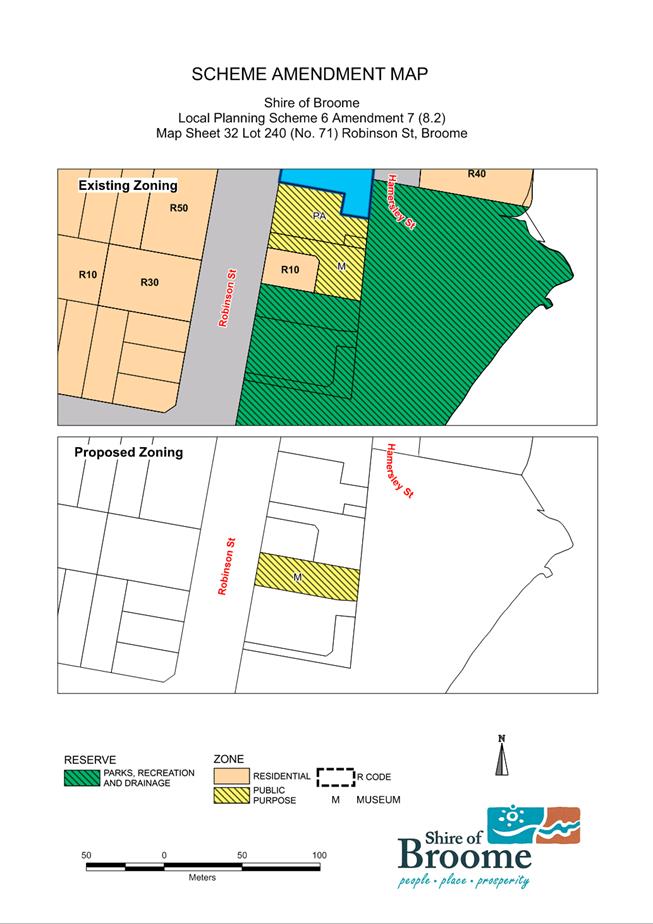
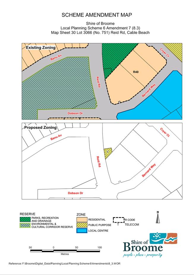
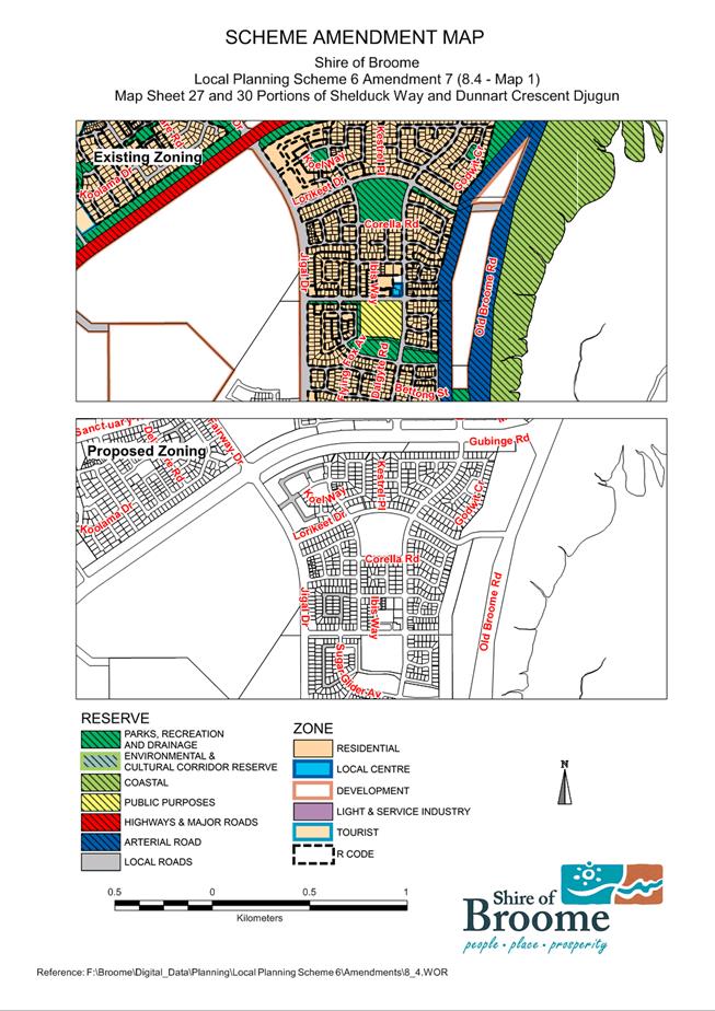
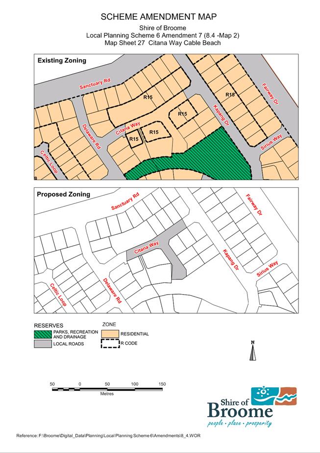
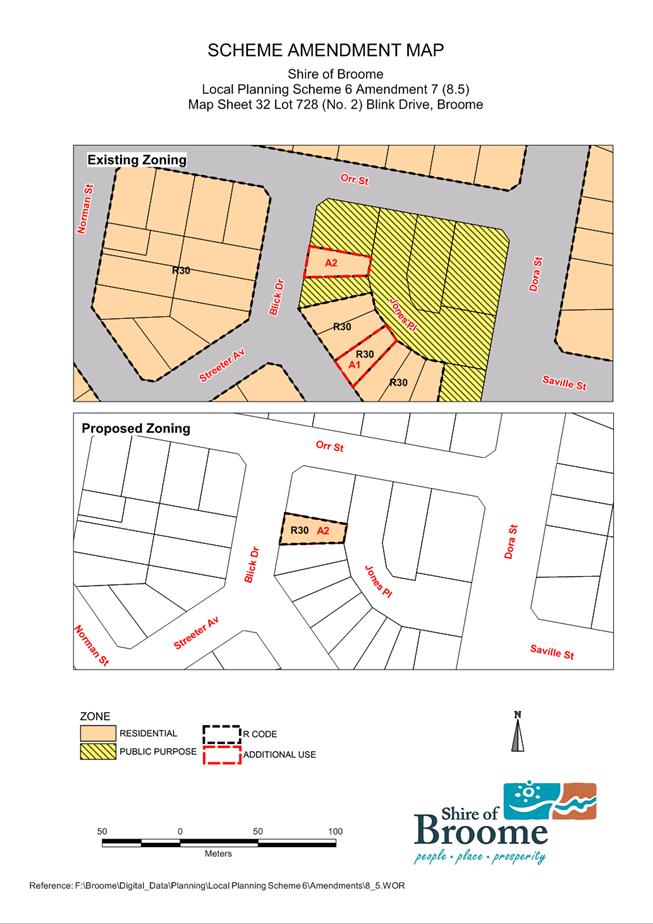
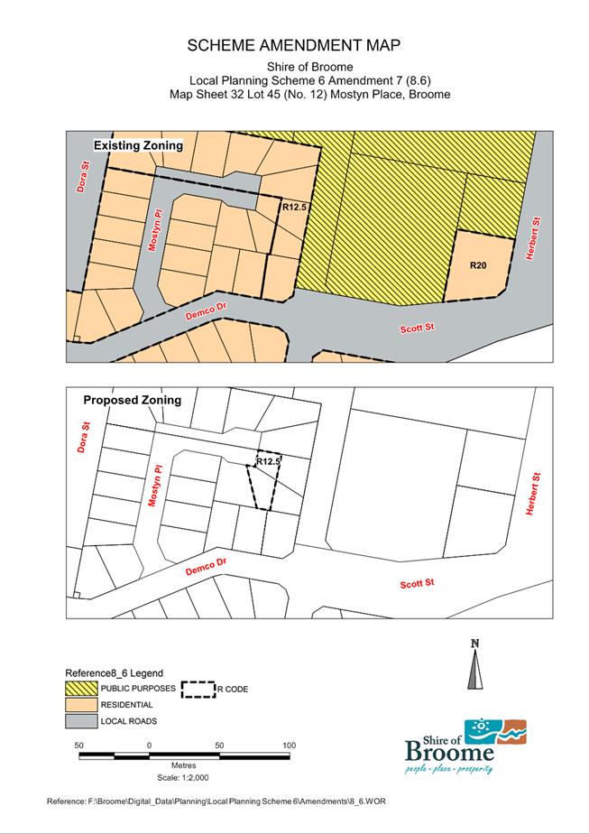
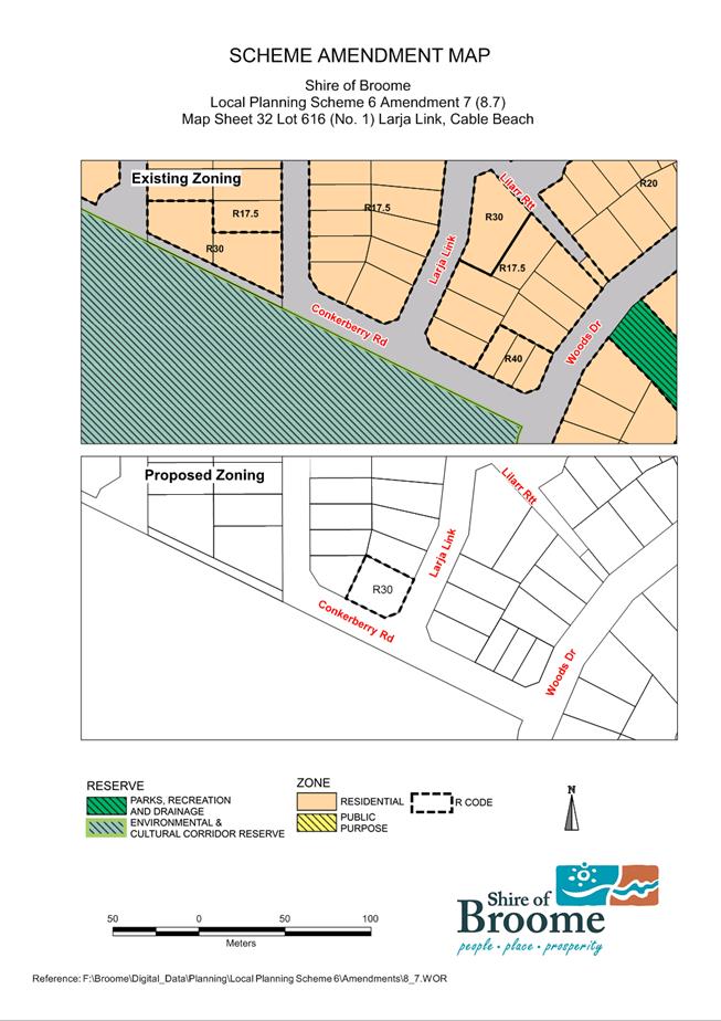
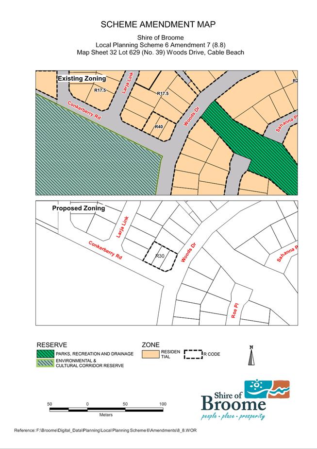
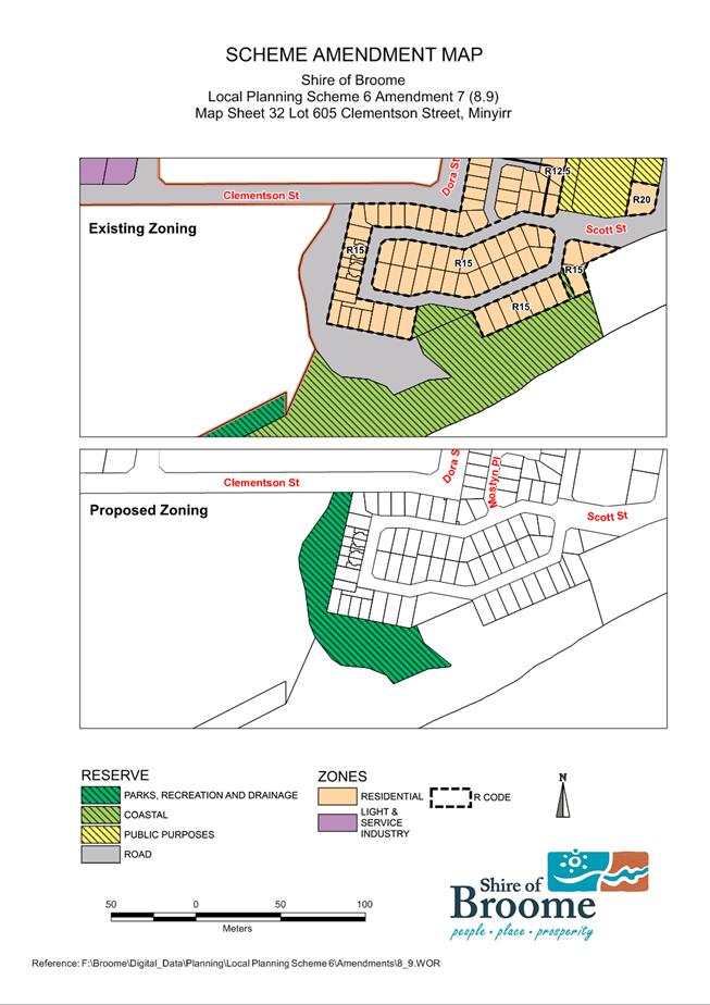
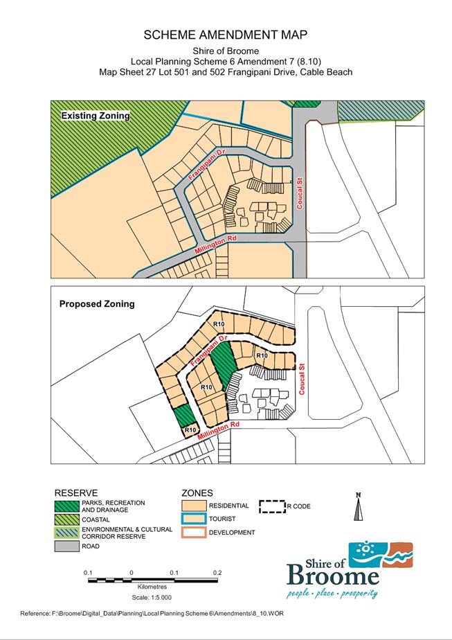
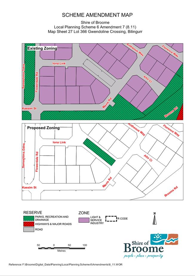
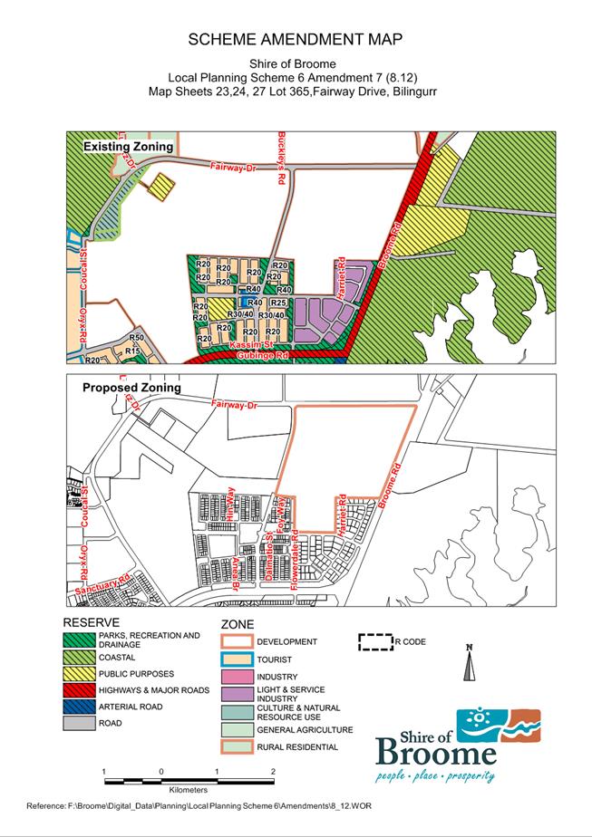
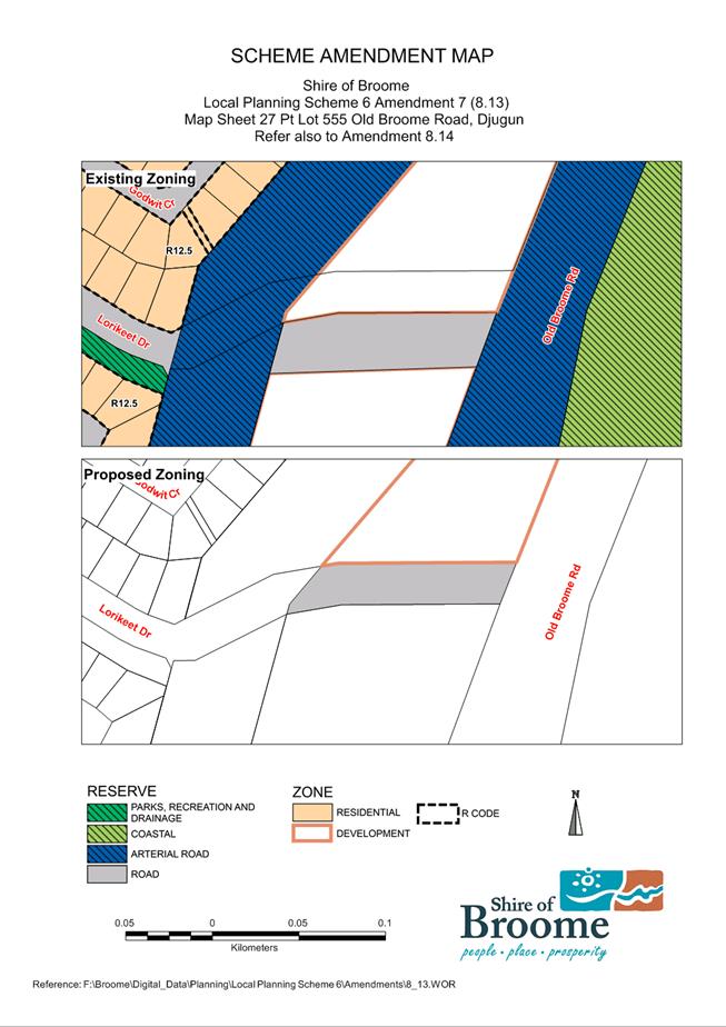
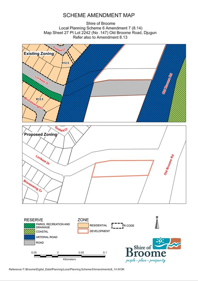
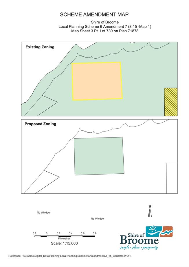
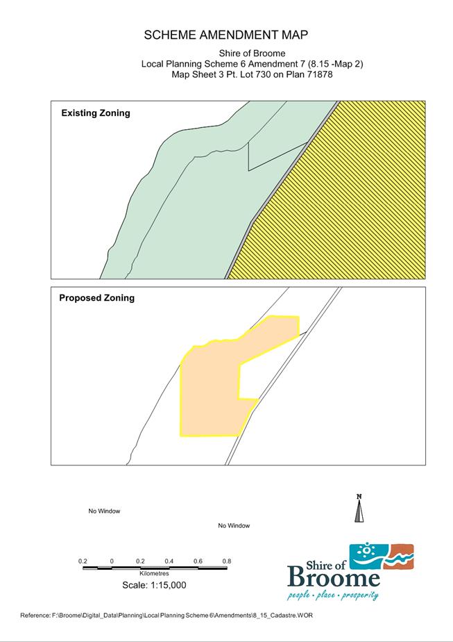
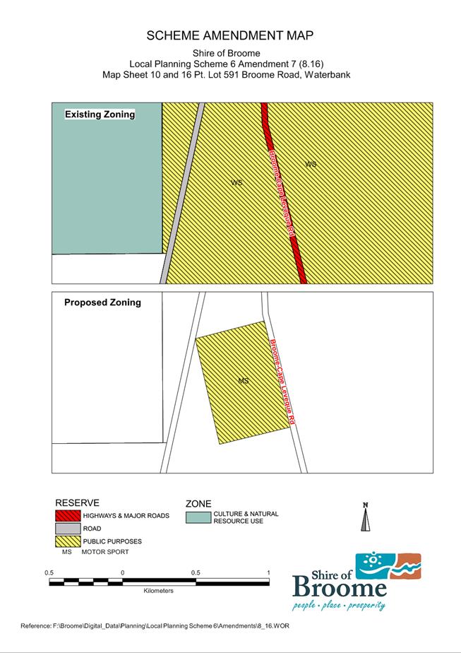
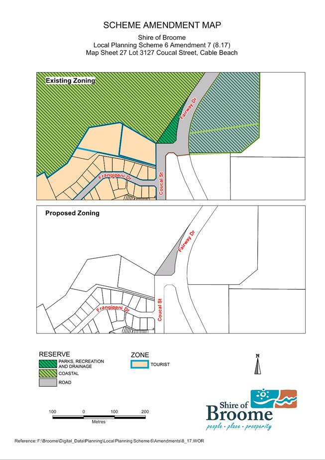
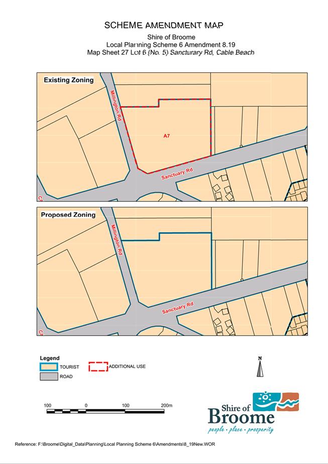
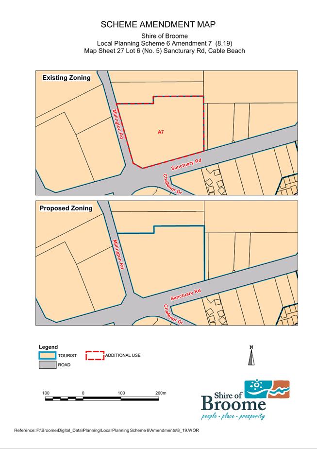
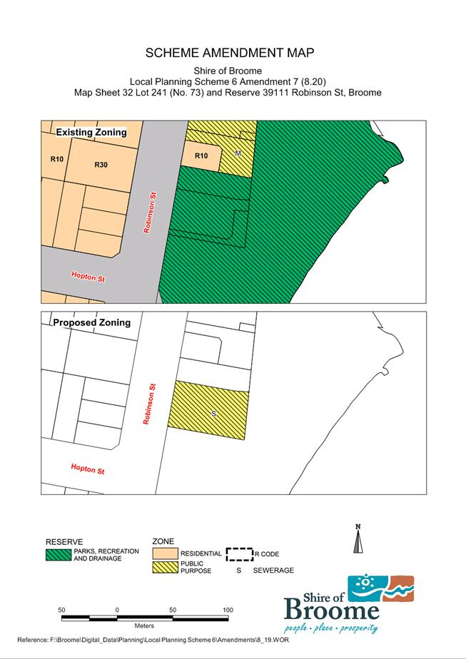

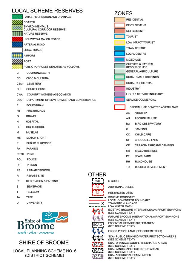
|
Item 9.2.4 - ADOPTION OF PROPOSED SCHEME AMENDMENT NO.7 TO LOCAL PLANNING
SCHEME NO.6 - OMNIBUS AMENDMENT
|
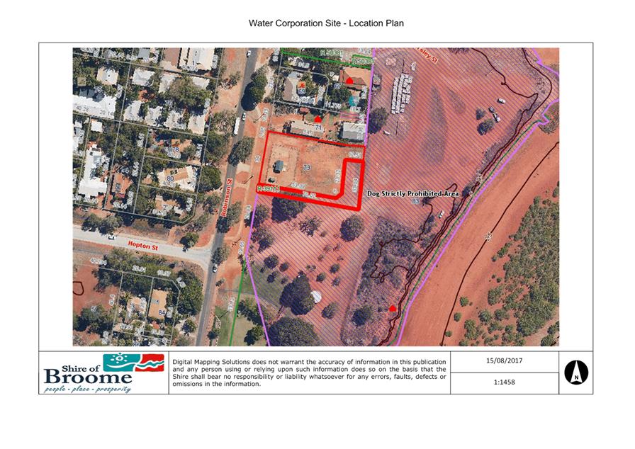
|
Item 9.2.4 - ADOPTION OF PROPOSED SCHEME AMENDMENT NO.7 TO LOCAL PLANNING
SCHEME NO.6 - OMNIBUS AMENDMENT
|
SCHEDULE OF SUBMISSIONS
For Amendment No: LPS6 -7
Proposal: Omnibus Amendment
|
Number
|
Name/ Address
|
Affected Property
|
Summary of Submissions
|
Officer Comment and Recommendation.
|
|
1
|
Water Corporation,
629 Newcastle Street, Leederville,
Perth
(2 submissions)
|
Reserve 39111,
Lot 240, 241 Robinson Street, Broome
|
No objection.
The Water Corporation supports the
Shire's amendment to Lot 240 Robinson Street the Water Corporation's leased
property to Public Purposes 'M' Museum.
However we would appreciate a change
to this Amendment to include the adjoining Water Corporation’s
properties Lot 241 & Reserve 39111 to change the zoning from
‘Parks Recreation &
Drainage’ to ‘Public Purposes’ reserve with the notation
‘S’
(Sewerage).
|
The proposed modification is
supported at an officer level as the land is currently used as a wastewater
pumping station therefore the change of reserve purpose would better reflect
the existing land use. The lot was previously zoned ‘Public Purpose-
Sewerage’ under previous Town Planning Scheme 4. Scheme amendment has
been modified accordingly.
Recommendation: Modify the Scheme
Amendment change the Local Scheme Reservation for Lot 241 and Reserve 39111
from ‘Parks and Recreation’ to ‘Public Purpose’ with
the notation of ‘S’ (sewerage).
|
|
2
|
Department of Water
PO Box 625, Kununurra
WA 6743
|
N/A
|
No objection.
The DOW provided detailed design
consideration in relation to the future development of a Motorplex facility.
|
Noted.
Recommendation: No modifications
required.
|
|
3
|
C Borella,
PO Box 1075
West Perth WA 6872
|
N/A
|
No objection.
Identified that consulting rooms in
Broome often have visiting consultants who are only in Broome once every five
weeks.
|
It is acknowledged that there may be
instances where health professionals are based in Broome on an infrequent
basis, however, it would be incorrect to assume that this applies to all
consulting rooms.
The proposed car parking provisions
will ensure that there is sufficient car parking when consulting rooms are
occupied. It is also worth noting that the revised standards are consistent
with other regional centres, such as Port Hedland.
Recommendation: No modifications
required.
|
|
4
|
G T Campbell, PO Box 44
Broome
WA 6725
|
Frangipani Estate, Cable Beach
|
It raises some questions and causes
me to comment as well.
As you would well know the
properties in the proposed scheme amendment area are the subject of a
registered strata plan.
The two questions that I have in
relation to this are:
l. Was the strata company advised of
this proposed amendment as it is likely to have an affect on the bylaws of
the strata company?
2. It may well the necessity to
create a sub strata company which under current legislation is not possible.
I acknowledge that the strata company legislation is under review
particularly in relation to where residential and tourism/commercial
properties are occurring. Has this been taken into account?
Further in this strata development
there are restrictive covenants and by laws that apply to the residential
components of the strata. What effect if any will this have?
It is pointed out that some services
are not located in the verge. For instance in my block the power is located
within the boundaries of the block but there is not any' easement to cover
such. I understand that with strata companies then can be an implied easement
but I question what effect the proposed amendment will have on the necessity
for an easement.
Finally I enquire what effect the
change of zoning will this have on the rateability of the property given that
it is currently is zoned tourism and will be changed to residential which
attracts a different rate in the dollar.
|
Purpose of Rezoning
The zoning of land is used to
control both the use of land and form of development. The proposed amendment
will ensure the zoning reflects the current land use of the lots (being
residential not tourist), and will ensure consistency with the Cable Beach
Development Strategy and Local Planning Strategy.
Implications on Strata Company
The rezoning of land is a tenure
blind process, and therefore will not have an impact on the strata body.
Notification to Affected Property
Owners
All affected property owners were
notified during the consultation process.
Rates
The Shire’s differential
rating system recognises that properties in Broome have different uses and
demand for Shire resources. The properties subject to the rezoning are
currently rated as ‘GRV Residential’ as they have a predominant
residential use. Consequently, the change in zone from ‘tourist’
to ‘residential’ will not impact the rateability of the subject
properties.
Recommendation: No modifications
required.
|
Minutes –
Ordinary Meeting of Council 7 September 2017 Page 728 of 1404
|
9.2.5 APPLICATION FOR DRY
CLEANING PREMISES - LAUNDRY IN ASSOCIATION WITH AN EXISTING TOURIST
DEVELOPMENT
LOCATION/ADDRESS: Lot
2235 No.10 Murray Road, Cable Beach
APPLICANT: Saltwater
Properties
FILE: MUR-1/10
AUTHOR: Senior
Planning Officer
CONTRIBUTOR/S: Nil
RESPONSIBLE
OFFICER: Director
Development and Community
DISCLOSURE
OF INTEREST: Nil.
DATE OF REPORT: 31
July 2017
|
|
SUMMARY: An
application has been received from the Kimberley
Sands Resort (KSR) which seeks approval to provide laundry services to
another tourist resort. The applicant seeks to utilise an existing
laundry facility at KSR to provide laundry services to guests of both KSR and
the Pearle Resort.
The application was advertised in the Broome Advertiser
over a 21 day period during which time a number of objections were received.
For this reason, the application has been referred to Council for its
consideration.
|
BACKGROUND
Previous
Considerations
OMC 6 July 2004 Item
9.2.11
OMC 14 July 2005 Item
9.3.7
OMC 27 February 2014 Item
9.2.13
Site & Surrounds
The subject site, comprising KSR, is
located on land zoned ‘Tourist’ under the Shire’s Local
Planning Scheme No.6 (LPS6). Council approval for the ‘Tourist
Development’ land-use was granted to the former ‘Pinctada
Resort’ in August of 2004 whereby the existing 71sqm laundry building the
subject of the current application was approved as a laundry to service the
resort.
Adjoining properties to the
north-west and across Murray Road to the south-west are zoned
’Tourist’ and are currently vacant. Reserve land (on the corner of
Murray Road and Gubinge Road) adjoins the site to the south-east while
‘Residential’ land adjoins the Kimberley Sands property to the rear
(north). Vehicular access to the property is available via existing hard-sealed
cross-over(s) onto Murray Road.
The Proposal
KSR currently utilises an existing
laundry facility on-site to provide laundry services to guests of the resort.
The applicant, Saltwater Properties, manages both the KSR and the Pearle Resort
located at 14 Millington Road, Cable Beach. As part of shared management
arrangements for KSR and the Pearle, the current application seeks approval for
the use of the existing laundry facility at the KSR to provide laundry services
to guests of the Pearle Resort.
The application is summarised as
follows:
- The
existing laundry service at the KSR will be expanded to cater for the laundry
requirements of its sister property the Pearle Resort, and potentially other
properties;
- No
services are to be made available to the general public;
- The
laundry service activity will utilise an existing building at the KSR
previously fitted out with equipment including washing machines, dryers, and
irons and will not involve any upgrading of the building or new equipment;
- No
increase in floor-space is proposed;
- The
laundry is proposed to operate between the hours of 7am – 4pm daily;
- The
provision of the laundry service to the Pearle Resort will involve one vehicle
movement between KSR and the Pearle Resort per day. An existing parking bay
located appurtenant to the laundry on-site at KSR will be available for the
service;
- It
is envisaged that the proposed service will have an additional 3 casual
employees. Parking for employees will be available via existing parking
bays on-site.
Land-Use – Local Planning
Scheme No.6
The existing laundry building at the
KSR was approved as part of the original approval for the tourist development
in 2004. The existing use of the laundry on-site fits with the definition of a
‘tourist development’ which allows for ‘on-site facilities
for the convenience of short-stay guests’. The land-use definition of a
‘tourist development’ under LPS6 is as follows:
Means a building, or group of
buildings forming a complex, designed for the accommodation of short-stay
guests and which provides on-site facilities for the convenience of short-stay
guests and for management of the development, where occupation by any person is
limited to a maximum of three months in any 12 month period.
However, as the current application
seeks to provide laundry services to guests outside of the subject lot the
activity no longer falls within the definition of a ‘tourist
development’. As such, the Shire must review
the proposed land use activity and determine what land use definition is
applicable and its land use permissibility under the Zoning Table.
It is noted
that the applicant is seeking to operate a laundry from the property, however
LPS6 does not have this as a specific land use definition. LPS6 does, however,
have a defined land use of ‘Dry Cleaning Premises’ which “Means
any land or building used for the cleaning of garments and other fabrics by
chemical processes.” Clause 3.18 establishes how to interpret the
Zoning Table and sets out that if a person proposes to carry out on land any
use that is not specifically mentioned in the Zoning Table and cannot
reasonably be determined as falling within the type, class of genus of activity
of any other use category then the application is to be treated as if it a
‘use not listed’.
With
consideration the current application, this report notes the distinction
between a dry cleaning premises which typically uses chemicals to clean
materials and a laundry which would typically use water. However, both activities
involve the cleaning of garments and other fabrics. In looking at the
current proposal, the service will involve the cleaning of garments and other
fabrics (such as sheets and towels) and as such is determined as falling within
the type same class or genus of activity as a ‘Dry Cleaning
Premises’.
A
‘Dry Cleaning Premises’ is a ‘D’ use in the Tourist
zone and as such can be approved at the discretion of the Council.
Local Planning Framework
– Cable Beach Development Strategy
The KSR is located within the area
the subject of the Cable Beach Development Strategy (CBDS). The CBDS
seeks to guide land-use and development towards ensuring that the precinct
remains attractive and engaging for both residents and tourists. The land-use
permissibility’s of LPS6 allow for a range of uses to be contemplated in
the Tourist zone and further to this, section 3.5 Land Use of the CBDS
makes clear that the ‘ultimate intention’ of the Strategy is to
ensure that tourist related land-uses service residents and visitors and add
value to the Cable Beach precinct.
While the objectives of the CBDS
establish that the predominant use of ‘Tourist’ zoned land is to be
for tourism, 3.5.1 Development Control Provisions encourages preferred
land-uses including ‘dry cleaning’ within the precinct. The CBDS
details that dry cleaning activities should be ‘in the form of a
laundromat with no more than 10 machines’ and when not proposed on a
designated priority active frontage (as is currently proposed). In these
circumstances, an application may be granted approval if it is considered to
demonstrate:
- The
proposed development will not have an adverse impact on adjoining
properties; and
- The
proposed development is considered to be appropriate in relation to other
existing uses within the area.
An assessment of the proposal with
consideration for the above criteria follows in the comment section below.
COMMENT
Land-Use Compatibility –
Local Planning Framework
As set out above, further to clause
3.18.2 of LPS6, the activity and use of the premises for the provision of
laundry services to guests fits within the ‘type, class, and genus’
of a dry cleaning premises. Under the CBDS, a dry
cleaning premises is a preferred land-use activity, and may be granted approval
if a proposal is considered to demonstrate that:
- The
proposed development will not have an adverse impact on adjoining
properties; and
- The
proposed development is considered to be appropriate in relation to other
existing uses within the area.
With consideration for the above, the
proposed land use activity
will be:
- incidental
to the predominant tourist use of the KSR site;
- in
the form of a laundromat and of a small-scale (less than 10 machines)
consistent with the provisions of 3.5.1 of the OBDS; and
- a
value-adding activity to the tourist development insofar as it will enhance the
capacity of the tourist development to provide laundry services to guests.
Additionally, the proposal:
- will
not have an adverse impact on adjoining properties, with the activity to
utilise existing facilities on a scale consistent with the existing tourist use
of the site;
- is
appropriate to the location on the basis that it is a type of use that is
compatible with the tourist zoning.
Site & Development Requirements
– Car Parking Provision
In assessing site and development
requirements applicable under LPS6, the application does not propose new
development or additional floor-space on the KSR site and therefore complies
with considerations such as plot ratio, building height, setback of development
and landscaping.
In assessing parking requirements for
the laundry, as the service will not be available to the general public and
limited to guests only, it is considered appropriate not to require customer parking.
Parking for employees, however, is relevant and must be considered in light of
overall parking arrangements for the KSR. Schedule 9, under Table 1
– Minimum Number of Car Parking Bays, sets out the parking
requirements applicable to a tourist development and incidental facilities such
as a laundry, restaurant, and day-spa.
The laundry service will be operated
by employees of KSR with 3 new casual staff to be employed. As shown in Attachment
1 the KSR currently has 71 car parking bays (plus 1 bus bay) available
on-site, catering to a total of 72 short-stay accommodation units and 30 staff.
The following table sets out the parking bays required for the overall Tourist
Development and incidental uses on-site.
|
Use
|
Bays
Required under Schedule 9
|
|
Short-Stay Accommodation Units @ 1
per 2 keyed unit
|
36
|
|
Visitor Bays @ 1 per 5 units
|
15
|
|
Day Spa
|
2
|
|
Restaurant @ 1 per 6sqm
|
14
|
|
Employee Parking @ 1 per
restaurant, spa etc.
|
2
|
|
Employee Parking for dry cleaning -
laundry premises
|
1
|
|
1 boat parking bay
|
1
|
|
Total Required On-site
|
71
|
|
Total Provided On-site
|
72
|
As detailed in the table above, there
is adequate car parking provided on-site to cater to the entirety of land-use
activity on-site. The applicant has explained that staffing arrangements for
the resort is characterised by shift-work and low-vehicle usage by staff,
meaning that a total of 10-15 staff are on-site at any one time, requiring
approximately 5 parking bays at any one time. In addition to the 72 parking
spaces provided on-site to cater for the parking needs of guests, staff,
restaurant and day-spa, there is also a loading bay available (appurtenant to
the laundry) for use by the van that will transfer laundry between the KSR and
the Pearle Resort. It is therefore considered that car parking provision
on-site is adequate to meet the requirements of the proposed use of the site in
accordance with Schedule 9 of LPS 6.
Public Consultation - Schedule
of Submissions
Though a ‘D’,
discretionary land-use for which advertising is not required to be undertaken
under LPS6 (and in accordance with Local Planning Policy 8.23 – Public
Consultation Planning Matters on the basis that no variations to relevant
requirements under Shire policy are proposed), the application was nevertheless
advertised in the Broome Advertiser inviting comments to be submitted over a 21
day period. Consultation was undertaken as it was foreseen that there may be
interest in and/or concern about the proposed use of the existing laundry
premises as proposed.
During the consultation period a
number of submissions were received and these have been addressed in the
attached Schedule of Submissions (refer Attachment 2).
A number of
the submissions received raised concern with the applicants foreshadowing that
the provision of laundry services may be provided to other properties in the
future. It is considered that the provision of laundry services to one other
property is appropriate, however if the services were expanded to other
properties, the loading and parking to support the activity may become
inadequate. As such it is recommended that a condition of approval be included
setting out that approval for the proposed activity extends to the provision of
laundry services to the Pearle property only.
There are
no other points raised in the submissions deemed to be valid planning
considerations.
Conclusion
Further to the above, the dry
cleaning premises as proposed is considered to be consistent with the land-use
objectives for the Cable Beach tourist precinct under the CBDS and compatible
with the land-use objectives and site and development requirements applicable
to the Tourist zone under LPS6. Accordingly, it is recommended that Council
resolve to approve the application, subject to conditions as set out in the
recommendation of this report.
CONSULTATION
As a ‘D’
(‘Discretionary’), land-use under LPS 6, in accordance with 3.17.2
of LPS 6 and the Shire’s Local Planning Policy 8.23 - Public
Consultation Planning Matters, advertising is not required to be
undertaken. However, upon receipt of the application it was acknowledged that
there may be some interest in the proposed use of the laundry premises at KSR.
Therefore, the proposal was advertised in the Broome Advertiser inviting
submissions to be provided to the Shire within 21 days.
A number of submissions were received
registering objection to the proposal (refer Attachment 2), and on this
basis, the application has been referred to Council for consideration.
STATUTORY ENVIRONMENT
Planning and Development Act 2005
Planning and Development (Local
Planning Schemes) Regulations 2015
Local Planning Strategy
Local Planning Scheme No.6
Cable Beach Development Strategy
POLICY IMPLICATIONS
Local Planning Policy 8.9 –
Parking
Local Planning Policy 8.23 –
Public Consultation Planning Matters
FINANCIAL IMPLICATIONS
Nil
RISK
Approval of
this application will see the provision
of laundry services in association with the operation of the KSR and Pearle
Resort. A condition of approval is recommended to allow for provision of laundry services to guests of
the KSR and Pearle Resorts only, and as such
does not present the potential for adverse impacts on the amenity of the
location or adjoining properties.
Recognising that the application has
satisfied all relevant requirements and is consistent with the land-use
objectives for the location under the local planning framework, there is a
considerable risk to Council that such a decision may be challenged at the State Administrative Tribunal should the application be refused.
Conversely, given that the
application complies with relevant provisions of the Shire’s planning
framework and addresses relevant matters to be considered under the Deemed
Provisions, should the application be approved there is low risk of such a
decision being successfully challenged on planning grounds.
STRATEGIC
IMPLICATIONS
Our People
Goal – Foster a community environment that is accessible, affordable,
inclusive, healthy and safe:
A healthy and safe environment
Our Place
Goal – Help to protect the nature and built environment and cultural
heritage of Broome whilst recognising the unique sense of the place:
A built environment that reflects
arid tropical climate design principles and historical built form
Retention and expansion of
Broome’s iconic tourism assets and reputation
VOTING REQUIREMENTS
Simple Majority
|
Council Resolution:
(Report Recommendation)
Moved: Cr B Rudeforth Seconded:
Cr D Male
That Council approves the application for a Dry
Cleaning Premises - Laundry at Lot 2235 (No.10) Murray Road, Cable Beach
submitted by Saltwater Properties, subject to the following
conditions:
1. Development
must be carried out in compliance with the plans and documentation
listed below and endorsed with the Council’s stamp, except where
amended by other conditions of this approval.
Plans
and Specifications
P1
(Site Plan), & P2 (Floor Plan) as received by the Shire 31 May 2017.
2. This approval is for the provision of laundry services to guests onsite and Lot 993 (No.14) Millington
Road, Cable Beach, only, with no services to be made available to members of
the public at any time.
CARRIED 5/1
|
Attachments
|
1.
|
Site Plan
|
|
2.
|
Schedule of Submissions
|
|
Item 9.2.5 - APPLICATION FOR DRY CLEANING PREMISES -
LAUNDRY IN ASSOCIATION WITH AN EXISTING TOURIST DEVELOPMENT
|
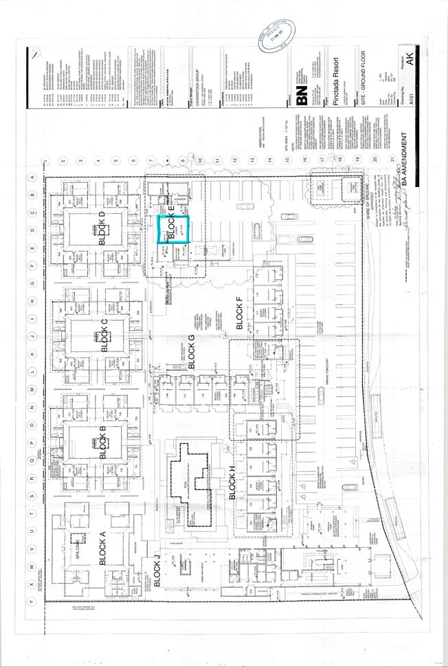
|
Item 9.2.5 - APPLICATION FOR DRY CLEANING PREMISES - LAUNDRY IN ASSOCIATION
WITH AN EXISTING TOURIST DEVELOPMENT
|
|
#
|
Name
|
Date
|
Submission
|
Officer Comment
|
Recommendation
|
|
1.
|
Kenneth Patterson
|
12.07.2017
|
The submission registered the following
comment:
1. The
cover letter in the application was signed by Angela Doyle, Operations
Manager of Kimberley Sands.
2. The
cover letter made no mention of dry cleaning, and referred only to
‘laundry’.
|
The cover letter was
signed by Angela Doyle as the applicant in her capacity as Operations Manager
for the Kimberley Sands. The signatures of both directors/land-owners,
company secretary, and Angela Doyle as the applicant, was provided.
In assessing an
application for Development Approval, consideration is given to the land-use
definitions and permissibility’s as contained in the Shire’s
Local Planning Scheme No.6 (LPS6). Additionally, consideration is also
given to the land-use and development objectives that apply under the
Shire’s Local Planning Strategy, LPS6, and the Cable Beach Development
Strategy.
In assessing the
current application, it is considered that the proposed activity and use of
the land does fit reasonably within the land-use classification of
‘dry-cleaning premises’ which is defined under LPS6 as:
“means
any land or building used for the cleaning of garments and other fabrics by
chemical processes”.
|
Noted. No action required.
|
|
2.
|
Michelle Parish
|
17.07.2017
|
The submission registered concern for the proposed
dry-cleaning activity, summarised as follows:
The interpretation of dry-cleaning premises
as defined in the Shire of Broome Health Local Laws 2006 means premises where
clothes or other articles are cleaned by the use of solvents without using
water; and section 9.1.1 lists a dry-cleaning premises as an offensive trade.
The dry-cleaning process uses solvents to
clean garments and when used, stored or disposed of inappropriately, these
chemicals are also a known health and environmental hazard. The vapours
emitted are potentially hazardous to guests staying at the resort and to
residents that live within 80m of the Kimberley Sands.
Dry-cleaning is an offensive trade and should
not be permitted in an accommodation facility in a tourist zone. Information
detailing the proposal should be made available to the general public.
|
In assessing the
current application, it is considered that the activity as proposed does fit
reasonably within the land-use classification of ‘dry-cleaning
premises’ which is defined under LPS6 as “means any land or
building used for the cleaning of garments and other fabrics by chemical
processes”.
It is noted from the
Health Local Law point of view, that there is a distinction between a dry
cleaning premises which typically uses chemicals to clean materials and a
laundry which would typically use water, however both activities involve the
cleaning of garments and other fabrics. In the absence of
‘laundry’ being a specific land use definition under LPS6, given
it is the same type of class of activity as a ‘Dry-cleaning premises’
(where by buildings are used for the cleaning of garments) for the purposes
of determining it land use permissibility under the Zoning Table, it is
considered to be a ‘D’ use in the Tourist zone.
Nevertheless, the
provision of laundry and/or dry-cleaning services is consistent with the
land-use objectives and use permissibility’s applicable to the Tourist
zone under the Shire’s Planning framework, on the basis that:
- the
activity will remain incidental to the predominant tourism use of the site
with no services to be made available to the general public.
- the
land-use definition of ‘Tourist Development’ allows for
facilities (such as dry-cleaning/laundry services) for the convenience of
guests, (as is standard practice in the hotel industry);
- the
provision of dry-cleaning services for the convenience of guests is
consistent with the objectives of the Shire’s Cable Beach Development
Strategy which specifically identifies the need for such services to be made
available within the precinct as a value adding element from a tourism
experience perspective;
- the
application complies with all relevant site and development requirements of
LPS6 and Shire Policy.
|
Noted. No action required.
|
|
3.
|
Rosemary Mitchell
|
17.07.2017
|
The submission registered concern for the
proposed dry-cleaning activity, summarised as follows:
I have concerns for the process that would
allow a premise in the tourist zone to operate a dry-cleaning service. The
Shire puts in a lot of checks and balances to ensure the safety of business
operators and clientele through its stringent regulations. I feel that this
proposal could not pass the tests applied to other businesses offering the
same services. An existing business should not be able to side-step the
stringent rules that another business has strictly followed. This is unfair
at a Shire regulation level and detrimental to supporting local business
owners such as Pearl Sea. Concerned for consistency and transparency.
|
A dry-cleaning land-use is a discretionary
land-use within the Tourist zone under LPS6. If the applicant wishes to
provide dry-cleaning services as defined under Health Local Laws (over and
above the laundry activity currently proposed); relevant approvals from Shire
Health would need to be obtained.
The Shire has advertised the application and
provided information explaining the proposal to those who have contacted
Shire Officer requesting such information.
Any application for a dry-cleaning premises
would be subject to the same process of assessment as has been undertaken in
the current case, with the exception that applications for dry-cleaning
land-use do not require advertising (as ‘D’, discretionary, and
‘P’, permitted, land-uses) in accordance with LPS6 & Local
Planning Policy 8.23 - Public Consultation Planning Matters. Nevertheless, in
the interests of transparency; Shire Officers elected to advertise the
current application as it was foreseen there may be interest in the proposal.
|
Noted. No action required.
|
|
4.
|
Dione Sutherland
|
17.07.2017
|
The submission registered concern for the proposed
dry-cleaning activity, summarised as follows:
The interpretation of dry-cleaning premises
as defined in the Shire of Broome Health Local Laws 2006 means premises where
clothes or other articles are cleaned by the use of solvents without using
water; and section 9.1.1 lists a dry-cleaning premises as an offensive trade.
The dry-cleaning process uses solvents to
clean garments and when used, stored or disposed of inappropriately, these
chemicals are also a known health and environmental hazard. The vapours
emitted are potentially hazardous to guests staying at the resort and to
residents that live within 80m of the Kimberley Sands.
Dry-cleaning is an offensive trade and should
not be permitted in an accommodation facility in a tourist zone. Information
detailing the proposal should be made available to the general public.
|
Refer Officer comment in response to
Submission 2 above.
|
Noted. No action required.
|
|
5.
|
Kenneth Patterson
|
17.07.2017
|
The submission registered concern for the
proposed dry-cleaning activity, summarised as follows:
I
viewed in your presence on 11 July 2017, the Kimberley Sands letter headed
"Application for Development Approval " (dated 30 May 2017) , I
would like to point out that this letter does not once mention the application
being for dry cleaning and does not relate to the Proposed Development for
Public Comment notice (29 June 2017). (The letter mentions
"laundry" a number of times.)
I have the following questions:-
1. How did the
Development Approval become "an application for a 'Dry Cleaning
Premises' "as advertised?
2. I do not
believe that the present laundry at Kimberley Sands Resort is going to become
a Dry Cleaning Premises as they have stated in their letter that they have
"NO plans to purchase or install new equipment." You advised me
that you had personally inspected the premises on receipt of this
application. What do you believe?
3. In the letter by
Kimberley Sands dated 30 May 2017 states: "We would also like the
opportunity to support the laundry requirements of our sister property, The
Pearle of Cable Beach and potentially other properties." The wording
"potentially other properties "strongly indicates that both this
letter and advertisement are misleading and not transparent .What do you
believe?
As you have advised that "this is an application that can be considered
under delegation in accordance with Shire Policy (i.e. does not require
Council consideration) "If the application for a "Dry Cleaning
Premises " is passed ,Pearl Sea Laundry will have no other choice than
to challenge the decision legally.
A Judge is then going to have to make a ruling on whether the premises are a
laundry or a dry cleaning premises. As the above Kimberley Sands letter
refers to laundry at all times, in my opinion, his ruling will be a laundry.
|
With respect to point 1 of the submission,
please refer to Officer Comment on submission 2 above. With respect to points
2 & 3 of the submission, see response below.
The application has not proposed and does not
show on submitted plans, any new development or additions of any kind to
facilitate the proposed use of the existing laundry facility. If the
applicant was to install new equipment which meant changing practices to
include ‘dry-cleaning’ activities as defined under Health Local
Laws; the applicant would then be required to obtain relevant approvals from
Shire Health. If any additions to buildings or floor-space was proposed in
the future; an application for Development Approval would need to be
submitted for this.
The application and assessment as set out in
the Council Agenda item has been assessed with consideration for the
Shire’s planning framework, in accordance with the Planning &
Development (Local Planning Schemes) Regulations 2015, further to the Planning
& Development Act 2005. As per these regulations, both the submitter
and applicant, may elect to exercise their ability to challenge a decision
made with respect an application for Development Approval.
Concerns raised in relation to the provision of
laundry services to other properties are noted. The information provided by
the applicant and assessment undertaken are on the basis that the service is
provided to one additional property only. As such it is recommended that a
condition to this effect be incorporated into the approval.
|
Noted.
It is recommended that a condition of
development approval be included setting out the following:
This approval is for the provision of laundry
services to guests onsite and Lot 993 (No.14) Millington Road, Cable Beach,
only, with no services to be made available to members of the public at any
time.
|
|
6.
|
Rachael Beresford
|
17.07.2017
|
The submission registered concern for the
proposed dry-cleaning activity, summarised as follows:
The interpretation of dry-cleaning premises
as defined in the Shire of Broome Health Local Laws 2006 means premises where
clothes or other articles are cleaned by the use of solvents without using
water; and section 9.1.1 lists a dry-cleaning premises as an offensive trade.
The dry-cleaning process uses solvents to
clean garments and when used, stored or disposed of inappropriately, these
chemicals are also a known health and environmental hazard. The vapours
emitted are potentially hazardous to guests staying at the resort and to
residents that live within 80m of the Kimberley Sands.
Dry-cleaning is an offensive trade and should
not be permitted in an accommodation facility in a tourist zone. Information
detailing the proposal should be made available to the general public.
|
Refer Officer comment in response to
Submission 2 above.
|
Noted. No action required.
|
|
7.
|
Katrina Comito (Pearl Sea Laundry)
|
17.07.2017
|
The submission registered concern for the
proposed dry-cleaning activity, summarised as follows:
I have been to the Shire to view the proposal
and it was not available for me to read. I have had a meeting with Shire
Officers and it was not available for me to view. I have been the owner of
Pearl Sea Laundry & Dry Cleaning located at 14 Flowerdale Road for 19
years and have a strong interest in the application. I have engaged the
services of a town planning advisor and he is keen to view the application.
|
Alex MacKenzie (Senior Planning Officer) and
Ty Matson (Manager Health & Ranger Services) met with the submitter at
the Shire Office to discuss the application. During the meeting copies of the
proposal were available to view, although copies of the application form were
not provided as per standard practice as such forms can contain confidential
information. The submitter was provided, both at the meeting and in
subsequent emails to both her husband and father, with details of the
proposal to make an informed submission of comment to the Shire.
|
Noted. No action required.
|
|
8.
|
Brian Philp
|
18.07.2017
|
The submission registered concern for the
proposed dry-cleaning activity, summarised as follows:
The interpretation of dry-cleaning premises
as defined in the Shire of Broome Health Local Laws 2006 means premises where
clothes or other articles are cleaned by the use of solvents without using
water; and section 9.1.1 lists a dry-cleaning premises as an offensive trade.
The dry-cleaning process uses solvents to
clean garments and when used, stored or disposed of inappropriately, these
chemicals are also a known health and environmental hazard. The vapours
emitted are potentially hazardous to guests staying at the resort and to
residents that live within 80m of the Kimberley Sands.
Dry-cleaning is an offensive trade and should
not be permitted in an accommodation facility in a tourist zone. Information
detailing the proposal should be made available to the general public.
|
Refer Officer comment in response to
Submission 2 above.
|
Noted. No action required.
|
|
9.
|
Anjayani Sam
|
18.07.2017
|
The submission registered concern for the
proposed dry-cleaning activity, summarised as follows:
The interpretation of dry-cleaning premises
as defined in the Shire of Broome Health Local Laws 2006 means premises where
clothes or other articles are cleaned by the use of solvents without using
water; and section 9.1.1 lists a dry-cleaning premises as an offensive trade.
The dry-cleaning process uses solvents to
clean garments and when used, stored or disposed of inappropriately, these
chemicals are also a known health and environmental hazard. The vapours
emitted are potentially hazardous to guests staying at the resort and to
residents that live within 80m of the Kimberley Sands.
Dry-cleaning is an offensive trade and should
not be permitted in an accommodation facility in a tourist zone. Information
detailing the proposal should be made available to the general public.
|
Refer Officer comment in response to
Submission 2 above.
|
Noted. No action required.
|
|
10.
|
Vinka Bridgeman
|
18.07.2017
|
The submission registered concern for the
proposed dry-cleaning activity, summarised as follows:
The interpretation of dry-cleaning premises
as defined in the Shire of Broome Health Local Laws 2006 means premises where
clothes or other articles are cleaned by the use of solvents without using
water; and section 9.1.1 lists a dry-cleaning premises as an offensive trade.
The dry-cleaning process uses solvents to
clean garments and when used, stored or disposed of inappropriately, these
chemicals are also a known health and environmental hazard. The vapours
emitted are potentially hazardous to guests staying at the resort and to
residents that live within 80m of the Kimberley Sands.
Dry-cleaning is an offensive trade and should
not be permitted in an accommodation facility in a tourist zone. Information
detailing the proposal should be made available to the general public.
|
Refer Officer comment in response to
Submission 2 above.
|
Noted. No action required.
|
|
11.
|
Claire Collis
|
19.07.2017
|
The submission registered concern for the
proposed dry-cleaning activity, summarised as follows:
The interpretation of dry-cleaning premises
as defined in the Shire of Broome Health Local Laws 2006 means premises where
clothes or other articles are cleaned by the use of solvents without using
water; and section 9.1.1 lists a dry-cleaning premises as an offensive trade.
The dry-cleaning process uses solvents to
clean garments and when used, stored or disposed of inappropriately, these
chemicals are also a known health and environmental hazard. The vapours
emitted are potentially hazardous to guests staying at the resort and to
residents that live within 80m of the Kimberley Sands.
Dry-cleaning is an offensive trade and should
not be permitted in an accommodation facility in a tourist zone. Information
detailing the proposal should be made available to the general public.
|
Refer Officer comment in response to
Submission 2 above.
|
Noted. No action required.
|
|
12.
|
Karen Servel
|
20.07.2017
|
The submission registered concern for the
proposed dry-cleaning activity, summarised as follows:
The interpretation of dry-cleaning premises
as defined in the Shire of Broome Health Local Laws 2006 means premises where
clothes or other articles are cleaned by the use of solvents without using
water; and section 9.1.1 lists a dry-cleaning premises as an offensive trade.
The dry-cleaning process uses solvents to
clean garments and when used, stored or disposed of inappropriately, these
chemicals are also a known health and environmental hazard. The vapours
emitted are potentially hazardous to guests staying at the resort and to
residents that live within 80m of the Kimberley Sands.
Dry-cleaning is an offensive trade and should
not be permitted in an accommodation facility in a tourist zone. Information
detailing the proposal should be made available to the general public.
|
Refer Officer comment in response to
Submission 2 above.
|
Noted. No action required.
|
|
13.
|
Paul Comito (Pearl Sea)
|
20.07.2017
|
The submission registered concern for the
proposed dry-cleaning activity, summarised as follows:
My comments requested by The Shire of Broome
relating to the above matter are that I disagree strongly and object to the
application for a “Drycleaning” premises located at Kimberley
Sands Resort to service another resort property located elsewhere being
approved for the following reasons.
I received an email from Kirsten Wood dated
19th July confirming the applicant being Cable Beach Operations have
completed an Application for Development Planning. A requested copy of this
document which is advertised as available for Public comment was declined.
The Application for Development Approval
(Local Planning Scheme NO 6.) Clearly states on the document the signature of
the Owner(s) is required on all applications. This application will not
proceed without the signature of all landowners.
Cable Beach Operations Pty Ltd / Saltwater
Properties Management Company, are NOT the landowners of the property.
Email received from Kirsten Wood dated 20th
July confirming “Angela Doyle is the applicant and also is the
applicant’s signature”. Angela Doyle is NOT the Landowner
as required for the application.
INTENTION TO OPERATE A COMMERCIAL LAUNDRY IN
TOURIST ZONED AREA
a) Copy
of email attached confirming from Director of Cable Beach Operations Pty Ltd
Paul Coggan acknowledge they intend to process The Pearle laundry and charge
the publicly owned unit owners of the Pearle Resort for a laundry service.
b)
The charging of any fee to publicly owned property holders legally
constitutes TRADE
c) I
have received advice from Environmental Health Directorate of the Health
Department quoting “if the laundry service is charging a fee for its
service. This is an important part of establishing if the laundry is a
‘trade’
d)
As a fee is being charge this now becomes a Commercial Laundry Premises not
permitted in a Tourist Zoned area.
Why is the charging of a fee for a service
being disregarded in this application?
TERMINOLOGY OF DRYCLEANING
a) The
application from Cable Beach Operations Pty Ltd does not meet the legal terminology
of Dry Cleaning. The Terminology of this description of the process is
attached from the Drycleaning Institute of Australia and is defined as per
specified description in the Shire of Broome Health Local Law 2006,
(Part 9 – OFFENSIVE TRADES) 9.4.1 Interpretation. Description of
a Laundry is also written in this clause of The health Act.
b) During
our meeting on Tuesdays 4th July with Alex and Ty, both gentleman
acknowledged the process of drycleaning being the cleaning of a shirt or
dress (clothing).
c) The
key word to relate to any interpretation when viewing the Town Planning
Scheme is Dry Cleaning and the descriptive terminology it implies.
Why is the descriptive terminology relating
to this application being misleadingly applied to this application?
Kimberley Sands DO NOT currently or in the
future intend to operate a Dry Cleaning premises as stated in the
Advertisement in the local paper placed by the Shire of Broome and as per
their written statement lodged by Angela Doyle. They do not have any Dry
Cleaning equipment or use any Dry cleaning processes on site to support that
they currently operate a dry cleaning operation now or in the future.
Angela Doyle’s letter constantly refers
to laundry equipment listed is “Commercial Washers” Plans
submitted also state laundry.
Why has the letter form Angela Doyle stating
“laundry Operations” been disguised and advertised as a Dry
Cleaning Premises by the CEO?
Is this being done to assist Saltwater
Properties to sidestep Zoning regulations?
Why has the application not been made public
via the Shire of Broome’s web site as per the advertisement by the
Shire stating it would be available online?
HEALTH ACT
Section 9.1.1 Interpretation States an
Offensive trade means any one or more of the trades, businesses or
occupations usually carried on, in connection, the following works or
establishments.
(b) Laundries, dry cleaning premises and dye works.
Charging of a fee for service now requires
Offensive trade act to be enforced prior to operations commencing.
BUILDING CLASSIFICATION
The Building where the current Dry Cleaning
Premises at Kimberley Sands is located is as per the Classification of
Buildings and Structure defined in the Building Code of Australia is not a
Class 8 structure.
Dry Cleaning premises or Commercial laundry Operation
is not permitted.
Why is this not being applied to the
applicant?
LEGAL ISSUE
I have been advised that should this
application be approve we will have grounds for legal action. Approving the
application for a Dry Cleaning premises only permits the applicant to operate
a Dry Cleaning premises, not a Commercial Laundry to service another resort.
This objection is not in any way my intention
to stop Kimberley Sands Resort or any other tourist facility in Broome from
operating their own on-site laundry for the purpose of servicing the property
it is located on. As written evidence has been provided with this letter
stating that fees will be charged, I disagree strongly that this important
point appears to be taken lightly. Allowing this to occur will set a
precedent whereby Management companies can profit and trade as a commercial
laundry under the false pretences of a Dry Cleaning Premises approved by The
Shire of Broome and side step zoning regulations.
I strongly object to a commercial laundry being
disguised as a Dry Cleaning premises as advertised by the CEO to slide into a
particular zoning area in disguise.
I also am also concerned as a rate payer the
lack of clarity, available information for the public as advertised and the
misleading statements being made public by the CEO regarding this issue along
with the reluctance to release documents for public viewing.
I would like to thank you for allowing me the
opportunity to voice my comments and objection, and trust that the Shire of
Broome will decline this application based on all the presented literature
and preserve the intended use of Tourist Zoned areas.
|
As per Officer comment above, the undertaking
of a dry-cleaning and/or laundry activity within the Tourist zone is a
supportable land-use with consideration for the objectives and provisions of
LPS6 and Cable Beach Development Strategy.
Shire Officers met with the submitter and
discussed the application at the Shire Office. All information relating to
the application was provided verbally at the meeting. Copies of the Cover
Letter and submitted plans were also available for viewing and were provided
electronically. It is standard practice not to release copies of application
forms to the public for the reason that such forms may contain confidential
information. The Shire however has clarified with the submitter the
information that was requested on the application form.
The Development Application form was signed
by the landowner and applicant in accordance with Shire procedures and this
has been communicated with the submitter.
INTENTION TO OPERATE A COMMERCIAL LAUNDRY IN
TOURIST ZONED AREA
The matter of whether a trade activity is
being undertaken or a fee is being charged relates to whether the activity
requires approval under the Health Local Law.
For the purposes of determining the
development application, the Shire must assess the application against the
provisions of LPS6. As set out in the comments above, it is considered that
the activity as proposed does fit reasonably within the land-use
classification of ‘dry-cleaning premises’ which is defined under
LPS 6 as “means any land or building used for the cleaning of
garments and other fabrics by chemical processes”.
It is noted from the
Health Local Law point of view, that there is a distinction between a dry
cleaning premises which typically uses chemicals to clean materials and a
laundry which would typically use water, however both activities involve the
cleaning of garments and other fabrics. In the absence of
‘laundry’ being a specific land use definition under LPS6, given
it is the same type of class of activity as a ‘Dry-cleaning
premises’ (where by buildings are used for the cleaning of garments)
for the purposes of determining it land use permissibility under the Zoning
Table, it is considered to be a ‘D’ use in the Tourist
zone.
If the development application is supported,
the Shire’s Environmental Health Officers will review the proposal
against the Health Local Law.
TERMINOLOGY OF DRYCLEANING
As set out in the comments above, it is
considered that the activity as proposed reasonably fits within type or class
of land use activity of ‘dry-cleaning premises’, in the absence
of ‘Landry’ being is specific land use definition under LPS6.
This is not being done to sidestep zoning
regulations.
HEALTH ACT
If the development application is supported,
the Shire’s Environmental Health Officers will review the proposal
against the Health Local Law and required permits/approvals must be sought
prior to commencement of operations.
BUILDING CLASSIFICATION
The application does not propose to alter the
existing building (or its use) on-site and therefore does not require
re-classification from a Building classification perspective.
LEGAL ISSUE
The particular cause for grounds which give
rise to legal action are not clearly outlined in the submission. As set out
in the comments above, the development application has been made consistent
with the requirements under LPS6 (as the landowners have consent to the
submission of the application).
With regards to the suggestion that the
application has been assessed towards ‘sidestepping zoning regulation’
- A dry-cleaning premises is a discretionary land-use within the Tourist zone
and may be granted approval under delegation without consideration of
Council, or advertising, if all relevant site and development requirements
are met. The application has been seen to satisfy relevant site and
development requirements and consistent with the land-use objectives for the
tourist zone and Cable Beach Precinct.
As set out above, it is noted from the Health
Local Law point of view, that there is a distinction between a dry cleaning
premises which typically uses chemicals to clean materials and a laundry
which would typically use water, however both activities involve the cleaning
of garments and other fabrics. In the absence of ‘laundry’ being
a specific land use definition under LPS6, given it is the same type of class
of activity as a ‘Dry-cleaning premises’ (where by buildings are
used for the cleaning of garments) for the purposes of determining it land
use permissibility under the Zoning Table, it is considered to be a
‘D’ use in the Tourist zone.
In reviewing this proposal it is deemed to
be:
- incidental to the
predominant tourist use of the KSR site;
- will not have an
adverse impact on adjoining properties, with the activity to utilise existing
facilities on a scale consistent with the existing tourist use of the site;
- is appropriate to the
location on the basis that it is a type of use that is compatible with the
tourist zoning.
As such in this case
it is recommended that development approval is issued.
|
Noted. No action required.
|
|
14.
|
Pearl Sea -
Katrina Comito
|
20.07.2017
|
The submission registered concern for the
proposed dry-cleaning activity, summarised as follows:
I have lived in Broome for the past 25 years
and I have owned and operated Pearl Sea Laundry Services for nearly 20
years. I started the business as a small coin operated laundromat and I
have worked very hard to build it into the large commercial laundry it is
today. My husband Paul joined the company in 2009 and over the past 8
years we have invested a considerable amount of time and money into
Broome’s economy and future with the build of our new premises at 14
Flowerdale Rd.
I am concerned to read of an application for
a Dry Cleaning Premises in a Tourist Zone at 10 Murray road in Cable
Beach. I have viewed the Application for Development Approval letter
submitted by Kimberley Sands Resort (KSR). At no point in the letter do
they mention any form of Dry Cleaning, in fact the opening paragraph states “Kimberley
Sands Resort & Spa is seeking approval to expand our current laundry
operations to cater for the laundry requirements of our sister property The
Pearle of Cable Beach and potentially other sites.”
The interpretation of Dry Cleaning Premises
as defined in the Shire of Broome Health Local Laws 2006 in section 9.4.1 “dry
cleaning establishment” means premises where clothes or other articles
are cleaned by the use of solvents without using water; and section 9.1.1
lists a dry cleaning premises as an offensive trade.
It would appear to me that Kimberley Sands
Resort & Spa is in fact seeking to operate a commercial laundry from
their premises. They do not seek to add more equipment to their current
facility because they already did this in April 2017 in readiness for the
submission of this application. There is currently only
commercial laundry equipment onsite and NO Dry Cleaning equipment.
Submitting an application for a “Dry Cleaning Premises” is
misleading and is in fact not once mentioned in their written application.
The application states “we are only
running at 20 – 30% capacity of our laundry’s
capability.” Until 12th June 2017 (approx. 2 weeks
after the application was submitted) Pearl Sea Laundry Services was
processing approximately 85% of KSR laundry. When they expanded their
operations and installed more commercial equipment in April 2017 they clearly
would have known this would have been the outcome. The current in-house
laundry at KSR was recently expanded with more commercial equipment in
readiness for this application.
The application also seeks to process the
laundry requirements of The Pearle of Cable Beach and “potentially
other properties””. The Pearle is under strata management
and so would be paying for the laundry services. If Kimberley Sands is
going to charge The Pearle (or any other property) for laundry services they
would then be operating as a commercial laundry. Is a commercial
laundry able to operate from a Tourist zone?
I find it grossly unfair and very misleading
of the Shire of Broome to consider approving this application. When we built
our new premises we adhered to all local Broome Shire Health and Planning
laws and regulations at considerable expense. The existing in-house
laundry at Kimberley Sands Resort has not had to adhere to these same laws
and regulations and so I feel it should not be able to operate as a
commercial laundry or a dry cleaning premises.
The Shire of Broome Customer Service Charter
states Integrity as one of their core values: Be honest, equitable
and ethical in all our dealings …. and Courtesy as another:
Provide courteous service and helpful solutions and I feel in this
situation that parts of these core values are lacking.
|
For the purposes of determining the
development application, the Shire must assess the application against the
provisions of LPS6. As set out in the comments above, it is considered that
the activity as proposed does fit reasonably within the land-use
classification of ‘dry-cleaning premises’ which is defined under
LPS6 as “means any land or building used for the cleaning of
garments and other fabrics by chemical processes”.
It is noted from the
Health Local Law point of view, that there is a distinction between a dry
cleaning premises which typically uses chemicals to clean materials and a
laundry which would typically use water, however both activities involve the
cleaning of garments and other fabrics. In the absence of
‘laundry’ being a specific land use definition under LPS6, given
it is the same type of class of activity as a ‘Dry-cleaning
premises’ (where by buildings are used for the cleaning of garments)
for the purposes of determining it land use permissibility under the Zoning
Table, it is considered to be a ‘D’ use in the Tourist
zone.
If the development application is supported,
the Shire’s Environmental Health Officers will review the proposal
against the Health Local Law and required permits/approvals must be sought
prior to commencement of operations.
Concerns raised in relation to the provision
of laundry services to other properties are noted. The information provided
by the applicant and assessment undertaken are on the basis that the service
is provided to one additional property only. As such it is recommended that a
condition to this effect be incorporated into the approval.
|
Noted. It is recommended that a condition of
development approval be included setting out the following:
This approval is for
the provision of laundry services to guests onsite and Lot 993 (No.14)
Millington Road, Cable Beach, only, with no services to be made available to
members of the public at any time.
|
|
15.
|
Kenneth Patterson
|
20.07.2017
|
The submission registered concern for the
proposed dry-cleaning activity, summarised as follows:
I am Kenn Patterson, a retired architect. My
daughter is Katrina Comito who with her husband Paul are the proprietors of
Pearl Sea Laundry and Dry Cleaning. I visited the Shire Offices 11 July 2017
to view copies of the proposal and was shown them by Alex MacKenzie Senior
Town Planner. The cover letter for the application did not mention
dry-cleaning. I find it difficult why Alex as an assessing officer could interpret
the application as being for dry-cleaning premises.
I read the letter dated 30 May 2017 submitted
by Kimberley Sands Resort and Spa which was headed "Application For
Development Approval ".
The letter did not mention the application
being for dry cleaning premises or mention dry cleaning at all. The letter
referred to "laundry " a number of times, washing sheets etc The A4
drawing showed the outline of a building named "laundry "(This was
part of the application) I copied the following sentence ,noting with
interest the word "laundry "
"We would also like the opportunity to
support the laundry requirements of our sister property, The Pearle of Cable
Beach and potentially other properties. "
I had previously read Alex's email dated 3
July 2017 to Paul at Pearl Sea Laundry stating:- "this
is an application that can be considered under delegation in accordance with
Shire Policy ( i.e. does not require Council consideration ). That same
email written by Alex states: "Just briefly to clarify what is proposed-
the application relates to an existing internal dry- cleaning facility at
Kimberley Sands....."
I find it very difficult to understand why
Alex as "myself and Stacey as assessing officers".
(Quoted from the same email). .....could interpret the
application as being for Dry Cleaning Premises .
I was advised by Katrina (my daughter)and
Paul (my son-in-law)from Pearl Sea Laundry that at their meeting with Ty and
Alex on Tuesday 4 July, 2017 to discuss the above application, Alex
advised them that he had made some errors when writing the above
advertisement. I comment on these below.
I find it also difficult to understand how
the application by Kimberley Sands letter dated 30 May 2017 which refers at
all times to a "laundry” turns into an application for a 'Dry
Cleaning Premises '. When I was with Alex viewing the above letter by
Kimberley Sands, I copied the statement that they have "NO plans to
purchase or install new equipment..."
so I do not believe that the present laundry
at Kimberley Sands Resort is going to become a Dry Cleaning Premises.
After my meeting with Alex, I tried to meet
with Stacey Bambrick in Health but was told she was not available.
I was going to discuss with Stacey whether
she knew the difference between a laundry and dry cleaning premises, as I had
previously seen a certificate from her on the Pearl Sea Laundry and Dry
Cleaning building. (In my opinion, Town Planning obviously
did not know the difference)
You have to ask the question: How did the
letter submitted by Kimberley Sands turn in to an application for a "Dry
Cleaning Premises"?
I make these comments on the advertisement:
1. There was no application for a 'Dry
Cleaning Premises ' in the letter.
2. There was no mention of the
applicant 'Cable Beach Operations Pty Ltd' in the letter
3. Pearl Sea Resort
should read The Pearle.
The Kimberly sands letter at all times
mentions laundry. They "would also like the opportunity to support the
laundry requirements....”
The letter also states that they have
"NO plans to purchase or install new equipment..."
So obviously the Applicant is not
trying to turn a present laundry into a dry-cleaning premises, particularly
when they want to wash sheets etc. Why would the Shire town planner change
the wording to a dry cleaner when it is obviously a laundry? I am going
to leave the resolution of this question to our Town Planner,Lex Barnett. We
strongly oppose the application for a 'Dry Cleaning Premises.'
|
As detailed in the Officer comment with
respect Submission 2 above; in assessing an application for a land-use
activity, consideration is given to relevant land-use definitions under LSP6.
Regardless of what is written on an application form, from a planning
assessment perspective, the most relevant land-use classification and
definition will be used.
In assessing the current application it was
determined that a laundry activity could reasonably be considered to fit
within the land-use definition of a ‘dry-cleaning premises’
(refer to Land-Use section of attached report). As discussed in the attached
report, a dry-cleaning premises as a land-use from a planning perspective is
different to a dry-cleaning premises as defined under Health Local Laws, due
to the difference in processes and chemicals.
Though approval as a dry-cleaning premises
can allow for laundry services to be undertaken; if the applicant wished to
change the nature of the service to include dry-cleaning the applicant would
need to make application to Shire Health as an Offensive Trade and meet all
relevant requirements.
The error referred to with regards to the
notice placed in the Broome Advertiser was and is noted. Essentially, the
notice stated that copies of the proposal would be available for viewing on
the Shire’s website. As the plans submitted were too large a format to
scan and transfer onto the website, copies were made available for viewing to
members of the public that enquired about the application. Copies of the
applicant’s cover letter which set out matters pertaining to all
aspects of the proposal was provided to those who enquired about the
application. It should also be noted that the application was not a
type of land-use proposal under Shire policy for which advertising was
actually required to be undertaken and effort was taken to ensure interests
in the proposal could be considered.
|
Noted. No action required.
|
|
16.
|
Brian & Kate McGlinchey
|
20.07.2017
|
The submission registered concern for the
proposed dry-cleaning activity, summarised as follows:
The interpretation of dry-cleaning premises
as defined in the Shire of Broome Health Local Laws 2006 means premises where
clothes or other articles are cleaned by the use of solvents without using
water; and section 9.1.1 lists a dry-cleaning premises as an offensive trade.
The dry-cleaning process uses solvents to
clean garments and when used, stored or disposed of inappropriately, these
chemicals are also a known health and environmental hazard. The vapours
emitted are potentially hazardous to guests staying at the resort and to
residents that live within 80m of the Kimberley Sands.
Dry-cleaning is an offensive trade and should
not be permitted in an accommodation facility in a tourist zone. Information
detailing the proposal should be made available to the general public.
|
Refer Officer comment in response to
Submission 2 above.
|
Noted. No action required.
|
|
17.
|
Belinda McKenzie
|
19.07.2017
|
The submission registered concern for the
proposed dry-cleaning activity, summarised as follows:
The interpretation of dry-cleaning premises
as defined in the Shire of Broome Health Local Laws 2006 means premises where
clothes or other articles are cleaned by the use of solvents without using
water; and section 9.1.1 lists a dry-cleaning premises as an offensive trade.
The dry-cleaning process uses solvents to
clean garments and when used, stored or disposed of inappropriately, these
chemicals are also a known health and environmental hazard. The vapours
emitted are potentially hazardous to guests staying at the resort and to
residents that live within 80m of the Kimberley Sands.
Dry-cleaning is an offensive trade and should
not be permitted in an accommodation facility in a tourist zone. Information
detailing the proposal should be made available to the general public.
|
Refer Officer comment in response to
Submission 2 above.
|
Noted. No action required.
|
|
18.
|
Lex Barnett -
Taylor Burrell Burnett
|
19.07.2017
|
The submission registered concern for the
proposed dry-cleaning activity, summarised as follows:
There is no explanation in the cover letter
of the application about the terms of trade between KSR and the Pearle
Resort. It is reasonable to assume that they will be seeking to trade on
commercial terms. The description of the application in the public notice
appears to be at odds with the description in the application as a laundry.
While laundry is not defined in the Planning
Scheme, laundry is defined in the Health Local Laws. Based on our reading of
the application and our understanding that the laundry is likely to trade
under normal commercial terms, it appears that the proposal would be defined
as a laundry as defined in the local laws and would therefore constitute an
offensive trade.
If the Shire grants approval to the
application as a dry-cleaning premises, then such approval would not actually
facilitate the activity that the proponents wish to undertake. Given that a
laundry as an unlisted use would be required to be advertised as an unlisted
use, pursuant to clause 3.18.2 (b) the legality of an approval for a use that
was not specifically advertised as such would be brought into question.
We therefore submit that, notwithstanding our
comments below, should the Shire contemplate approving this application, the
application should be readvertised with the use being described more
appropriately as a laundry.
We note that the applicants letter explains
that there would be no increase in delivery traffic as there is already some
transport of laundry between KSR and the Pearle.
The more significant concern is in the
possibility that the laundry may ultimately be used to service other resorts
in the area. If this were the case then the use is likely to have an adverse
impact on the amenity of the locality. The potential of the application to
expand to provide a laundry service for a number of resorts would ultimately
create a commercial service operation that would be out of keeping with the
character of the area and inconsistent with the intent of the Tourist zone.
We therefore submit that the application
should not be approved on the basis that:
1. The
proposal is effectively a commercial laundry operation that would be
inconsistent with the character of the area and the intent of the Tourist
zone; and
2. The
application provides insufficient detail of the potential impact of the
proposal, particularly in terms of factors such as traffic impact.
Alternatively, if the Shire is inclined to
approve the application, we submit that it should be limited to providing the
service only for the KSR and Pearle Resort.
|
It is understood that
the KSR intends to provide laundry services to the Pearle Resort further to a
shared management arrangement of the Tourist Development use. It is assumed
the laundry service will be undertaken on commercial terms given the
commercial nature of existing tourist development land-use on the subject
site(s). In the case of the current application, whether the terms of trade
between KSR and the Pearle Resort are on a commercial basis is not a valid
planning consideration.
Further to clause
3.18.2 of LPS6, the activity and use of the land as proposed has been
determined to reasonably fall within the type, class, and genus of
activity as that defined as dry-cleaning premises. A ‘dry-cleaning
premises’ is defined under LPS6 as:
“means any land
or building used for the cleaning of garments and other fabrics by chemical
processes”.
Ultimately, the
activity as proposed will involve the use of a building for the cleaning of
garments/fabrics. Given that a laundry is not a specific land use definition
under LPS6, consistent with clause 3.18.2, it is deemed to reasonably fall
within the type, class, and genus of activity as that defined as
dry-cleaning premises, which is a ‘D’ use in the Tourist zone.
If the applicant
wished to change the nature of the service to include
‘dry-cleaning’ (as defined under Health Local Laws, the applicant
would need to make application to Shire Health as an Offensive Trade and meet
all relevant requirements).
Furthermore, the
provision of laundry and/or dry-cleaning services is deemed consistent with
the land-use objectives and use permissibility’s applicable to the
Tourist zone under the Shire’s Planning framework, on the basis that:
- the
activity will remain incidental to the predominant tourism use of the site
with no services to be made available to the general public.
- the
land-use definition of ‘Tourist Development’ allows for
facilities (such as dry-cleaning/laundry services) for the convenience of
guests, (as is standard practice in the hotel industry);
- the
provision of dry-cleaning services for the convenience of guests is
consistent with the objectives of the Shire’s Cable Beach Development
Strategy which specifically identifies the need for such services to be made
available within the precinct as a value adding element from a tourism
experience perspective; and
- the
application complies with all relevant site and development requirements of
LPS 6 and Shire Policy.
With respect to the concern raised for
potential traffic impacts associated with the proposal; whilst noting that
the submission states “we would agree that the level of (traffic)
movement is unlikely to cause any major impact on the amenity”; the
application has explained that there will be one vehicle movement per day
between the KSR and the Pearle associated with the proposed activity. As set
out in the attached report, an assessment of car parking provision for the
site as a whole, has shown there to be adequate parking bays to cater to
guests, staff and the van to be used for transport of laundry between KSR and
the Pearle Resort.
|
Noted.
As set out in the recommendation of the
report, the application is recommended for approval as a ‘Dry Cleaning
Premises – Laundry’ to reflect the proposed use and services to
be provided. Approval is recommended to be conditioned to limit the provision
of services to guests of the KSR and Pearle Resort’s only, with no
services to be made available to the general public.
|
Minutes –
Ordinary Meeting of Council 7 September 2017 Page 753 of 1404
|
9.2.6 UNMANAGED DRAINAGE AND
RECREATION RESERVE 41279 - DE MARCHI ROAD
LOCATION/ADDRESS: De
Marchi Road and Solway Loop
APPLICANT: Shire
of Broome
FILE: RES
41279
AUTHOR: Land
Tenure Officer
CONTRIBUTOR/S: Nil
RESPONSIBLE
OFFICER: Director
Development and Community
DISCLOSURE
OF INTEREST: Nil
DATE OF REPORT: 3
August 2017
|
|
SUMMARY: Shire
officers have recently become aware that Reserve 41279 for the purpose of ‘drainage
and recreation’ is currently unmanaged. Reserve 41279 is located
between De Marchi Road and Solway Loop and is known as ‘Solway
Park’.
Given the importance of this land for drainage and
recreation in the De Marchi Road/Solway Loop locality and the fact that this
land is currently maintained by the Shire, this report recommends that
Council seek Management Orders in favour of the Shire of Broome for Reserve
41279 for the purpose of ‘drainage and recreation’.
|
BACKGROUND
Previous
Considerations
Nil
COMMENT
Shire officers have recently become aware that Reserve 41279
for the purpose of ‘drainage and recreation’ is currently
unmanaged. Reserve 41279 is located between De Marchi Road and Solway
Loop (Attachments 1 and 2) and is known as ‘Solway Park’ and
also used for drainage. The Shire currently undertakes maintenance of
this Reserve.
As a result, it is considered desirable for the Shire to
have management control of this Reserve.
To have Management Orders issued in favour of the Shire of
Broome for Reserve 41279, the Shire must write to the Department of Planning,
Lands and Heritage (DPLH) requesting the Minister for Lands issue
Management Orders in favour of the Shire of Broome.
It is therefore recommended that Council supports the Shire
writing to the DPLH requesting that the Minister for Lands issue Management
Orders for Reserve 41279 in the favour of the Shire of Broome.
CONSULTATION
Department of Planning, Lands and Heritage
The matter was discussed at the Yawuru Park Council Working Group
meeting on 5 July 2017 and no concerns were raised by any Working Group
members.
STATUTORY ENVIRONMENT
Land Administration Act 1997 (WA)
Section 46. Care, control and management of
reserves
1) The
Minister may by order place with any one person or jointly with any 2 or more
persons the care, control and management of a reserve for the same purpose as
that for which the relevant Crown land is reserved under section 41 and for
purposes ancillary or beneficial to that purpose and may in that order subject
that care, control and management to such conditions as the Minister specifies.
(2) The
Minister may, with the consent of the management body of a reserve and of the
holders of any interests within the reserve, by order vary any condition to
which the care, control and management of the reserve is subject.
(3) The
Minister may —
(a) by
order confer on a management body power, subject to section 18, to grant a
lease or sublease or licence over the whole or any part of the Crown land
within the reserve in question for the purposes referred to in subsection (1);
and
(b) approve
a mortgage of any such lease.
(3a) The
Minister may by order —
(a) without
the consent of the management body of a reserve, vary —
(i) an
order made under subsection (3)(a); or
(ii) an
order made under section 33 of the repealed Act or section 42 or 43 of the Land
Act 1898 7 that subsists as an order made under subsection (3)(a),
in relation to whether or not
prior approval in writing of the Minister is required to a grant of a lease,
sublease, or licence; or
(b) with
the consent of the management body of a reserve, vary any other condition to
which —
(i) an
order made under subsection (3)(a); or
(ii) an
order made under section 33 of the repealed Act or section 42 or 43 of the Land
Act 1898 7 that subsists as an order made under subsection (3)(a),is
subject.
(3b)
The Minister’s approval under section 18 is not required for the exercise
of a power conferred under subsection (3)(a) unless —
(a) the
person on whom the power is conferred is —
(i) a
body corporate that is constituted for a public purpose under an enactment and
is an agency of the Crown in right of the State; or
(ii) a
person referred to in subsection (10)(b),
and the order provides that
the Minister’s approval under section 18 is required; or
(b) the
person on whom the power is conferred is a person other than a person referred
to in paragraph (a).
(4 If
an unmanaged reserve is the subject of —
(a) a
lease granted under section 47; or
(b) a
licence, or a lease or profit à prendre, granted under section 48, or of
any other interest in the unmanaged reserve, the Minister may under subsection
(1) place the care, control and management of that reserve with a management
body subject to that licence, lease or profit à prendre or other
interest, the term of which continues unbroken by that placing.
(5) An
order made under subsection (1), (2), (3) or (3a) does not create any interest
in Crown land in the relevant reserve in favour of the management body of that
reserve.
(6) If
Crown land reserved under section 41 for the purpose of recreation is leased or
subleased under a power conferred under subsection (3), the lessee or
sublessee may, unless the terms of the management order or the lease or
sublease otherwise provide, restrict public access to the area leased.
(7) A
person with whom the care, control and management of a reserve is placed by
order under subsection (1) has, by virtue of this subsection, the capacity,
functions and powers to hold and deal with the reserve in a manner consistent
with the order, any order conferring power on that person under subsection
(3)(a) and this Act to the extent that the person does not already have that
capacity or those functions and powers.
(8) Subsection
(7) does not authorise a management body to perform a function or exercise a
power if another enactment expressly prevents the person from performing that
function or exercising that power, or expressly authorises another person to
perform that function or exercise that power.
(9) Any
instrument in relation to the care, control and management of a reserve entered
into or given by a person holding an office referred to in subsection
(10)(b)(i) or (iii) is taken to have been entered into or given by the person
for the time being holding that office.
(10) In
subsection (1), a reference to a person is a reference to —
(a) a
person having perpetual succession;
(b) a
person not having perpetual succession who is —
(i) a
Minister to whom the Act specified in the relevant order is for the time being
committed by the Governor; or
(ii) [deleted]
(ii) a
person holding a prescribed office.
(11) If
an order made under section33 of the repealed Act subsists under clause 16(1)
of Schedule 2 as if it were a management order under section 46(1), the
Minister may by order vary that order to place the care, control and management
of the reserve the subject of the order with a person referred to in subsection
(10).
(12)
An order made under section 46(1) before the coming into operation of section
12 of the Land Administration Amendment Act 2000 1 may be varied by
the Minister by order to place the care, control and management of the reserve
the subject of the order with a person referred to in subsection (10).
POLICY IMPLICATIONS
Nil
FINANCIAL IMPLICATIONS
There will be no direct additional costs to the Shire
associated with accepting the Management Order for the currently unmanaged
reserve. The Reserve serves a drainage and recreation purpose which the Shire
currently maintains.
RISK
Nil
STRATEGIC
IMPLICATIONS
Our People
Goal – Foster a community environment that is accessible, affordable, inclusive,
healthy and safe:
Affordable services and initiatives
to satisfy community need
Accessible and safe community spaces
Participation in recreational and
leisure activity
Our Place
Goal – Help to protect the nature and built environment and cultural
heritage of Broome whilst recognising the unique sense of the place:
Realistic and sustainable land use
strategies for the Shire within state and national frameworks and in
consultation with the community
Our
Prosperity Goal – Create the means to enable local jobs creation and
lifestyle affordability for the current and future population:
Affordable and equitable services and
infrastructure
VOTING REQUIREMENTS
Simple Majority
|
Council Resolution:
(Report Recommendation)
Moved: Cr D Male Seconded:
Cr M Fairborn
That Council requests that the Chief Executive
Officer write to the Department of Planning, Lands and Heritage
requesting Management Orders in favour of the Shire of Broome for Reserve
41279 for the purpose of ‘drainage and recreation’.
CARRIED UNANIMOUSLY 6/0
|
Attachments
|
1.
|
Reserve 41279
|
|
2.
|
Aerial image of Reserve
41279
|
|
Item 9.2.6 - UNMANAGED DRAINAGE AND RECREATION RESERVE
41279 - DE MARCHI ROAD
|
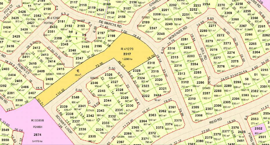
Reserve 41279
Request for Management Orders in the
favour of the Shire of Broome for the purpose of ‘drainage and
recreation’
|
Item 9.2.6 - UNMANAGED DRAINAGE AND RECREATION RESERVE 41279 - DE MARCHI ROAD
|
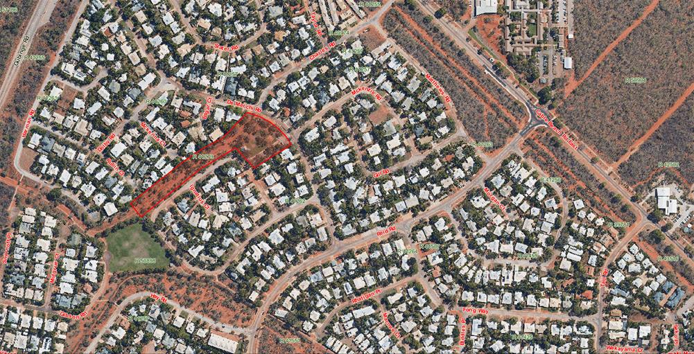
Minutes –
Ordinary Meeting of Council 7 September 2017 Page 760 of 1404
|
9.2.7 UNMANAGED PEDESTRIAN
ACCESS WAY RESERVE 34414 - ANNE STREET AND PRYOR DRIVE
LOCATION/ADDRESS: Anne
Street and Pryor Drive
APPLICANT: Shire
of Broome
FILE: RES
34414
AUTHOR: Land
Tenure Officer
CONTRIBUTOR/S: Nil
RESPONSIBLE
OFFICER: Director
Development and Community
DISCLOSURE
OF INTEREST: Nil
DATE OF REPORT: 3
August 2017
|
|
SUMMARY: Shire
officers have recently become aware that Reserve 34414 for the purpose of
‘pedestrian access way’ is currently unmanaged. Reserve
34414 is located between Anne Street and Pryor Drive and while it is currently
closed off to public access, the Reserve provides a drainage function and
could serve as a pedestrian access way in the future.
Given the current and future importance of this Reserve in
servicing the surrounding area, this report recommends that Council seek
Management Orders in favour of the Shire of Broome for Reserve 34414 for the
purpose of ‘drainage and access’.
|
BACKGROUND
Previous
Considerations
Nil.
COMMENT
Shire officers have recently become aware that Reserve 34414
for the purpose of ‘pedestrian access way’ is currently
unmanaged. Reserve 34414 is a laneway located between Anne Street and
Pryor Drive (Attachments 1 and 2).
The Shire of Broome Community Safety Plan developed in 2016
recommended an audit of Broome’s laneways with a view to closing those
contributing to antisocial behaviour. Reserve 34414 was closed as part of
the outcome of this audit in May 2017.
However, following the implementation of the urban renewal
strategy being developed by the Housing Authority for the Anne Street area, it
may be desirable to reopen this laneway. In addition, the Reserve serves
an important drainage function. Therefore, it is considered desirable for
the Shire to have management control of this Reserve.
To have Management Orders issued in favour of the Shire of
Broome for Reserve 34414, the Shire must write to the Department of Planning,
Lands and Heritage (DPLH) requesting the Minister for Lands issue
Management Orders in favour of the Shire of Broome.
It is therefore recommended that Council supports the Shire
writing to the DPLH requesting that the Minister for Lands issue Management
Orders for Reserve 34414 in favour of the Shire of Broome.
CONSULTATION
Department of Planning, Lands and Heritage
The matter was discussed at the Yawuru Park Council Working
Group meeting held on 5 July 2017 and no concerns were raised by any Working
Group members.
STATUTORY ENVIRONMENT
Land Administration Act 1997 (WA)
Section 46. Care, control and management of
reserves
1)
The Minister may by order place with any one person or jointly with any 2 or
more persons the care, control and management of a reserve for the same purpose
as that for which the relevant Crown land is reserved under section 41 and for
purposes ancillary or beneficial to that purpose and may in that order subject
that care, control and management to such conditions as the Minister specifies.
(2) The
Minister may, with the consent of the management body of a reserve and of the
holders of any interests within the reserve, by order vary any condition to
which the care, control and management of the reserve is subject.
(3) The
Minister may —
(a) by
order confer on a management body power, subject to section 18, to grant a
lease or sublease or licence over the whole or any part of the Crown land
within the reserve in question for the purposes referred to in subsection (1);
and
(b) approve
a mortgage of any such lease.
(3a) The
Minister may by order —
(a) without
the consent of the management body of a reserve, vary —
(i) an
order made under subsection (3)(a); or
(ii) an
order made under section 33 of the repealed Act or section 42 or 43 of the Land
Act 1898 7 that subsists as an order made under subsection (3)(a),
in relation to whether or not
prior approval in writing of the Minister is required to a grant of a lease,
sublease, or licence; or
(b) with
the consent of the management body of a reserve, vary any other condition to
which —
(i) an
order made under subsection (3)(a); or
(ii) an
order made under section 33 of the repealed Act or section 42 or 43 of the Land
Act 1898 7 that subsists as an order made under subsection (3)(a),is
subject.
(3b) The
Minister’s approval under section 18 is not required for the exercise of
a power conferred under subsection (3)(a) unless —
(a) the
person on whom the power is conferred is —
(i) a
body corporate that is constituted for a public purpose under an enactment and
is an agency of the Crown in right of the State; or
(ii) a
person referred to in subsection (10)(b),
and the order provides that
the Minister’s approval under section 18 is required; or
(b) the
person on whom the power is conferred is a person other than a person referred
to in paragraph (a).
(4) If
an unmanaged reserve is the subject of —
(a) a
lease granted under section 47; or
(b) a
licence, or a lease or profit à prendre, granted under section 48, or of
any other interest in the unmanaged reserve, the Minister may under subsection
(1) place the care, control and management of that reserve with a management
body subject to that licence, lease or profit à prendre or other
interest, the term of which continues unbroken by that placing.
(5) An
order made under subsection (1), (2), (3) or (3a) does not create any interest
in Crown land in the relevant reserve in favour of the management body of that
reserve.
(60 If
Crown land reserved under section 41 for the purpose of recreation is leased or
subleased under a power conferred under subsection (3), the lessee or sublessee
may, unless the terms of the management order or the lease or sublease
otherwise provide, restrict public access to the area leased.
(7) A
person with whom the care, control and management of a reserve is placed by
order under subsection (1) has, by virtue of this subsection, the capacity,
functions and powers to hold and deal with the reserve in a manner consistent
with the order, any order conferring power on that person under subsection
(3)(a) and this Act to the extent that the person does not already have that
capacity or those functions and powers.
(8) Subsection
(7) does not authorise a management body to perform a function or exercise a
power if another enactment expressly prevents the person from performing that
function or exercising that power, or expressly authorises another person to
perform that function or exercise that power.
(9) Any
instrument in relation to the care, control and management of a reserve entered
into or given by a person holding an office referred to in subsection
(10)(b)(i) or (iii) is taken to have been entered into or given by the person
for the time being holding that office.
(10) In
subsection (1), a reference to a person is a reference to —
(a) a
person having perpetual succession;
(b) a
person not having perpetual succession who is —
(i) a
Minister to whom the Act specified in the relevant order is for the time being
committed by the Governor; or
[(ii) [deleted]
(ii) a
person holding a prescribed office.
(11) If
an order made under section 33 of the repealed Act subsists under clause 16(1)
of Schedule 2 as if it were a management order under section 46(1), the
Minister may by order vary that order to place the care, control and management
of the reserve the subject of the order with a person referred to in subsection
(10).
(12) An
order made under section 46(1) before the coming into operation of section
12 of the Land Administration Amendment Act 2000 1 may be varied by
the Minister by order to place the care, control and management of the reserve
the subject of the order with a person referred to in subsection (10).
POLICY IMPLICATIONS
Nil
FINANCIAL IMPLICATIONS
There will be no direct additional costs to the Shire
associated with accepting the Management Order for the currently unmanaged
reserve. The Reserve currently serves a pedestrian access way purpose
which may be required in the future as well as a drainage function.
RISK
Nil
STRATEGIC
IMPLICATIONS
Our People
Goal – Foster a community environment that is accessible, affordable,
inclusive, healthy and safe:
Affordable services and initiatives
to satisfy community need
A healthy and safe environment
Our Place
Goal – Help to protect the nature and built environment and cultural
heritage of Broome whilst recognising the unique sense of the place:
Realistic and sustainable land use
strategies for the Shire within state and national frameworks and in
consultation with the community
Our
Prosperity Goal – Create the means to enable local jobs creation and lifestyle
affordability for the current and future population:
Affordable and equitable services and
infrastructure
VOTING REQUIREMENTS
Simple Majority
|
Council Resolution:
(Report Recommendation)
Moved: Cr M Fairborn Seconded:
Cr P Matsumoto
That Council requests that the Chief Executive
Officer write to the Department of Planning, Lands and Heritage
requesting Management Orders in favour of the Shire of Broome for Reserve
34414 for the purpose of ‘drainage and access’.
CARRIED UNANIMOUSLY 6/0
|
Attachments
|
1.
|
Reserve 34414
|
|
2.
|
Aerial image of Reserve
34414
|
|
Item 9.2.7 - UNMANAGED PEDESTRIAN ACCESS WAY RESERVE
34414 - ANNE STREET AND PRYOR DRIVE
|
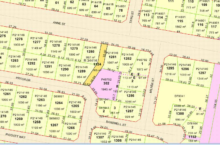
Reserve 34414
Request for Management Orders in
favour of the Shire of Broome for the purpose of ‘drainage and
access’
|
Item 9.2.7 - UNMANAGED PEDESTRIAN ACCESS WAY RESERVE 34414 - ANNE STREET AND
PRYOR DRIVE
|
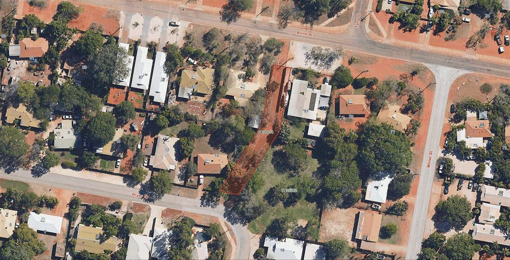
Minutes –
Ordinary Meeting of Council 7 September 2017 Page 768 of 1404
|
9.2.8 CONSTRUCTION OF A
VOLUNTEER BUSHFIRE BRIGADE HEADQUARTERS
LOCATION/ADDRESS: Nil
APPLICANT: Nil
FILE: LAW012
AUTHOR: Manager
Emergency, Health and Ranger Services
CONTRIBUTOR/S: Land
Tenure Officer
RESPONSIBLE
OFFICER: Director
Development and Community
DISCLOSURE
OF INTEREST: Nil
DATE OF REPORT: 8
August 2017
|
|
SUMMARY: In
2013 grant funding was committed to the Shire by the Department of Fire and
Emergency Services to construct a new headquarters for the Broome Volunteer
Bushfire Brigade. Initially it was proposed that the headquarters be
constructed at land on Broome Road, however it has since been found that this
site was unsuitable which has delayed the construction of the facility.
Officers have now identified a new site that is suitable.
This report recommends that Council supports the Shire
writing to the Department of Planning, Lands and Heritage seeking creation of
a reserve for the purpose of ‘fire and emergency services’ with
Management Orders in favour of the Shire of Broome.
|
BACKGROUND
Previous
Considerations
Nil.
The Shire of Broome is authorised by the Bush Fires Act
1954 to establish and maintain Bush Fire Brigades. The Shire established
and maintains the Broome Volunteer Bushfire Brigade (BVBFB) to mitigate
the bushfire risk to the Shire. Under a current Memorandum of Understanding (MOU)
the brigade is managed by the Department of Fire and Emergency Services (DFES).
The Shire is still responsible for resourcing the Brigade, however in practical
terms most of the expenditure is recouped from the DFES through operational
grants funded by the Emergency Services Levy (ESL).
The current BVBFB facilities include two sites; a storage
depot on 15 Farrell Street, Broome where two fire response units are housed,
and a facility on 56 Walcott Street, Broome where a fast response unit is
located. The Walcott Street facility is located within a residential area and
serves as the headquarters for the Brigade.
In 2013, DFES committed to provide the Shire with a grant in
the amount of $960,000 (excluding GST) for a new headquarters for the BVBFB.
This grant has been carried over by DFES for a number of years whilst a
suitable site for the construction of the facility was located. Initially, it
was proposed that the facility would be constructed on Lot 2642 Broome Road and
substantial work was undertaken by officers to secure tenure of the site.
However late in the process, it was identified that this site would be
unsuitable due it being a future drainage discharge point.
Shire officers then undertook another comprehensive review
for potential locations for the BVBFB. Site considerations included:
· size –
at least 3000 square metres of land is required for the headquarters;
· location
– the headquarters have to be on the outskirts of Broome to attract
volunteers to the rural bush fire brigade;
· cost of land
acquisition – the grant does not cover the cost of land purchase or
leasing;
· availability
of services – the headquarters require electricity and reticulated water;
· zoning under
Local Planning Scheme No 6 – the land needs to be appropriately zoned;
· native title
– to secure tenure any native title issues need to be resolved; and
· natural
hazard risks – the headquarters have to be able to achieve an acceptable
level of hazard immunity to be able to serve the community in an emergency.
Investigations regarding potential sites was exhaustive and
lengthy. There were very few sites that met all of the above
criteria. Many potential sites were discounted because of lack of
services or because of cost implications associated with site works to bring
electricity and reticulated water to the site or achieve an acceptable level of
hazard immunity.
Ultimately, the site identified as best meeting all of the
criteria was a parcel of Unallocated Crown Land (UCL), being Lot 1047 on
Deposited Plan 187779 (Lot 1047 Wattle Drive), located between the Broome
Speedway and Caravan Park. This land was therefore identified as the
preferred location (see Attachment 1).
Lot 1047 is 2.28 hectares in area and is on the outskirts of
Broome. Electricity and reticulated water are available to the
site. As the land is UCL, no costs are associated with the creation of a
reserve vested with the Shire.
The subject land is zoned ‘Public Purpose’ under
the Shire’s Local Planning Scheme No 6. The proposed use of the land for
the BVBFB would therefore be consistent with the provisions of the Scheme.
Native title has been resolved in relation to the site, and
while the site is subject to coastal hazards, this can be rectified by the
importation of a relatively small volume of fill.
DFES indicated that they strongly supported the location of
the BVBFB headquarters on this site, compared to other sites identified through
the review of possible locations.
COMMENT
The proposed site will be used to construct a headquarters
for the BVBFB. This will include office space, indoor training
facilities, ablutions, equipment storage and communication facilities. In
addition a large shed will be constructed that will have the capacity to house
5 large fire appliances or 10 light vehicles. This shed will also include
a maintenance area.
Aside from the buildings, additional space is required to
provide space for vehicle parking, wash down areas for vehicles and equipment,
a ‘hot’ training area, and an area to house other vehicles that are
brought up from Perth for the peak fire season.
Shire officers have consulted with the Department of
Planning, Lands and Heritage (DPLH) regarding the subject land and they
confirmed native title has been extinguished for Lot 1047 pursuant to Clause 9,
Schedule 6, Part 1, of the Yawuru Area Agreement Indigenous Land Use Agreement.
To formalise tenure over the land, the Shire of Broome must
write to the DPLH requesting the Minister of Lands create the reserve with
Management Orders in favour of the Shire of Broome.
It is therefore recommended that Council supports the CEO
writing to the DPLH seeking the Minister for Lands create the reserve for the
purpose of ‘Fire and Emergency Services’ with Management Orders in
favour of the Shire of Broome.
As discussed above, the site will require some fill to
achieve a level of hazard immunity from coastal processes. However, this
will only be required over the land on which the shed and associated structural
infrastructure are located.
The current DFES grant guidelines stipulate that costs
associated with site works are the responsibility of the local
government. Lot 1047 has been identified as being at risk of a 1 in 500
year flood event in the Shire’s Coastal Vulnerability Study. In order to
achieve an acceptable level of hazard immunity, up to 1600m3 of fill
will be required. The fill and additional works to achieve this hazard immunity
are estimated to cost $75,000. This has not previously been allocated by
Council in the budget process.
In recognition of the additional costs required to make the
site fit for purpose, the Shire’s Chief Executive Officer has written to
the DFES Commissioner asking for special dispensation to include an additional
$75,000 as part of the grant for the purpose of site works. At the time of
preparing this report a response to this request has not been received. If the
Commissioner does not grant this request, it is officers’ recommendation
that Council request the Chief Executive Officer write to DFES and decline to
take up the grant to build the new BVBFB Headquarters.
CONSULTATION
Officers have undertaken extensive
consultation with DFES to select a site suitable for the proposed purpose.
Criteria identified by DFES officers has informed the site selection process.
Officers have not been able to identify any other suitable site that may become
available to the Shire.
In reviewing the potential
availability of other sites, Shire officers have also had discussions with the
Aboriginal Lands Trust, Yawuru and the Department of Parks and Wildlife.
STATUTORY ENVIRONMENT
Land Administration Act 1997 (WA)
Section 46. Care, control and management of
reserves
1) The
Minister may by order place with any one person or jointly with any 2 or more
persons the care, control and management of a reserve for the same purpose as
that for which the relevant Crown land is reserved under section 41 and
for purposes ancillary or beneficial to that purpose and may in that order
subject that care, control and management to such conditions as the Minister
specifies.
(2) The
Minister may, with the consent of the management body of a reserve and of the
holders of any interests within the reserve, by order vary any condition to
which the care, control and management of the reserve is subject.
(3)
The Minister may —
(a) by
order confer on a management body power, subject to section 18, to grant a
lease or sublease or licence over the whole or any part of the Crown land
within the reserve in question for the purposes referred to in subsection (1);
and
(b) approve
a mortgage of any such lease.
(3a) The
Minister may by order —
(a) without
the consent of the management body of a reserve, vary —
(i) an
order made under subsection (3)(a); or
(ii) an
order made under section 33 of the repealed Act or section 42 or 43 of the Land
Act 1898 7 that subsists as an order made under subsection (3)(a),
in relation to whether or not
prior approval in writing of the Minister is required to a grant of a lease,
sublease, or licence; or
(b) with
the consent of the management body of a reserve, vary any other condition to
which —
(i) an
order made under subsection (3)(a); or
(ii) an
order made under section 33 of the repealed Act or section 42 or 43 of the Land
Act 1898 7 that subsists as an order made under subsection (3)(a),is
subject.
(3b) The
Minister’s approval under section 18 is not required for the exercise of
a power conferred under subsection (3)(a) unless —
(a) the
person on whom the power is conferred is —
(i) a
body corporate that is constituted for a public purpose under an enactment and
is an agency of the Crown in right of the State; or
(ii) a
person referred to in subsection (10)(b),
and the order provides that
the Minister’s approval under section 18 is required; or
(b) the
person on whom the power is conferred is a person other than a person referred
to in paragraph (a).
(4) If
an unmanaged reserve is the subject of —
(a) a
lease granted under section 47; or
(b) a
licence, or a lease or profit à prendre, granted under section 48, or of
any other interest in the unmanaged reserve, the Minister may under subsection
(1) place the care, control and management of that reserve with a management
body subject to that licence, lease or profit à prendre or other
interest, the term of which continues unbroken by that placing.
(5) An
order made under subsection (1), (2), (3) or (3a) does not create any interest
in Crown land in the relevant reserve in favour of the management body of that
reserve.
(6) If
Crown land reserved under section 41 for the purpose of recreation is leased or
subleased under a power conferred under subsection (3), the lessee or sublessee
may, unless the terms of the management order or the lease or sublease
otherwise provide, restrict public access to the area leased.
(7) A
person with whom the care, control and management of a reserve is placed by
order under subsection (1) has, by virtue of this subsection, the capacity,
functions and powers to hold and deal with the reserve in a manner consistent
with the order, any order conferring power on that person under subsection
(3)(a) and this Act to the extent that the person does not already have that
capacity or those functions and powers.
(8) Subsection
(7) does not authorise a management body to perform a function or exercise a
power if another enactment expressly prevents the person from performing that
function or exercising that power, or expressly authorises another person to
perform that function or exercise that power.
(9) Any
instrument in relation to the care, control and management of a reserve entered
into or given by a person holding an office referred to in subsection
(10)(b)(i) or (iii) is taken to have been entered into or given by the person
for the time being holding that office.
(10) In
subsection (1), a reference to a person is a reference to —
(a) a
person having perpetual succession;
(b) a
person not having perpetual succession who is —
(i) a
Minister to whom the Act specified in the relevant order is for the time being
committed by the Governor; or
(ii) deleted]
(ii) a
person holding a prescribed office.
(11) If
an order made under section 33 of the repealed Act subsists under clause 16(1)
of Schedule 2 as if it were a management order under section 46(1), the
Minister may by order vary that order to place the care, control and management
of the reserve the subject of the order with a person referred to in subsection
(10).
(12)
An order made under section 46(1) before the coming into operation of section
12 of the Land Administration Amendment Act 2000 1 may be varied by
the Minister by order to place the care, control and management of the reserve
the subject of the order with a person referred to in subsection (10).
Bush
Fires Act 1954 (WA)
36. Local
government may expend moneys in connection with control and extinguishment of
bush fires
A
local government may, notwithstanding anything to the contrary contained in any
other Act —
(a) purchase and maintain appliances,
equipment, and apparatus for the prevention, control and extinguishment of bush
fires;
(b) clear
a street, road or reserve vested in it or under its control, of bush, and other
inflammable material, for the purpose of preventing the occurrence or spread of
a fire;
(c) [deleted]
(d) establish
and maintain bush fire brigades as a part of its organisation for the
prevention, control, and extinguishment of bush fires;
(e) use
any vehicle in controlling or extinguishing a bush fire or in the attempting so
to do but the local government must pay to the owner or hirer of the vehicle,
in respect of any damage done to a tyre of that vehicle while it was being so
utilized, an amount assessed by an employee of the local government authorised
by it to assess the cost of that damage;
(f) assist
the occupier of farm lands within its district to acquire appliances, equipment
and apparatus for the prevention, control, and extinguishment of bush fires
upon or threatening his land, including the sale, loan or exchange to the
occupier of appliances, equipment and apparatus belonging to the local
government.
POLICY IMPLICATIONS
Nil
FINANCIAL IMPLICATIONS
The grant for the BVBFB headquarters
construction project and the capital project is included in the Shire’s
2017/2018 budget. It is anticipated that the project will be fully grant
funded. On-going maintenance costs are anticipated but are not known at this
time, however these costs are not expected to be significant. All utilities are
recouped through the DFES operating grant scheme. There are no costs associated
with obtaining the Management Order for the site.
RISK
There are no significant risks
associated with the granting of the Management Order to the Shire.
STRATEGIC
IMPLICATIONS
Our People
Goal – Foster a community environment that is accessible, affordable,
inclusive, healthy and safe:
A healthy and safe environment
Our Place
Goal – Help to protect the nature and built environment and cultural
heritage of Broome whilst recognising the unique sense of the place:
Realistic and sustainable land use
strategies for the Shire within state and national frameworks and in
consultation with the community
Our
Prosperity Goal – Create the means to enable local jobs creation and
lifestyle affordability for the current and future population:
Affordable and equitable services and
infrastructure
VOTING REQUIREMENTS
Simple Majority
|
Council Resolution:
(Report Recommendation)
Moved:
Cr D Male Seconded:
Cr W Fryer
That Council requests that the Chief
Executive Officer write to the Department of Planning, Lands
and Heritage requesting the creation of a reserve over Lot 1047 on Deposited
Plan 187779 for the purpose of ‘fire and emergency services’ with
Management Orders in favour of the Shire of Broome.
CARRIED UNANIMOUSLY 6/0
|
Attachments
|
1.
|
Aerial image of
proposed location
|
|
Item 9.2.8 - CONSTRUCTION OF A VOLUNTEER BUSHFIRE BRIGADE
HEADQUARTERS
|
ATTACHMENT
NO 1 – LOT 1047 WATTLE DRIVE
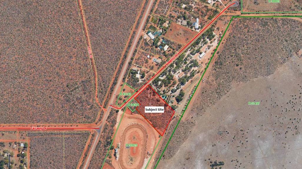
Minutes –
Ordinary Meeting of Council 7 September 2017 Page 773 of 1404
|
9.2.9 TRANSFER OF LAND TO
FACILITATE BROOME NORTH - STAGE 2
LOCATION/ADDRESS: Lot
365 FAIRWAY DRIVE, BILINGURR
APPLICANT: Department
of Planning, Lands and Heritage
FILE: FAI-1/GEN,
PLA88
AUTHOR: Land
Tenure Officer
CONTRIBUTOR/S: Nil
RESPONSIBLE
OFFICER: Director
Development and Community
DISCLOSURE
OF INTEREST: Nil
DATE OF REPORT: 15
August 2017
|
|
SUMMARY: The
Shire of Broome has received a request for comment from the Department of
Planning, Lands and Heritage (DPLH) regarding the transfer of
Unallocated Crown Land Lot 365 on Deposited Plan 74365 to LandCorp in fee
simple. The transfer of this land parcel is proposed to facilitate
Stage 2 of the Broome North development.
As delegation does not exist for officers to provide
comment the request is being referred to Council for consideration.
This report recommends that Council responds to the DPLH
advising that it supports the transfer of Lot 365 on Deposited Plan 74365 in
fee simple to LandCorp to facilitate Stage 2 of the Broome North development,
and that any future use of the subject land will need to be consistent with
the Shire’s Local Planning Scheme No. 6 and Local Planning Strategy.
|
BACKGROUND
Previous Considerations
OMC 20 June 2013 Item
9.2.7
OMC 21 March 2013 Item
9.2.6
OMC 29 November 2012 Item 9.2.1
OMC 18 March 2010 Item
9.3.1
SMC 22 February 2010 Item
9.3.1 and 9.3.2
OMC 26 November 2009 Item 9.3.2
OMC 29 October 2009 Item
9.3.2
OMC 4 August 2009 Item
9.3.2
OMC 20 June 2013 Item 9.2.7
Council adopted the Broome North Local Development Plan
– Stage Two January 2013/ Revision E subject to a number of
modifications. Council resolved:
|
COUNCIL
RESOLUTION:
That Council:
1. That
Council adopts the recommendations listed against each submission in the
Schedule of Submissions included in Attachment No 7.
2. Pursuant
to the Shire of Broome Town Planning Scheme No 4, Clause 4.25.3.4 adopts the
Broome North Local development Plan – Stage Two January 2013Revision E,
subject to the following modifications being completed to the satisfaction of
the Director Development Services:
a. A
summary of the outcomes of the noise assessment report and DEC comments are
incorporated into the Local Development Plan report including that lots
requiring noise screeding of outdoor areas which will be subject to a
Detailed Area Plan controlling the position of primary outdoor living areas.
b. The
following notation be included on the Local Development Plan:
All development on lots identified as being affected by noise must be
developed to the standard set out within the Local Development Plan, until
such time as the Speedway and Motocross are relocated or appropriate
arrangements are in place to the satisfaction of the Shire.
c. The
following notation be included on the Local Development Plan:
All road pavements will be constructed to the following standards, as a
minimum:
i. Major
Access Street – 7.4m wide pavement;
ii. Local
Access Streets – 6m wide pavement; and
iii. Local
Access Streets adjacent to POS areas – 5.5m wide pavement with embayed
parking. Embayed parking would not be required for the portion of a
street which is 6m from the tangent point of a curve and the road pavement
width for this section of the street can remain at 5.5m. Alternately 6m
wide pavement can be installed with embayed parking adjacent to the active
Public Open Space and higher density urban living areas.
d. The
road typologies contained within the Local Development Report must be updated
to reflect 1. c) above.
e. The
following notation be included on the Local Development Plan:
Prior to the redevelopment of the former poultry farm (Lot 2605 Fairway
Drive), additional soil and groundwater investigations will be required to
determine whether the sire is suitable for the proposed land use. Based
on the former land use and soil sample results the site may need to be reported
to the DEC under the Contaminated Sites Act.
3. Authorise
the Director Development Services to upon receipt of the amended Local
Development Plan addressing point 1 above, forward the amended Local
Development Plan to WAPC for adoption pursuant to Clause 4.25.3.5 of Town
Planning Scheme No 4.
4. Authorise
the Chief Executive Officer and Shire President to engross all documentation
as required.
5. Request
the Chief Executive Officer to in conjunction with the Speedway and Motocross
prepare a Noise Management Plan for the operations of the Speedway and
Motocross consistent with the noise report and DEC comments.
6. Request
the Chief Executive Officer to prepare a future report to Council that
outlines potential funding sources or grants to assist with the relocation of
the Speedway, Motocross and development of other motor sports associated
sports from its current location.
CARRIED
UNANIMOUSLY 6/0
|
The Department of Planning, Lands and Heritage (DPLH)
have now received a request from LandCorp to commence the transfer of
Unallocated Crown Land (UCL) Lot 365 on Deposited Plan 74365, located on
the corner of Fairway Drive and Broome Road (see area shown in red in Attachment
1), to LandCorp in fee simple. The transfer of this land parcel is
proposed to facilitate Stage 2 of the Broome North development.
The DPLH is seeking Council’s comments on the proposed
transfer.
COMMENT
Lot 365 on Deposited Plan 74365 is zoned
‘Development’ in accordance with the Shire’s Local Planning
Scheme No. 6 (LPS6).
The DPLH has advised the subject land is not subject to
native title pursuant to the Rubibi Community Native Title Determination
(WAD6006/1998, WAD223/2004).
Section 16(3) approval pursuant to the Mining Act 1978
has been received by the Department of Mines, Industry Regulation and Safety,
who also requested that LandCorp abides by the guidelines of the Western
Australian Planning Commission, Planning Bulletin No. 87, with regards to the
Broome Gas Pipeline located on the western boundary of the proposal.
The Shire has previously provided support for the Broome
North development. Therefore, in order to facilitate Stage 2 of the
development, it is recommended that Council advises the DPLH that it supports
the transfer of Lot 365 on Deposited Plan 74365 in fee simple to LandCorp and
that any future use of the subject land will need to be consistent with the
Shire’s Local Planning Scheme No. 6 and Local Planning Strategy.
CONSULTATION
There has been ongoing consultation between LandCorp and the
Shire of Broome since 2009 in relation to the Broome North development.
STATUTORY
ENVIRONMENT
Land Administration Act 1997.
POLICY
IMPLICATIONS
Nil
FINANCIAL
IMPLICATIONS
Nil
RISK
Nil
STRATEGIC
IMPLICATIONS
Our Place Goal – Help to
protect the nature and built environment and cultural heritage of Broome whilst
recognising the unique sense of the place:
Realistic and sustainable land use
strategies for the Shire within state and national frameworks and in
consultation with the community
VOTING REQUIREMENTS
Simple Majority
|
Council Resolution:
(Report Recommendation)
Moved: Cr M Fairborn Seconded:
Cr B Rudeforth
That Council requests that the Chief Executive
Officer write to the Department of Planning, Lands and Heritage advising
that:
1. Council
supports the transfer of Lot 365 on Deposited Plan 74365 in fee simple to
LandCorp to facilitate Stage 2 of the Broome North development; and
2. Any
future use of the subject land will need to be consistent with the
Shire’s Local Planning Scheme No. 6 and Local Planning Strategy.
CARRIED
UNANIMOUSLY 6/0
|
Attachments
|
Item 9.2.9 - TRANSFER OF LAND TO FACILITATE BROOME NORTH
- STAGE 2
|
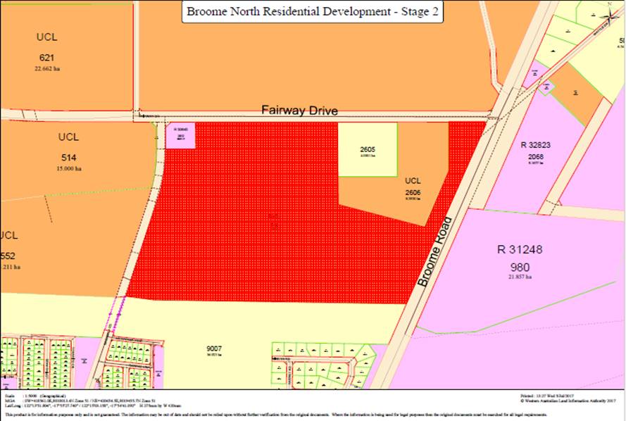
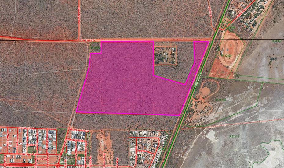 Lot 365 on DP 74365 to transfer in fee
simple to LandCorp to facilitate Broome North Stage 2
9.3
Our Prosperity
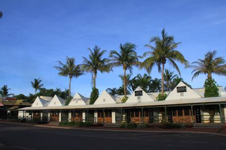
PRIORITY STATEMENT
Our
region has grown significantly over the past years in terms of population,
economy and industry – this will continue! Balancing ecological
sustainability with economic growth and retaining the ‘look and
feel’ of Broome and its environs are an ongoing challenge for the region.
Encouraging appropriate investment and business development opportunities to
ensure a strong, diverse economic base is essential for community prosperity
and the success of our future generations.
Focusing
on developing clear pathways linking education with employment for our youth
and the community at large is essential as we aim to retain our local people
and continue to build a skilled and highly motivated workforce.
Business
and Industry partnerships must be fostered to ensure sustainable economic
growth is achieved, along with the provision of affordable and equitable
services and infrastructure. Ensuring development meets community needs
and legislative requirements whilst creating close community relationships and
enhancing our understanding of local heritage and cultural issues will continue
to be a major focus. The built environment must contribute to the
economy, long term viability of the region and provide a quality lifestyle for
all.
Minutes – Ordinary
Meeting of Council 7 September 2017 Page 781 of 1404
|
With regard to Item 9.3.1, Cr
D Male declared a Financial Interest as “client of my business”
and departed the Chambers at 5.36pm.
|
|
|
|
9.3.1 COLD
STORAGE LOGISTICS HUB FEASIBILITY STUDY
LOCATION/ADDRESS: Nil
APPLICANT: Nil
FILE: PLA01
AUTHOR: Manager
Community and Economic Development
CONTRIBUTOR/S: Nil
RESPONSIBLE
OFFICER: Director
Development and Community
DISCLOSURE
OF INTEREST: Nil
DATE OF REPORT: 3
August 2017
|
|
SUMMARY: The
Kimberley Pilbara Cattlemen’s Association has requested support from
the Shire of Broome towards commissioning a Cold Storage Logistics Hub
feasibility study.
This project aligns with actions within the draft Broome
Growth Plan, which includes a focus on projects to ensure appropriate
logistics and infrastructure are in place to support growth and success of
pastoral and agricultural investment.
The final report will present an investment ready model
for companies looking to invest in the region. The association is seeking a
contribution of $10,000 (ex GST) towards a total project budget of $150,000.
|
BACKGROUND
Previous
Considerations
Nil.
Broome’s Growth Planning
Partnership (GPP) comprises the Shire of Broome, the Kimberley
Development Commission, the Yawuru Registered Native Title Body Corporate,
LandCorp, the Department of Planning and the Department of Regional Development
collaborating to develop the Broome Growth Plan (Growth Plan). The
Growth Plan covers Broome and its economic area of influence.
The Broome Growth Plan is currently
undergoing final revisions as an advanced draft, and is anticipated to be
presented in coming months to the Shire’s Economic Development Advisory
Committee prior to Council for consideration.
The draft Growth Plan supports growth
in the region’s agricultural industries as a key element of supporting
the aspirational growth targets established in the Plan. The
establishment of cold storage facilities is identified as a project in the draft
Growth Plan to support the region’s agricultural industry.
The Kimberley
Pilbara Cattleman’s Association (KPCA) is commissioning a Cold
Storage Logistics Hub feasibility study and is seeking funding from the Shire
of Broome and other partners towards the writing of the final business case for
the Hub.
COMMENT
The State Government has identified agrifood as a
significant growth opportunity and set a target of seeing the sector’s
exports double in real value by 2025. The identified drivers, particularly in
Asia, for this growth include:
· population growth;
· diversification
and improvement in diet;
· rising incomes;
and
· increasing
urbanisation.
Within the Growth Plan context,
agriculture is defined as the growing of crops, food production, managing
rangelands, aquaculture and livestock. This sector is expected to be an ongoing
contributor to Broome’s Gross Regional Product (GRP), with
opportunities to expand land and marine based outputs in the region.
With advances in production methods
and new technology, agriculture is more sustainable and has the potential to
contribute a 30% increase to Broome’s current economy – including
the generation of between 22 – 120 full time jobs.
To enable this potential, a number of
indicative projects have been identified to guide the provision of suitable
infrastructure. The development of cold storage facilities at a central
location (or hub) or at the Port and/or Airport is considered as a key project,
and the KPCA is looking to continue the current momentum and interest.
The KPCA will complete the study by
the end of this calendar year (2017), the scope of which will include:
1. Identify
and recommend a priority and secondary location for the cold storage logistics
hub in Broome;
2. Identify
drivers for the requirement of the facilities, and current and anticipated
industry demand across the horticulture, pastoral and aquaculture sectors in
the region;
3. Define
the current opportunity for volume and predict using modelling for the next 10
and 20 years of horticulture, aquaculture and pastoral products;
4. Identify
the necessary approvals required, any environmental issues and typical
mitigation responses for the recommended site/s;
5. Determine
if there is a business case to develop a cold storage logistics hub in Broome
and define return on investment timelines, including ongoing maintenance and
depreciation matters;
6. Conduct
all relevant checks, including but not limited to Tenure Checks and necessary
government checks;
7. Provide
engineering design and a high-level construction, including fire suppression
costs appropriate to location and to a contemporary standard of design, safety
and construction;
8. Include
technology and innovations that provide for effective and efficient cold
storage facilities that are logistically smooth and utilise the most cost
effective power system;
9. In
consultation with industry (horticulture, aquaculture and pastoral) ensure the
design capacity is capable of delivering the required volume of fresh and
frozen produce over an operational life of at least twenty-five years; and
10. Ensure all
environmental, regulatory and occupational health and safety requirements are
met.
The KPCA has indicated formal support
has been received from Yawuru, Department of Primary Industries and Regional
Development and Regional Development Australia. The Shire will receive
acknowledgment within the document and media.
Overall, it is expected that the
feasibility study and business case will cost $150,000 and KPCA is seeking that
the Shire contribute $10,000 plus GST towards to study. While the Shire has not
budgeted any funds specifically for this project, it is considered that the
project has significant merit and has the potential to have a positive impact
upon sustainable economic growth for Broome and the surrounding regions as
highlighted in the comments above.
It is also considered positive that
the KPCA, as a key advocacy body, is taking active interest in delivering one
of the opportunities identified in the draft Broome Growth Plan. A $10,000
contribution from the Shire is seen sounds investment for a project that has
the potential to deliver positive outcomes for the Shire.
CONSULTATION
The Shire has received a formal
request from the KPCA which is included as Attachment 1.
The strategic identification of a
Cold Storage Logistics Hub has emerged during consultation and research as part
of the development of the Broome Growth Plan. Ideally this request would have
been tabled at the Shire’s Economic Development and Advisory Committee
for recommendation, however due to the timing of the next meeting (being
rescheduled for September 2017) it was not possible.
STATUTORY ENVIRONMENT
Local Government Act 1995.
POLICY IMPLICATIONS
Nil
FINANCIAL IMPLICATIONS
There is currently no allocated budget for this project.
However, given the value for money this funding request represents it is
recommended that Council resolve to support the request, with the funds to be
allocated as a part of the first quarter Financial Costings Review.
Should no savings be identified across the
organisation’s budget during this process, the overall 2017/2018 budget
would go into a deficit of $10,000.
RISK
|
Risk
|
Type
|
Rank
|
Mitigation
|
|
Consistent and transparent process
|
Reputational
|
Low
|
The request will be assessed by
Council and a MOU is entered into setting out conditions of accepting
funding.
|
|
Broome Growth Plan is still in
draft format
|
Reputational
|
Low
|
While the Plan has not been
finalised, this initiative had strong backing throughout the process.
|
|
Value for money
|
Financial
|
Low
|
Project has been identified as a
key economic development initiative, thus contribution to a private sector
led feasibility study is considered a sound investment.
|
|
The Shire does not support the
funding request
|
Reputational
|
Medium
|
Council support the funding request
to show the Shire’s commitment on delivering outcomes identified in the
draft Broome Growth Plan.
|
STRATEGIC
IMPLICATIONS
Our
Prosperity Goal – Create the means to enable local jobs creation and
lifestyle affordability for the current and future population:
Key economic development strategies
for the Shire which are aligned to regional outcomes working through recognised
planning and development groups/committees
VOTING REQUIREMENTS
Absolute Majority
|
Council Resolution:
(Report Recommendation)
Moved: Cr W Fryer Seconded:
Cr M Fairborn
That Council:
1. Supports the
request for funding from the Kimberley Pilbara Cattlemen’s Association
and provide $10,000 (ex GST) from the 2017/18 budget.
2. Authorises
the Chief Executive Officer to enter into a Memorandum of Understanding with
the Kimberley Pilbara Cattlemen’s Association, including the following
conditions:
(a) Acknowledgement
of the Shire of Broome as a project funder and partner;
(b) The
Shire is consulted as a part of the process of preparing the Cold Storage
Logistic Hub feasibility study;
(c) Presentation
of a project update is provided to Council at the half way point of the
project;
(d) A
copy of the Cold Storage Logistic Hub feasibility study is provided to the
Shire; and
(e) Submission
of an acquittal of expended funds no more than one month following the
completion of the project.
3. Authorises
the Chief Executive Officer to make a budget amendment as part of the first
quarter Finance and Costings Review, and allocate $10,000 to GL 1367210
Economic Development Expenses.
CARRIED UNANIMOUSLY BY ABSOLUTE
MAJORITY 5/0
|
Cr D Male
returned to the Chambers at 5.37pm and the Chairman advised the Report
Recommendation was carried.
Attachments
|
1.
|
Broome Cold Storage
Funding Request from KPCA
|
|
Item 9.3.1 - COLD STORAGE LOGISTICS HUB FEASIBILITY STUDY
|
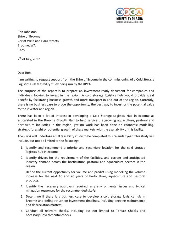
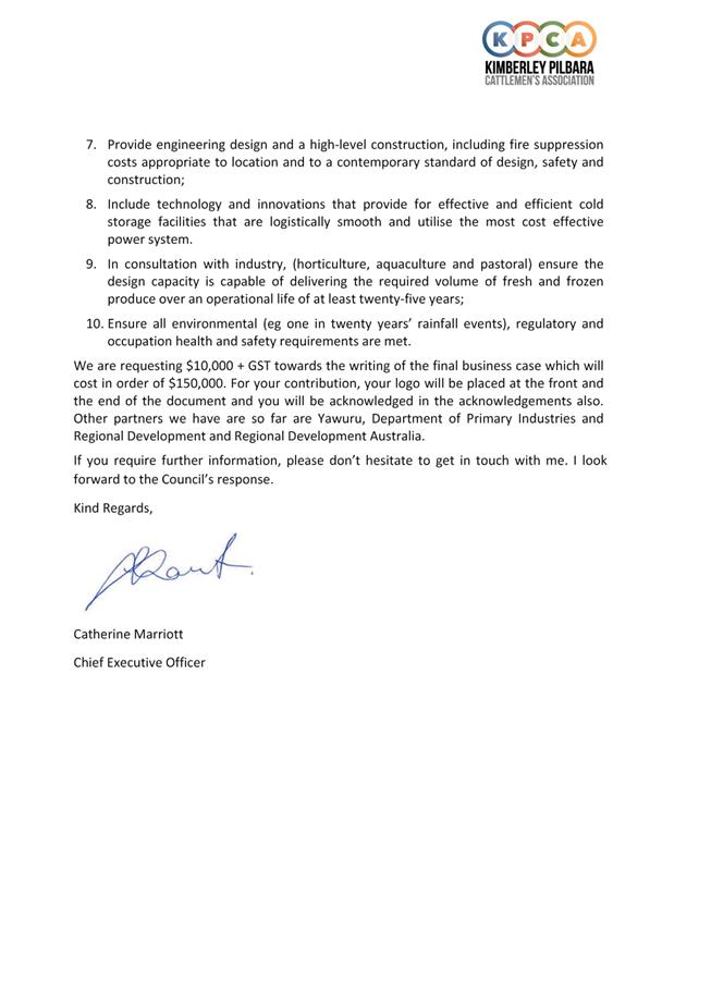
9.4
Our Organisation
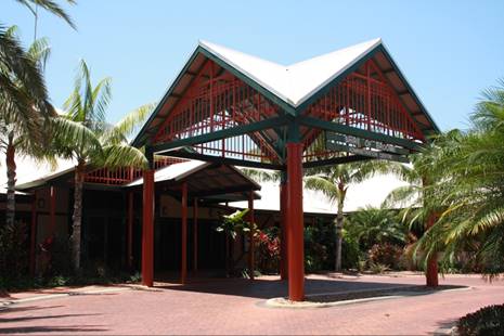
PRIORITY STATEMENT
Council will strive to create an environment where
local governance is delivered in an open and accountable manner; where we
provide leadership to the region in such areas as planning and financial
management; where the community has the opportunity to contribute to the
Council’s decision making thereby fostering ownership of strategies and
initiatives.
In delivering open, accountable and inclusive
governance, we will be ever mindful that we operate within a highly regulated
environment that requires a high level of compliance.
Council will strive to be the conduit between the
other spheres of government and the community, translating State and Federal
law, policy and practice into customer focussed, on ground service delivery
that support’s Broome’s unique lifestyle.
The
Region is experiencing significant change with Council dedicated to sound
governance, effective leadership and innovation, and high quality
services. Building organisational capacity is a priority with a
commitment to delivering services to the community in a sustainable, effective
and accountable way.
Minutes –
Ordinary Meeting of Council 7 September 2017 Page 787 of 1404
|
9.4.1 MONTHLY PAYMENT LISTING -
JULY 2017
LOCATION/ADDRESS: Nil
APPLICANT: Nil
FILE: FRE02
AUTHOR: Finance
Officer - Creditors
CONTRIBUTOR/S: Nil
RESPONSIBLE
OFFICER: Director
Corporate Services
DISCLOSURE
OF INTEREST: Nil
DATE OF REPORT: 1
August 2017
|
|
SUMMARY: This report recommends that Council
receives the list of payments made under delegated authority, as per the
attachment to this report for the month of July 2017.
|
BACKGROUND
Previous
Considerations
Nil
COMMENT
The Chief Executive Officer (CEO) has
delegated authority to make payments from the Municipal and Trust funds in
accordance with budget allocations.
The Shire provides payments to
suppliers by either Electronic Funds Transfer (EFT), cheque, credit card or
direct debit.
Attached is a list of all payments
processed under delegated authority during the month of July 2017.
CONSULTATION
Nil
STATUTORY ENVIRONMENT
Local Government (Financial
Management) Regulations 1996
13. Payments from
municipal fund or trust fund by CEO, CEO’s duties as to etc.
(1) If the local
government has delegated to the CEO the exercise of its power to make payments
from the municipal fund or the trust fund, a list of accounts paid by the CEO
is to be prepared each month showing for each account paid since the last such
list was prepared —
(a) the payee’s name;
(b) the amount of the payment;
and
(c) the date of the payment;
and
(d) sufficient information to
identify the transaction.
(2) A
list of accounts for approval to be paid is to be prepared each month
showing —
(a) for each account which
requires council authorisation in that month —
(i) the
payee’s name; and
(ii) the
amount of the payment; and
(iii) sufficient
information to identify the transaction; and
(b) the date of the meeting of
the council to which the list is to be presented.
(3) A list prepared under
subregulation (1) or (2) is to be —
(a) presented to the council at
the next ordinary meeting of the council after the list is prepared; and
(b) recorded in the minutes of
that meeting.
POLICY IMPLICATIONS
Nil
FINANCIAL IMPLICATIONS
List of payments made in accordance
with budget and delegated authority.
RISK
The risk of Council not adopting this
report is extreme as this will result in non-compliance with Regulation 13 of
the Local Government (Financial Management) Regulations 1996. The
likelihood of this ever occurring is rare due to the CEO’s implementation
of procedures to ensure payment details are disclosed to Council in a timely
manner, as well as Procurement and Purchasing policies which ensure these
payments are made in accordance with budget and delegated authority and comply
with Local Government (Financial Management) Regulations 1996.
STRATEGIC
IMPLICATIONS
Our
Organisation Goal – Continually enhance the Shire’s organisational
capacity to service the needs of a growing community:
An organisational culture that
strives for service excellence
Responsible resource allocation
Effective community engagement
Improved systems, processes and
compliance
VOTING REQUIREMENTS
Simple Majority
|
Council Resolution:
(Report Recommendation)
Moved: Cr B Rudeforth Seconded:
Cr W Fryer
That Council:
Receives the list of payments
made from the Municipal and Trust Accounts in July 2017 totalling
$3,493,561.35 (Attachment 1) in accordance with the requirements of
Regulation 12 of the Local Government (Financial Management) Regulations 1996
covering:
• EFT
Vouchers 41320 – 41362, 41365 - 41652 totalling $3,328,140.99;
• Municipal
Cheque Vouchers 57471-57476 totalling $857.65;
• Trust
Cheque Voucher 3436 totalling $6491.03; and
• Credit
Card Payments & Municipal Direct Debits DD22713.1 – DD22925.8
totalling $158,071.68.
CARRIED
UNANIMOUSLY 6/0
|
Attachments
|
1.
|
Payment Listing July
2017
|
|
Item 9.4.1 - MONTHLY PAYMENT LISTING - JULY 2017
|
|
Part 5. Division 4. Section 5.42
Delegation of some powers to CEO. Sub Section Finance
|
|
|
Management Regulation 12.
|
|
|
|
|
Each payment must show on a list the
payees name, the amount of the payment, the date of
|
|
|
the payment and sufficient
information to identify the transaction.
|
|
|
|
|
|
|
|
|
|
This report incorporates the
Delegation of Authority (Administration Regulation 19)
|
|
|
|
|
|
|
|
|
PAYMENTS BY EFT & CHEQUE &
FROM TRUST - JULY 2017
|
|
|
|
|
|
|
|
|
MUNICIPAL ELECTRONIC TRANSFER - JULY
2017
|
|
|
EFT
|
Date
|
Name
|
Description
|
Amount
|
Del Auth
|
|
EFT41320
|
04/07/2017
|
BROOME SCOOTERS P/L
|
Equipment (RFQ 17-50),
maintenance & consumables- Depot
|
24,076.43
|
MFS
|
|
EFT41321
|
04/07/2017
|
SHIRE OF BROOME
|
BCITF commission- June
2017
|
41.25
|
MFS
|
|
EFT41322
|
04/07/2017
|
BUILDING COMMISSION -
INC BCITF
|
BRB levy- June 2017
|
5,837.21
|
MFS
|
|
EFT41323
|
04/07/2017
|
SHIRE OF BROOME
|
BRB commission- June
2017
|
110.00
|
MFS
|
|
EFT41324
|
06/07/2017
|
SALARY & WAGES
|
Payroll S & W
|
225.00
|
MFS
|
|
EFT41325
|
06/07/2017
|
ATO
|
PAYG
|
126,607.20
|
MFS
|
|
EFT41326
|
06/07/2017
|
SALARY & WAGES
|
Payroll S & W
|
380.00
|
MFS
|
|
EFT41327
|
06/07/2017
|
SALARY & WAGES
|
Payroll S & W
|
750.00
|
MFS
|
|
EFT41328
|
06/07/2017
|
SALARY & WAGES
|
Payroll S & W
|
550.00
|
MFS
|
|
EFT41329
|
06/07/2017
|
SALARY & WAGES
|
Payroll S & W
|
500.00
|
MFS
|
|
EFT41330
|
06/07/2017
|
SALARY & WAGES
|
Payroll S & W
|
248.65
|
MFS
|
|
EFT41331
|
06/07/2017
|
SALARY & WAGES
|
Payroll S & W
|
420.00
|
MFS
|
|
EFT41332
|
06/07/2017
|
SALARY & WAGES
|
Payroll S & W
|
667.21
|
MFS
|
|
EFT41333
|
06/07/2017
|
SALARY & WAGES
|
Payroll S & W
|
540.18
|
MFS
|
|
EFT41334
|
06/07/2017
|
SALARY & WAGES
|
Payroll S & W
|
790.33
|
MFS
|
|
EFT41335
|
06/07/2017
|
SALARY & WAGES
|
Payroll S & W
|
410.00
|
MFS
|
|
EFT41336
|
06/07/2017
|
SALARY & WAGES
|
Payroll S & W
|
625.72
|
MFS
|
|
EFT41337
|
06/07/2017
|
SALARY & WAGES
|
Payroll S & W
|
372.90
|
MFS
|
|
EFT41338
|
06/07/2017
|
SALARY & WAGES
|
Payroll S & W
|
340.00
|
MFS
|
|
EFT41339
|
06/07/2017
|
SALARY & WAGES
|
Payroll S & W
|
259.27
|
MFS
|
|
EFT41340
|
06/07/2017
|
SALARY & WAGES
|
Payroll S & W
|
108.09
|
MFS
|
|
EFT41341
|
06/07/2017
|
SALARY & WAGES
|
Payroll S & W
|
300.00
|
MFS
|
|
EFT41342
|
06/07/2017
|
SALARY & WAGES
|
Payroll S & W
|
662.65
|
MFS
|
|
EFT41343
|
06/07/2017
|
SALARY & WAGES
|
Payroll S & W
|
1,829.87
|
MFS
|
|
EFT41344
|
06/07/2017
|
SALARY & WAGES
|
Payroll S & W
|
930.10
|
MFS
|
|
EFT41345
|
06/07/2017
|
SALARY & WAGES
|
Payroll S & W
|
540.00
|
MFS
|
|
EFT41346
|
06/07/2017
|
SALARY & WAGES
|
Payroll S & W
|
520.00
|
MFS
|
|
EFT41347
|
06/07/2017
|
SALARY & WAGES
|
Payroll S & W
|
1,177.26
|
MFS
|
|
EFT41348
|
06/07/2017
|
SALARY & WAGES
|
Payroll S & W
|
19.40
|
MFS
|
|
EFT41351
|
07/07/2017
|
BROOME FIRST NATIONAL
REAL ESTATE
|
Staff rent
|
3,867.26
|
MFS
|
|
EFT41352
|
07/07/2017
|
DELL AUSTRALIA P/L
|
Dell XPS 15- IT
|
3,449.89
|
MFS
|
|
EFT41353
|
07/07/2017
|
FITEVENTS
|
Broome Marathon 2017
sponsorship- Community & Economic Development
|
11,000.00
|
MFS
|
|
EFT41354
|
07/07/2017
|
HEAD OFFICE LANDGATE
|
UV revaluations &
Certificates of Title- Rates
|
1,731.40
|
MFS
|
|
EFT41355
|
07/07/2017
|
KIMBERLEY BOOKSHOP
|
Books- Media &
Library
|
2,390.89
|
MFS
|
|
EFT41356
|
07/07/2017
|
LOCAL GOVERNMENT
PROFESSIONALS AUSTRALIA, NSW
|
Performance excellence
program- IT
|
6,545.00
|
MFS
|
|
EFT41357
|
07/07/2017
|
MOSMAN PARK ARTS
FOUNDATION
|
Healthways sponsorship
(recoupable)- National Youth Week Project
|
2,800.00
|
MFS
|
|
EFT41358
|
07/07/2017
|
NORTHWEST HYDRO
SOLUTIONS
|
Maintenance materials-
Works
|
1,378.28
|
MFS
|
|
EFT41359
|
07/07/2017
|
PEARL COAST PROPERTIES
P/L
|
Frederick Street Main
Drain Project- Retention payment (Invoice 9038 -31/05/16)
|
87,668.52
|
MFS
|
|
EFT41360
|
07/07/2017
|
ROADLINE CIVIL
CONTRACTORS
|
Reconstruction of Archer
Street(RFQ 16-01)- Retention payment
|
31,740.40
|
MFS
|
|
EFT41361
|
07/07/2017
|
SECURITY &
TECHNOLOGY SERVICES (NORWEST)
|
CCTV (RFQ17-46), Data
cabling (RFQ16-98) & maintenance- Various Shire sites
|
60,076.21
|
MFS
|
|
EFT41362
|
07/07/2017
|
WEST AUSTRALIAN
NEWSPAPERS
|
Shire news &
advertising- Various Shire sites
|
5,636.76
|
MFS
|
|
EFT41365
|
07/07/2017
|
BRUCE RUDEFORTH
|
Councillor sitting fees
& allowances
|
5,200.00
|
MFS
|
|
EFT41366
|
07/07/2017
|
CHRISTOPHER RALPH
MITCHELL
|
Councillor sitting fees
& allowances
|
5,200.00
|
MFS
|
|
EFT41367
|
07/07/2017
|
DESIREE MALE
|
Councillor sitting fees
& allowances
|
5,200.00
|
MFS
|
|
EFT41368
|
07/07/2017
|
ELSTA REGINA FOY
|
Councillor sitting fees
& allowances
|
5,200.00
|
MFS
|
|
EFT41369
|
07/07/2017
|
HAROLD NORMAN TRACEY
|
Deputy President sitting
fees & allowances
|
8,140.25
|
MFS
|
|
EFT41370
|
07/07/2017
|
MALA PREM-OCEAN SKY
FAIRBORN
|
Councillor sitting fees
& allowances
|
5,200.00
|
MFS
|
|
EFT41371
|
07/07/2017
|
PHILIP FRANCIS MATSUMOTO
|
Councillor sitting fees
& allowances
|
5,200.00
|
MFS
|
|
EFT41372
|
07/07/2017
|
RONALD JAMES JOHNSTON
|
Shire President sitting
fees & allowances
|
18,431.25
|
MFS
|
|
EFT41373
|
07/07/2017
|
WARREN THOMAS FRYER
|
Councillor sitting fees
& allowances
|
5,200.00
|
MFS
|
|
EFT41374
|
10/07/2017
|
COMCARE
|
T3389- Bond refund Civic
Centre
|
200.00
|
MFS
|
|
EFT41375
|
10/07/2017
|
SHIRE OF BROOME
|
Refund T3389 (to pay
invoice 43696)
|
274.00
|
MFS
|
|
EFT41376
|
10/07/2017
|
MARK JOHN LEDGERWOOD
|
Rates refund due to
overpayment for assessment A303670
|
883.40
|
MFS
|
|
EFT41377
|
06/07/2017
|
SALARY & WAGES
|
Payroll S & W
|
355,496.56
|
MFS
|
|
EFT41378
|
13/07/2017
|
AARLI BAR
|
Catering- Town Beach
Masterplan function
|
375.00
|
MFS
|
|
EFT41379
|
13/07/2017
|
AVANTGARDE TECHNOLOGIES
|
Labour consultant- IT
|
9,625.00
|
MFS
|
|
EFT41380
|
13/07/2017
|
AVERY AIRCONDITIONING
P/L
|
Airconditioning
maintenance- Various Shire sites
|
17,340.54
|
MFS
|
|
EFT41381
|
13/07/2017
|
BRIDGESTONE AUSTRALIA
LTD
|
Tyres- Rangers
|
575.92
|
MFS
|
|
EFT41382
|
13/07/2017
|
BROOME BOLT SUPPLIES WA
P/L
|
Concrete- Depot
|
726.00
|
MFS
|
|
EFT41383
|
13/07/2017
|
BROOME BOWLING CLUB
|
Infrastructure team
building- HR
|
500.00
|
MFS
|
|
EFT41384
|
13/07/2017
|
BROOME COMPUTING &
NETWORK SERVICES
|
Consultant expenses- IT
|
3,600.00
|
MFS
|
|
EFT41385
|
13/07/2017
|
BROOME EVENTS &
PARTY HIRE
|
Materials- National
Youth Week Event
|
209.00
|
MFS
|
|
EFT41386
|
13/07/2017
|
BROOME SURF LIFE SAVING
CLUB INC
|
Kidsport applications-
Club Development
|
305.00
|
MFS
|
|
EFT41387
|
13/07/2017
|
BROOME VOLUNTEER FIRE
& RESCUE SERVICE
|
Prescribed burn- Rangers
|
5,000.00
|
MFS
|
|
EFT41388
|
13/07/2017
|
CARDNO (WA) P/L
|
Modelling &
consultancy- Cable Beach Foreshore & Infrastructure
|
4,856.96
|
MFS
|
|
EFT41389
|
13/07/2017
|
CBCA WA BRANCH (INC)
|
Books purchase- Library
|
158.25
|
MFS
|
|
EFT41390
|
13/07/2017
|
CHEMCENTRE
|
Analytical expenses-
Health
|
310.20
|
MFS
|
|
EFT41391
|
13/07/2017
|
DATACOM SOLUTIONS (AU)
P/L
|
Intranet services- IT
|
8,250.00
|
MFS
|
|
EFT41392
|
13/07/2017
|
FERAL FILMS
|
Community events- Media
|
3,300.00
|
MFS
|
|
EFT41393
|
13/07/2017
|
FIRE & SAFETY
SERVICES
|
Building maintenance-
Roebuck Bay Caravan Park & Broome Museum
|
490.00
|
MFS
|
|
EFT41394
|
13/07/2017
|
GAVIN JOHN NOTTLE
|
Crossover Subsidy - Lot
260/17 Tokamuru Bend
|
515.00
|
MFS
|
|
EFT41395
|
13/07/2017
|
GLASS'S INFORMATION
SERVICES P/L
|
Internet Autoedge,
Pricing & Forecaster- IT
|
2,084.50
|
MFS
|
|
EFT41396
|
13/07/2017
|
HART SPORT
|
Equipment- BRAC
|
463.80
|
MFS
|
|
EFT41397
|
13/07/2017
|
HORIZON POWER
|
Electricity charges
|
54,148.79
|
MFS
|
|
EFT41398
|
13/07/2017
|
JAMES BENNETT P/L
|
Books stock- Library
|
214.88
|
MFS
|
|
EFT41399
|
13/07/2017
|
JETRIDGE HOLDINGS P/L
|
Installation of drainage
at Crab Creek (RFQ17-42)- Infrastructure
|
27,799.20
|
MFS
|
|
EFT41400
|
13/07/2017
|
KIMBERLEY DISTRIBUTORS
|
Kiosk stock- BRAC
|
269.43
|
MFS
|
|
EFT41401
|
13/07/2017
|
M KELLY AIRCONDITIONING
|
Ice machine repairs-
Depot
|
313.50
|
MFS
|
|
EFT41402
|
13/07/2017
|
MANDALAY TECHNOLOGIES
P/L
|
Annual software
subscription- Waste Management Facility
|
23,668.03
|
MFS
|
|
EFT41403
|
13/07/2017
|
MERCURE HOTEL - PERTH
|
Accommodation Shire
President & CEO- Office of the CEO
|
540.00
|
MFS
|
|
EFT41404
|
13/07/2017
|
MIDNIGHT BASKETBALL
AUSTRALIA
|
Youth development
program- BRAC
|
770.00
|
MFS
|
|
EFT41405
|
13/07/2017
|
MINSHULL MECHANICAL
REPAIRS
|
Compressor kit &
tyre inflator- Rangers
|
477.90
|
MFS
|
|
EFT41406
|
13/07/2017
|
NEVERFAIL SPRINGWATER
LTD
|
Drinking water- Depot
|
118.45
|
MFS
|
|
EFT41407
|
13/07/2017
|
NIRRUMBUK ABORIGINAL
CORPORATION
|
Labour hire (Gardener)-
P&G
|
6,940.18
|
MFS
|
|
EFT41408
|
13/07/2017
|
NORTH AUSSIE ICE
|
Safety equipment- Depot
|
37.62
|
MFS
|
|
EFT41409
|
13/07/2017
|
NORTH WEST COAST
SECURITY
|
Security expenses-
Various Shire sites
|
8,221.96
|
MFS
|
|
EFT41410
|
13/07/2017
|
REPCO
|
Tools- Workshop
|
348.25
|
MFS
|
|
EFT41411
|
13/07/2017
|
ROADLINE CIVIL
CONTRACTORS
|
Construction plant &
materials (RFQ 17-33)- Crab Creek Road
|
109,339.89
|
MFS
|
|
EFT41412
|
13/07/2017
|
ROEBUCK TREE SERVICE
|
Handrail for stairs-
Roebuck Bay Caravan Park
|
1,523.00
|
MFS
|
|
EFT41413
|
13/07/2017
|
ROSMECH SALES &
SERVICE P/L
|
Vehicle parts- Workshop
|
1,430.00
|
MFS
|
|
EFT41414
|
13/07/2017
|
SAI GLOBAL LIMITED
|
Annual subscription to
Australian Standards on-line- Engineering
|
5,261.85
|
MFS
|
|
EFT41415
|
13/07/2017
|
SECURITY &
TECHNOLOGY SERVICES (NORWEST)
|
Safety alarm
maintenance- BRAC
|
132.00
|
MFS
|
|
EFT41416
|
13/07/2017
|
SIGNS PLUS
|
Printing business cards-
HR
|
2,020.00
|
MFS
|
|
EFT41417
|
13/07/2017
|
STRATCO WA P/L
|
Consumables- Nursery
|
683.24
|
MFS
|
|
EFT41418
|
13/07/2017
|
SUN PICTURES WA P/L
|
WAYRBA voting
competition rewards- Library
|
116.00
|
MFS
|
|
EFT41419
|
13/07/2017
|
SUNNY SIGN COMPANY P/L
|
Signs- Depot
|
1,453.65
|
MFS
|
|
EFT41420
|
13/07/2017
|
BUDGET CAR & TRUCK
RENTAL
|
Car rental hire Shire
staff- Infrastructure & Office of the CEO
|
308.97
|
MFS
|
|
EFT41421
|
13/07/2017
|
T - QUIP
|
Vehicle parts- Workshop
|
35.95
|
MFS
|
|
EFT41422
|
13/07/2017
|
TELSTRA
|
Phone charges
|
2,564.70
|
MFS
|
|
EFT41423
|
13/07/2017
|
THE WORKWEAR GROUP
(NNT)
|
Staff uniform- HR
|
479.50
|
MFS
|
|
EFT41424
|
13/07/2017
|
VISIMAX SAFETY
|
Equipment- Rangers
|
1,457.80
|
MFS
|
|
EFT41425
|
13/07/2017
|
WA HINO
|
Vehicle parts- Workshop
|
156.49
|
MFS
|
|
EFT41426
|
17/07/2017
|
SHIRE OF BROOME
|
T3194- Refund Civic
Centre bond
|
3,474.00
|
MFS
|
|
EFT41427
|
17/07/2017
|
THE MAKERS
|
T3194- Refund Civic
Centre bond
|
180.00
|
MFS
|
|
EFT41428
|
17/07/2017
|
WATER CORPORATION
|
Water usage &
service charges- Various Shire sites
|
31,866.41
|
MFS
|
|
EFT41429
|
18/07/2017
|
BROOM TIME CLEANING
|
Cleaning services March
2017- Various Shire sites
|
14,247.00
|
MFS
|
|
EFT41430
|
18/07/2017
|
BROOME BOWLING CLUB
|
Sponsorship- Broome
Bowling Club
|
1,100.00
|
MFS
|
|
EFT41431
|
18/07/2017
|
BROOME PROGRESSIVE
SUPPLIES
|
Consumables- Various
Shire sites
|
1,229.57
|
MFS
|
|
EFT41432
|
18/07/2017
|
HERBERT SMITH FREEHILLS
|
Legal expenses- Matter
no:82554275
|
3,245.84
|
MFS
|
|
EFT41433
|
18/07/2017
|
KIMBERLEY WASHROOM
SERVICES
|
Sanitary waste removal-
Shire various sites
|
740.00
|
MFS
|
|
EFT41434
|
18/07/2017
|
PINDAN LABOUR SOLUTIONS
P/L
|
Temporary Shire staff-
Various Shire sites
|
16,360.62
|
MFS
|
|
EFT41435
|
18/07/2017
|
PRINTING IDEAS
|
Signage & brochures-
Waste Management Facility & Civic Centre
|
3,621.37
|
MFS
|
|
EFT41436
|
18/07/2017
|
TACKLE WORLD
|
Operating expense-
Rangers
|
67.00
|
MFS
|
|
EFT41437
|
18/07/2017
|
TELSTRA
|
Phone charges
|
619.16
|
MFS
|
|
EFT41438
|
18/07/2017
|
TOTALLY WORKWEAR
|
Staff uniform- HR &
embroidery- Library
|
804.20
|
MFS
|
|
EFT41439
|
19/07/2017
|
SHIRE OF BROOME
|
T2465- Bond receipted
against Invoice 44001
|
1,300.00
|
MFS
|
|
EFT41440
|
19/07/2017
|
ADVANCE EXCAVATIONS
|
Street Lighting-
Infrastructure
|
57,956.41
|
MFS
|
|
EFT41441
|
19/07/2017
|
ADVANCED ELECTRICAL
EQUIPMENT P/L
|
Materials &
electrical works- P&G
|
172.21
|
MFS
|
|
EFT41442
|
19/07/2017
|
ASK ALEX
|
Pruning- Bedford Park
& Chinatown
|
1,573.00
|
MFS
|
|
EFT41443
|
19/07/2017
|
BP AUSTRALIA P/L
|
Diesel- Depot
|
18,269.86
|
MFS
|
|
EFT41444
|
19/07/2017
|
BROOME CAMPUS NORTH
REGIONAL TAFE
|
OSH course- HR
|
5,600.00
|
MFS
|
|
EFT41445
|
19/07/2017
|
BROOME PROGRESSIVE
SUPPLIES
|
Kiosk stock &
consumables- BRAC & Depot
|
1,239.02
|
MFS
|
|
EFT41446
|
19/07/2017
|
BROOME TREE & PALM
SERVICE
|
Mulching- Waste Management
Facility
|
39,881.60
|
MFS
|
|
EFT41447
|
19/07/2017
|
COAST & COUNTRY
ELECTRICS
|
Electrical works-
Mulberry Tree Day Care
|
1,456.58
|
MFS
|
|
EFT41448
|
19/07/2017
|
DANS QUALITY PAINTING
& DECORATING P/L
|
Painting expense- BRAC
|
4,906.00
|
MFS
|
|
EFT41449
|
19/07/2017
|
DEPT OF THE PREMIER
& CABINET
|
Government Gazette
publications & advertising- Development & Community & Rates
|
2,839.95
|
MFS
|
|
EFT41450
|
19/07/2017
|
DINGO PROMOTIONS
|
Promotions expense-
Media
|
649.00
|
MFS
|
|
EFT41451
|
19/07/2017
|
EAST TO WEST DATA &
ELECTRICAL SERVICES
|
Electrical works- Male
oval & Depot tower maintenance- IT
|
12,016.40
|
MFS
|
|
EFT41452
|
19/07/2017
|
FIELD AIR CONDITIONING
& AUTO ELECTRICAL P/L
|
Vehicle parts &
equipment maintenance- Works
|
439.50
|
MFS
|
|
EFT41453
|
19/07/2017
|
FIXIT BROOME
|
Building maintenance- Gantheaume
Point Ablutions
|
157.23
|
MFS
|
|
EFT41454
|
19/07/2017
|
FOOTPRINT CLEANING
|
Cleaning expense- Civic
Centre
|
918.50
|
MFS
|
|
EFT41455
|
19/07/2017
|
HORIZON POWER
|
Electricity charges
|
27,367.95
|
MFS
|
|
EFT41456
|
19/07/2017
|
KGT Employment
|
Apprentice wages-
Workshop
|
2,778.16
|
MFS
|
|
EFT41457
|
19/07/2017
|
KIMBERLEY DISTRIBUTORS
|
Kiosk stock &
consumables- BRAC
|
1,934.42
|
MFS
|
|
EFT41458
|
19/07/2017
|
KIMBERLEY FUEL & OIL
SERVICES
|
Engine oil- Waste
Management Facility
|
506.00
|
MFS
|
|
EFT41459
|
19/07/2017
|
KIMBERLEY GOLD PURE
DRINKING WATER
|
12 months water cooler
hire- Civic Centre
|
132.00
|
MFS
|
|
EFT41460
|
19/07/2017
|
KIMBERLEY QUARRY P/L
|
Material
purchase(RFQ17-41) & drainage maintenance- Crab Creek Road
|
139,659.40
|
MFS
|
|
EFT41461
|
20/07/2017
|
BROOME FIRST NATIONAL
REAL ESTATE
|
Staff Rent & community
storage
|
17,176.36
|
MFS
|
|
EFT41462
|
20/07/2017
|
CHARTER PROPERTY GROUP
P/L
|
Staff rent
|
2,607.14
|
MFS
|
|
EFT41463
|
20/07/2017
|
HUTCHINSON REAL ESTATE
|
Staff Rent
|
2,085.71
|
MFS
|
|
EFT41464
|
20/07/2017
|
KENNETH RAYMOND DONOHOE
|
Staff Rent
|
2,824.40
|
MFS
|
|
EFT41465
|
20/07/2017
|
MAX BERNARD GRAFFEN
|
Staff Rent
|
2,166.67
|
MFS
|
|
EFT41466
|
20/07/2017
|
PRD NATIONWIDE
|
Staff Rent &
community storage
|
5,113.70
|
MFS
|
|
EFT41467
|
20/07/2017
|
RAY WHITE BROOME
|
Staff Rent
|
15,599.40
|
MFS
|
|
EFT41468
|
20/07/2017
|
RYAN & PAULA JACK
|
Staff Rent
|
3,128.57
|
MFS
|
|
EFT41469
|
20/07/2017
|
SALARY & WAGES
|
Payroll S & W
|
306,660.00
|
MFS
|
|
EFT41470
|
20/07/2017
|
SALARY & WAGES
|
Payroll S & W
|
225.00
|
MFS
|
|
EFT41471
|
20/07/2017
|
SALARY & WAGES
|
Payroll S & W
|
930.10
|
MFS
|
|
EFT41472
|
20/07/2017
|
ATO
|
PAYG
|
105,049.64
|
MFS
|
|
EFT41473
|
20/07/2017
|
SALARY & WAGES
|
Payroll S & W
|
380.00
|
MFS
|
|
EFT41474
|
20/07/2017
|
SALARY & WAGES
|
Payroll S & W
|
540.00
|
MFS
|
|
EFT41475
|
20/07/2017
|
SALARY & WAGES
|
Payroll S & W
|
540.00
|
MFS
|
|
EFT41476
|
20/07/2017
|
SALARY & WAGES
|
Payroll S & W
|
750.00
|
MFS
|
|
EFT41477
|
20/07/2017
|
SALARY & WAGES
|
Payroll S & W
|
550.00
|
MFS
|
|
EFT41478
|
20/07/2017
|
SALARY & WAGES
|
Payroll S & W
|
1,177.26
|
MFS
|
|
EFT41479
|
20/07/2017
|
SALARY & WAGES
|
Payroll S & W
|
500.00
|
MFS
|
|
EFT41480
|
20/07/2017
|
SALARY & WAGES
|
Payroll S & W
|
248.65
|
MFS
|
|
EFT41481
|
20/07/2017
|
SALARY & WAGES
|
Payroll S & W
|
364.00
|
MFS
|
|
EFT41482
|
20/07/2017
|
SALARY & WAGES
|
Payroll S & W
|
1,829.88
|
MFS
|
|
EFT41483
|
20/07/2017
|
SALARY & WAGES
|
Payroll S & W
|
420.00
|
MFS
|
|
EFT41484
|
20/07/2017
|
SALARY & WAGES
|
Payroll S & W
|
667.21
|
MFS
|
|
EFT41485
|
20/07/2017
|
SALARY & WAGES
|
Payroll S & W
|
540.18
|
MFS
|
|
EFT41486
|
20/07/2017
|
SALARY & WAGES
|
Payroll S & W
|
790.33
|
MFS
|
|
EFT41487
|
20/07/2017
|
SALARY & WAGES
|
Payroll S & W
|
410.00
|
MFS
|
|
EFT41488
|
20/07/2017
|
SALARY & WAGES
|
Payroll S & W
|
19.40
|
MFS
|
|
EFT41489
|
20/07/2017
|
SALARY & WAGES
|
Payroll S & W
|
175.00
|
MFS
|
|
EFT41490
|
20/07/2017
|
SALARY & WAGES
|
Payroll S & W
|
625.72
|
MFS
|
|
EFT41491
|
20/07/2017
|
SALARY & WAGES
|
Payroll S & W
|
372.90
|
MFS
|
|
EFT41492
|
20/07/2017
|
SALARY & WAGES
|
Payroll S & W
|
340.00
|
MFS
|
|
EFT41493
|
20/07/2017
|
SALARY & WAGES
|
Payroll S & W
|
549.52
|
MFS
|
|
EFT41494
|
20/07/2017
|
SALARY & WAGES
|
Payroll S & W
|
108.09
|
MFS
|
|
EFT41495
|
20/07/2017
|
SALARY & WAGES
|
Payroll S & W
|
485.27
|
MFS
|
|
EFT41496
|
20/07/2017
|
SALARY & WAGES
|
Payroll S & W
|
300.00
|
MFS
|
|
EFT41497
|
20/07/2017
|
SALARY & WAGES
|
Payroll S & W
|
662.65
|
MFS
|
|
EFT41498
|
21/07/2017
|
MERCURE INN - BROOME
|
Trainer accommodation-
HR
|
318.00
|
MFS
|
|
EFT41499
|
21/07/2017
|
LACHLAN BIRCH PAINTING
SERVICES
|
Building maintenance-
Sam Male Lugger
|
9,009.00
|
MFS
|
|
EFT41500
|
21/07/2017
|
LANDMARK OPERATIONS LTD
|
Chemicals & steel
posts- BRAC, P&G & Waste Management Facility
|
201.63
|
MFS
|
|
EFT41501
|
21/07/2017
|
MARKETFORCE
|
Advertising- Planning,
HR & Chinatown Redevelopment
|
973.54
|
MFS
|
|
EFT41502
|
21/07/2017
|
PINDAN LABOUR SOLUTIONS
P/L
|
Temporary Shire staff-
Various Shire sites
|
5,587.60
|
MFS
|
|
EFT41503
|
21/07/2017
|
POOL WISDOM
|
Pool chemicals- BRAC
|
1,012.00
|
MFS
|
|
EFT41504
|
21/07/2017
|
REEN AUTO ELECTRICS
|
Vehicle maintenance-
Workshop
|
1,079.00
|
MFS
|
|
EFT41505
|
21/07/2017
|
SGS AUSTRALIA P/L
|
Analytical expense-
Health
|
176.00
|
MFS
|
|
EFT41506
|
21/07/2017
|
SHERIDANS FOR BADGES
|
Desk name plate- Office
of the CEO
|
119.68
|
MFS
|
|
EFT41507
|
21/07/2017
|
SHIRE OF WYNDHAM EAST
KIMBERLEY
|
Regional Library meeting
catering- Library
|
95.00
|
MFS
|
|
EFT41508
|
21/07/2017
|
SONIC HEALTHPLUS P/L
|
Recruitment expenses -
HR
|
231.00
|
MFS
|
|
EFT41509
|
21/07/2017
|
SPORTS STAR TROPHIES
|
Medals & ribbons-
BRAC
|
653.65
|
MFS
|
|
EFT41510
|
21/07/2017
|
TELSTRA
|
Telephone charges
|
59.95
|
MFS
|
|
EFT41511
|
21/07/2017
|
TERRITORY RURAL BROOME
|
Reticulation parts-
Depot
|
6,786.37
|
MFS
|
|
EFT41512
|
21/07/2017
|
THE WORKWEAR GROUP
(NNT)
|
Staff uniforms- HR
|
187.40
|
MFS
|
|
EFT41513
|
21/07/2017
|
TNT EXPRESS
|
Freight- Health &
Workshop
|
705.35
|
MFS
|
|
EFT41514
|
21/07/2017
|
TOLL EXPRESS
|
Pool chemicals- BRAC
|
522.67
|
MFS
|
|
EFT41515
|
21/07/2017
|
TOTALLY WORKWEAR
|
Staff uniforms- HR
|
1,052.40
|
MFS
|
|
EFT41516
|
21/07/2017
|
TRAVELWORLD BROOME
|
Staff flights-
Development & Community Services & Infrastructure
|
1,840.00
|
MFS
|
|
EFT41517
|
21/07/2017
|
UDLA
|
Consultant expense- BRAC
|
1,650.00
|
MFS
|
|
EFT41518
|
21/07/2017
|
VANDERFIELD P/L
|
Vehicle parts- Workshop
|
377.89
|
MFS
|
|
EFT41519
|
21/07/2017
|
VERON & PETTY
TRADING TRUST
|
Floorball equipment-
BRAC
|
1,994.30
|
MFS
|
|
EFT41520
|
21/07/2017
|
WA KOOKABURRAS FLOORBALL
CLUB INC
|
Equipment purchase- BRAC
|
5,500.00
|
MFS
|
|
EFT41521
|
21/07/2017
|
WESTRAC
|
Vehicle parts- Workshop
|
441.21
|
MFS
|
|
EFT41522
|
24/07/2017
|
AVERY AIRCONDITIONING
P/L
|
Air conditioning
maintenance (RFQ17-44)- Various Shire sites
|
7,465.67
|
MFS
|
|
EFT41523
|
24/07/2017
|
BITUMEN SEALING SERVICES
P/L
|
Maintenance &
sealing works- Works
|
9,753.48
|
MFS
|
|
EFT41524
|
24/07/2017
|
BROOME DIESEL &
HYDRAULIC SERVICE
|
Vehicle parts &
equipment- Workshop
|
542.90
|
MFS
|
|
EFT41525
|
24/07/2017
|
CABLE BEACH ELECTRICAL
SERVICE
|
Electrical works- Depot
|
522.50
|
MFS
|
|
EFT41526
|
24/07/2017
|
AUSTRALIA POST
|
Postage Charges.
Period ending 30.06.17
|
1,304.61
|
MFS
|
|
EFT41527
|
24/07/2017
|
CT MECHANICAL &
SERVICES
|
Vehicle repairs- Waste
Management Facility
|
660.00
|
MFS
|
|
EFT41528
|
24/07/2017
|
CUTTING EDGES
REPLACEMENT PARTS P/L
|
Vehicle parts- Workshop
|
132.00
|
MFS
|
|
EFT41529
|
24/07/2017
|
DC DATA COMMS
|
Intercom installation
& equipment maintenance- Waste Management Facility
|
7,606.21
|
MFS
|
|
EFT41530
|
24/07/2017
|
FIRE & SAFETY
SERVICES
|
Fire equipment testing
(RFQ 14-51) & building maintenance- Civic Centre
|
872.67
|
MFS
|
|
EFT41531
|
24/07/2017
|
HERBERT SMITH FREEHILLS
|
Legal expenses- Matter
No's: 82466596, 82573709, 82626632, 82573709, 82646467.
|
42,030.43
|
MFS
|
|
EFT41532
|
24/07/2017
|
JEREMY THOMAS MACMATH
|
Reimbursement catering
expenses- Chinatown Workshop
|
58.55
|
MFS
|
|
EFT41533
|
24/07/2017
|
KIM CURRY
|
Refund holiday program-
BRAC
|
110.00
|
MFS
|
|
EFT41534
|
24/07/2017
|
LG ASSIST AUSTRALIA
|
Recruitment advertising
(12 month package)- HR
|
4,950.00
|
MFS
|
|
EFT41535
|
24/07/2017
|
OCLC (UK) LTD
|
Annual license &
maintenance- IT
|
6,064.96
|
MFS
|
|
EFT41536
|
24/07/2017
|
PASPALEY PEARLING CO.
|
Rent- Chinatown
Redevelopment Office
|
19,173.00
|
MFS
|
|
EFT41537
|
24/07/2017
|
PRD NATIONWIDE
|
Levies- Staff Housing
|
3,562.50
|
MFS
|
|
EFT41538
|
24/07/2017
|
SECUREX SECURITY P/L
|
Security monitoring fee-
Various Shire sites
|
921.80
|
MFS
|
|
EFT41539
|
24/07/2017
|
ZEEBAR
|
Reward &
Recognition- HR
|
200.00
|
MFS
|
|
EFT41540
|
26/07/2017
|
MANAGING AUSTRALIAN
DESTINATIONS P/L
|
T3400- Bond refund
Events
|
1,100.00
|
MFS
|
|
EFT41541
|
26/07/2017
|
SHIRE OF BROOME
|
T3400- Bond refund
Events
|
974.50
|
MFS
|
|
EFT41542
|
27/07/2017
|
AAA ASPHALT
|
Catemul- Depot
|
2,035.00
|
MFS
|
|
EFT41543
|
27/07/2017
|
ABLE ELECTRICAL (WA) P/L
|
Street Lighting- Works
|
110.00
|
MFS
|
|
EFT41544
|
27/07/2017
|
AIR LIQUIDE
|
Gas bottle rental-
Workshop
|
24.05
|
MFS
|
|
EFT41545
|
27/07/2017
|
ALETTA JOYCE NUGENT
|
Reimbursement of study
expenses- HR
|
2,800.00
|
MFS
|
|
EFT41546
|
27/07/2017
|
ANDREW BLACK LANDSCAPES
|
Garden maintenance- Broome
Visitor Centre
|
640.00
|
MFS
|
|
EFT41547
|
27/07/2017
|
ANSER GROUP P/L
|
Lighting design-
Sandpiper Avenue & Cable Beach Rd West
|
4,070.00
|
MFS
|
|
EFT41548
|
27/07/2017
|
AUTOPRO BROOME
|
Tool's & vehicle
parts- Depot & Workshop
|
1,454.15
|
MFS
|
|
EFT41549
|
27/07/2017
|
AVERY AIRCONDITIONING
P/L
|
Air Conditioning
maintenance- Various Shire sites
|
3,801.23
|
MFS
|
|
EFT41550
|
27/07/2017
|
BEST KIMBERLEY COMPUTING
|
Copier charges- IT
|
1,423.78
|
MFS
|
|
EFT41551
|
27/07/2017
|
BETTER PATHWAYS
AUSTRALIA
|
Lighthouse training- HR
|
2,530.00
|
MFS
|
|
EFT41552
|
27/07/2017
|
BK SIGNS
|
Advertising &
promotions- Library
|
324.50
|
MFS
|
|
EFT41553
|
27/07/2017
|
BMT CONSTRUCTIONS
|
Carpentry repairs- Sam
Male Lugger
|
7,661.50
|
MFS
|
|
EFT41554
|
27/07/2017
|
BROOME MOTORS
|
Vehicle
replacements(RFQ17-45), parts & repairs- Infrastructure
|
65,151.06
|
MFS
|
|
EFT41555
|
27/07/2017
|
CABLE BEACH ELECTRICAL
SERVICE
|
Lighting
replacement(RFQ17-09) & electrical works- Male Oval & Cable Beach
|
12,925.00
|
MFS
|
|
EFT41556
|
27/07/2017
|
CONNOLLY HOMES P/L
|
Crossover Subsidies-
2/379 Hatoyama & 53/479 Tomarito
|
1,030.00
|
MFS
|
|
EFT41557
|
27/07/2017
|
DOMINIQUE JEANINE
ROUSSILLE
|
Rates refund due to
overpayment for assessment A110412
|
1,943.03
|
MFS
|
|
EFT41558
|
27/07/2017
|
MONICA EDGAR
|
Midnight Basketball
Tournament Night Manager- BRAC
|
230.00
|
MFS
|
|
EFT41559
|
27/07/2017
|
PETER JAMES MCBRIDE
|
Reimbursement of study
expenses- HR
|
1,131.00
|
MFS
|
|
EFT41560
|
27/07/2017
|
ROEBUCK BAY HOTEL
|
Refreshments- Office of
the CEO
|
628.10
|
MFS
|
|
EFT41561
|
27/07/2017
|
STEVEN JOHN HARDING
|
Car hire- Infrastructure
|
114.61
|
MFS
|
|
EFT41562
|
27/07/2017
|
VIVA ENERGY AUSTRALIA
|
Fuel card purchases From
01.06.17- 30.06.17
|
19.25
|
MFS
|
|
EFT41563
|
27/07/2017
|
WATER CORPORATION
|
Trade waste charges- New
caravan dump point (BVC)
|
89.88
|
MFS
|
|
EFT41564
|
27/07/2017
|
WATER CORPORATION
|
Water usage &
service charges- Various Shire sites
|
1,537.53
|
MFS
|
|
EFT41565
|
27/07/2017
|
BP BROOME CENTRAL &
TYREPLUS BROOME
|
Unleaded fuel- Depot
|
301.80
|
MFS
|
|
EFT41566
|
27/07/2017
|
BRETTS PEST MANAGEMENT
|
Pest control- Civic
Centre
|
150.00
|
MFS
|
|
EFT41567
|
27/07/2017
|
BRIDGESTONE AUSTRALIA
LTD
|
4 x new tyres- Workshop
|
1,063.83
|
MFS
|
|
EFT41568
|
27/07/2017
|
BROOME BOLT SUPPLIES WA
P/L
|
Tool replacements-
Workshop & P&G
|
1,550.01
|
MFS
|
|
EFT41569
|
27/07/2017
|
BROOME CLARK RUBBER
|
Chemicals, equipment
& maintenance- BRAC & staff housing
|
1,140.43
|
MFS
|
|
EFT41570
|
27/07/2017
|
BROOME HISTORICAL
SOCIETY & MUSEUM
|
Community Sponsorship
Program 2017- Rae Val Repairs
|
5,000.00
|
MFS
|
|
EFT41571
|
27/07/2017
|
BROOME PLUMBING &
GAS
|
Plumbing works- Various
Shire sites
|
820.00
|
MFS
|
|
EFT41572
|
27/07/2017
|
BROOME REGIONAL
VOLUNTEER BUSHFIRE BRIGADE
|
Bush Fire mitigation-
Rangers
|
5,000.00
|
MFS
|
|
EFT41573
|
27/07/2017
|
BROOME RETICULATION
|
Replace roof & liner
on effluent tank (RFQ17/15)- Haynes Oval
|
18,678.00
|
MFS
|
|
EFT41574
|
27/07/2017
|
BROOME SCOOTERS P/L
|
Equipment replacement
& repairs- P&G
|
645.20
|
MFS
|
|
EFT41575
|
27/07/2017
|
BROOME TOWING &
SALVAGE
|
Impound cost &
abandoned vehicle towing- Rangers
|
528.00
|
MFS
|
|
EFT41576
|
27/07/2017
|
BROOME TREE & PALM
SERVICE
|
Green waste mulching
(RFQ16-05)- Waste Management Facility & P&G
|
22,008.80
|
MFS
|
|
EFT41577
|
27/07/2017
|
BROOME VETERINARY
HOSPITAL
|
Provision of boarding,
veterinary & euthanasia costs 2016/2017- Rangers
|
7,673.06
|
MFS
|
|
EFT41578
|
27/07/2017
|
BROOME WHEEL ALIGNING
& SUSPENSION
|
Vehicle parts- P&G
|
310.00
|
MFS
|
|
EFT41579
|
27/07/2017
|
BROOMECRETE
|
Footpath maintenance-
Chinatown
|
1,352.34
|
MFS
|
|
EFT41580
|
27/07/2017
|
BUNNINGS BROOME
|
Consumables &
materials- Various Shire sites
|
5,109.65
|
MFS
|
|
EFT41581
|
27/07/2017
|
CABLE BEACH TYRE SERVICE
P/L
|
Tyres & repairs-
Various Shire sites
|
16,236.00
|
MFS
|
|
EFT41582
|
27/07/2017
|
CARDNO (WA) P/L
|
Consultant expenses-
Infrastructure
|
12,501.04
|
MFS
|
|
EFT41583
|
27/07/2017
|
CJD EQUIPMENT P/L
|
Vehicle parts- Workshop
|
241.23
|
MFS
|
|
EFT41584
|
27/07/2017
|
CLARITY COMMUNICATIONS
|
Direct email
communication management- Media
|
55.00
|
MFS
|
|
EFT41585
|
27/07/2017
|
COAST & COUNTRY ELECTRICS
|
Electrical works-
Various sites
|
14,511.57
|
MFS
|
|
EFT41586
|
27/07/2017
|
COATES HIRE OPERATIONS
P/L
|
Portable toilet hire-
Work for the dole program
|
249.88
|
MFS
|
|
EFT41587
|
27/07/2017
|
BROOME DIESEL &
HYDRAULIC SERVICE
|
Vehicle maintenance-
Workshop
|
20.00
|
MFS
|
|
EFT41588
|
27/07/2017
|
COLES SUPERMARKETS
|
Consumables- Various
Shire sites
|
1,055.28
|
MFS
|
|
EFT41589
|
27/07/2017
|
DATA#3 LIMITED
|
Consultancy &
equipment maintenance- IT
|
14,150.67
|
MFS
|
|
EFT41590
|
27/07/2017
|
DEAN WILSON TRANSPORT
P/L
|
Freight- Workshop
|
96.29
|
MFS
|
|
EFT41591
|
27/07/2017
|
DIRECTCOMMS P/L
|
Annual maintenance fee
(SMS messaging service)- Library
|
65.21
|
MFS
|
|
EFT41592
|
27/07/2017
|
FIELD AIR CONDITIONING
& AUTO ELECTRICAL P/L
|
Plant maintenance &
repair- Workshop
|
1,176.70
|
MFS
|
|
EFT41593
|
27/07/2017
|
FOOTPRINT CLEANING
|
Cleaning services
(RFT17/02) & consumables- Various Shire sites
|
47,343.85
|
MFS
|
|
EFT41594
|
27/07/2017
|
G. BISHOPS TRANSPORT
SERVICES P/L
|
Freight- Various Shire
sites
|
1,239.92
|
MFS
|
|
EFT41595
|
27/07/2017
|
GINREAB THAI
|
Catering- OMC 29/06/2017
|
300.00
|
MFS
|
|
EFT41596
|
27/07/2017
|
GULLY'S ELECTRICAL
SERVICES
|
Sewer pump repairs-
Roebuck Bay Caravan Park
|
1,677.50
|
MFS
|
|
EFT41597
|
27/07/2017
|
HEAD OFFICE LANDGATE
|
Valuations, UV to GRV
descriptions- Rates
|
1,151.48
|
MFS
|
|
EFT41598
|
27/07/2017
|
HOLDFAST FLUID POWER NW
P/L
|
Repairs &
maintenance- Workshop
|
5,251.36
|
MFS
|
|
EFT41599
|
27/07/2017
|
HORIZON POWER
|
Electricity charges
|
9,247.72
|
MFS
|
|
EFT41600
|
27/07/2017
|
BLACKWOODS
|
Consumables- Depot
|
5,114.28
|
MFS
|
|
EFT41601
|
27/07/2017
|
JETRIDGE HOLDINGS P/L
|
Drainage & various
repairs- Works & Town Beach
|
2,616.00
|
MFS
|
|
EFT41602
|
27/07/2017
|
KIMBERLEY CAMPING &
OUTBACK SUPPLIES
|
Staff uniform- Various
Shire sites
|
1,105.65
|
MFS
|
|
EFT41603
|
27/07/2017
|
KIMBERLEY DISTRIBUTORS
|
Kiosk stock- BRAC
|
808.29
|
MFS
|
|
EFT41604
|
27/07/2017
|
KIMBERLEY GOLD PURE
DRINKING WATER
|
Drinking water- Various
Shire sites
|
266.00
|
MFS
|
|
EFT41605
|
27/07/2017
|
KIMBERLEY KERBS
|
Kerbing Maintenance-
Infrastructure
|
12,685.75
|
MFS
|
|
EFT41606
|
27/07/2017
|
KIMBERLEY LINEMARKING
|
Line marking- Various
Shire sites
|
8,299.50
|
MFS
|
|
EFT41607
|
27/07/2017
|
KIMBERLEY QUARRY P/L
|
Road base (RFQ17/41)
& materials- Crab Creek Road
|
11,637.14
|
MFS
|
|
EFT41608
|
27/07/2017
|
KIMBERLEY TRUSS
|
Small tool maintenance-
Depot
|
66.91
|
MFS
|
|
EFT41609
|
27/07/2017
|
KOTT GUNNING LAWYERS
|
Legal expenses-
Development & Community
|
8,674.71
|
MFS
|
|
EFT41610
|
27/07/2017
|
L.P AIRCONDITIONING
INSTALLATION
|
Airconditioner
replacement- BRAC & Administration Office
|
9,000.00
|
MFS
|
|
EFT41611
|
27/07/2017
|
LAIRD TRAN STUDIO
|
Office layout design-
Development & Community
|
2,286.90
|
MFS
|
|
EFT41612
|
27/07/2017
|
LGIS RISK MANAGEMENT
|
OSH contract incl.
travel & accommodation- HR
|
11,570.92
|
MFS
|
|
EFT41613
|
27/07/2017
|
M P ROGERS &
ASSOCIATES P/L
|
Consultant expense- Town
Beach Revetment Project
|
3,084.48
|
MFS
|
|
EFT41614
|
27/07/2017
|
MARKETFORCE
|
Advertising- HR,
Planning & Health
|
5,098.99
|
MFS
|
|
EFT41615
|
27/07/2017
|
MCCORRY BROWN
EARTHMOVING P/L
|
Pindan supply(RFT
16-07), Plant hire(RFQ15-45) & materials- Waste Management Facility
|
302,810.42
|
MFS
|
|
EFT41616
|
27/07/2017
|
MCINTOSH & SON
|
Vehicle parts &
repairs- Workshop
|
663.21
|
MFS
|
|
EFT41617
|
27/07/2017
|
MELBOURNE INTERNATIONAL
COMEDY FESTIVAL
|
Box office royalties-
Civic Centre
|
2,409.87
|
MFS
|
|
EFT41618
|
27/07/2017
|
MERCURE HOTEL - PERTH
|
Shire staff
accommodation- Infrastructure & Office of the CEO
|
1,015.00
|
MFS
|
|
EFT41619
|
27/07/2017
|
MOORE STEPHENS (WA) P/L
|
Financial reporting
workshop- HR
|
5,569.67
|
MFS
|
|
EFT41620
|
27/07/2017
|
NIRRUMBUK ABORIGINAL
CORPORATION
|
Labour hire (Gardener)-
P&G
|
8,519.38
|
MFS
|
|
EFT41621
|
27/07/2017
|
NORTH WEST COAST
SECURITY
|
Security services- Shire
various sites
|
7,707.16
|
MFS
|
|
EFT41622
|
27/07/2017
|
NORTHWEST HYDRO
SOLUTIONS
|
Reticulation parts-
Depot
|
2,558.88
|
MFS
|
|
EFT41623
|
27/07/2017
|
NS PROJECTS P/L
|
Project management:
defects & liability (RFQ 15-04)- BRAC aquatic upgrade
|
1,386.00
|
MFS
|
|
EFT41624
|
27/07/2017
|
NYAMBA BURU YAWURU LTD
|
Consultant expense-
Jetty to Jetty Project Design
|
6,454.22
|
MFS
|
|
EFT41625
|
28/07/2017
|
CAMMS
|
License maintenance
& Support - IT
|
1,980.00
|
MFS
|
|
EFT41626
|
28/07/2017
|
OHURA CONSULTING
|
Recruitment expenses- HR
|
176.00
|
MFS
|
|
EFT41627
|
28/07/2017
|
PARKER BLACK &
FORREST P/L
|
Padlocks- Town Beach
toilets
|
239.80
|
MFS
|
|
EFT41628
|
28/07/2017
|
PAYTEC TECHNOLOGY THAT
COUNTS
|
Print Management System
(RFQ16-24)- IT
|
742.50
|
MFS
|
|
EFT41629
|
28/07/2017
|
PINDAN LABOUR SOLUTIONS
P/L
|
Temporary Shire staff-
HR
|
6,794.42
|
MFS
|
|
EFT41630
|
28/07/2017
|
PRINTING IDEAS
|
Stationery &
advertising- Corporate Services & Rangers
|
1,437.60
|
MFS
|
|
EFT41631
|
28/07/2017
|
RALPH BEATTIE BOSWORTH
P/L
|
Consultant expense- KRO2
|
4,180.00
|
MFS
|
|
EFT41632
|
28/07/2017
|
REGAL TRANSPORT
|
Freight- BRAC &
Workshop
|
326.79
|
MFS
|
|
EFT41633
|
28/07/2017
|
ROADLINE CIVIL
CONTRACTORS
|
Construction plant &
materials (RFQ 17-33)- Crab Creek Road
|
339,699.25
|
MFS
|
|
EFT41634
|
28/07/2017
|
SEAT ADVISOR P/L
|
Operational expenses-
Civic Centre
|
659.13
|
MFS
|
|
EFT41635
|
28/07/2017
|
SECUREPAY P/L
|
Transaction fees- Civic Centre
|
21.12
|
MFS
|
|
EFT41636
|
28/07/2017
|
SECURITY &
TECHNOLOGY SERVICES (NORWEST)
|
New underground conduit-
Administration Office & Library
|
1,188.28
|
MFS
|
|
EFT41637
|
28/07/2017
|
SGL CONSULTING GROUP
AUSTRALIA P/L
|
Consultant expense- BRAC
|
8,250.00
|
MFS
|
|
EFT41638
|
28/07/2017
|
SIGMA CHEMICALS
|
Pool equipment- BRAC
|
9,049.70
|
MFS
|
|
EFT41639
|
28/07/2017
|
SUNNY SIGN COMPANY P/L
|
Signs- Depot & Works
|
4,659.60
|
MFS
|
|
EFT41640
|
28/07/2017
|
KIMBERLEY SOILS
LABORATORY
|
Materials testing- Crab
Creek Road Upgrade
|
4,389.00
|
MFS
|
|
EFT41641
|
28/07/2017
|
TALIS CONSULTANTS
|
Project management
services(RFQ15-37 & 15-36)- Waste Management Facility
|
18,564.36
|
MFS
|
|
EFT41642
|
28/07/2017
|
TECHNOLOGY ONE LTD
|
License maintenance
& support- IT
|
14,963.30
|
MFS
|
|
EFT41643
|
28/07/2017
|
TELSTRA
|
Phone charges
|
7,397.39
|
MFS
|
|
EFT41644
|
28/07/2017
|
TENDERLINK.COM
|
Consultant expense-
Governance
|
2,750.00
|
MFS
|
|
EFT41645
|
28/07/2017
|
TRAVELWORLD BROOME
|
Shire Staff flights-
Infrastructure
|
1,509.99
|
MFS
|
|
EFT41646
|
28/07/2017
|
VANDERFIELD P/L
|
Vehicle parts- Workshop
|
2,564.01
|
MFS
|
|
EFT41647
|
28/07/2017
|
WOOLWORTHS LTD
|
Organisational Training-
HR
|
241.35
|
MFS
|
|
EFT41648
|
28/07/2017
|
WATER CORPORATION
|
Water usage &
service charges- Various Shire sites
|
17,903.43
|
MFS
|
|
EFT41649
|
28/07/2017
|
GAILEEN MASUDA
|
T3375- Bond refund Civic
Centre
|
502.35
|
MFS
|
|
EFT41650
|
28/07/2017
|
SHIRE OF BROOME
|
T3375- Bond refund Civic
Centre
|
3,201.08
|
MFS
|
|
EFT41651
|
28/07/2017
|
JENNIFER JONES
|
T3325- Bond refund Staff
housing
|
1,466.69
|
MFS
|
|
EFT41652
|
28/07/2017
|
SHIRE OF BROOME
|
T3325- Bond refund Staff
housing
|
33.31
|
MFS
|
|
MUNICIPAL ELECTRONIC FUNDS TRANSFER
TOTAL:
|
$3,328,140.99
|
|
|
|
|
|
|
|
|
|
|
|
|
|
|
|
|
|
|
|
|
MUNICIPAL CHEQUES - JULY 2017
|
|
EFT
|
Date
|
Name
|
Description
|
Amount
|
Del Auth
|
|
57471
|
04/07/2017
|
DEPT OF TRANSPORT
|
Shire of Broome plates-
Customer Service
|
200.00
|
MFS
|
|
57472
|
13/07/2017
|
DEPT OF TRANSPORT
|
Shire of Broome plates-
Customer Service
|
400.00
|
MFS
|
|
57473
|
13/07/2017
|
SHIRE OF BROOME
|
BRAC petty cash
(17.03.17- 20.06.17)
|
72.05
|
MFS
|
|
57474
|
13/07/2017
|
SHIRE OF BROOME
|
Depot Petty Cash
(13.02.17- 23.06.17)
|
52.40
|
MFS
|
|
57475
|
31/07/2017
|
DEPT OF TRANSPORT
|
Shire of Broome plates-
Customer Service
|
90.20
|
MFS
|
|
57476
|
31/07/2017
|
TARGET AUSTRALIA P/L
|
Water balloons- BRAC
School holiday program
|
43.00
|
MFS
|
|
MUNICIPAL CHEQUES TOTAL:
|
$857.65
|
|
|
|
|
|
|
|
|
|
|
|
|
|
|
|
|
|
|
|
|
|
|
|
TRUST CHEQUES - JULY 2017
|
|
Cheque
|
Date
|
Name
|
Description
|
Amount
|
Del Auth
|
|
3436
|
04/07/2017
|
BUILDING &
CONSTRUCTION INDUSTRY TRAINING FUND
|
BCITF levy- June 2017
|
6491.03
|
MFS
|
|
TRUST CHEQUES TOTAL:
|
$6,491.03
|
|
|
|
|
|
|
|
|
|
|
|
|
|
|
|
|
|
|
|
|
|
|
|
MUNICIPAL DIRECT DEBIT/CREDIT CARD
PAYMENTS - JULY 2017
|
|
DD#
|
Date
|
Name
|
Description
|
Amount
|
Del Auth
|
|
DD22713.1
|
04/07/2017
|
SUPERANNUATION
|
Superannuation
contributions
|
54,940.32
|
MFS
|
|
DD22713.2
|
04/07/2017
|
SUPERANNUATION
|
Superannuation
contributions
|
82.43
|
MFS
|
|
DD22713.3
|
04/07/2017
|
SUPERANNUATION
|
Superannuation
contributions
|
606.13
|
MFS
|
|
DD22713.4
|
04/07/2017
|
SUPERANNUATION
|
Superannuation
contributions
|
358.84
|
MFS
|
|
DD22713.5
|
04/07/2017
|
SUPERANNUATION
|
Superannuation
contributions
|
419.75
|
MFS
|
|
DD22713.6
|
04/07/2017
|
SUPERANNUATION
|
Superannuation
contributions
|
1,285.72
|
MFS
|
|
DD22713.7
|
04/07/2017
|
SUPERANNUATION
|
Superannuation
contributions
|
308.07
|
MFS
|
|
DD22713.8
|
04/07/2017
|
SUPERANNUATION
|
Superannuation
contributions
|
266.16
|
MFS
|
|
DD22713.9
|
04/07/2017
|
SUPERANNUATION
|
Superannuation
contributions
|
279.14
|
MFS
|
|
DD22783.1
|
17/07/2017
|
TOYOTA FINANCIAL
SERVICES AUST.
|
Vehicle lease
(RFQ16-90)- Chinatown Redevelopment
|
449.59
|
MFS
|
|
DD22800.1
|
18/07/2017
|
SUPERANNUATION
|
Superannuation
contributions
|
56,029.52
|
MFS
|
|
DD22800.2
|
18/07/2017
|
SUPERANNUATION
|
Superannuation
contributions
|
617.99
|
MFS
|
|
DD22800.3
|
18/07/2017
|
SUPERANNUATION
|
Superannuation
contributions
|
291.27
|
MFS
|
|
DD22800.4
|
18/07/2017
|
SUPERANNUATION
|
Superannuation
contributions
|
419.75
|
MFS
|
|
DD22800.5
|
18/07/2017
|
SUPERANNUATION
|
Superannuation
contributions
|
1,085.36
|
MFS
|
|
DD22800.6
|
18/07/2017
|
SUPERANNUATION
|
Superannuation
contributions
|
314.76
|
MFS
|
|
DD22800.7
|
18/07/2017
|
SUPERANNUATION
|
Superannuation
contributions
|
393.49
|
MFS
|
|
DD22800.8
|
18/07/2017
|
SUPERANNUATION
|
Superannuation
contributions
|
317.53
|
MFS
|
|
DD22800.9
|
18/07/2017
|
SUPERANNUATION
|
Superannuation
contributions
|
314.35
|
MFS
|
|
DD22854.1
|
10/07/2017
|
FINES ENFORCEMENT
REGISTRY
|
Fines enforcement
registry fee- Rangers
|
4,468.00
|
MFS
|
|
DD22713.10
|
04/07/2017
|
SUPERANNUATION
|
Superannuation
contributions
|
316.37
|
MFS
|
|
DD22713.11
|
04/07/2017
|
SUPERANNUATION
|
Superannuation
contributions
|
371.51
|
MFS
|
|
DD22713.12
|
04/07/2017
|
SUPERANNUATION
|
Superannuation
contributions
|
2,273.13
|
MFS
|
|
DD22713.13
|
04/07/2017
|
SUPERANNUATION
|
Superannuation
contributions
|
559.29
|
MFS
|
|
DD22713.14
|
04/07/2017
|
SUPERANNUATION
|
Superannuation
contributions
|
337.76
|
MFS
|
|
DD22713.15
|
04/07/2017
|
SUPERANNUATION
|
Superannuation
contributions
|
596.70
|
MFS
|
|
DD22713.16
|
04/07/2017
|
SUPERANNUATION
|
Superannuation
contributions
|
486.33
|
MFS
|
|
DD22713.17
|
04/07/2017
|
SUPERANNUATION
|
Superannuation contributions
|
286.52
|
MFS
|
|
DD22713.18
|
04/07/2017
|
SUPERANNUATION
|
Superannuation
contributions
|
277.75
|
MFS
|
|
DD22713.19
|
04/07/2017
|
SUPERANNUATION
|
Superannuation
contributions
|
589.59
|
MFS
|
|
DD22713.20
|
04/07/2017
|
SUPERANNUATION
|
Superannuation
contributions
|
671.20
|
MFS
|
|
DD22713.21
|
04/07/2017
|
SUPERANNUATION
|
Superannuation
contributions
|
2,063.68
|
MFS
|
|
DD22713.22
|
04/07/2017
|
SUPERANNUATION
|
Superannuation
contributions
|
785.35
|
MFS
|
|
DD22713.23
|
04/07/2017
|
SUPERANNUATION
|
Superannuation
contributions
|
1,237.02
|
MFS
|
|
DD22713.24
|
04/07/2017
|
SUPERANNUATION
|
Superannuation
contributions
|
327.56
|
MFS
|
|
DD22713.25
|
04/07/2017
|
SUPERANNUATION
|
Superannuation
contributions
|
129.18
|
MFS
|
|
DD22800.10
|
18/07/2017
|
SUPERANNUATION
|
Superannuation
contributions
|
379.78
|
MFS
|
|
DD22800.11
|
18/07/2017
|
SUPERANNUATION
|
Superannuation
contributions
|
720.05
|
MFS
|
|
DD22800.12
|
18/07/2017
|
SUPERANNUATION
|
Superannuation
contributions
|
2,308.92
|
MFS
|
|
DD22800.13
|
18/07/2017
|
SUPERANNUATION
|
Superannuation
contributions
|
344.32
|
MFS
|
|
DD22800.14
|
18/07/2017
|
SUPERANNUATION
|
Superannuation
contributions
|
608.42
|
MFS
|
|
DD22800.15
|
18/07/2017
|
SUPERANNUATION
|
Superannuation
contributions
|
456.73
|
MFS
|
|
DD22800.16
|
18/07/2017
|
SUPERANNUATION
|
Superannuation
contributions
|
292.22
|
MFS
|
|
DD22800.17
|
18/07/2017
|
SUPERANNUATION
|
Superannuation contributions
|
283.67
|
MFS
|
|
DD22800.18
|
18/07/2017
|
SUPERANNUATION
|
Superannuation
contributions
|
624.17
|
MFS
|
|
DD22800.19
|
18/07/2017
|
SUPERANNUATION
|
Superannuation
contributions
|
684.68
|
MFS
|
|
DD22800.20
|
18/07/2017
|
SUPERANNUATION
|
Superannuation
contributions
|
2,100.32
|
MFS
|
|
DD22800.21
|
18/07/2017
|
SUPERANNUATION
|
Superannuation
contributions
|
800.04
|
MFS
|
|
DD22800.22
|
18/07/2017
|
SUPERANNUATION
|
Superannuation
contributions
|
1,260.12
|
MFS
|
|
DD22800.23
|
18/07/2017
|
SUPERANNUATION
|
Superannuation
contributions
|
270.63
|
MFS
|
|
DD22800.24
|
18/07/2017
|
SUPERANNUATION
|
Superannuation
contributions
|
205.37
|
MFS
|
|
DD22925.1
|
08/08/2017
|
COMMONWEALTH BANK OF
AUSTRALIA
|
Credit card annual fees-
Finance (credit card payment July 2017)
|
110.01
|
MFS
|
|
DD22925.2
|
08/08/2017
|
VIRGIN AUSTRALIA
|
Shire staff flights- Corporate
Services & Library (credit card payment July 2017)
|
1,592.52
|
MFS
|
|
DD22925.3
|
08/08/2017
|
QANTAS AIRWAYS LTD
|
Shire President,
councillors, staff & author flights- Office of the CEO & Library
(credit card payment July 2017)
|
7,774.89
|
MFS
|
|
DD22925.4
|
08/08/2017
|
FACEBOOK
|
Facebook advertising-
Civic Centre & Media (credit card payment July 2017)
|
180.00
|
MFS
|
|
DD22925.5
|
08/08/2017
|
DEPT OF RACING, GAMING
& LIQUOR
|
Occasional liquor
license- Civic Centre (credit card payment July 2017)
|
57.00
|
MFS
|
|
DD22925.6
|
08/08/2017
|
DEPT OF ENVIRONMENT
REGULATION
|
Clearing permit-
Infrastructure (credit card payment July 2017)
|
200.00
|
MFS
|
|
DD22925.7
|
08/08/2017
|
DEPT OF TRANSPORT
|
Jetty license- Town
Beach (credit card payment July 2017)
|
39.10
|
MFS
|
|
DD22925.8
|
08/08/2017
|
iSUBSCRIBE
|
Magazine subscriptions-
Library (credit card payment July 2017)
|
2,221.61
|
MFS
|
|
MUNICIPAL DIRECT DEBIT TOTAL:
|
$158,071.68
|
|
|
|
|
|
|
|
|
MUNICIPAL ELECTRONIC TRANSFER TOTAL
|
$3,328,140.99
|
|
|
|
|
|
|
|
|
MUNICIPAL CHEQUES TOTAL
|
$857.65
|
|
|
|
|
|
|
|
|
TRUST CHEQUE TOTAL
|
$6,491.03
|
|
|
|
|
|
|
|
|
MUNICIPAL DIRECT DEBIT/ CREDIT CARD
TOTAL
|
$158,071.68
|
|
|
|
|
|
|
|
|
TOTAL PAYMENTS - JULY 2017
|
$3,493,561.35
|
|
|
|
|
|
|
|
|
Key for Delegation of Authority:
|
|
|
|
|
CEO
|
Chief Executive Officer
|
|
|
|
|
MFS
|
Manager Financial Services
|
|
|
|
|
DCS
|
Director Corporate Services
|
|
|
|
Minutes –
Ordinary Meeting of Council 7 September 2017 Page 812 of 1404
|
9.4.2 MONTHLY STATEMENT OF
FINANCIAL ACTIVITY REPORT JULY 2017
LOCATION/ADDRESS: Nil
APPLICANT: Nil
FILE: FRE02
AUTHOR: Coordinator
Financial Services
CONTRIBUTOR/S: Manager
Financial Services
RESPONSIBLE
OFFICER: Director
Corporate Services
DISCLOSURE
OF INTEREST: Nil
DATE OF REPORT: 14
August 2017
|
|
SUMMARY: Council
is required by legislation to consider and adopt the Monthly Statement of
Financial Activity Report for the period ended 31 July 2017, as required by
Regulation 34(1) of the Local Government (Financial Management)
Regulations 1996 (FMR).
Council is further provided with a General Fund Summary of
Financial Activity (Schedules 2 to 14) which provides comprehensive
information on Council’s operations by Function and Activity.
|
BACKGROUND
Previous
Considerations
Council is
provided with the Monthly Financial Activity Report which has been developed in
line with statutory reporting standards and provides Council with a holistic
overview of the operations of the Shire of Broome.
Supplementary
information has been provided in the form of Notes to the Monthly Report and a
General Fund Summary of Financial Activity, which discloses Council’s
Revenue and Expenditure in summary form, by Programme (Function and Activity).
Disclosure
and supply of appropriate explanations for variances presented in the Statement
of Financial Activity, is mandatory under FMR 34(2)(b) as stated in Policy
2.1.1 Materiality in Financial Reporting.
FMR 34(5)
requires a local government to adopt a percentage or value, calculated in
accordance with the Australian Accounting Standards (AAS) and Council’s
adopted risk management matrix thresholds, to be used in statements of
financial activity for reporting material variances.
COMMENT
The 2017/2018 Annual Budget was
adopted at the Ordinary Meeting of Council on 29 June 2017.
The following
are key indicators supporting the year to-date budget position with respect to
the Annual Forecast Budget:
Budget Year elapsed 8.49%
Total Rates Raised Revenue 100%
(of which 5.68% were paid)
Total Other Operating Revenue 28%
Total Operating Expenditure 3%
Total Capital Revenue
2%
Total Capital Expenditure 1%
Total Sale of Assets Revenue 0%
More detailed explanations of variances are contained in
Note 2 of the Monthly Statement of Financial Activity. The commentary
identifies material variations between the expected year-to-date budget
position and the position at the reporting date.
Based on the 2017/2018 Annual Budget
presented at the Ordinary Meeting of Council on 29 June 2017, Council adopted a
balanced budget to 30 June 2018.
It should be noted that the Shire of
Broome is currently in the process of preparing its Annual Financial
Statements. This requires several processes to occur which can affect the
Shire’s end-of-year financial position. As these processes are underway,
the financial position presented in this report cannot be relied upon as the
final position for the Shire of Broome. The final position for the Shire of
Broome will be presented to Council as part of the Annual Financial Statements
at a later date.
CONSULTATION
Nil
STATUTORY ENVIRONMENT
Local
Government (Financial Management) Regulations 1996
34.
Financial activity statement report — s. 6.4
(1A) In this regulation
—
“committed
assets” means revenue unspent but set aside under the annual budget for a
specific purpose.
(1) A
local government is to prepare each month a statement of financial activity
reporting on the sources and applications of funds, as set out in the annual
budget under regulation 22(1)(d), for that month in the following detail
—
(a) annual
budget estimates, taking into account any expenditure incurred for an
additional purpose under section 6.8(1)(b) or (c);
(b) budget
estimates to the end of the month to which the statement relates;
(c) actual
amounts of expenditure, revenue and income to the end of the month to which the
statement relates;
(d) material
variances between the comparable amounts referred to in paragraphs (b) and (c);
and
(e) the
net current assets at the end of the month to which the statement relates
(2) Each
statement of financial activity is to be accompanied by documents containing
—
(a) an
explanation of the composition of the net current assets of the month to which
the statement relates, less committed assets and restricted assets;
(b) an
explanation of each of the material variances referred to in subregulation
(1)(d); and
(c) such
other supporting information as is considered relevant by the local government.
(3)
The information in a statement of financial activity may be shown —
(a)
according to nature and type classification;
(b)
by program; or
(c)
by business unit.
(4) A
statement of financial activity, and the accompanying documents referred to in
subregulation (2), are to be —
(a) presented
at an ordinary meeting of the council within 2 months after the end of the
month to which the statement relates; and
(b) recorded
in the minutes of the meeting at which it is presented.
(5) Each
financial year, a local government is to adopt a percentage or value,
calculated in accordance with the AAS, to be used in statements of financial
activity for reporting material variances.
Local
Government Act 1995
6.8.
Expenditure from municipal fund not included in annual budget
(1) A
local government is not to incur expenditure from its municipal fund for an
additional purpose except where the expenditure —
(a) is
incurred in a financial year before the adoption of the annual budget by the
local government;
(b) is
authorised in advance by resolution*; or
(c) is
authorised in advance by the mayor or president in an emergency.
*
Absolute majority required.
(1a) In
subsection (1) —
“additional
purpose” means a purpose for
which no expenditure estimate is included in the local government’s
annual budget.
(2)
Where expenditure has been incurred by a local government —
(a) pursuant
to subsection (1)(a), it is to be included in the annual budget for that
financial year; and
(b) pursuant
to subsection (1)(c), it is to be reported to the next ordinary meeting of the
council.
POLICY IMPLICATIONS
2.1.1
Materiality in Financial Reporting
FINANCIAL IMPLICATIONS
The
adoption of the Monthly Financial Report is retrospective. Accordingly, the
financial implications associated with adopting the Monthly Financial Report
are nil.
RISK
The Financial Activity report is
presented monthly and provides a retrospective picture of the activities at the
Shire. Contained within the report is information pertaining to the financial
cost and delivery of strategic initiatives and key projects.
In order to mitigate the risk of
budget over-runs or non-delivery of projects, the Chief Executive Officer has
implemented internal control measures such as regular Council and management
reporting and the quarterly FACR process to monitor financial performance
against budget estimates. Materiality reporting thresholds have been
established at half the adopted Council levels, which equate to $5,000 for
operating budget line items and $10,000 for capital items, to alert management
prior to there being irreversible impacts.
It should also be noted that there is
an inherent level of risk of misrepresentation of the financials through either
human error or potential fraud. The establishment of control measures through a
series of efficient systems, policies and procedures, which fall under the
responsibility of the CEO as laid out in the Local Government (Financial
Management Regulations) 1996 regulation 5, seek to mitigate the possibility
of this occurring. These controls are set in place to provide daily, weekly and
monthly checks to ensure that the integrity of the data provided is reasonably
assured.
STRATEGIC
IMPLICATIONS
Our
Prosperity Goal – Create the means to enable local jobs creation and
lifestyle affordability for the current and future population:
Affordable and equitable services and
infrastructure
Affordable land for residential,
industrial, commercial and community use
Key economic development strategies
for the Shire which are aligned to regional outcomes working through recognised
planning and development groups/committees
Our
Organisation Goal – Continually enhance the Shire’s organisational
capacity to service the needs of a growing community:
An organisational culture that
strives for service excellence
Sustainable and integrated strategic
and operational plans
Responsible resource allocation
Effective community engagement
Improved systems, processes and
compliance
VOTING REQUIREMENTS
Simple Majority
|
Council Resolution:
(Report Recommendation)
Moved: Cr D Male Seconded:
Cr P Matsumoto
That Council:
1. Adopts
the Monthly Financial Activity Report for the period ended 31 July 2017; and
2. Receives
the General Fund Summary of Financial Activity (Schedules 2-14) for the
period ended 31 July 2017.
CARRIED
UNANIMOUSLY 6/0
|
Attachments
|
1.
|
2017-18 Monthly
Activity Statement - July 2017
|
|
2.
|
Summary Schedule
|
|
3.
|
Schedule 3-14
|
|
Item 9.4.2 - MONTHLY STATEMENT OF FINANCIAL ACTIVITY
REPORT JULY 2017
|
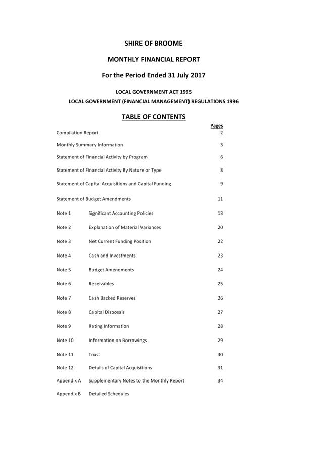
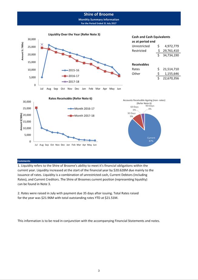
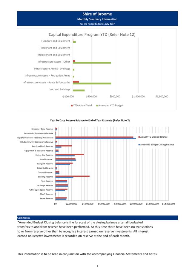
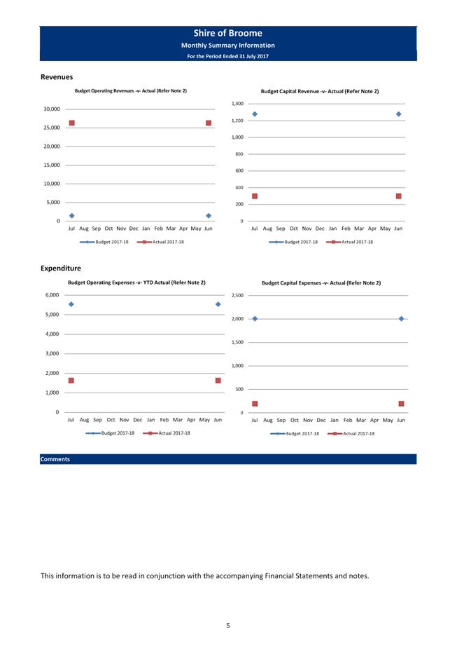
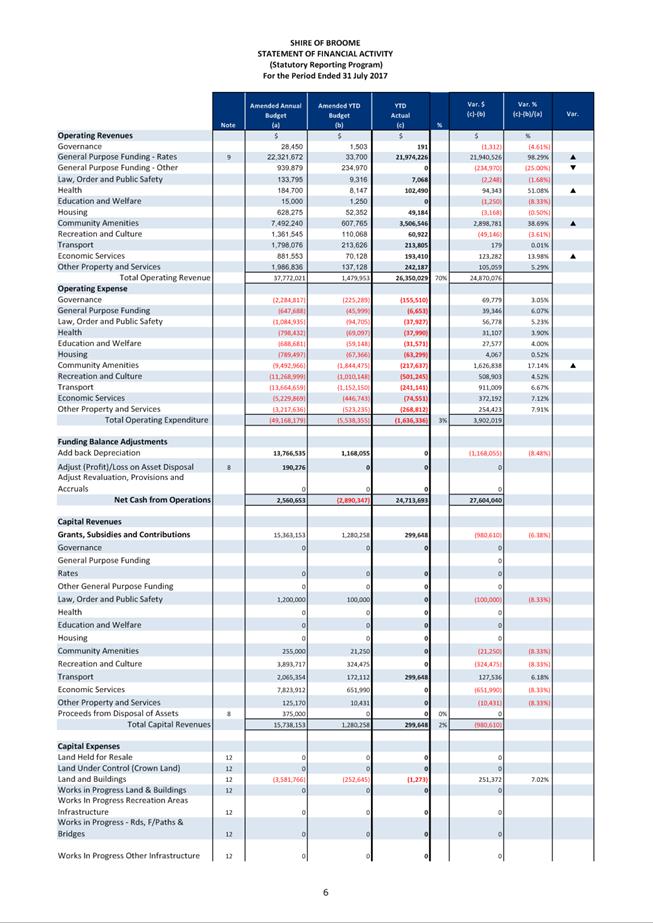
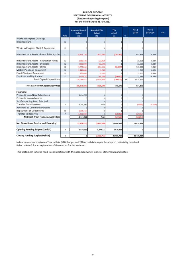
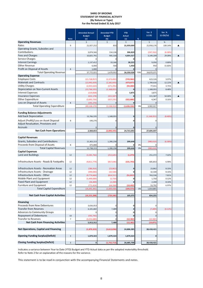
|
Item 9.4.2 - MONTHLY STATEMENT OF FINANCIAL ACTIVITY
REPORT JULY 2017
|
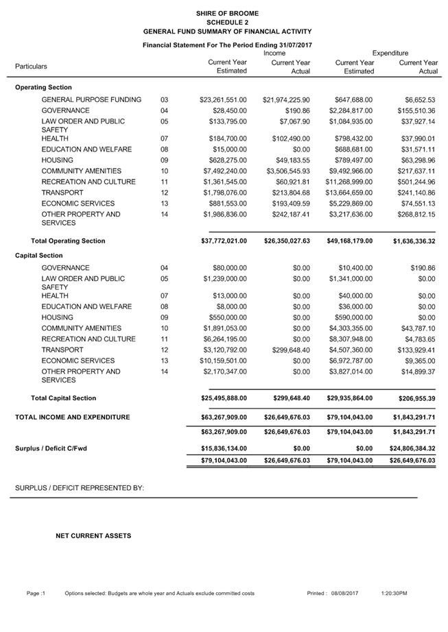
|
Item 9.4.2 - MONTHLY STATEMENT OF FINANCIAL ACTIVITY REPORT JULY 2017
|

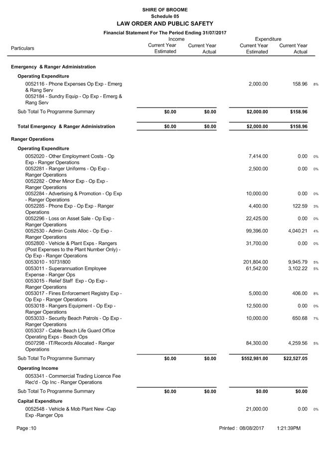
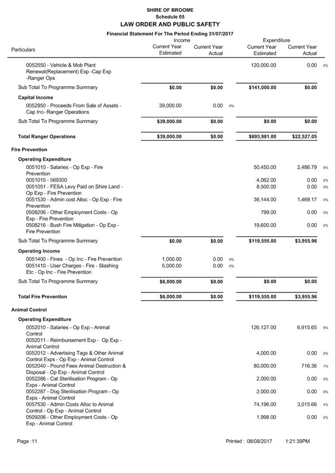
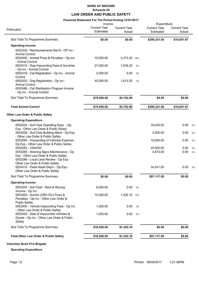
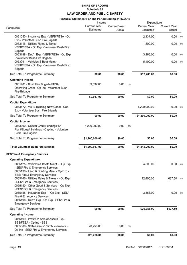
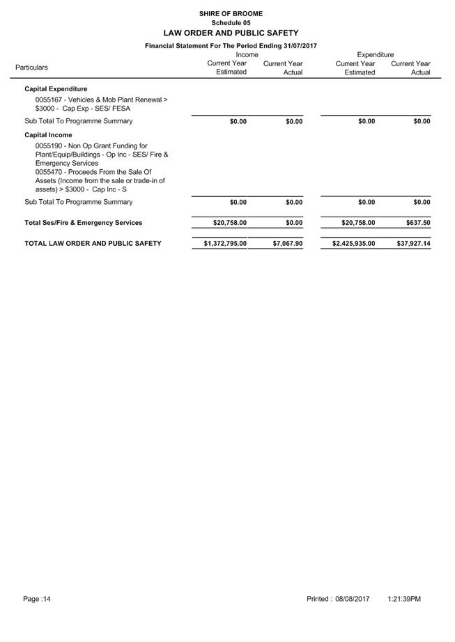
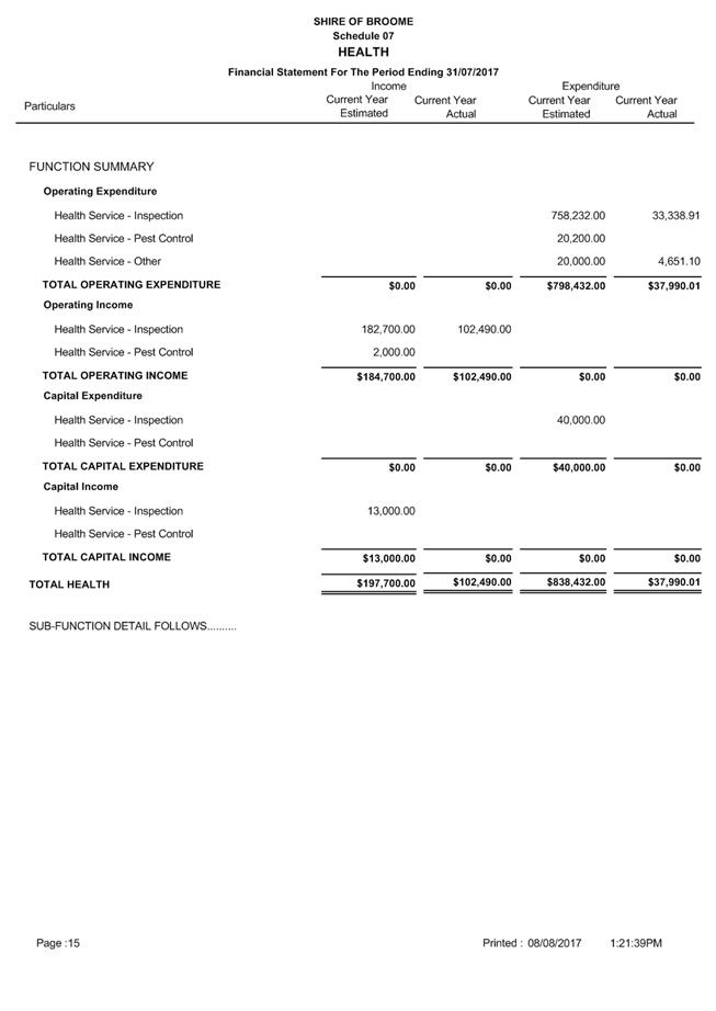
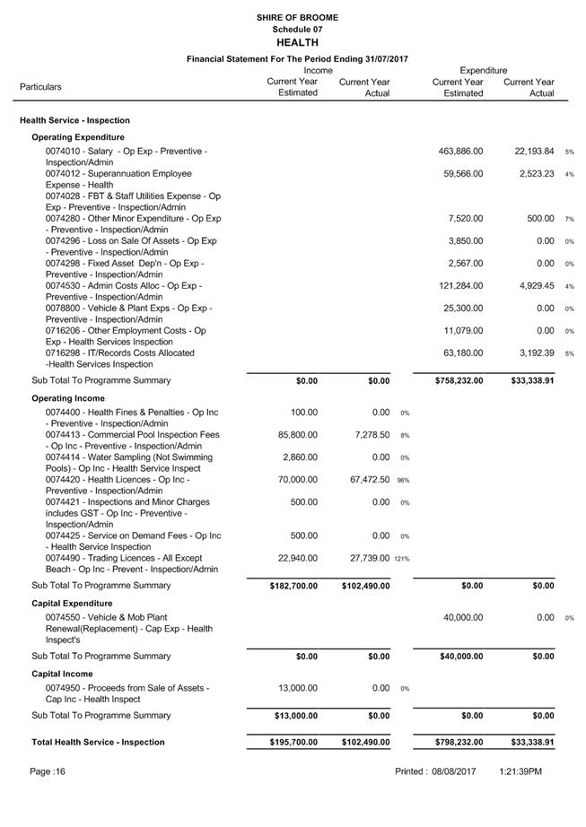
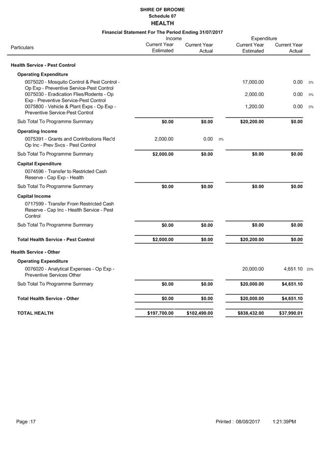
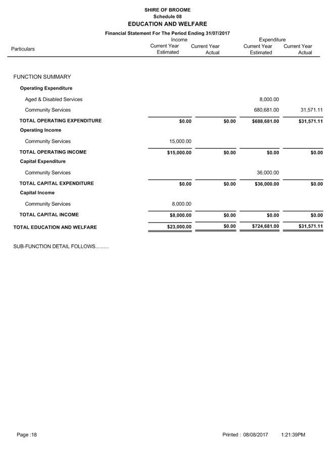
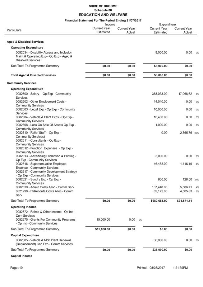

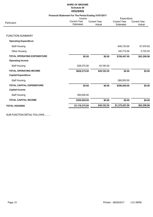
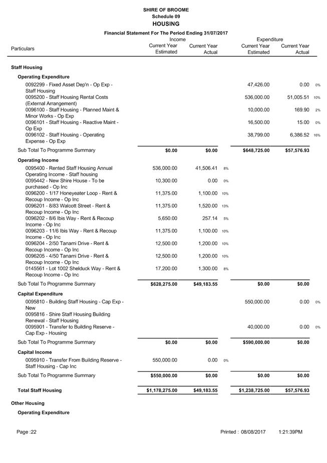
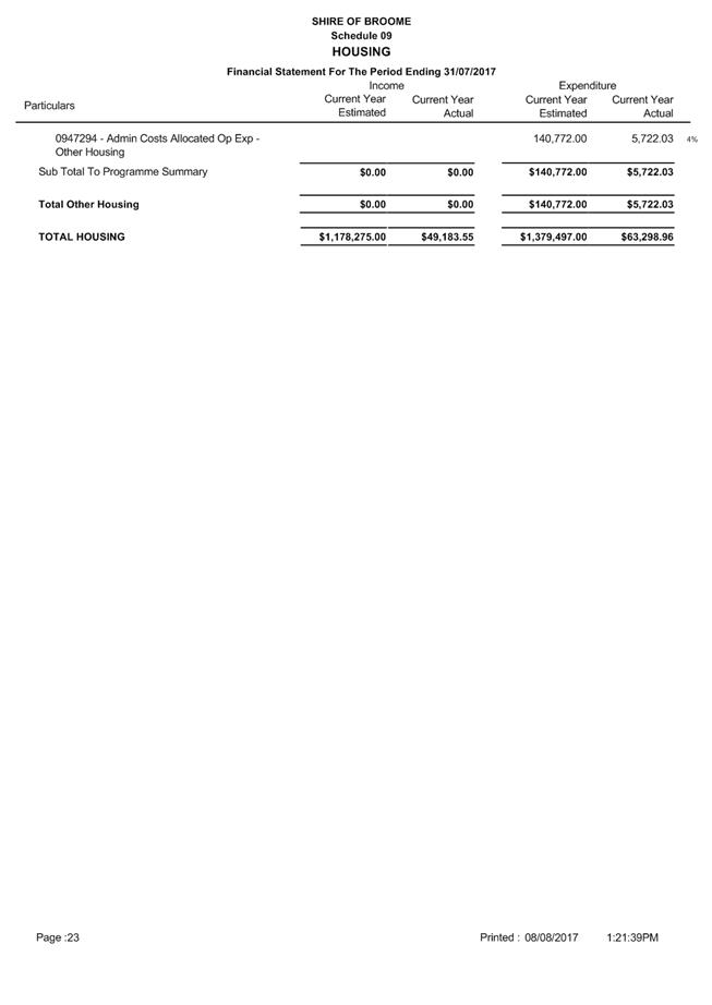
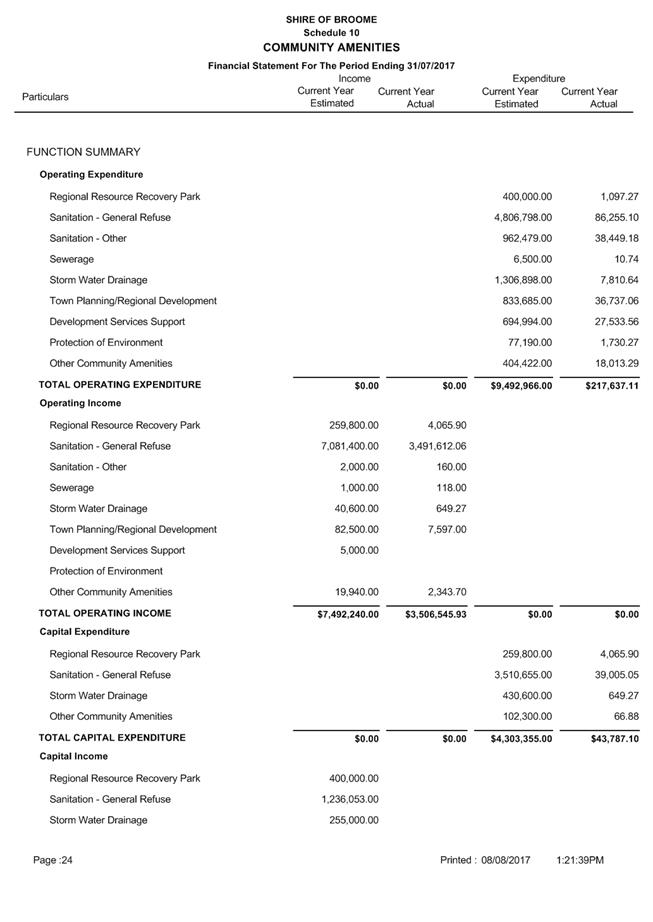

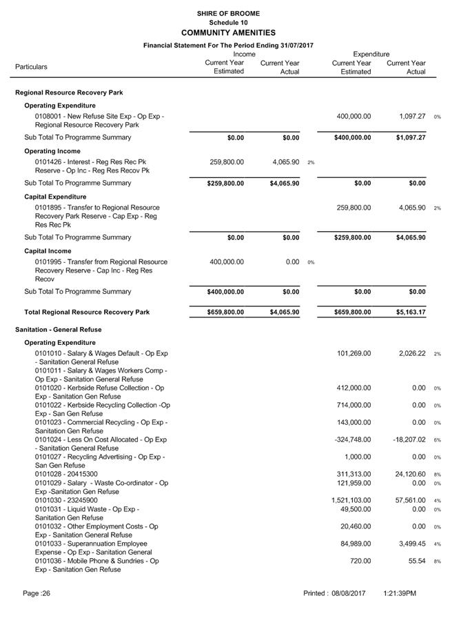
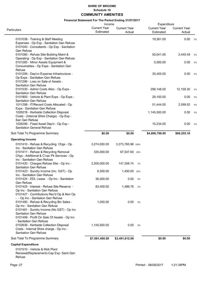
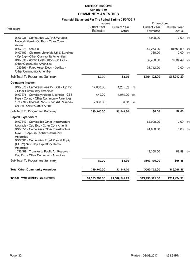
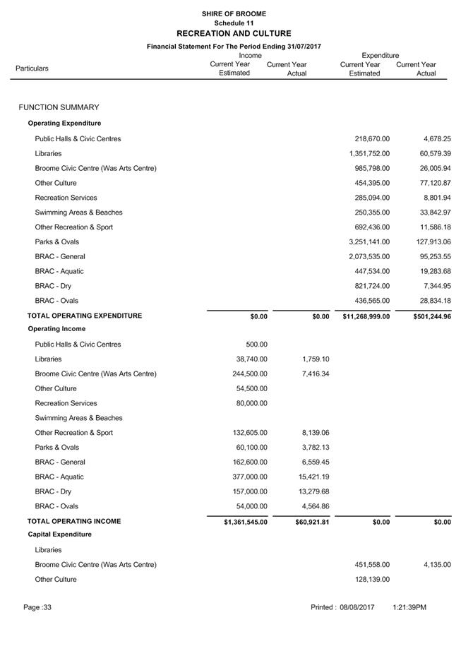
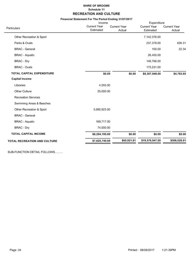
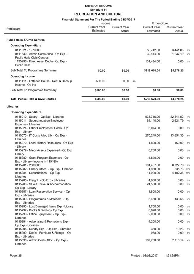
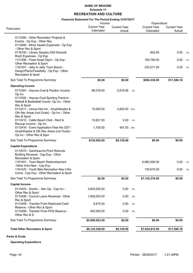
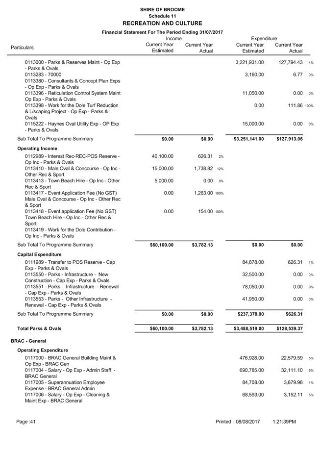
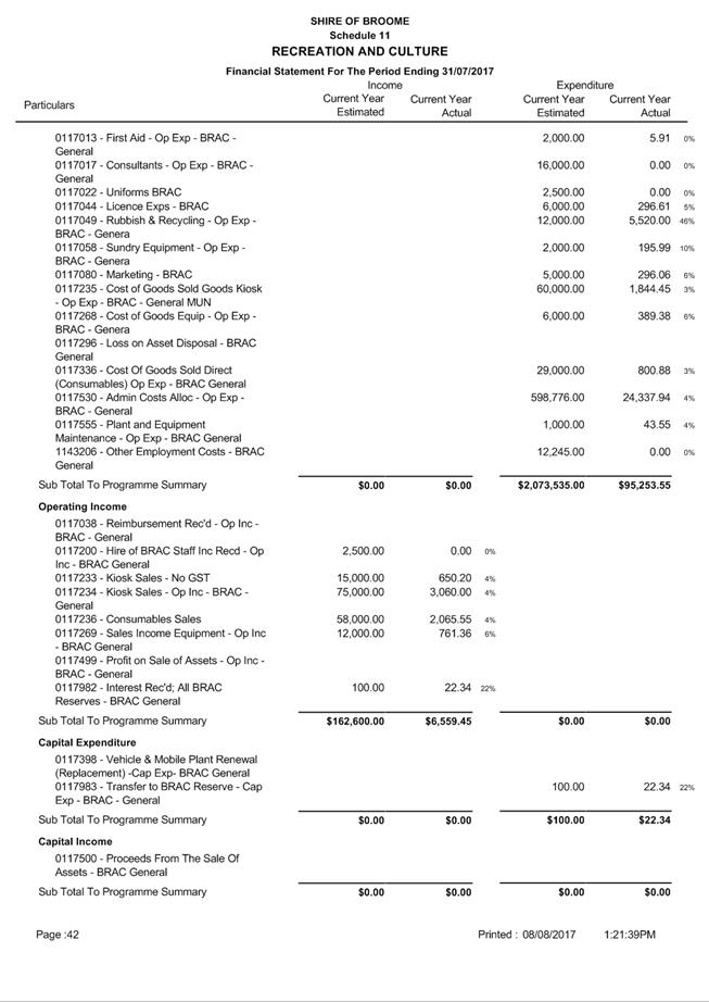
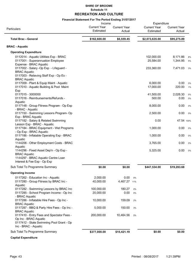
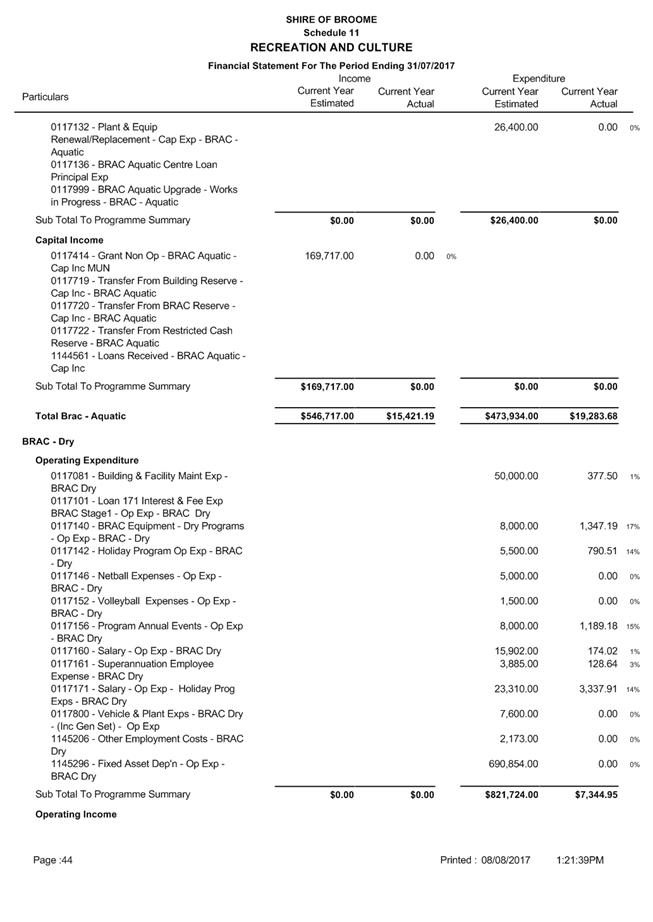
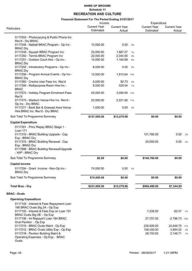
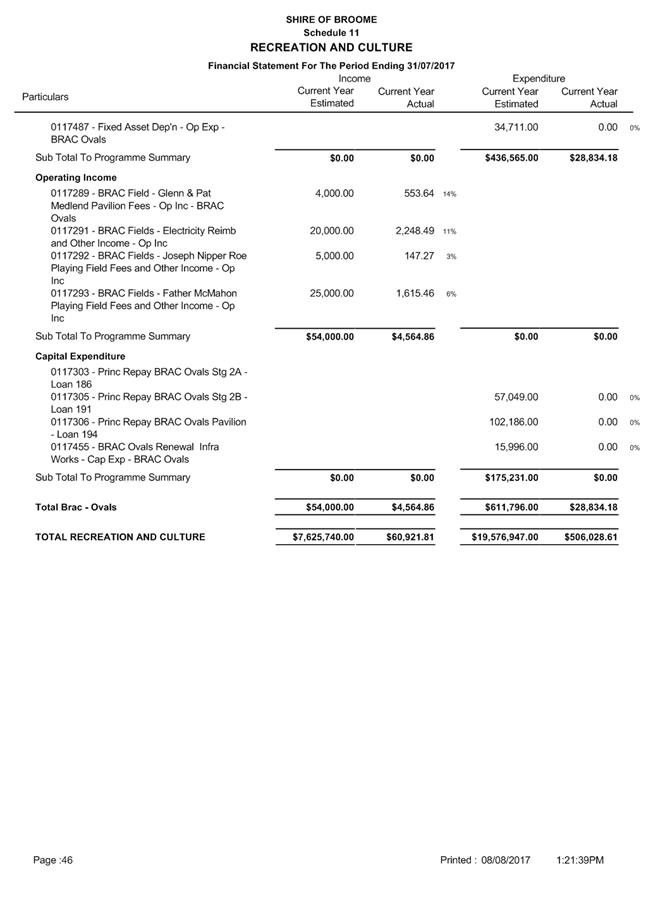
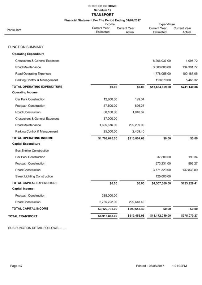
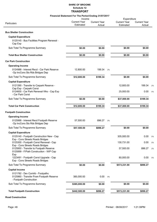
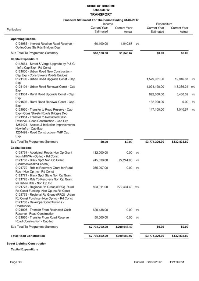
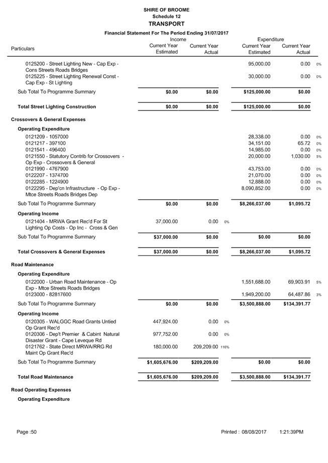
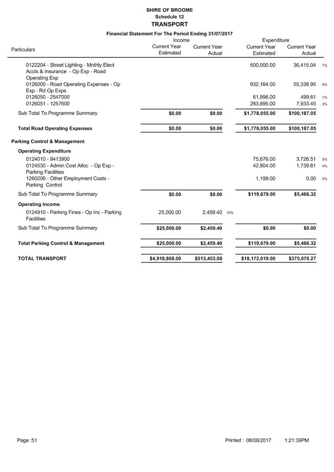
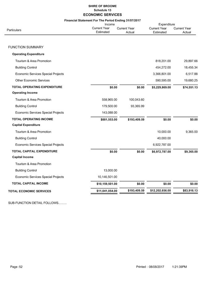
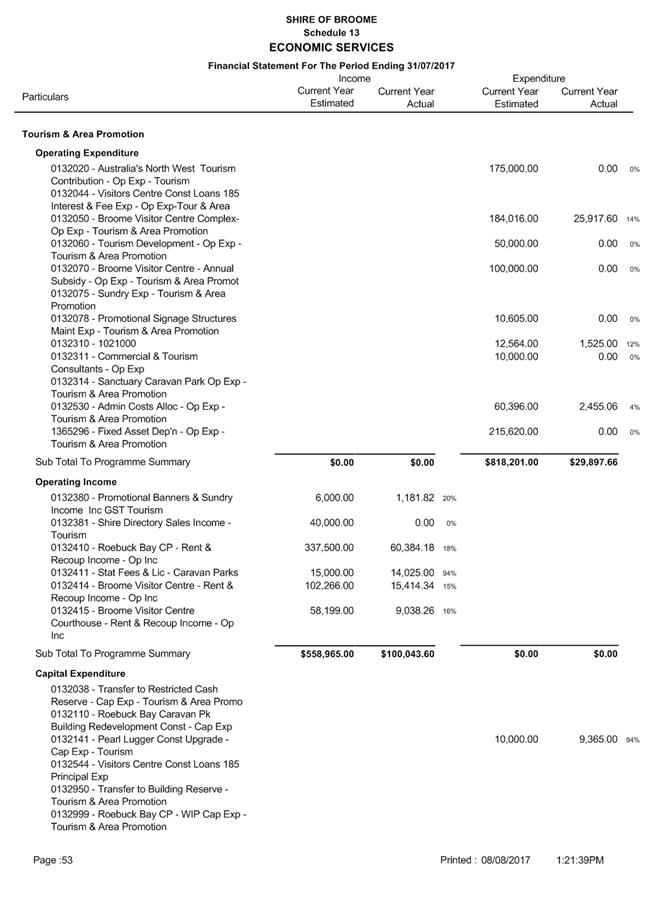
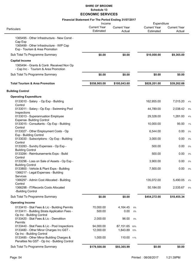
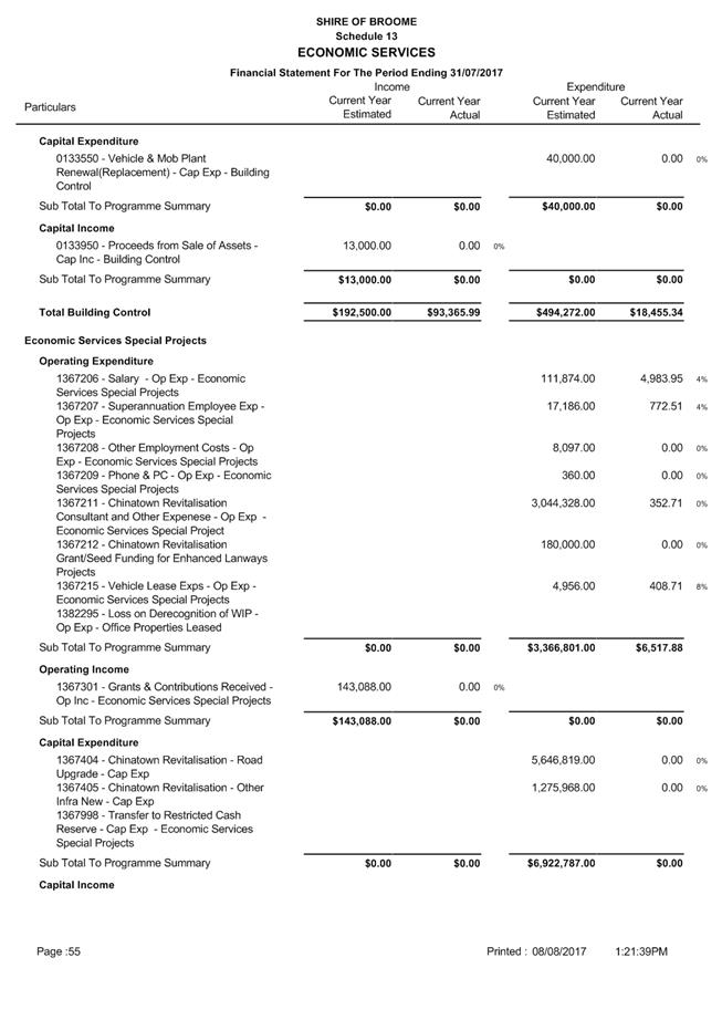
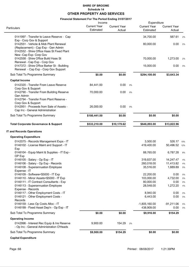
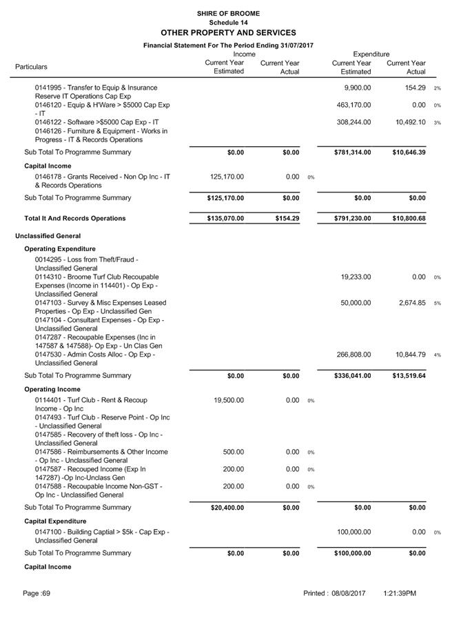
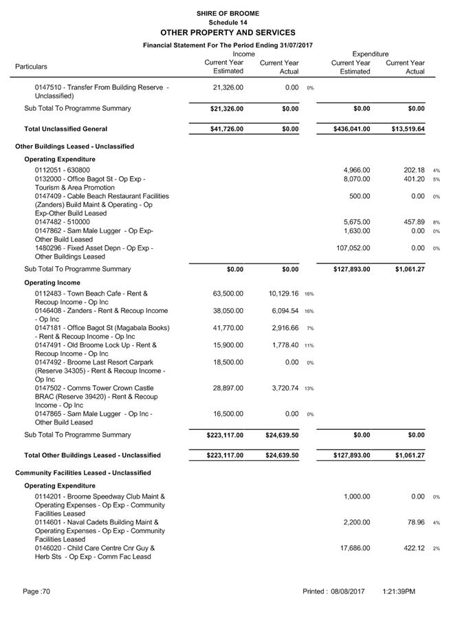
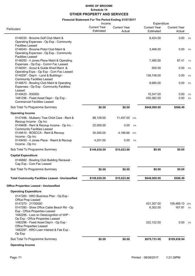
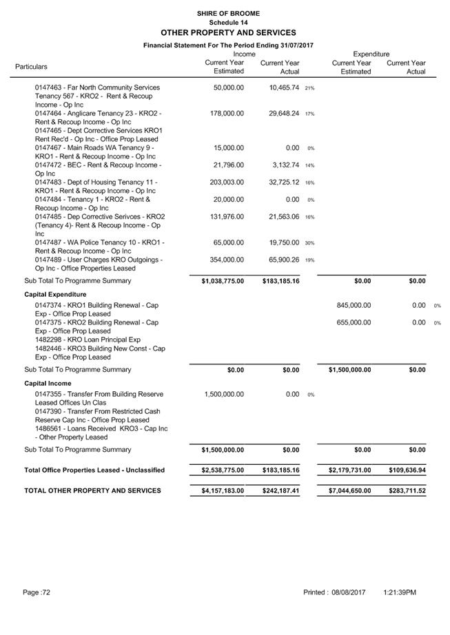
Minutes –
Ordinary Meeting of Council 7 September 2017 Page 924 of 1404
|
9.4.3 EXECUTION OF DOCUMENTS ON
BEHALF OF THE SHIRE OF BROOME
LOCATION/ADDRESS: Nil
APPLICANT: Nil
FILE: ARE05
AUTHOR: Manager
Governance
CONTRIBUTOR/S: Nil
RESPONSIBLE
OFFICER: Director
Corporate Services
DISCLOSURE
OF INTEREST: Nil
DATE OF REPORT: 1
August 2017
|
|
SUMMARY: This
report proposes to withdraw Delegation LGA17 – Execution of
Documents– Authorisation without the Common Seal and replace it with an
Authorisation to Execute Documents on behalf of the Shire of Broome, where
the Common Seal is not required, as contemplated by Section 5.43 (ha) of the Local
Government Act 1995 (the Act).
|
BACKGROUND
Previous
Considerations
OMC 19 March 2009 Item
9.1.2
OMC 18 March 2010 Item
9.1.1
OMC 17 March 2011 Item
9.1.2
OMC 15 March 2012 Item
9.4.4
OMC 20 June 2013 Item
9.4.4
OMC 27 March 2014 Item
9.4.4
OMC 18 December 2014 Item
9.4.2
OMC 31 March 2016 Item
9.4.4
OMC 23 February 2017 Item
9.4.6
The Council currently has in place Delegation LGA17 -
Execution of Documents – Authorisation without the Common Seal, pursuant
to the provisions of section 9.49A (4) & (5) of the Act.
Section 5.43 of the Act imposes a number of limitations on
the delegation powers of a local government, with paragraph (ha) of the section
specifically preventing the power under section 9.49A(4) to authorise a person
to sign documents on behalf of the local government, being delegated.
Additionally, Section 9.49A (4) of the Act specifically
provides that – “A local
government may, by resolution, authorise…”.
COMMENT
The provision of an authority to a number of Shire staff to
execute documents on behalf of the Shire provides a framework for gains in
organisational efficiency through the provision of more autonomy and workflow
control to individual Directorates. Additionally, there should be significant
improvements in the timeframe for executing documents.
A draft Execution of Documents - Staff Authorisations
document has been prepared and is attached to this report (Attachment 1). The
draft authorisation reflects the proposed recommendation authorising the Chief
Executive Officer (CEO) and Directors to sign documents that are necessary or
appropriate to be signed for these officers to carry out their functions and
duties under any written law. This includes the signing of deeds however
excludes any documents requiring the Common Seal.
The recommendation also includes authorisation for Managers
to sign documents deemed necessary or appropriate to be signed for these
officers to carry out their functions and duties under any written law, with
the exception of deeds and excluding items requiring the common seal. The draft
authorisation also includes examples of documents that can and cannot be
executed under the proposed authorisation for officer clarification.
The recommendation in the report has been developed after
consultation with the Chief Executive Officer and the relevant Directors and is
based on ensuring compliance with the Act.
CONSULTATION
External consultation with the community is not required for
the issue the subject of this report.
STATUTORY ENVIRONMENT
Local Government Act 1995
Section 5.43 – Limit on Delegations to CEO
A local government cannot delegate to a CEO any of the
following powers or duties —
(a) any power or duty that requires a decision of an
absolute majority or a 75% majority of the local government;
(b) accepting a tender which exceeds an amount determined
by the local government for the purpose of this paragraph;
(c) appointing an auditor;
(d) acquiring or disposing of any property valued at an
amount exceeding an amount determined by the local government for the purpose
of this paragraph;
(e) any of the local government’s powers under section
5.98, 5.98A, 5.99, 5.99A or 5.100;
(f) borrowing money on behalf of the local government;
(g) hearing or determining an objection of a kind
referred to in section 9.5;
(ha) the power under section 9.49A(4) to authorise a
person to sign documents on behalf of the local government;
Section 9.49A – Execution of Documents
1) A document is duly executed by a local government
if:-
(a) the
common seal of the local government is affixed to it in accordance with
subsections (2) and (3); or
(b) it
is signed on behalf of the local government by a person or persons authorised
under subsection (4) to do so.
2) The common seal of a local government is not to
be affixed to any document except as authorised by the local government.
3) The
common seal of the local government is to be affixed to a document in the
presence of:-
(a) the
mayor or president; and
(b) the
chief executive officer or a senior employee authorised by the chief executive
officer, each of whom is to sign the document to attest that the common seal was
so affixed.
4) A local government may, by resolution, authorise
the Chief Executive Officer, another employee or an agent of the local
government to sign documents on behalf of the local government, either
generally or subject to conditions or restrictions specified in the
authorisation.
5) A
document executed by a person under an authority under subsection (4) is not to
be regarded as a deed unless the person executes it as a deed and is permitted
to do so by the authorization.
6) A
document purporting to be executed in accordance with this section is to be
presumed to be duly executed unless the contrary is shown.
7) When
a document is produced bearing a seal purporting to be the common seal of the
local government, it is to be presumed that the seal is the common seal of the
local government unless the contrary is shown.
Section
9.49B – Contract formalities
1) Insofar as the formalities of making, varying or
discharging a contract are concerned, a person acting under the authority of a
local government may make, vary or discharge a contract in the name of or on
behalf of the local government in the same manner as if that contract was made,
varied or discharged by a natural person.
2) The making, variation or discharge of a contract
in accordance with subsection (1) is effectual in law and binds the local
government concerned and other parties to the contract.
Subsection (1) does not prevent a local government from making, varying or
discharging a contract under its common seal
POLICY IMPLICATIONS
There are no direct policy impacts.
FINANCIAL IMPLICATIONS
None from this report.
RISK
The non-withdrawal of Delegation LGA17 would result in risk
of non-compliance with the Act.
A suitable replacement process is required to ensure that
the benefits of streamlining processes and procedures to enable efficient
performance of functions continues.
STRATEGIC
IMPLICATIONS
Our
Organisation Goal – Continually enhance the Shire’s organisational
capacity to service the needs of a growing community:
An organisational culture that
strives for service excellence
Improved systems, processes and
compliance
VOTING REQUIREMENTS
Absolute Majority
|
Council Resolution:
(Report Recommendation)
Moved: Cr D Male Seconded:
Cr P Matsumoto
That Council:
1. Withdraws
Delegation LGA17 – Execution of Documents – Authorisation without
Common Seal.
2. Pursuant
to Section 9.49A (4) of the Local Government Act 1995, authorises the
following officers of the Shire of Broome to sign on behalf of the Shire of
Broome:
(a) any
document, including Deeds, that is necessary or appropriate to be signed for
these officers to carry out their functions and duties under any written law;
i. Chief Executive Officer
ii. Director Development
& Community
iii. Director
Infrastructure Services
iv. Director Corporate
Services.
(b) any
document, excluding Deeds, that is necessary or appropriate to be signed to
carry out the Manager’s functions and duties under any written law;
i. Manager
Governance
ii.
Manager Financial Services
iii. Manager
Information Services
iv.
Manager Planning & Building Services
v.
Manager Health, Emergency & Ranger Services
vi.
Manager Community & Economic Development
vii.
Manager Sport & Recreation
vii.
Manager Infrastructure Operations
ix.
Manager Engineering.
CARRIED UNANIMOUSLY BY ABSOLUTE MAJORITY 6/0
|
Attachments
|
1.
|
SOB Draft Execution of
Documents - Staff Authorisations
|
|
Item 9.4.3 - EXECUTION OF DOCUMENTS ON BEHALF OF THE
SHIRE OF BROOME
|
Shire of Broome
Execution of Documents
– Authorisations
[s9.49A of the Local
Government Act 1995]
Extract from OCM Minutes – 31
August 2017
Council authorises the
following Officers of the Shire of Broome to on behalf of the Shire of Broome,
as specified:-
(a) any
document, including Deeds, that is necessary or appropriate to be signed for
these officers to carry out their functions and duties under any written law;
i. The
Chief Executive Officer
ii. The
Director of Development & Community Services
iii. The Director of
Infrastructure Services
iv. The Director of
Corporate Services
(b) any
document, excluding Deeds, that is necessary or appropriate to be signed to
carry out the Manager’s functions and duties under any written law;
v. Manager
Governance
vi. Manager Financial
Services
vii. Manager
Information Services
viii. Manager
Planning & Building Services
ix. Manager Health,
Emergency & Ranger Services
x. Manager
Community & Economic Development
xi. Manager Sport
& Recreation
xii. Manager
Infrastructure Operations
xiii. Manager
Engineering
Note: Refer to
Attachment 1 - Advice Note for further details on document types.
Attachment 1 - Advice Note
SHIRE OF BROOME
PART A - EXAMPLES OF DOCUMENTS THAT CAN BE EXECUTED UNDER
COUNCIL AUTHORISATION
|
|
Document Description
|
|
Document Description
|
|
1
|
Restrictive Covenants
– under s.129BA of the Transfer of Land Act 1893 and any
discharge or modifications of covenants
|
11
|
Reciprocal Access
agreements and withdrawal or modification of Reciprocal Access agreements
|
|
2
|
Lodgement, modification and
withdrawal of Caveats
|
12
|
Management Statements and
withdrawal or modification of Management Statements
|
|
3
|
Lodgement, modification
and withdrawal of Memorial
|
13
|
General Legal and Service
Agreements
|
|
4
|
Leases where Council has
previously resolved to enter into or have been approved under delegation,
including renewals, extensions or modifications of leases, including leases
for staff housing
|
14
|
Contracts for the
provision of services or goods, including those to be entered into following
a tender process
|
|
5
|
Deeds of Agreement,
Development Contribution Deeds and Deeds of Release;
|
15
|
Transfer of land
documents where Council has previously resolved to either purchase or dispose
of land or land is being transferred to the Shire for a public purpose
|
|
6
|
Licences
|
16
|
Debenture documents for
loans which Council has resolved to raise
|
|
7
|
Covenants and any
discharge or modification of covenants
|
17
|
New Funding or Contracts
of Agreement between the Council and State or Commonwealth Governments or
Private Organisations for programs to which Council has previously adopted,
or additions to existing programs, which in the view of the Chief Executive
Officer are in accordance with the original intent of the adopted program
|
|
8
|
Easements and the
surrender or modification of easements
|
18
|
Records Disposal
Authorisation
|
|
9
|
Notifications on title
and withdrawal or modification of notifications
|
19
|
Letters requested to be
written by Council by resolution, which are not of a Political nature
|
|
10
|
Rights of Carriageway
agreements and withdrawal or modification of Rights of Carriageway agreements
|
20
|
|
PART B - EXAMPLES OF DOCUMENTS WHERE THE COMMON SEAL IS/OR
MAYBE REQUIRED
|
|
Document Description
|
|
Document Description
|
|
1
|
New or Revised Town
Planning Schemes
|
4
|
C/Wealth or State
Governments documents where legislation specifically requires the seal.
|
|
2
|
Amendments to Town
Planning Schemes
|
5
|
Documents of a Ceremonial
Nature – such as Sister City agreements
|
|
3
|
New, Revised or
Amendments to Local Laws
|
|
|
Minutes –
Ordinary Meeting of Council 7 September 2017 Page 936 of 1404
|
9.4.4 MINUTES OF THE JOINT
MEETING OF THE KIMBERLEY ZONE OF WALGA AND REGIONAL COLLABORATIVE GROUP HELD
30 JUNE 2017
LOCATION/ADDRESS: Nil
APPLICANT: Nil
FILE: OGS03
& RCG01
AUTHOR: Executive
Assistant to the CEO
CONTRIBUTOR/S: Nil
RESPONSIBLE
OFFICER: Chief
Executive Officer
DISCLOSURE
OF INTEREST: Nil
DATE OF REPORT: 31
July 2017
|
|
SUMMARY: This
report requests Council to receive and endorse the Minutes from the Joint
meeting of the Kimberley Zone of WALGA and Regional Collaborative Group held
on 30 June 2017.
|
BACKGROUND
Previous
Considerations
A copy of the minutes from the meeting held 30 June 2017
between members of the Kimberley Zone of WALGA and Kimberley Regional
Collaborative Group (RCG) are attached for Council consideration (refer
Attachment 1 - Kimberley Regional Group Minutes 30 June 2017).
As a result of a past decision of the group, both the
Kimberley Zone and RCG meetings are joined.
It should be remembered that the Kimberley Zone of WALGA is
a group established to represent regional issues to the State Council of the
Western Australian Local Government Association (WALGA).
The RCG is a deed of agreement
between four (4) local governments with the Minister for Local Government to
progress regional reform.
COMMENT
The minutes and respective background
information are attached to this report and the following comments are made in
relation to the resolutions passed by the Group. Additional recommendations
have been made where necessary for Council’s consideration.
8.1 STATE COUNCIL
MEETING AGENDA AND PRESIDENT’S REPORT
The State
Council Agenda and President’s Report had been included in the Agenda for
member Council’s consideration. The Kimberley Zone of WALGA resolved to
note the Agenda and President’s Report, in addition to referring Item 5.7
of the State Council Agenda to WALGA for further advice. Item 5.7 was in
regards to the WALGA Draft Housing Strategy Guide and Housing and Community
Profile Database. A copy of the summary minutes from the State Council meeting
held on 5 July 2017 are attached for Council's information (refer Attachment
2 - State Council Summary Minutes 5 July 2017 ).
|
RESOLUTION:
That the Kimberley Zone of
WALGA;
1. Notes
the State Council Meeting Agenda and President’s Report, and
2. To
refer item 5.7 of the State Council Agenda to WALGA to seek further advice.
Moved: Cr Mitchell Seconded:
Cr White
CARRIED
UNANIMOUSLY 5/0
|
8.2 2018-19
WALGA STATE BUDGET SUBMISSION
The proposed priorities for WALGA’s 2018-19 State
Budget Submission was detailed for member consideration. A summary of
WALGA’s budget submission is outlined below:
|
Program
|
WALGA Request
|
Met?
|
Budget Commitment
|
|
Community Sport and Recreation Facilities
|
Return the fund to $20m per annum from 2016-17 to
2020-21. The fund was reduced to $7m per annum as part of the 2015-16 Budget.
|
Partially met.
|
A $20 million contribution will be made to the fund in
2016-17 and 2018-19, before dropping to $12m per annum from 2019-20.
|
|
Emergency Risk Management
|
Additional $30m over four years for the Risk Assessment
and Mitigation Works Program, and for implementation of the WAPC Policy
– Bushfire Risk Management Planning.
Increase the AWARE Fund to $2m per annum ongoing, an
increase of $150,000 per year.
|
Partially met.
|
$3m is provided in 2016-17 for bushfire risk management
processes, including an increase of $299,000 for the National Bushfire
Mitigation Program.
|
|
Public Libraries Taskforce and South West Library
Consortium
|
Additional $1.5m over two years for the Public Library
Taskforce and South West Library Consortium Project Manager.
|
Unclear.
|
An additional $186,000 is included in the budget for the
State Library of WA, though its intended use is not clear.
|
|
Local Infrastructure Assets Renewal and New Assets
– Country Local Government Fund
|
Additional $50m per annum ongoing.
|
Not met.
|
2016-17 Budget provides for the phasing out of the CLGF.
|
|
Capacity Building – Country Local Government Fund
|
Additional $5m per annum from 2016-17 to 2018-19
|
Partially met.
|
$1.5m in 2016-17 and $2.3m in 2017-18 is allocated
through the CLGF for capacity building, an increase of $358,000 in the budget
year.
|
|
Ageing Australia
|
Additional $5m over five years for Age Friendly
Strategies, and additional $3m over three years for
|
Not met.
|
Not funded
|
|
RESOLUTION:
(REPORT RECOMMENDATION)
That the Kimberley Zone
of WALGA notes the 2018-19 State Budget Submission by WALGA.
Moved: Cr White Seconded:
Cr Mitchell
CARRIED UNANIMOUSLY 5/0
|
8.3 CASHLESS
WELFARE CARD TRIAL
The Australian
Government is currently trialling a Cashless Debit Card as a means to address
social harm associated with alcohol consumption, illicit drug use and
gambling.
An independent evaluation has
indicated positive results from the trial in the two sites of Ceduna, South
Australia and Kununurra, Western Australia, and consultation by the Department
of Social Services in Broome has indicated broad stakeholder support for the
initiative and potential for the trial to benefit the local community.
Following Council endorsement, the
Shire of Broome lodged a formal request for Broome to be considered as a third
site for the Australian Government’s Cashless Debit Card trial.
This report
requested the Kimberley Regional Group’s consideration of advocating for
an extension of the current East Kimberley trial to the remaining local
governments in the Kimberley.
|
RESOLUTION:
That the Kimberley
Regional Group:
1. Notes
the level of consultation and work undertaken within Broome by the Shire of
Broome and the Department of Social Services to date, and the broad support
for the implementation of the Cashless Debit Card in Broome.
2. Supports
the Shire of Broome make a formal request to the Hon. Alan Tudge MP, Minister
for Human Services requesting that Broome become a trial site for the
Cashless Debit Card Trial.
3. Notes
the positive results from the trials of the Cashless Debit Card from the
current trial in Kununurra and Ceduna.
4. Request
that the Department of Human Services conduct further consultation across the
Kimberley to gauge key stakeholder support.
Moved: Cr White Seconded:
Cr Mitchell
CARRIED
UNANIMOUSLY 5/0
|
9.1 KIMBERLEY
REGIONAL GROUP MEETING RESOLUTION STATUS REPORT
A status report was provided from the
Kimberley Zone Project Officer outlining progress or otherwise on Resolutions
passed by the Zone/RCG since July 2016. The status report was received and
noted for finalisation under the authorisation of the Secretariat.
|
RESOLUTION:
(REPORT RECOMMENDATION)
That the Kimberley Regional
Group:
1. Notes
the outstanding Resolution Status Report;
2. Authorises
the Secretariat to proceed with co-ordinating the finalisation of outstanding
action items arising from meeting resolutions.
Moved: Cr Mitchell Seconded:
Cr Edwards
CARRIED
UNANIMOUSLY 3/0
|
9.2 KIMBERLEY
REGIONAL GROUP 16/17 FINANCIAL ACTIVITY REPORT
A Financial
Activity Report was presented for adoption, indicating the KRG have a surplus
of $164,251 as at 7 June 2017.
|
RESOLUTION:
(REPORT RECOMMENDATION)
That the Kimberley Regional Group adopts the Financial
Activity Report for the period ended 7 June 2017.
Moved: Cr Mitchell
Seconded: Askew
CARRIED UNANIMOUSLY 4/0
|
9.3 LAND
TENURE POLICY POSITION UPDATE
This report provided an update on the
Land Tenure Implementation Plan for the KRG. The Kimberley Land Tenure Policy
proposal was developed in August 2016 in consultation with the executive group,
followed by a detailed project scope. Naja Business Consulting Services was
engaged to develop the policy.
The Kimberley Land Tenure Policy
– Implementation Strategy Scope was presented for member’s
consideration and is outlined in the minutes attached (refer Attachment 3 -
Attachments to Kimberley Regional Group Minutes).
|
RESOLUTION:
(REPORT RECOMMENDATION)
That the Kimberley Regional Group receives the Kimberley
Land Tenure Policy - Implementation Strategy Scope.
Moved: Cr Edwards Seconded:
Cr Mitchell
CARRIED UNANIMOUSLY 4/0
|
9.4 REGIONAL
WASTE TECHNICAL ADVISORY GROUP (TAG) – MINUTES OF MEETING
This report presented the minutes
from the Regional Waste TAG meeting held 6 June 2017. The meeting minutes are
attached to this report for Council’s information (refer Attachment 3
- Attachments to Kimberley Regional Group Minutes).
|
RESOLUTION:
(REPORT RECOMMENDATION)
That the Kimberley
Regional Group receives the minutes from the Regional Waste TAG meeting held
6 June 2017.
Moved: Cr Mitchell Seconded:
Cr White
CARRIED UNANIMOUSLY 4/0
|
9.5 DEPARTMENT
OF LOCAL GOVERNMENT & COMMUNITIES 2017 GRANT FUND EXPENDITURE –
KIMBERLEY VOLUNTEERING STRATEGY – STAGE 2 STRATEGY AND ACTION PLAN
This report provided an update as to the status of the
Department of Local Government and Communities grant funding to progress the
development of the Action Plan for the Kimberley Regional Group.
On 26 June 2015,
The Department of Local Government and Communities awarded $55,000 to the
Regional Collaborative Group to develop a Kimberley Volunteering Strategy Stage
1 - Consultation.
The four (4)
Kimberley Council’s of Broome, Derby West Kimberley, Wyndham East
Kimberley and Halls Creek all have volunteering service agencies in their
regions that provide varying levels of volunteering support in the community.
The Kimberley Volunteering Strategy will consolidate and build upon the many
excellent initiatives, programs and activities by Council and independent
volunteering agencies to develop a strategic vision for the region which will
shape the actions to be implemented over the next five (5) years to achieve
united goals.
The objective of
the project was to undertake consultation with volunteers, volunteer service
agencies and Local Governments across the Kimberley to inform the development
of the Kimberley Volunteering Strategy.
The Kimberley
Volunteering Strategy – Stage 2 – Strategy and Action Plan, will
take on six (6) project phases as outlined below:
· Phase
One (1 - Environmental Scan;
· Phase
Two (2) – Workshop;
· Phase
Three (3) - Develop Volunteering Strategy;
· Phase
Four (4) – Develop Action Plan;
· Phase
Five (5) – Alignment of Kimberley Action Plan with each Shire’s
Strategic Community Plan; and
· Phase
Six (6) – Convene and establish a volunteering engagement group for each
Shire to discuss the action plan and develop activities for implementation of
Stage Three (3).
Details on each
of the project phases can be found in the meeting minutes attached (refer Attachment 1 - Kimberley Regional Group Minutes 30
June 2017).
|
RESOLUTION:
(REPORT RECOMMENDATION)
That the Kimberley Regional Group authorises the
Secretariat to finalise the Department of Local Government and Communities
2017 Grant Funding application and Financial Assistance Agreement.
Moved: Cr Mitchell Seconded:
Cr White
CARRIED UNANIMOUSLY 4/0
|
CONSULTATION
Nil
STATUTORY ENVIRONMENT
Nil
POLICY IMPLICATIONS
Nil
FINANCIAL IMPLICATIONS
There are no direct financial
implications to the Shire of Broome from any of the aforementioned resolutions
passed by the Kimberley Zone of WALGA/Regional Collaborative Group.
RISK
There is minimal risk associated with the recommendation of
this report to the Shire of Broome.
STRATEGIC
IMPLICATIONS
Our People
Goal – Foster a community environment that is accessible, affordable, inclusive,
healthy and safe:
Affordable services and initiatives
to satisfy community need
High level social capital that
increases community capacity
Our
Prosperity Goal – Create the means to enable local jobs creation and
lifestyle affordability for the current and future population:
Affordable and equitable services and
infrastructure
Key economic development strategies
for the Shire which are aligned to regional outcomes working through recognised
planning and development groups/committees
Our Organisation
Goal – Continually enhance the Shire’s organisational capacity to
service the needs of a growing community:
An organisational culture that
strives for service excellence
Sustainable and integrated strategic
and operational plans
Responsible resource allocation
Effective community engagement
Retention and attraction of staff
Improved systems, processes and
compliance
VOTING REQUIREMENTS
Simple Majority
Attachments
|
1.
|
Kimberley Regional
Group Minutes 30 June 2017
|
|
2.
|
State Council Summary
Minutes 5 July 2017
|
|
3.
|
Attachments to
Kimberley Regional Group Minutes
|
|
Item 9.4.4 - MINUTES OF THE JOINT MEETING OF THE
KIMBERLEY ZONE OF WALGA AND REGIONAL COLLABORATIVE GROUP HELD 30 JUNE 2017
|
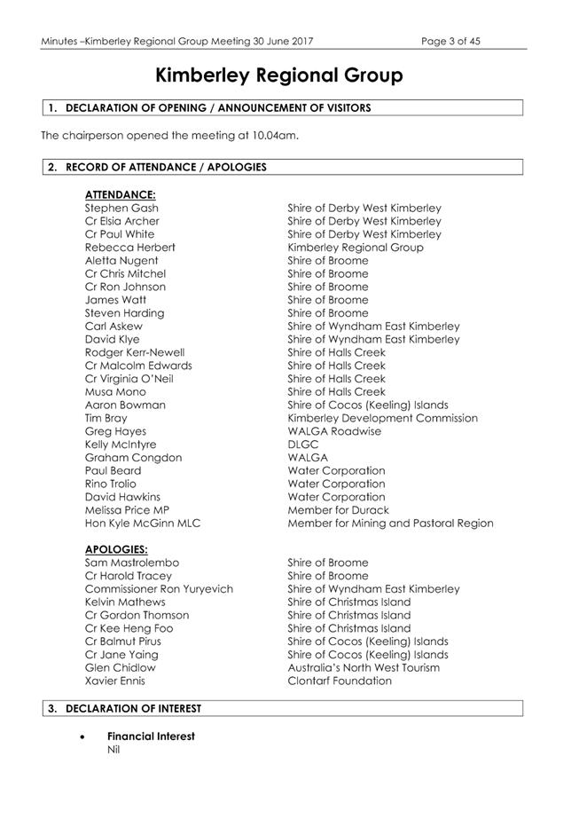
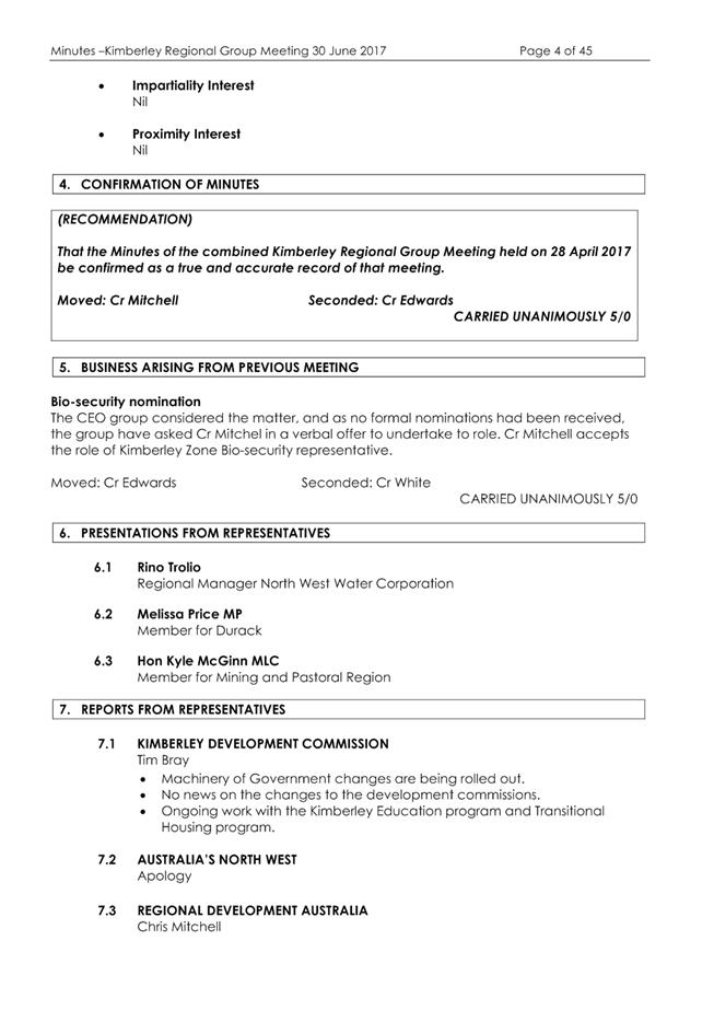


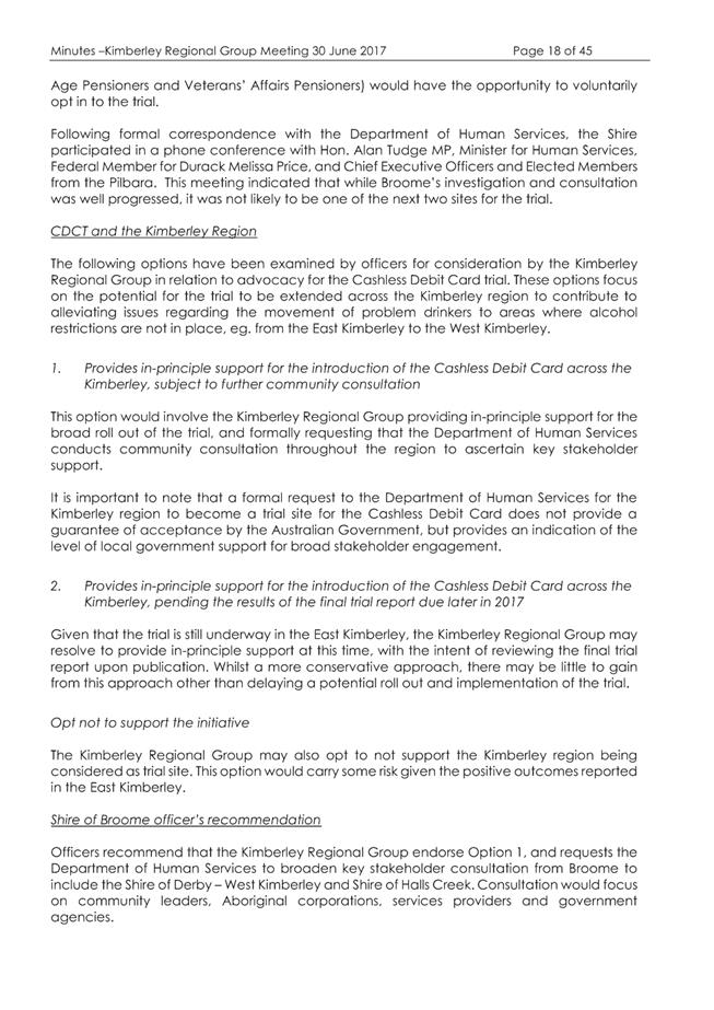
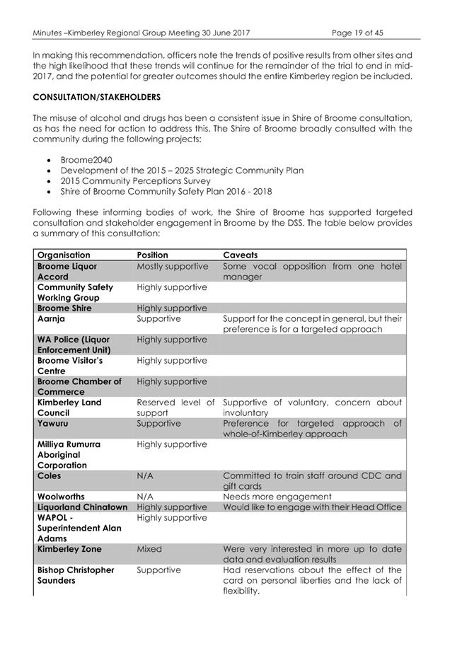
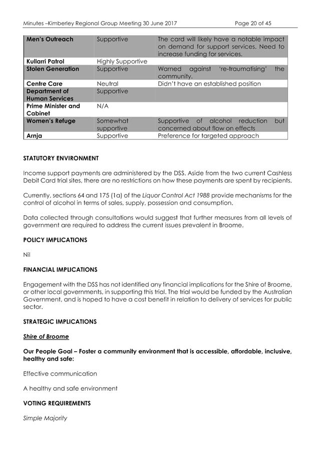
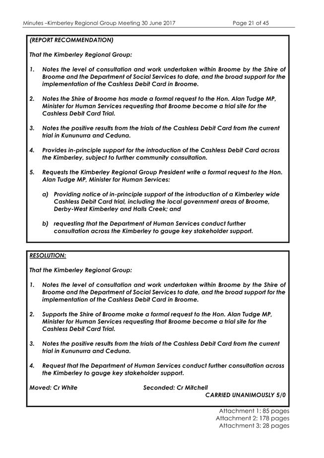

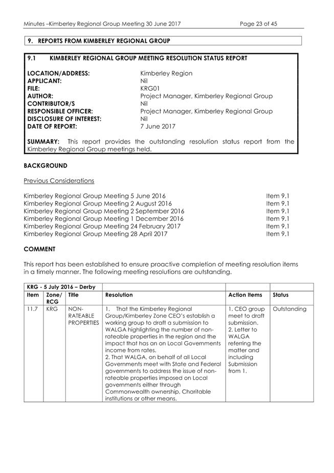
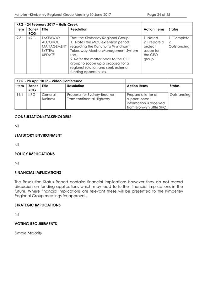
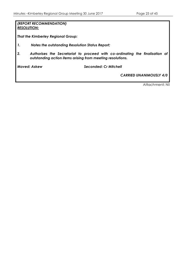
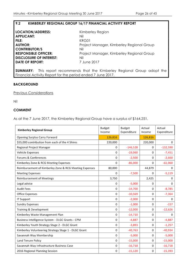
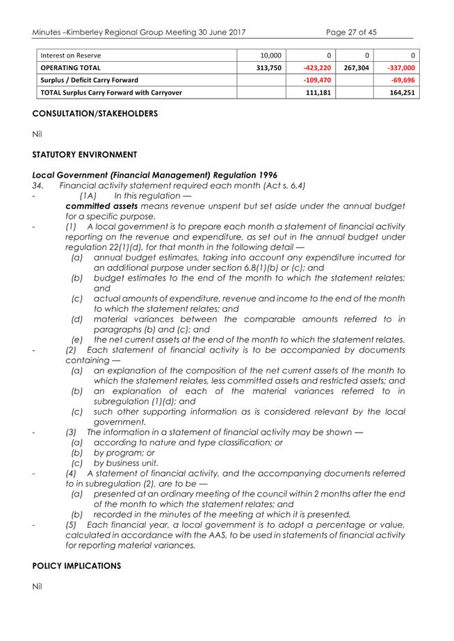
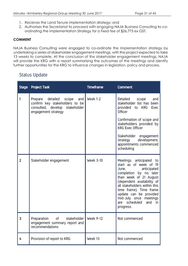

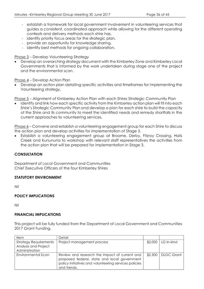
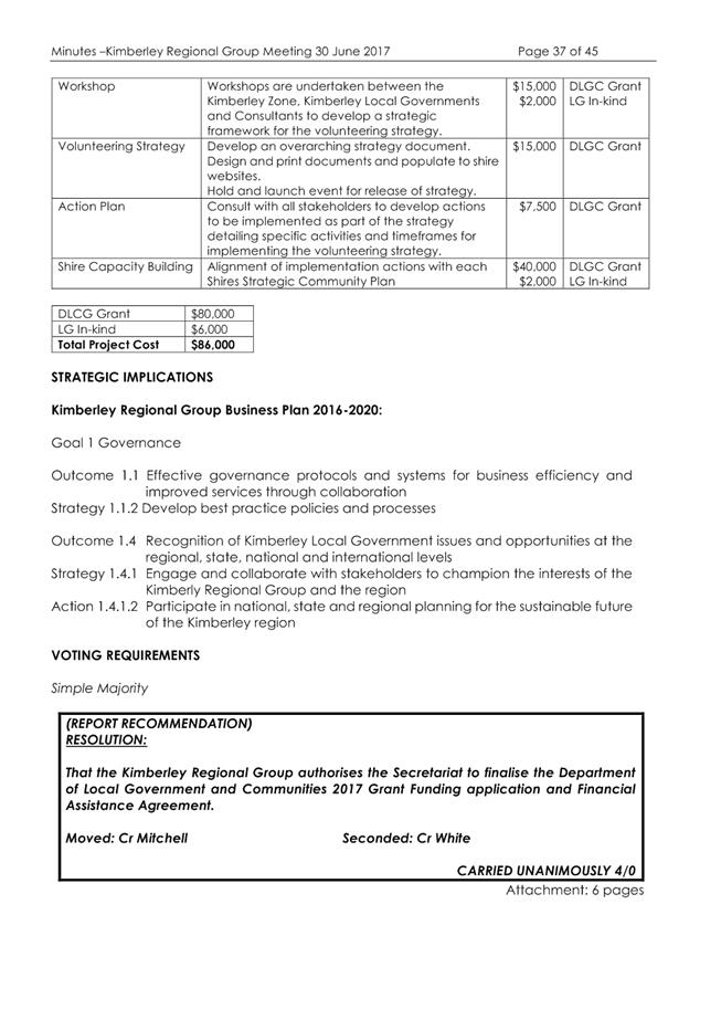

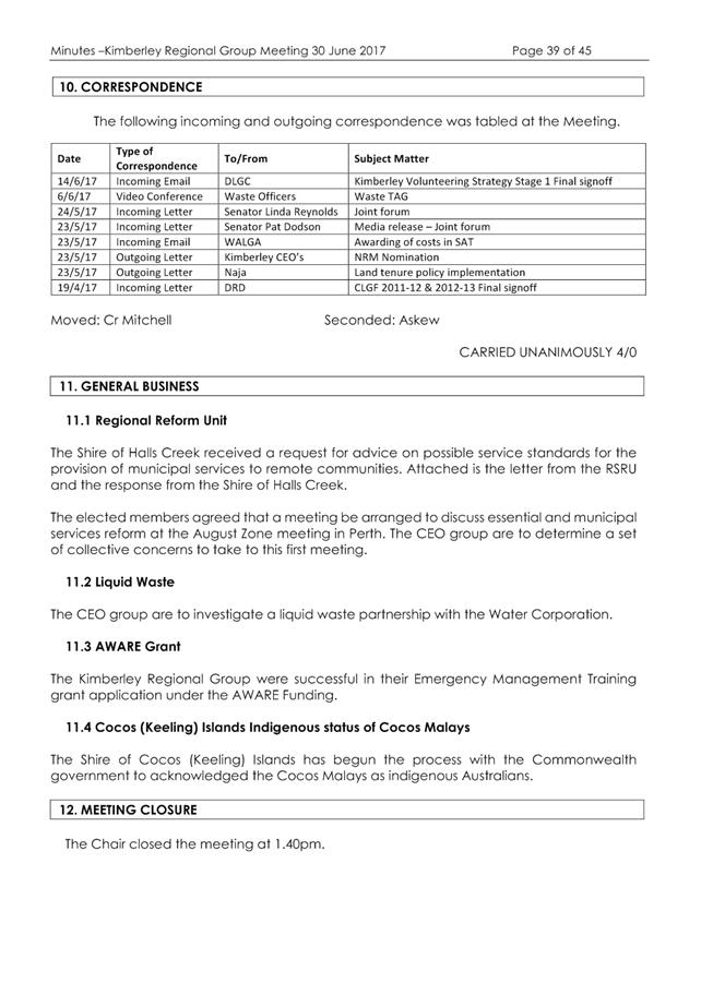
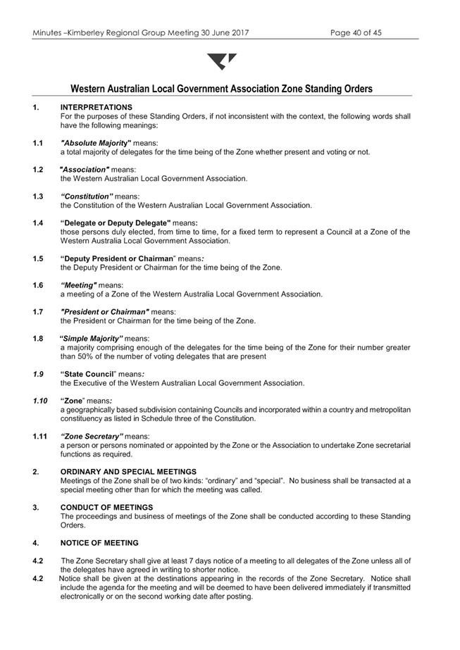
|
Item 9.4.4 - MINUTES OF THE JOINT MEETING OF THE KIMBERLEY ZONE OF WALGA AND
REGIONAL COLLABORATIVE GROUP HELD 30 JUNE 2017
|
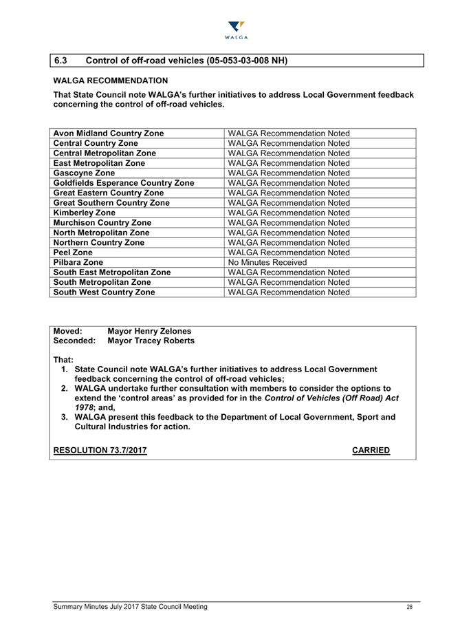
|
Item 9.4.4 - MINUTES OF THE JOINT MEETING OF THE KIMBERLEY ZONE OF WALGA AND
REGIONAL COLLABORATIVE GROUP HELD 30 JUNE 2017
|

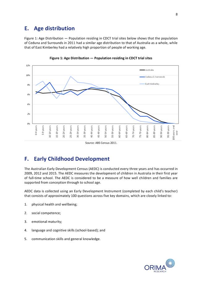
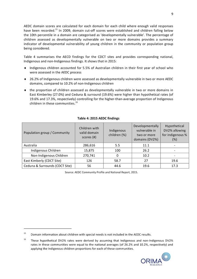
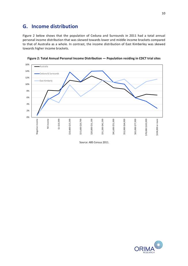
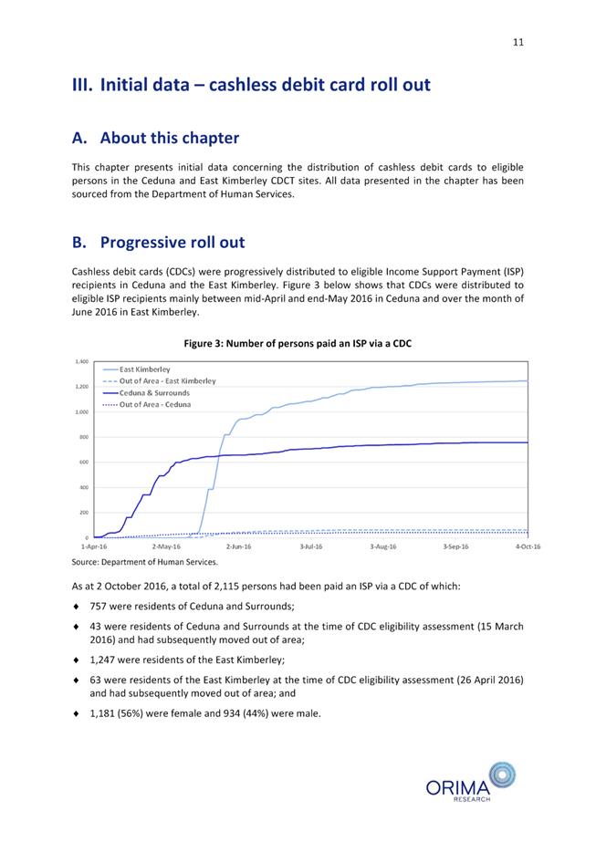
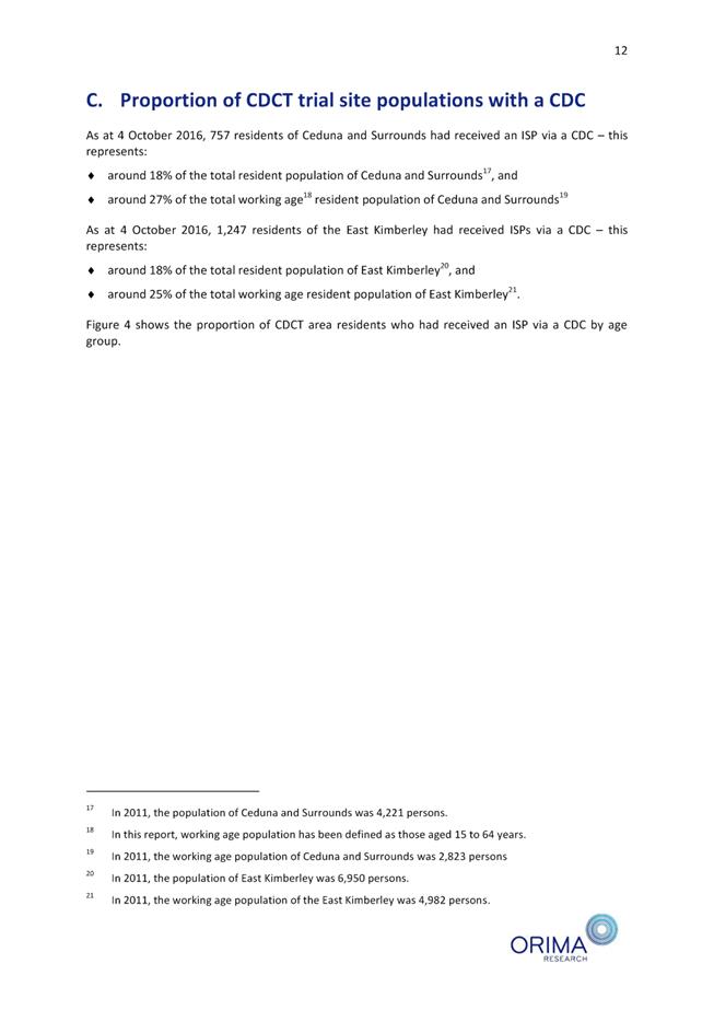
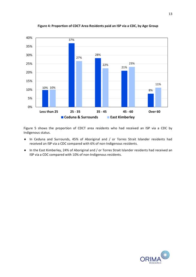
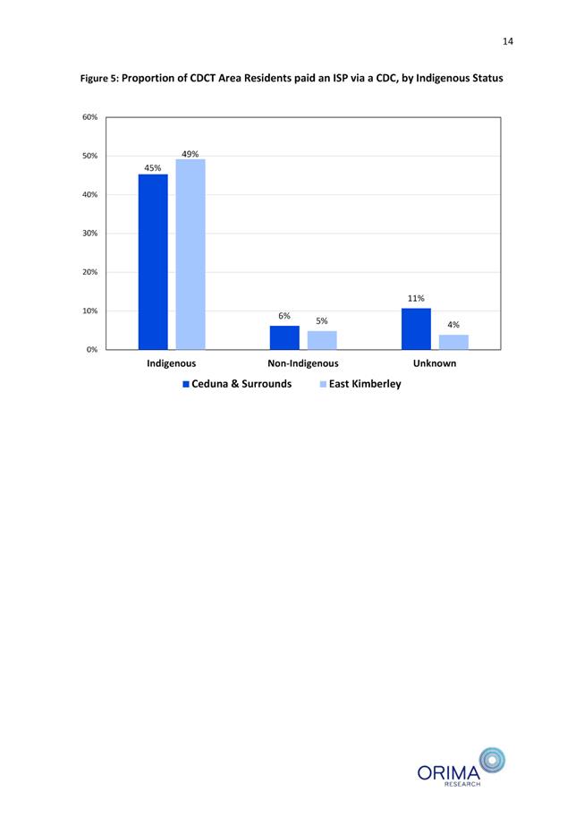
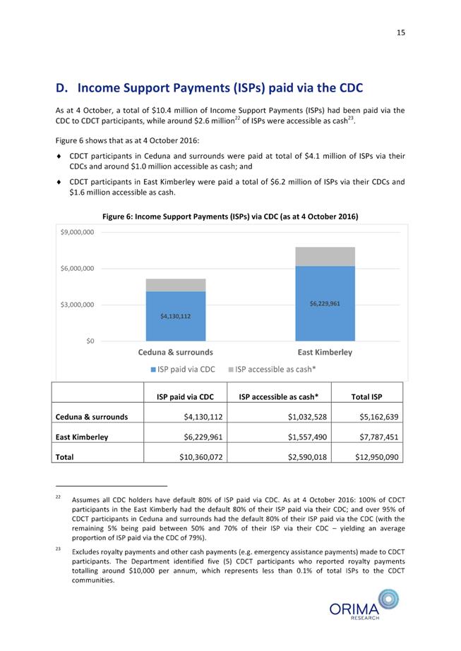
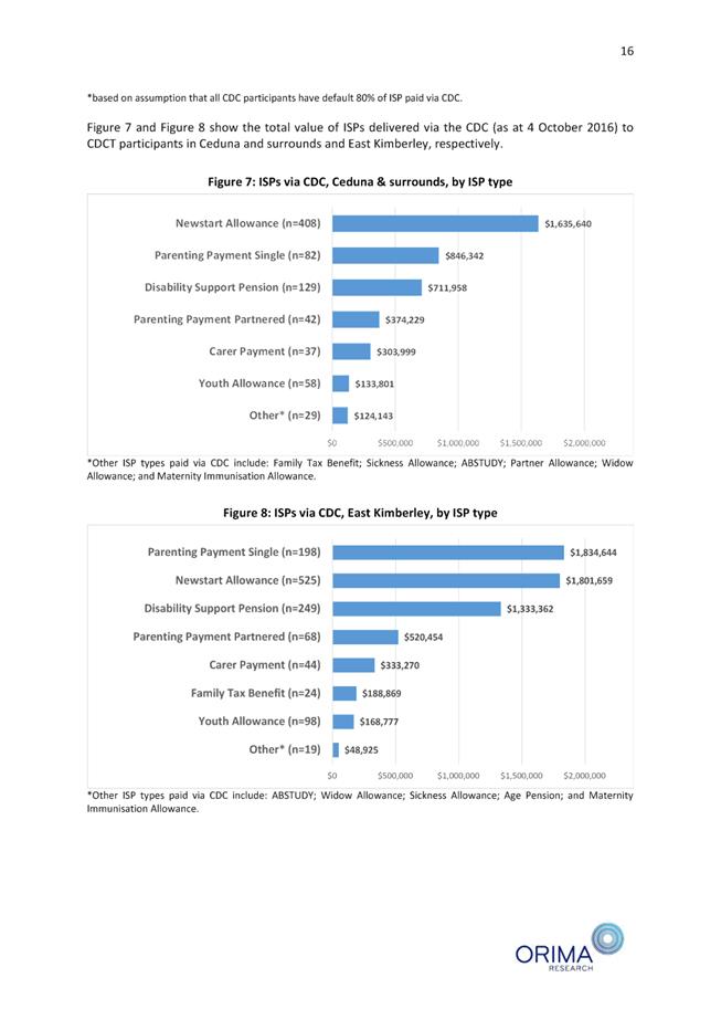
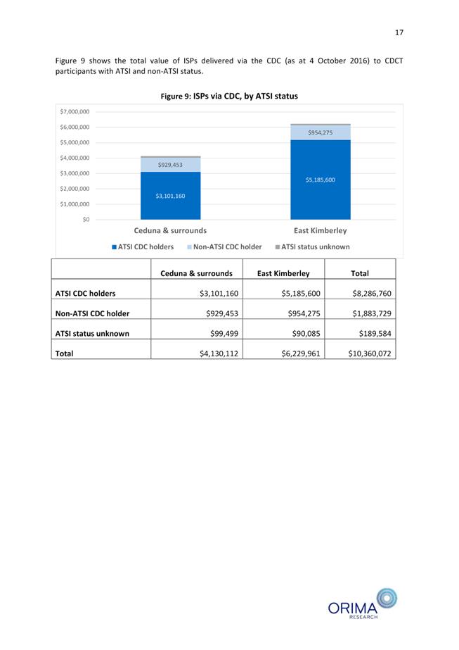
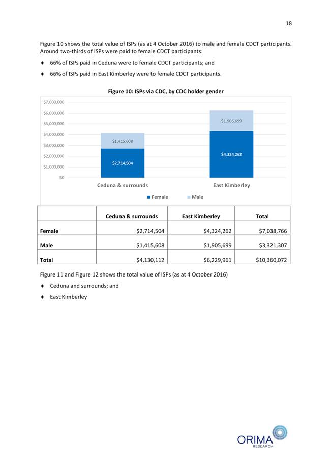
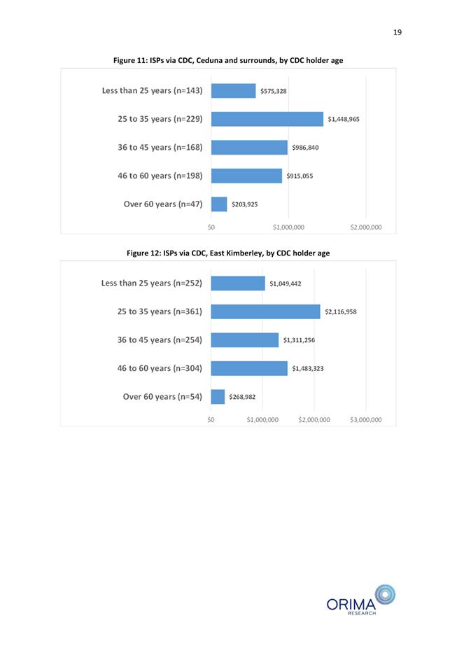
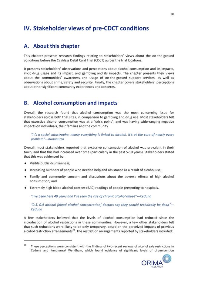


Minutes –
Ordinary Meeting of Council 7 September 2017 Page 1326 of 1404
|
9.4.5 MINUTES OF THE JOINT
MEETING OF THE KIMBERLEY ZONE OF WALGA AND REGIONAL COLLABORATIVE GROUP HELD
31 JULY 2017
LOCATION/ADDRESS: Nil
APPLICANT: Nil
FILE: OGS03
& RCG01
AUTHOR: Executive
Assistant to the CEO
CONTRIBUTOR/S: Nil
RESPONSIBLE
OFFICER: Chief
Executive Officer
DISCLOSURE
OF INTEREST: Nil
DATE OF REPORT: 31
July 2017
|
|
SUMMARY:
This report requests Council to receive and endorse the Minutes from the
Joint meeting of the Kimberley Zone of WALGA and Regional Collaborative Group
held on 31 July 2017.
|
BACKGROUND
Previous
Considerations
A copy of the minutes from the meeting held 31 July 2017
between members of the Kimberley Zone of WALGA and Kimberley Regional Collaborative
Group (RCG) are attached for Council consideration (refer Attachment 1 -
Kimberley Regional Group Minutes 31 July 2017).
As a result of a past decision of the group, both the
Kimberley Zone and RCG meetings are joined.
It should be remembered that the Kimberley Zone of WALGA is
a group established to represent regional issues to the State Council of the
Western Australian Local Government Association (WALGA).
The RCG is a deed of agreement
between four (4) local governments with the Minister for Local Government to
progress regional reform.
COMMENT
The minutes and respective background
information are attached to this report and the following comments are made in
relation to the resolutions passed by the Group. Additional recommendations
have been made where necessary for Council’s consideration.
8.1 STATE COUNCIL
MEETING AGENDA AND PRESIDENT’S REPORT
The State Council Agenda and
President’s Report was not received in time for member consideration due
to the Kimberley Zone of WALGA and Kimberley Regional Group meeting being held
in August to coincide with Local Government Week in Perth.
|
RESOLUTION:
(REPORT RECOMMENDATION)
That the Kimberley Zone of WALGA notes the State
Council Meeting Agenda and President’s Report has not been included in the
Zone Agenda for member’s consideration.
Moved: Cr Mitchell Seconded:
Cr Edwards
CARRIED
UNANIMOUSLY 4/0
|
9.1 KIMBERLEY
REGIONAL GROUP MEETING RESOLUTION STATUS REPORT
A status report was provided from the
Kimberley Zone Project Officer outlining progress or otherwise on Resolutions
passed by the Zone/RCG since July 2016. The status report was received and
noted for finalisation under the authorisation of the Secretariat.
|
RESOLUTION:
(REPORT RECOMMENDATION)
That the Kimberley Regional Group:
1.
Notes the outstanding Resolution Status Report;
2. Authorises
the Secretariat to proceed with co-ordinating the finalisation of outstanding
action items arising from meeting resolutions.
Moved: Cr Mitchell Seconded:
Cr White
CARRIED
UNANIMOUSLY 3/0
|
9.2 KIMBERLEY
REGIONAL GROUP 16/17 FINANCIAL ACTIVITY REPORT
A Financial
Activity Report was presented for adoption, indicating the KRG have a surplus
of $141,961 as at end of June 2017.
|
RESOLUTION:
(REPORT RECOMMENDATION)
That the Kimberley Regional Group adopts the
Financial Activity Report for the period ended 30 June 2017.
Moved: Cr Edwards Seconded:
Cr Mitchell
CARRIED
UNANIMOUSLY 3/0
|
9.3 LAND
TENURE BUSINESS CASE UPDATE
This report provided an update on the
Land Tenure Implementation Plan for the KRG (refer Attachment 2 –
Attachments to Kimberley Regional Group Minutes). The Kimberley Land Tenure
Policy proposal was developed in August 2016 in consultation with the executive
group, followed by a detailed project scope. Naja Business Consulting Services
was engaged to develop the policy.
|
RESOLUTION:
(REPORT RECOMMENDATION)
That the Kimberley Regional Group receives the
Kimberley Land Tenure Policy - Implementation Strategy Update.
Moved: Cr Mitchell Seconded:
Cr Edwards
CARRIED
UNANIMOUSLY 3/0
|
9.4 REGIONAL
WASTE TECHNICAL ADVISORY GROUP (TAG) – MINUTES OF MEETING
This report presented the minutes
from the Regional Waste TAG meeting held 30 June 2017. A copy of the minutes
are attached for Council’s information (refer Attachment 2 –
Attachments to Kimberley Regional Group Minutes).
|
RESOLUTION:
(REPORT RECOMMENDATION)
That the Kimberley Regional Group receives the
minutes from the Regional Waste TAG meeting held 30 June 2017.
Moved: Cr Mitchell Seconded:
Cr White
CARRIED
UNANIMOUSLY 3/0
|
9.5 2016-17
ANNUAL PERFORMANCE REPORT
The 2016-17 Annual Performance Report
was presented for member’s consideration. The Annual Performance Report
is a review of the operational performance of the Kimberley Regional Group
against the Kimberley Strategic Community Plan 2016-2026 and the Kimberley
Regional Business Plan 2016-2020 (refer Attachment 2 – Attachments to
Kimberley Regional Group Minutes).
|
RESOLUTION:
That the Kimberley Regional Group receive the
2016-17 Annual Performance Report.
Moved: Cr Mitchell Seconded:
Cr White
CARRIED UNANIMOUSLY
3/0
|
11.2 AIRFARE SUBMISSION
A draft
submission on behalf of the Kimberley Zone was tabled for member endorsement.
The submission to the Economics and Industry Standing Committee for the inquiry
into regional airfares in Western Australia was prepared by the Kimberley Zone,
culminating the concerns of each Council’s individual submissions.
|
RESOLUTION:
That the Kimberley Zone of WALGA;
1. Endorse
the submission for the inquiry into regional airfares in Western Australia,
and
2. Authorise
the Secretariat to submit the submission to the Economics and Industry
Standing Committee.
Moved: Cr Mitchell Seconded:
Cr Edwards
CARRIED
UNANIMOUSLY 4/0
|
CONSULTATION
Nil
STATUTORY ENVIRONMENT
Nil
POLICY IMPLICATIONS
Nil
FINANCIAL IMPLICATIONS
There are no direct financial
implications to the Shire of Broome from any of the aforementioned resolutions
passed by the Kimberley Zone of WALGA/Regional Collaborative Group.
RISK
There is minimal risk associated with the recommendation of
this report to the Shire of Broome.
STRATEGIC
IMPLICATIONS
Our People
Goal – Foster a community environment that is accessible, affordable,
inclusive, healthy and safe:
Affordable services and initiatives
to satisfy community need
High level social capital that
increases community capacity
Our Prosperity
Goal – Create the means to enable local jobs creation and lifestyle
affordability for the current and future population:
Affordable and equitable services and
infrastructure
Key economic development strategies
for the Shire which are aligned to regional outcomes working through recognised
planning and development groups/committees
Our
Organisation Goal – Continually enhance the Shire’s organisational
capacity to service the needs of a growing community:
An organisational culture that
strives for service excellence
Sustainable and integrated strategic
and operational plans
Responsible resource allocation
Effective community engagement
Retention and attraction of staff
Improved systems, processes and
compliance
VOTING REQUIREMENTS
Simple Majority
Attachments
|
1.
|
Kimberley Regional
Group Minutes 31 July 2017
|
|
2.
|
Attachments to
Kimberley Regional Group Minutes
|
|
Item 9.4.5 - MINUTES OF THE JOINT MEETING OF THE
KIMBERLEY ZONE OF WALGA AND REGIONAL COLLABORATIVE GROUP HELD 31 JULY 2017
|
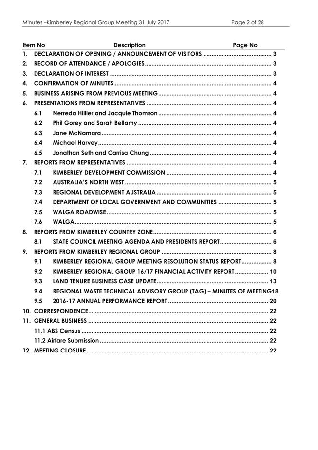
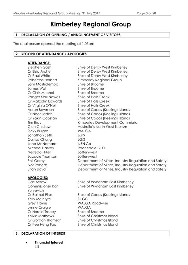
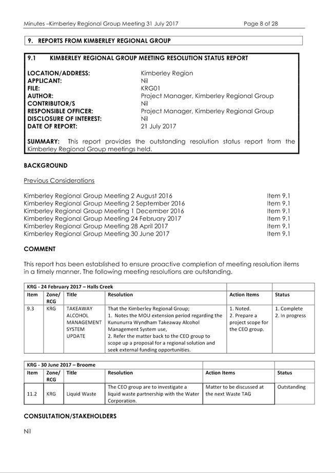
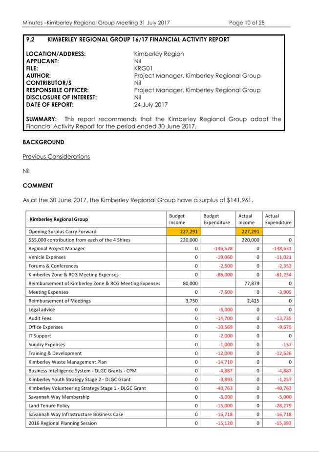
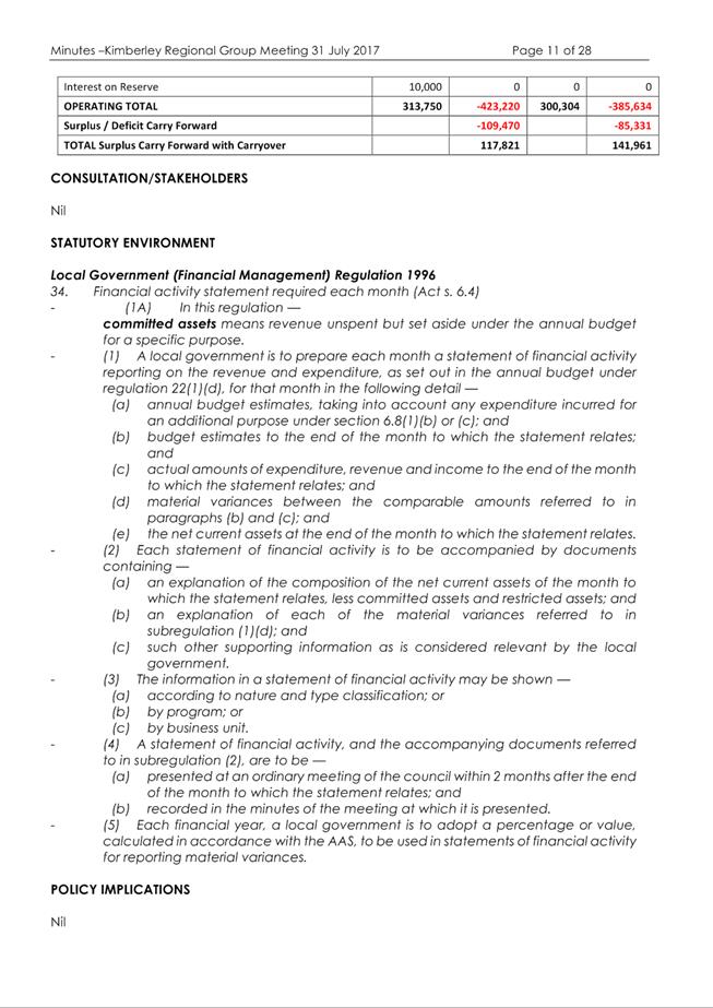
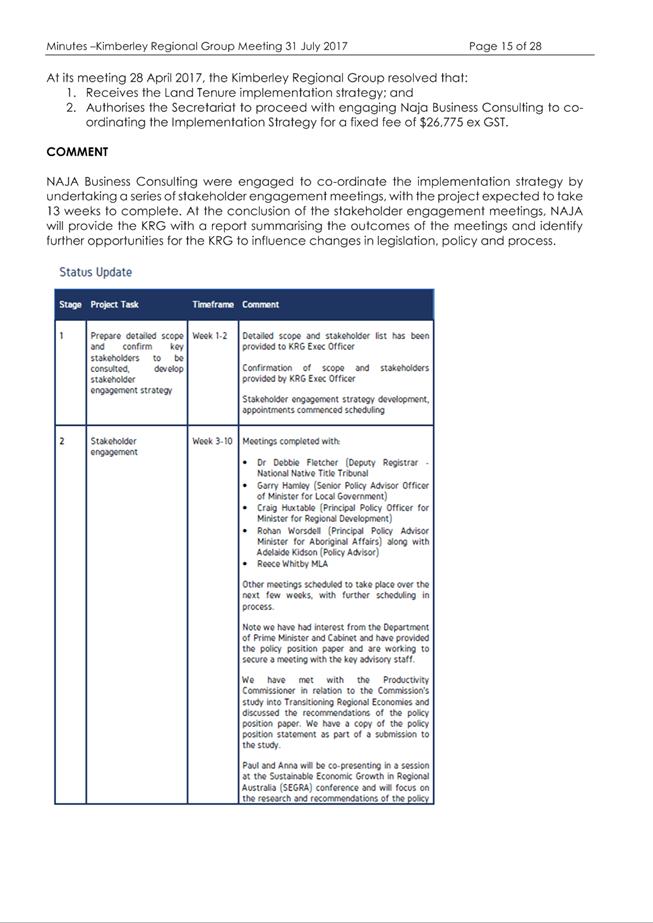

|
Item 9.4.5 - MINUTES OF THE JOINT MEETING OF THE KIMBERLEY ZONE OF WALGA AND
REGIONAL COLLABORATIVE GROUP HELD 31 JULY 2017
|
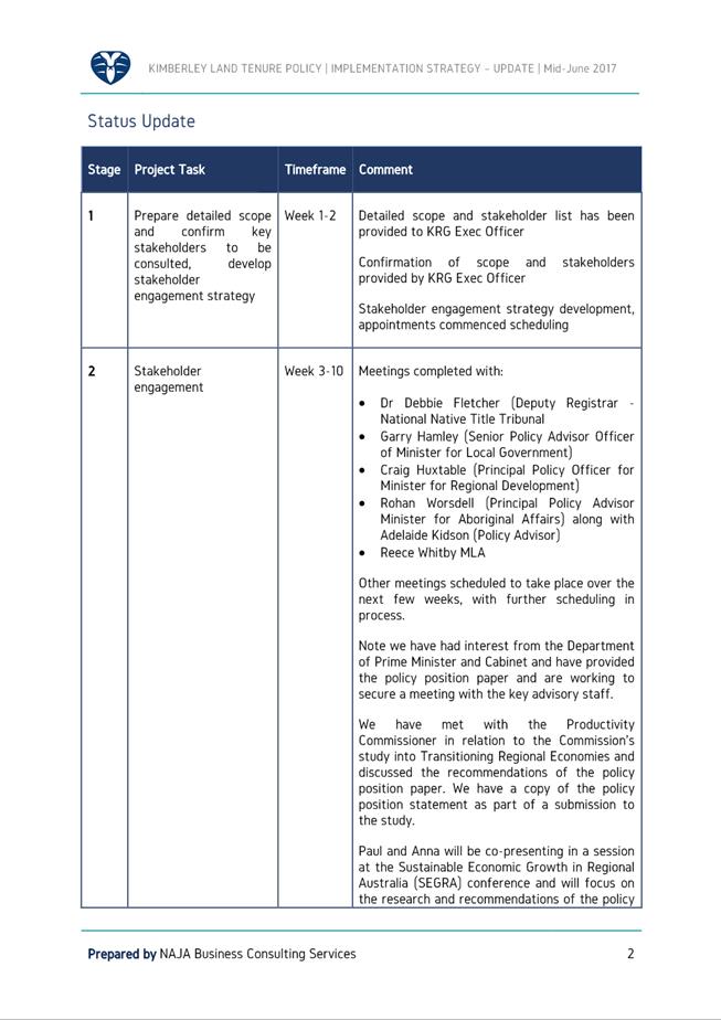
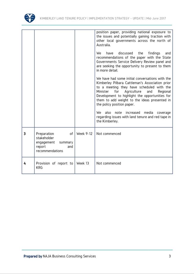
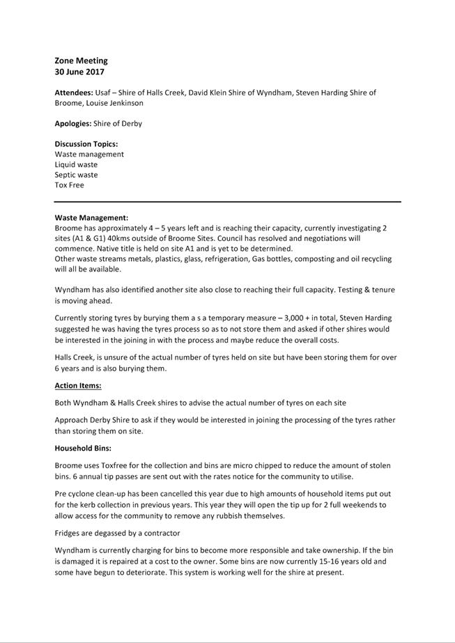


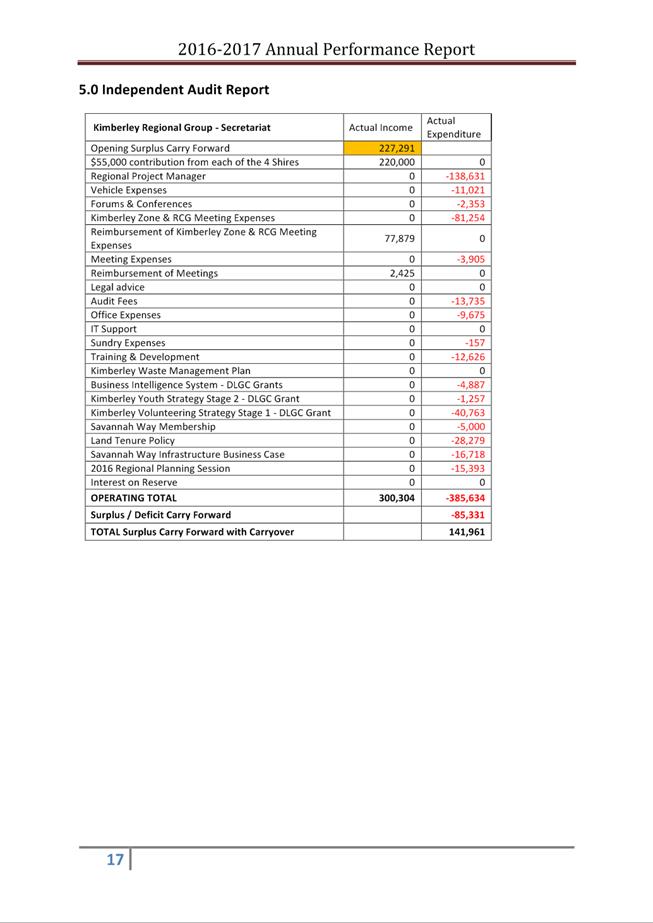
10.
Reports
Of
Committees
Minutes
– Ordinary Meeting of Council 7 September 2017 Page
1403 of 1404
There
are no reports in this section.
Nil.
Nil.
Nil
There being no further business the
Chairman declared the meeting closed at 5.40pm.


